| Listing 1 - 5 of 5 |
Sort by
|
Dissertation
Year: 2013 Publisher: Gent : s.n.,
Abstract | Keywords | Export | Availability | Bookmark
 Loading...
Choose an application
- Reference Manager
- EndNote
- RefWorks (Direct export to RefWorks)
Het doel van deze thesis is om automatisch de locaties van bruggen en tunnels te bepalen. Het aanvullen en actualiseren van digitale kaarten is arbeidsintensief. De automatisering van dit proces zou dus heel wat tijdswinst opleveren. Om ons doel te verwezenlijken, ontwikkelen we twee methoden, die beide machine learning toepassen. Eén methode behandelt kruisingen van wegen gevormd door bruggen of tunnels, de andere klassieke tunnels, bijvoorbeeld onder een rivier, berg of een stadsgedeelte. De stappen die worden gevolgd zijn bij beide methodes gelijkaardig.We maken gebruik van een zo groot mogelijke training set bestaande uit gekende knooppunten in het wegennet. Deze locaties zijn beschikbaar in een databank. Voor elk knooppunt bepalen we bijhorende bundels van GPS-sporen. De relevante sporen vinden we door middel van distance based matching. Het bundelen gebeurt op basis van de (rij)richting van de sporen.Door het bestuderen van de sporen rond de knooppunten kunnen we een aantal eigenschappen selecteren die relevant zijn voor classificatie, in het bijzonder hoogteverschil, indraai-, stop- en afremgedrag bij kruisende wegen en dichtheid van de bundel traces bij tunnels. We bepalen een optimale numerieke weergave voor elk van deze attributen. Aan de hand van deze gegevens gaan we met behulp van een bestaand machine learning algoritme een classifier trainen. Deze classifier kan vervolgens worden gebruikt om andere knooppunten te classificeren. The purpose of this thesis is to automatically determine the locations of bridges and tunnels. The updating of digital maps is labor-intensive. Having computers perform this task would save a lot of time. To accomplish our goal we develop two separate methods, both using machine learning. One method handles crossings of roads formed by bridges or tunnels, the other handles regular tunnels, for example under a river, mountain or sections of a city. The steps followed by both methods aresimilar.We make use of an, as large as possible, training set consisting of known nodes in the road network. These locations are available in a database. For each node we determine matching bundles of GPS-traces. The relevant traces are found throughthe use of distance based matching. Bundling happens based on the (driving) direction of the traces.By studying the traces around the node we can select a number of properties that are relevant to classification, in particular height difference, turning, stopping and braking behavior for crossing roads and the density of trace bundles for tunnels. We determine the optimal numerical representation for each of these attributes. Based on these data we train a classifier, using an existing machine learning algorithm. This classifiercan then be used to classify other nodes.
Algoritme - algorithm. --- Bruggen. --- GPS. --- Java - Java. --- Kunstmatige intelligentie - artificial intelligence. --- Meerlagig perceptron. --- Neuraal netwerk - neural network. --- SQL - SQL. --- TomTom. --- Tunnels. --- Verkeersoverwegen.


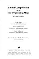
ISBN: 0201554429 0201554437 9780201554427 Year: 1992 Publisher: Reading Addison-Wesley
Abstract | Keywords | Export | Availability | Bookmark
 Loading...
Choose an application
- Reference Manager
- EndNote
- RefWorks (Direct export to RefWorks)
Artificial intelligence. Robotics. Simulation. Graphics --- Neural networks (Computer science) --- #TELE:SISTA --- neurocomputer --- neuraal netwerk --- Neural networks (Computer science). --- Artificial neural networks --- Nets, Neural (Computer science) --- Networks, Neural (Computer science) --- Neural nets (Computer science) --- Artificial intelligence --- Natural computation --- Soft computing

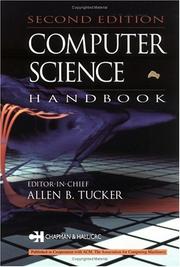
ISBN: 158488360X 9781584883609 Year: 2004 Publisher: Boca Raton Chapman and Hall/CRC
Abstract | Keywords | Export | Availability | Bookmark
 Loading...
Choose an application
- Reference Manager
- EndNote
- RefWorks (Direct export to RefWorks)
Computer. Automation --- Computer science --- Engineering --- Handbooks, manuals, etc. --- 681.3*A --- algoritme --- computerarchitectuur --- computergeometrie --- cryptografie --- datastructuur --- grafisch programma --- informatiemanagement --- intelligente software --- multimedia --- neuraal netwerk --- operationeel systeem (operating system) --- programmeertaal --- General literature --- 681.3*A General literature --- Informatics --- Science --- Computer science - Handbooks, manuals, etc. --- Engineering - Handbooks, manuals, etc.

ISBN: 0201515601 0201503956 9780201515602 9780201503951 Year: 1992 Volume: 1 Publisher: Redwood City, CA : Addison-Wesley,
Abstract | Keywords | Export | Availability | Bookmark
 Loading...
Choose an application
- Reference Manager
- EndNote
- RefWorks (Direct export to RefWorks)
Ordinateurs neuronaux --- 681.3*F --- neuraal netwerk --- neurocomputer --- Theory of computation --- 681.3*F Theory of computation --- Neural computers --- Neural networks (Neurobiology) --- #TELE:SISTA --- 536.75 --- Biological neural networks --- Nets, Neural (Neurobiology) --- Networks, Neural (Neurobiology) --- Neural nets (Neurobiology) --- Cognitive neuroscience --- Neurobiology --- Neural circuitry --- 536.75 Entropy. Statistical thermodynamics. Irreversible processes --- Entropy. Statistical thermodynamics. Irreversible processes --- Neural net computers --- Neural network computers --- Neurocomputers --- Electronic digital computers --- Natural computation --- Artificial intelligence --- Computer science --- Artificial intelligence. Robotics. Simulation. Graphics --- Neural computers. --- Neural networks (Neurobiology). --- Réseaux nerveux --- Monograph --- Neural circuitry.

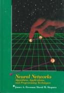
ISBN: 0201513765 9780201513769 Year: 1992 Publisher: Reading Addison-Wesley
Abstract | Keywords | Export | Availability | Bookmark
 Loading...
Choose an application
- Reference Manager
- EndNote
- RefWorks (Direct export to RefWorks)
neuraal netwerk --- neuraal algoritme --- 681.3*F11 --- Models of computation: automata bounded action devices computability theory relations among models self-modifying machines unbounded-action devices--See also {681.3*F41} --- Computer algorithms. --- Neural networks (Computer science) --- 681.3*F11 Models of computation: automata bounded action devices computability theory relations among models self-modifying machines unbounded-action devices--See also {681.3*F41} --- Neural networks (Computer science). --- Computer algorithms --- Artificial neural networks --- Nets, Neural (Computer science) --- Networks, Neural (Computer science) --- Neural nets (Computer science) --- Artificial intelligence --- Natural computation --- Soft computing --- Algorithms --- 681.3*F11 Models of computation: automata; bounded action devices; computability theory; relations among models; self-modifying machines; unbounded-action devices--See also {681.3*F41} --- Models of computation: automata; bounded action devices; computability theory; relations among models; self-modifying machines; unbounded-action devices--See also {681.3*F41} --- Artificial intelligence. Robotics. Simulation. Graphics --- Computer architecture. Operating systems --- Algorithmes --- Réseaux neuronaux (Informatique)
| Listing 1 - 5 of 5 |
Sort by
|

 Search
 Feedback
 About UniCat
  Help
Help News
News