
 Search
 Feedback
 About UniCat
  Help
Help News
News
| Listing 1 - 10 of 25 | << page >> |
Sort by
|
Book

ISBN: 9783030813581 Year: 2022 Publisher: Cham Springer International Publishing :Imprint: Springer
Abstract | Keywords | Export | Availability | Bookmark
 Loading...
Choose an application
- Reference Manager
- EndNote
- RefWorks (Direct export to RefWorks)
Hydrologic models. --- Hydrological modeling --- Hydrological models --- Hydrology --- Hydrology models --- Models and modelmaking --- Models
Book
ISBN: 9789811903045 Year: 2022 Publisher: Singapore Springer Nature Singapore :Imprint: Springer
Abstract | Keywords | Export | Availability | Bookmark
Loading...Choose an application
- Reference Manager
- EndNote
- RefWorks (Direct export to RefWorks)
Environmental sciences --- Hydrologic models --- Hydrological modeling --- Hydrological models --- Hydrology --- Hydrology models --- Models and modelmaking --- Models
Book
ISBN: 3030813576 3030813584 Year: 2022 Publisher: Cham, Switzerland : Springer,
Abstract | Keywords | Export | Availability | Bookmark
Loading...Choose an application
- Reference Manager
- EndNote
- RefWorks (Direct export to RefWorks)
Hydrologic models. --- Hydrological modeling --- Hydrological models --- Hydrology --- Hydrology models --- Models and modelmaking --- Models
Book
ISBN: 9811903034 9811903042 Year: 2022 Publisher: Singapore : Springer,
Abstract | Keywords | Export | Availability | Bookmark
Loading...Choose an application
- Reference Manager
- EndNote
- RefWorks (Direct export to RefWorks)
Environmental sciences --- Hydrologic models --- Hydrological modeling --- Hydrological models --- Hydrology --- Hydrology models --- Models and modelmaking --- Models
Book
ISBN: 3036565116 3036565124 Year: 2023 Publisher: [Place of publication not identified] : MDPI - Multidisciplinary Digital Publishing Institute,
Abstract | Keywords | Export | Availability | Bookmark
Loading...Choose an application
- Reference Manager
- EndNote
- RefWorks (Direct export to RefWorks)
Water resource systems planning and management issues are often very complex. The pressures on water resources are increasing with the expanding scale of global development involving ecological and hydrological consequences in river basins and groundwater aquifers, and water-quality deterioration. All this leads to the increasing need for investigating the effects of different human influences and impacts on the hydrological regime and on water quality like as land-use changes, climatic variability and climate changes, and intensified water and land-use practices. The Special Issue "Advances in Flow Modeling for Water Resources and Hydrological Engineering" presents a collection of scientific contributions that provides a sample of the state-of-the-art and forefront research in this field. In particular, basin-wide water resources planning, watershed management, flood forecasting, droughts, climate change impacts on flood risk and water resources, reservoir operation and management, river morphology and sediment transport, river water quality, and irrigation were the main research and practice targets that the papers published in this Special Issue aimed to address.
Hydrologic models. --- Hydrological modeling --- Hydrological models --- Hydrology --- Hydrology models --- Models and modelmaking --- Models
Book
ISBN: 3036571140 3036571159 Year: 2023 Publisher: [Place of publication not identified] : MDPI,
Abstract | Keywords | Export | Availability | Bookmark
Loading...Choose an application
- Reference Manager
- EndNote
- RefWorks (Direct export to RefWorks)
Hydrologic models. --- Hydrological modeling --- Hydrological models --- Hydrology --- Hydrology models --- Models and modelmaking --- Models
Book
ISBN: 1614701822 9781614701828 9781606927052 1606927051 Year: 2009 Publisher: New York : Nova Science Publishers,
Abstract | Keywords | Export | Availability | Bookmark
Loading...Choose an application
- Reference Manager
- EndNote
- RefWorks (Direct export to RefWorks)
Runoff --- Rain and rainfall --- Hydrologic models. --- Hydrological modeling --- Hydrological models --- Hydrology --- Hydrology models --- Models and modelmaking --- Mathematical models. --- Models
ISBN: 9780521869188 0521869188 9780511535734 9780511378881 0511378882 9780511376160 0511376162 0511535732 1107179521 9781107179523 1281243426 9781281243423 9786611243425 6611243429 0511377991 9780511377990 051137710X 051137464X Year: 2008 Publisher: Cambridge : Cambridge University Press,
Abstract | Keywords | Export | Availability | Bookmark
Loading...Choose an application
- Reference Manager
- EndNote
- RefWorks (Direct export to RefWorks)
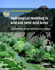
Arid and semi-arid regions are defined as areas where water is at its most scarce. The hydrological regime in these areas is extreme and highly variable, and they face great pressures to deliver and manage freshwater resources. However, there is no guidance on the decision support tools that are needed to underpin flood and water resource management in arid areas. UNESCO initiated the Global network for Water and Development Information for arid lands (GWADI), and arranged a workshop of the world's leading experts to discuss these issues. This book presents chapters from contributors to the workshop, and includes case studies from the world's major arid regions to demonstrate model applications, and web links to tutorials and state of the art modelling software. This volume is a valuable reference for researchers and engineers working on the water resources of arid and semi-arid regions.
Hydrologic models --- Water-supply --- Water resources development --- Arid regions --- Management --- Hydrological modeling --- Hydrological models --- Hydrology --- Hydrology models --- Models and modelmaking --- Models
Periodical
Abstract | Keywords | Export | Availability | Bookmark
Loading...Choose an application
- Reference Manager
- EndNote
- RefWorks (Direct export to RefWorks)
Hydrology --- Hydrologic models --- Hydrological forecasting --- Hydrologie --- Modèles hydrologiques --- Prévision hydrologique --- Research --- Périodiques. --- Recherche --- Hydrological modeling --- Hydrological models --- Hydrology models --- Forecasting --- Models --- Earth sciences --- Models and modelmaking --- Aquatic sciences --- Hydrography --- Water
Book
ISBN: 953515155X 9533078081 Year: 2012 Publisher: IntechOpen
Abstract | Keywords | Export | Availability | Bookmark
Loading...Choose an application
- Reference Manager
- EndNote
- RefWorks (Direct export to RefWorks)
This edition of Evapotranspiration - Remote Sensing and Modeling contains 23 chapters related to the modeling and simulation of evapotranspiration (ET) and remote sensing-based energy balance determination of ET. These areas are at the forefront of technologies that quantify the highly spatial ET from the Earth's surface. The topics describe mechanics of ET simulation from partially vegetated surfaces and stomatal conductance behavior of natural and agricultural ecosystems. Estimation methods that use weather based methods, soil water balance, the Complementary Relationship, the Hargreaves and other temperature-radiation based methods, and Fuzzy-Probabilistic calculations are described. A critical review describes methods used in hydrological models. Applications describe ET patterns in alpine catchments, under water shortage, for irrigated systems, under climate change, and for grasslands and pastures. Remote sensing based approaches include Landsat and MODIS satellite-based energy balance, and the common process models SEBAL, METRIC and S-SEBS. Recommended guidelines for applying operational satellite-based energy balance models and for overcoming common challenges are made.
Evapotranspiration --- Hydrologic models. --- Remote sensing. --- Consumptive use --- Water-supply --- Evaporation (Meteorology) --- Plants --- Hydrological modeling --- Hydrological models --- Hydrology --- Hydrology models --- Models and modelmaking --- Transpiration --- Water requirements --- Models --- Hydrology & the hydrosphere
| Listing 1 - 10 of 25 | << page >> |
Sort by
|