| Listing 1 - 6 of 6 |
Sort by
|
Book
ISBN: 9021230577 Year: 1970 Publisher: Delft Waltman
Abstract | Keywords | Export | Availability | Bookmark
 Loading...
Choose an application
- Reference Manager
- EndNote
- RefWorks (Direct export to RefWorks)
bouwkunde --- landmeten --- situatiemeting --- hoogtemetingen --- uitzetten --- kadaster --- metingen --- omrekeningstabellen --- Hoogtemeting --- Topografie --- Landmeten --- Situatiemeting --- Uitzetting --- Geografie --- Algemeen.
Book
ISBN: 9077456058 9789077456057 Year: 2006 Publisher: Amsterdam Vrije Universiteit
Abstract | Keywords | Export | Availability | Bookmark
 Loading...
Choose an application
- Reference Manager
- EndNote
- RefWorks (Direct export to RefWorks)
Archeology --- 15.31 methods and techniques of archaeology. --- Archeologie. --- Archeology. --- Hoogtemeting.
Book
Year: 1959 Publisher: Tervuren Musée royal du Congo belge
Abstract | Keywords | Export | Availability | Bookmark
 Loading...
Choose an application
- Reference Manager
- EndNote
- RefWorks (Direct export to RefWorks)
Sciences pures --- Topografie --- Topographie --- Zuivere wetenschappen --- Altitudes --- Congo (République du) --- Hoogtemeting --- Kongorepubliek --- 526.3
Book
ISBN: 9789040723872 9040723877 9786610730902 1280730900 9071301877 Year: 2003 Publisher: Delft Delft university press
Abstract | Keywords | Export | Availability | Bookmark
 Loading...
Choose an application
- Reference Manager
- EndNote
- RefWorks (Direct export to RefWorks)
Inleiding Landmeetkunde is bedoeld voor studenten van universiteit en hogeschool. Van de vlakke landmeetkunde worden grondbegrippen, berekenings- en meet methoden, maar ook instrumentele onderwerpen behandeld. Belangrijke hoofdstukken zijn gewijd aan de fotogrammetrie, de kartografie, hydrografische metingen, maatvoering van bouwprojecten en plaats bepaling met radiosatelieten. Voorts wordt aan dacht besteed aan de kadastrale registratie en de landinrichting.
geodesie --- landmeetkunde --- Geodesy. Cartography --- waterpas --- theodoliet --- afstandsmeting --- veelhoeksmeting --- tachymeter --- (zie ook: waterpassing) --- Landmeetkunde. --- Cartografie. --- topografie (landmeetkunde) --- hoogtemeting --- fotogrammetrie --- cartografie --- Kartografie --- Fotogrammetrie --- 712.24

ISBN: 3110175495 9786612195082 1282195085 3110200082 9783110200089 9783110175493 Year: 2008 Publisher: Berlin Boston
Abstract | Keywords | Export | Availability | Bookmark
 Loading...
Choose an application
- Reference Manager
- EndNote
- RefWorks (Direct export to RefWorks)
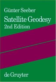
This book covers the entire field of satellite geodesy and is intended to serve as a textbook for advanced undergraduate and graduate students, as well as a reference for professionals and scientists in the fields of engineering and geosciences such as geodesy, surveying engineering, geomatics, geography, navigation, geophysics and oceanography. The text provides a systematic overview of fundamentals including reference systems, time, signal propagation and satellite orbits, together with observation methods such as satellite laser ranging, satellite altimetry, gravity field missions, very long baseline interferometry, Doppler techniques, and Global Navigation Satellite Systems (GNSS). Particular emphasis is given to positioning techniques, such as the NAVSTAR Global Positioning System (GPS), and to applications. Numerous examples are included which refer to recent results in the fields of global and regional control networks; gravity field modeling; Earth rotation and global reference frames; crustal motion monitoring; cadastral and engineering surveying; geoinformation systems; land, air, and marine navigation; marine and glacial geodesy; and photogrammetry and remote sensing. This book will be an indispensable source of information for all concerned with satellite geodesy and its applications, in particular for spatial referencing, geoinformation, navigation, geodynamics, and operational positioning.
Satellite geodesy. --- Geografie --- Globale Navigatie. --- satellietgeodesie --- geodesie --- referentiesysteem --- doppler effect --- CCD camera --- aardsatelliet --- satelliet --- gps (global positioning system) (global position system) --- laseraltimetrie --- hoogtemeting --- satelliethoogtemeting --- (zie ook: vliegtuiglaseraltimetrie) --- Satellite geodesy --- Global positioning system. --- Satellite. --- Theoretical Astronomy --- Artificial satellites in geodesy --- Geodesy --- Geodetic satellites --- Satellites artificiels en géodésie.
Book
ISBN: 9780123819604 0123819601 9786613612038 1280582251 0123819628 9780123819628 9780128008843 0128008849 0128011327 Year: 2012 Publisher: Amsterdam ; London Waltham, Mass. ; London Elsevier ; Academic Press
Abstract | Keywords | Export | Availability | Bookmark
 Loading...
Choose an application
- Reference Manager
- EndNote
- RefWorks (Direct export to RefWorks)
Measurement and Instrumentation introduces undergraduate engineering students to the measurement principles and the range of sensors and instruments that are used for measuring physical variables. Based on Morris's Measurement and Instrumentation Principles, this brand new text has been fully updated with coverage of the latest developments in such measurement technologies as smart sensors, intelligent instruments, microsensors, digital recorders and displays and interfaces. Clearly and comprehensively written, this textbook provides students with the knowledge and tools, incl
Measurement. --- Automatic control. --- Engineering instrument. --- Control engineering --- Control equipment --- Control theory --- Engineering instruments --- Automation --- Programmable controllers --- Measuring --- Mensuration --- Mathematics --- Technology --- Metrology --- Physical measurements --- meetapparatuur --- meetsysteem --- meetsoftware --- optische meettechniek --- kalibratie --- data acquisitie (daq) --- labview --- signaalverwerking --- temperatuurmeting --- drukmeting --- stroommeter --- hoogtemeting --- massaflowmeter --- krachtmeting --- trillingsmeting --- transductor --- Engineering --- General and Others --- Engineering instruments. --- Automatic control --- Engineering instrument --- Measurement --- Instruments, Engineering --- Scientific apparatus and instruments --- 681.51 --- 681.51 Automatic control systems in general. Technical cybernetic features --- Automatic control systems in general. Technical cybernetic features --- Measuring instruments.
| Listing 1 - 6 of 6 |
Sort by
|

 Search
 Feedback
 About UniCat
  Help
Help News
News