| Listing 1 - 3 of 3 |
Sort by
|

ISBN: 3110170728 3110879956 Year: 2001 Publisher: Berlin : Walter de Gruyter & Co.,
Abstract | Keywords | Export | Availability | Bookmark
 Loading...
Choose an application
- Reference Manager
- EndNote
- RefWorks (Direct export to RefWorks)
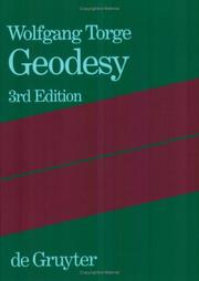
The third edition of this well-known textbook, first published in 1980, has been completely revised in order to adequately reflect the drastic changes which occurred in the field of geodesy in the last twenty years. Reference systems are now well established by space techniques, which dominate positioning and gravity field determination. Terrestrial techniques still play an important role at local and regional applications, whereby remarkable progress has been made with respect to automatic data acquisition. Evaluation methods are now three-dimensional in principle, and have to take the gravity
geodetisch instrument --- Geodesy. --- Geografie --- Geodesie. --- Geophysics. --- Geodesy --- geodesie --- referentiesysteem --- zwaartekracht --- Degrees of latitude and longitude --- Geodetics --- Geophysics --- Geomatics --- Mathematical geography --- Surveying --- Geological physics --- Terrestrial physics --- Earth sciences --- Physics --- GEOPHYSIQUE --- GEODESIE --- TRAITE
Book
ISBN: 9010102165 Year: 1976 Publisher: Amsterdam Elsevier
Abstract | Keywords | Export | Availability | Bookmark
 Loading...
Choose an application
- Reference Manager
- EndNote
- RefWorks (Direct export to RefWorks)
landmeten --- waterpassen --- detailmeting --- geodetisch instrument --- oppervlaktemeting --- waterpassing --- (zie ook: waterpas) --- #BIBC:bibl.Reekmans --- kadaster --- topografie (landmeetkunde) --- 550.81 --- 528.4 --- 528.37 --- Landmeten --- Waterpassen --- 528.4 Field surveying. Land surveying. Cadastral survey. Topography. Engineering survey. Special fields of surveying --- Field surveying. Land surveying. Cadastral survey. Topography. Engineering survey. Special fields of surveying --- 550.81 Geological prospecting. Simplest exploration methods. Geomorphological investigations while prospecting --- Geological prospecting. Simplest exploration methods. Geomorphological investigations while prospecting --- Principles of leveling
Book
ISBN: 903341404X 9033414031 9033414058 903341662X 9033416611 Year: 1986 Publisher: Leuven Uitgeverij Acco
Abstract | Keywords | Export | Availability | Bookmark
 Loading...
Choose an application
- Reference Manager
- EndNote
- RefWorks (Direct export to RefWorks)
528.1 --- #KVIV --- #ABIB:kand --- foutentheorie --- geodesie --- fotogrammetrie --- Urbain L. Van Twembeke --- wetenschap --- topografie --- landmeetkunde --- landmeten --- waarneming --- wiskunde --- statistiek --- 528 --- 528 )* TOPOGRAFIE --- topografie (landmeetkunde) --- 528.1 Theory of errors and adjustment in geodesy and photogrammetry --- Theory of errors and adjustment in geodesy and photogrammetry --- 528.02/.03 --- 528.42 --- metrologie --- Geodesie --- Geodesy. Surveying. Photogrammetry. Cartography--?.02/.03 --- Topographic surveying --- 528.42 Topographic surveying --- 528.02/.03 Geodesy. Surveying. Photogrammetry. Cartography--?.02/.03 --- Géodésie --- topografische opnamen --- hoogte --- geodetisch instrument --- 528.2 --- Academic collection --- Landmeten --- Topografie --- metingen --- 528.2 Figure of the Earth. Earth measurement. Mathematical geodesy. Physical geodesy. Astronomical geodesy --- Figure of the Earth. Earth measurement. Mathematical geodesy. Physical geodesy. Astronomical geodesy --- 389 --- Metrologie --- 389 Metrologie --- Geodesy. Cartography --- Geografie --- Algemeen.
| Listing 1 - 3 of 3 |
Sort by
|

 Search
 Feedback
 About UniCat
  Help
Help News
News