
 Search
 Feedback
 About
About Help
Help News
News
| Listing 1 - 7 of 7 |
Sort by
|
ISBN: 1282771817 9786612771811 0520938674 9780520938670 0520244451 9780520244450 0520244478 9780520244474 9781282771819 661277181X Year: 2005 Publisher: Berkeley, Calif. : ©2005 University of California Press,
Abstract | Keywords | Export | Availability | Bookmark
 Loading...
Choose an application
- Reference Manager
- EndNote
- RefWorks (Direct export to RefWorks)
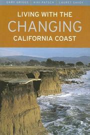
Crowded into the beautiful, narrow strip at the edge of the ocean, the large number of people who live near California's dynamic coastline often have little awareness of the hazards-waves, tides, wind, storms, rain, and runoff-that erode and impact the coast and claim property on a regular basis. This up-to-date, authoritative, and easy-to-use book, a geological profile of the California coast from Mexico to the Oregon border, describes the landforms and processes that shape the coastline and beaches, documents how erosion has affected development, and discusses the options that are available for dealing with coastal hazards and geologic instability. A completely revised and updated edition of Living with the California Coast (1985), this book features hundreds of new photographs and the latest data on human activity on the coast, on climate change, on rising seas levels, and on coastal erosion and protection. With its dramatic photographs and mile-by-mile maps, Living with the Changing California Coast will be an essential resource for those intending to buy or build along the coast, those who need specific information about various coastal regions, and those who are seeking information about how this remarkable coastline has evolved. *279 photographs portray natural coastal features and processes and illustrate many instances of what can happen to buildings on the coast *81 maps, covering the entire coast, detail types of coastal landforms, coastline erosion rates, locations of seawalls or armor, and other specific areas of interest *Offers specific advice for homebuyers,residents, and developers on which areas to avoid, on what safety measures should be taken, and on what danger signals should be heeded
Shore protection --- Coasts --- Coastal zone management --- america. --- california coast. --- california residents. --- california. --- climate change. --- coastal features. --- coastal hazards. --- coastal landscape. --- coastline. --- erosion. --- geologic change. --- geologic instability. --- geologic processes. --- geological profile. --- homebuyers. --- human impact. --- land developers. --- land development. --- landforms. --- maps. --- mexico. --- natural world. --- nonfiction. --- oregon border. --- photographs. --- practical guide. --- reference guide. --- regional geography. --- regional geology. --- regional history. --- sea levels. --- united states.
Book
Year: 2021 Publisher: Basel, Switzerland MDPI - Multidisciplinary Digital Publishing Institute
Abstract | Keywords | Export | Availability | Bookmark
Loading...Choose an application
- Reference Manager
- EndNote
- RefWorks (Direct export to RefWorks)
This book includes papers published in the Special Issue titled “Coastal Dynamic and Evolution”, which aimed to collect multidisciplinary studies that involved the evaluation of coastal evolution at different temporal scales, from hours and days to months and years, as well as historical changes. The volume contains investigations carried out by means of aerial photos and satellite images, as well as results from in situ surveys and observations aimed at assessing morphological changes in shoreline and dune systems as a consequence of chronic flooding and erosion processes or the occurrence of specific weather-related events. Studies on the evaluation of past and future sea-level variations and related impacts have also been included. In order to provide the reader with a wide overview of different coastal settings and methodological approaches, case studies from Russia, Italy, California (USA), Morocco, Spain, Indonesia, Ireland and Colombia have been included in this Special Issue. The content may be of interest to those who perform a wide range of investigations related to coastal analysis and management, especially to researchers and academics who can exploit the provided approaches and methodologies.
Research & information: general --- cultural heritage --- shoreline dynamics --- GIS --- UAV --- Palaeolithic --- Volga --- European Russia --- XBeach --- inundation --- erosion --- BSS --- Sant Esteve 2008 --- coarse sediment --- D50 --- sieving --- sand size --- sand parameters --- coastal dynamics --- aesthetic appeal --- Baltic Sea --- coastal dunes --- Curonian Spit --- Delphi technique --- paired comparison survey --- psychophysical approach --- Jakarta Bay --- sea level rise --- river discharge --- flooding --- tides --- currents --- beach ridges --- mathematical reconstruction --- curve fitting --- Ombrone River Delta --- coastline --- cliff and bluff retreat --- erosion rate --- uncertainty --- sea-level rise --- adaptive management --- Alicante --- beach nourishment --- CIEL*a*b* --- coastal management --- Costa Blanca --- mineralogical characterization --- sediment colour --- tourism --- western Mediterranean --- EOF --- beach profiles --- reef flat --- sand rich --- accretion --- mangrove --- coastal dynamic --- salinization --- Rhizophora mangle --- Avicennia germinans --- Laguncularia racemosa --- wave energy --- Hurricane Katia --- longshore transport --- dissipative --- tsunami propagation --- tsunami flooding --- sicilian coast --- coastal hazard --- dune characterization --- anthropic occupation --- fragmentation index --- dune surface --- coastal landscape evolution --- geomorphological analysis --- palaeo-shore platform --- relative sea-level changes --- sea-level proxy --- vertical ground movements --- campi flegrei volcanic area --- coastal landscapes --- coastal evolution assessment
Book
Year: 2021 Publisher: Basel, Switzerland MDPI - Multidisciplinary Digital Publishing Institute
Abstract | Keywords | Export | Availability | Bookmark
Loading...Choose an application
- Reference Manager
- EndNote
- RefWorks (Direct export to RefWorks)
This volume collects papers dealing with the integrated study of emerged and submerged areas, by means of different approaches and techniques. It shows the reasons why the integration of terrestrial and marine datasets would be desirable in geoenvironmental studies, and demonstrates how such an integration is unquestionably beneficial in modern research, ranging from Late Quaternary landscape evolution to geohazards, geomorphological mapping, geoarchaeology, geoheritage and geodiversity, and marine benthic habitat mapping.
Research & information: general --- coastal landscape evolution --- Roman harbours --- archaeological sea level marker --- cultural heritage documentation --- unmanned surface vessel --- remote sensing of acoustic and optical data --- 3D photogrammetric point cloud --- water resources --- geodiversity assessment --- geosystem services --- geoheritage --- hydro-geodiversity --- Sesia Val Grande UNESCO Global Geopark --- underwater geoheritage --- geosites --- geomorphological survey --- geotourism --- Portofino Park --- Italy --- rocky coast --- extreme waves --- active erosion --- geohazard --- Croatia --- morphostratigraphy --- sea-level changes --- marine terraces --- river incisions --- Adriatic Sea --- coastal geomorphology --- submarine geomorphology --- cliffs --- Cilento --- southern Italy --- geomorphometry --- seafloor mapping --- spatial analysis --- algal reefs --- bioconstruction volume --- multibeam bathymetry --- sound velocity --- Quaternary sediment --- submerged alluvial plain --- coastal morphodynamics --- climate change --- vulnerability index --- Gozo --- Malta --- terrestrial geomorphology --- white ribbon --- paleo-geography --- coastal management --- eastern Adriatic coast --- estuary --- sea-level rise --- tufa --- multi-beam --- sub-bottom profiler --- holocene --- Last Glacial Maximum --- Sardinia --- Sumatra --- barrier island --- earthquake --- tsunami --- land subsidence --- liquefaction --- morphology resilience --- GIS --- sea level oscillation --- Tyrrhenian margin --- n/a
Book
Year: 2021 Publisher: Basel, Switzerland MDPI - Multidisciplinary Digital Publishing Institute
Abstract | Keywords | Export | Availability | Bookmark
Loading...Choose an application
- Reference Manager
- EndNote
- RefWorks (Direct export to RefWorks)
This book includes papers published in the Special Issue titled “Coastal Dynamic and Evolution”, which aimed to collect multidisciplinary studies that involved the evaluation of coastal evolution at different temporal scales, from hours and days to months and years, as well as historical changes. The volume contains investigations carried out by means of aerial photos and satellite images, as well as results from in situ surveys and observations aimed at assessing morphological changes in shoreline and dune systems as a consequence of chronic flooding and erosion processes or the occurrence of specific weather-related events. Studies on the evaluation of past and future sea-level variations and related impacts have also been included. In order to provide the reader with a wide overview of different coastal settings and methodological approaches, case studies from Russia, Italy, California (USA), Morocco, Spain, Indonesia, Ireland and Colombia have been included in this Special Issue. The content may be of interest to those who perform a wide range of investigations related to coastal analysis and management, especially to researchers and academics who can exploit the provided approaches and methodologies.
Research & information: general --- cultural heritage --- shoreline dynamics --- GIS --- UAV --- Palaeolithic --- Volga --- European Russia --- XBeach --- inundation --- erosion --- BSS --- Sant Esteve 2008 --- coarse sediment --- D50 --- sieving --- sand size --- sand parameters --- coastal dynamics --- aesthetic appeal --- Baltic Sea --- coastal dunes --- Curonian Spit --- Delphi technique --- paired comparison survey --- psychophysical approach --- Jakarta Bay --- sea level rise --- river discharge --- flooding --- tides --- currents --- beach ridges --- mathematical reconstruction --- curve fitting --- Ombrone River Delta --- coastline --- cliff and bluff retreat --- erosion rate --- uncertainty --- sea-level rise --- adaptive management --- Alicante --- beach nourishment --- CIEL*a*b* --- coastal management --- Costa Blanca --- mineralogical characterization --- sediment colour --- tourism --- western Mediterranean --- EOF --- beach profiles --- reef flat --- sand rich --- accretion --- mangrove --- coastal dynamic --- salinization --- Rhizophora mangle --- Avicennia germinans --- Laguncularia racemosa --- wave energy --- Hurricane Katia --- longshore transport --- dissipative --- tsunami propagation --- tsunami flooding --- sicilian coast --- coastal hazard --- dune characterization --- anthropic occupation --- fragmentation index --- dune surface --- coastal landscape evolution --- geomorphological analysis --- palaeo-shore platform --- relative sea-level changes --- sea-level proxy --- vertical ground movements --- campi flegrei volcanic area --- coastal landscapes --- coastal evolution assessment
Book
Year: 2021 Publisher: Basel, Switzerland MDPI - Multidisciplinary Digital Publishing Institute
Abstract | Keywords | Export | Availability | Bookmark
Loading...Choose an application
- Reference Manager
- EndNote
- RefWorks (Direct export to RefWorks)
This book includes papers published in the Special Issue titled “Coastal Dynamic and Evolution”, which aimed to collect multidisciplinary studies that involved the evaluation of coastal evolution at different temporal scales, from hours and days to months and years, as well as historical changes. The volume contains investigations carried out by means of aerial photos and satellite images, as well as results from in situ surveys and observations aimed at assessing morphological changes in shoreline and dune systems as a consequence of chronic flooding and erosion processes or the occurrence of specific weather-related events. Studies on the evaluation of past and future sea-level variations and related impacts have also been included. In order to provide the reader with a wide overview of different coastal settings and methodological approaches, case studies from Russia, Italy, California (USA), Morocco, Spain, Indonesia, Ireland and Colombia have been included in this Special Issue. The content may be of interest to those who perform a wide range of investigations related to coastal analysis and management, especially to researchers and academics who can exploit the provided approaches and methodologies.
cultural heritage --- shoreline dynamics --- GIS --- UAV --- Palaeolithic --- Volga --- European Russia --- XBeach --- inundation --- erosion --- BSS --- Sant Esteve 2008 --- coarse sediment --- D50 --- sieving --- sand size --- sand parameters --- coastal dynamics --- aesthetic appeal --- Baltic Sea --- coastal dunes --- Curonian Spit --- Delphi technique --- paired comparison survey --- psychophysical approach --- Jakarta Bay --- sea level rise --- river discharge --- flooding --- tides --- currents --- beach ridges --- mathematical reconstruction --- curve fitting --- Ombrone River Delta --- coastline --- cliff and bluff retreat --- erosion rate --- uncertainty --- sea-level rise --- adaptive management --- Alicante --- beach nourishment --- CIEL*a*b* --- coastal management --- Costa Blanca --- mineralogical characterization --- sediment colour --- tourism --- western Mediterranean --- EOF --- beach profiles --- reef flat --- sand rich --- accretion --- mangrove --- coastal dynamic --- salinization --- Rhizophora mangle --- Avicennia germinans --- Laguncularia racemosa --- wave energy --- Hurricane Katia --- longshore transport --- dissipative --- tsunami propagation --- tsunami flooding --- sicilian coast --- coastal hazard --- dune characterization --- anthropic occupation --- fragmentation index --- dune surface --- coastal landscape evolution --- geomorphological analysis --- palaeo-shore platform --- relative sea-level changes --- sea-level proxy --- vertical ground movements --- campi flegrei volcanic area --- coastal landscapes --- coastal evolution assessment
Book
Year: 2021 Publisher: Basel, Switzerland MDPI - Multidisciplinary Digital Publishing Institute
Abstract | Keywords | Export | Availability | Bookmark
Loading...Choose an application
- Reference Manager
- EndNote
- RefWorks (Direct export to RefWorks)
This volume collects papers dealing with the integrated study of emerged and submerged areas, by means of different approaches and techniques. It shows the reasons why the integration of terrestrial and marine datasets would be desirable in geoenvironmental studies, and demonstrates how such an integration is unquestionably beneficial in modern research, ranging from Late Quaternary landscape evolution to geohazards, geomorphological mapping, geoarchaeology, geoheritage and geodiversity, and marine benthic habitat mapping.
coastal landscape evolution --- Roman harbours --- archaeological sea level marker --- cultural heritage documentation --- unmanned surface vessel --- remote sensing of acoustic and optical data --- 3D photogrammetric point cloud --- water resources --- geodiversity assessment --- geosystem services --- geoheritage --- hydro-geodiversity --- Sesia Val Grande UNESCO Global Geopark --- underwater geoheritage --- geosites --- geomorphological survey --- geotourism --- Portofino Park --- Italy --- rocky coast --- extreme waves --- active erosion --- geohazard --- Croatia --- morphostratigraphy --- sea-level changes --- marine terraces --- river incisions --- Adriatic Sea --- coastal geomorphology --- submarine geomorphology --- cliffs --- Cilento --- southern Italy --- geomorphometry --- seafloor mapping --- spatial analysis --- algal reefs --- bioconstruction volume --- multibeam bathymetry --- sound velocity --- Quaternary sediment --- submerged alluvial plain --- coastal morphodynamics --- climate change --- vulnerability index --- Gozo --- Malta --- terrestrial geomorphology --- white ribbon --- paleo-geography --- coastal management --- eastern Adriatic coast --- estuary --- sea-level rise --- tufa --- multi-beam --- sub-bottom profiler --- holocene --- Last Glacial Maximum --- Sardinia --- Sumatra --- barrier island --- earthquake --- tsunami --- land subsidence --- liquefaction --- morphology resilience --- GIS --- sea level oscillation --- Tyrrhenian margin --- n/a
| Listing 1 - 7 of 7 |
Sort by
|