| Listing 1 - 7 of 7 |
Sort by
|
Map
ISBN: 3897052296 Year: 2001 Publisher: Köln : Emons,
Abstract | Keywords | Export | Availability | Bookmark
 Loading...
Choose an application
- Reference Manager
- EndNote
- RefWorks (Direct export to RefWorks)
Cologne (Germany) --- Cologne (Allemagne) --- Maps --- Historical geography --- Maps, Topographic --- Aerial views --- Cartes --- Géographie historique --- Cartes topographiques --- Vues aériennes
Book
ISBN: 287900943X Year: 2006 Publisher: Paris : D. Carré : Paris musées, Musée Carnavalet-Histoire de Paris,
Abstract | Keywords | Export | Availability | Bookmark
 Loading...
Choose an application
- Reference Manager
- EndNote
- RefWorks (Direct export to RefWorks)
Aerial photography --- Photographie aérienne --- Henrard, Roger, --- Paris (France) --- Aerial views. --- Aerial photographs. --- Vues aériennes --- Photographies aériennes
Book
ISBN: 0893814695 Year: 1991 Publisher: New York, N.Y. : Professional Photography Division of Eastman Kodak Co. : Aperture : Distributed in the United States by Farrar, Straus and Giroux,
Abstract | Keywords | Export | Availability | Bookmark
 Loading...
Choose an application
- Reference Manager
- EndNote
- RefWorks (Direct export to RefWorks)
Peru --- Pérou --- Pictorial works --- Aerial views. --- Description and travel --- Ouvrages illustrés --- Vues aériennes --- Descriptions et voyages

ISBN: 9781905624058 Year: 2007 Publisher: Swindon [U.K.] : English Heritage,
Abstract | Keywords | Export | Availability | Bookmark
 Loading...
Choose an application
- Reference Manager
- EndNote
- RefWorks (Direct export to RefWorks)
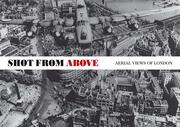
During the Second World War, the Royal Air Force undertook a remarkable aerial survey of the British Isles. Taking photographs from a low flying Spitfire, they mapped the whole of the United Kingdom. A selection of these is published here for the first time. Focusing on London, they show the havoc wreaked by the Luftwaffe. Earlier historic aerial views from the National Monuments Record, from early balloon photos to views from the 1930s, are also included in the book. The contemporary shots, taken by English Heritage's aerial photographer, Damien Grady, who by flying at the same height in a helicopter, has either recreated these views or produced ones that complement the earlier photographs. The book is laid out with the historic shot on one side of the page and the modern equivalent on the other. For example, we see the Isle of Dogs and Canary Wharf reduced to rubble in the Second World War, compared with the shimmering metal and glass towers of today. Another shots shows Heathrow, still a grassy field dotted with a few military planes during the war, unrecognizable compared with today's sprawling international airport. The historic shots show remarkable detail - factories with their roofs camouflaged to escape the attention of the German bombers; Hyde Park turned into allotments; even the details of films showing in Leicester Square. Commentary is provided by London expert Steven Brindle, who details the remarkable transformation the city has undergone during the last 60 years.
Historic buildings --- Monuments historiques --- Pictorial works. --- Ouvrages illustrés --- London (England) --- Londres (Angleterre) --- Aerial photographs. --- History --- Aerial views. --- Photographies aériennes --- Histoire --- Vues aériennes
Book
ISBN: 9789058264817 Year: 2007 Publisher: Leuven Davidsfonds
Abstract | Keywords | Export | Availability | Bookmark
 Loading...
Choose an application
- Reference Manager
- EndNote
- RefWorks (Direct export to RefWorks)
Regional documentation --- Belgium --- Belgique --- Aerial views --- Vues aériennes --- 982 --- België --- C3 --- België [land - BE] --- erfgoed --- landschap --- fotografie --- Kunst en cultuur --- Vues aériennes --- Aerial photographs --- Pictorial works --- Aerial views.
Book
ISBN: 2804603512 9782804603519 Year: 1999 Volume: 1 Publisher: Tournai : La Renaissance du livre,
Abstract | Keywords | Export | Availability | Bookmark
 Loading...
Choose an application
- Reference Manager
- EndNote
- RefWorks (Direct export to RefWorks)
Cet ouvrage accompagne l'exposition des photographies de Mariyn Bridges, au Musée de la photographie. Cet artiste, spécialisée dans la photographie aérienne a réalisé un "portrait pris du ciel " de la Wallonie. Ce livre inaugure une nouvelle collection, au sein des éditions du MET, intitulé "Regards".
Fotografie --- Photographie --- Wallonie --- Wallonië --- Wallonia (Belgium) --- Wallonie (Belgique) --- Aerial views. --- Pictorial works --- Vues aériennes --- Ouvrages illustrés --- Photographie aérienne --- Photographie documentaire --- Bridges, Marilyn --- Wallonie-région --- 770.9493 --- Arts Photography Belgium --- Vues aériennes --- Ouvrages illustrés
Book
ISBN: 9782940406401 2940406405 Year: 2012 Publisher: Genève : MētisPresses,
Abstract | Keywords | Export | Availability | Bookmark
 Loading...
Choose an application
- Reference Manager
- EndNote
- RefWorks (Direct export to RefWorks)
Aerial photography --- Aerial views --- Aerial photography in geography --- Space (Art) --- Photographie aérienne --- Vues aériennes --- Photographie aérienne en géographie --- Espace (Art) --- History --- Histoire --- Photographie aérienne --- Vues aériennes --- Photographie aérienne en géographie --- History.
| Listing 1 - 7 of 7 |
Sort by
|

 Search
 Feedback
 About UniCat
  Help
Help News
News