| Listing 1 - 10 of 52 | << page >> |
Sort by
|
Map
Abstract | Keywords | Export | Availability | Bookmark
 Loading...
Choose an application
- Reference Manager
- EndNote
- RefWorks (Direct export to RefWorks)
Book
Year: 1827 Publisher: Paris : Janet et Cotelle,
Abstract | Keywords | Export | Availability | Bookmark
 Loading...
Choose an application
- Reference Manager
- EndNote
- RefWorks (Direct export to RefWorks)
Book
Abstract | Keywords | Export | Availability | Bookmark
 Loading...
Choose an application
- Reference Manager
- EndNote
- RefWorks (Direct export to RefWorks)
BEL Belgium & GDL --- Almache --- Belgium --- botany --- ecology --- geology --- topographical maps
Book
Year: 2002 Publisher: Sohier Jean Leurquin
Abstract | Keywords | Export | Availability | Bookmark
 Loading...
Choose an application
- Reference Manager
- EndNote
- RefWorks (Direct export to RefWorks)
BEL Belgium & GDL --- Belgium --- Fays-Famenne --- Froidfontaine --- Haut-Fays --- Wimbe --- botany --- ecology --- geology --- topographical maps
Book
Year: 1917 Publisher: Epsom (UK) L.W. Andrews & Son
Abstract | Keywords | Export | Availability | Bookmark
 Loading...
Choose an application
- Reference Manager
- EndNote
- RefWorks (Direct export to RefWorks)
BRI British Isles --- British Isles --- area map --- checklists --- decline --- dedication --- flora statistics --- flora survey --- topographical maps
Book
Abstract | Keywords | Export | Availability | Bookmark
 Loading...
Choose an application
- Reference Manager
- EndNote
- RefWorks (Direct export to RefWorks)
BRI British Isles --- British Isles --- Ireland --- botanical districts --- checklists --- eco survey --- endemics --- flora elements --- topographical maps
Book
Year: 1840 Publisher: London (UK) Longman, Orme, Brown, Green and Longman
Abstract | Keywords | Export | Availability | Bookmark
 Loading...
Choose an application
- Reference Manager
- EndNote
- RefWorks (Direct export to RefWorks)
BRI British Isles --- British Isles --- England --- area map --- botanical districts --- flora survey --- general geography --- topographical maps
Book
Year: 1898 Publisher: Washington
Abstract | Keywords | Export | Availability | Bookmark
 Loading...
Choose an application
- Reference Manager
- EndNote
- RefWorks (Direct export to RefWorks)
AMN North America --- Alaska --- North America --- geographic maps --- geological maps --- mineral resources --- topographical maps

ISBN: 9781589480261 1589480260 Year: 2007 Publisher: Redlands, California ESRI Press
Abstract | Keywords | Export | Availability | Bookmark
 Loading...
Choose an application
- Reference Manager
- EndNote
- RefWorks (Direct export to RefWorks)
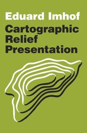
"The renowned Swiss cartographer, Eduard Imhof, devoted his career to raising the standards of map design. In 1965, his breakthrough book published in German, Kartographische Gelandedarstellung, filled a huge void in cartographic instruction. The book was translated into English in 1982 as Cartographic Relief Presentation, expanding its influence and reasserting Imhof's mission to improve the precision and readability of maps. Cartographic Relief Presentation was an expensive book with a limited press run that made it a rare find in recent years. Now, ESRI Press has reissued Eduard Imhof's masterpiece as an affordable volume for mapping professionals, scholars, scientists, students, and anyone interested in cartography." "This new edition of Cartographic Relief Presentation was edited for clarity and consistency but preserves Imhof's insightful commentary and analytical style. Color maps, aerial photographs, and instructive illustrations are faithfully reproduced. The book offers guidelines for properly rendering terrain in maps of all types and scales whether drawn by traditional means or with the aid of a computer. Cartographic Relief Presentation was among the essential mapping and graphical design books of the twentieth century. Its continuing relevance for the twenty-first century is assured with this publication."--Jacket.
Topographic maps --- 528 --- 912 --- Hypsographic maps --- Hypsometric maps --- Maps, Topographic --- Relief maps --- Topo maps --- Topographical maps --- Maps --- Cartografie --- Kaarten
Book
Year: 1874 Publisher: London (UK) Whittaker & Co
Abstract | Keywords | Export | Availability | Bookmark
 Loading...
Choose an application
- Reference Manager
- EndNote
- RefWorks (Direct export to RefWorks)
BRI British Isles --- British Isles --- area map --- climates --- flora statistics --- floristics --- geology --- history of botany --- taxonomical survey --- topographical maps --- waterways
| Listing 1 - 10 of 52 | << page >> |
Sort by
|

 Search
 Feedback
 About UniCat
  Help
Help News
News