| Listing 1 - 2 of 2 |
Sort by
|
Book
ISSN: 16848241 ISBN: 9789251060568 9251060568 Year: 2008 Volume: 13 Publisher: Rome: FAO,
Abstract | Keywords | Export | Availability | Bookmark
 Loading...
Choose an application
- Reference Manager
- EndNote
- RefWorks (Direct export to RefWorks)
Disaster risk management (DRM) combines, through a management perspective, the concept of prevention, mitigation and preparedness with response to the rising frequency and severity of natural hazards and disasters. This guide provides a set of tools that have been developed and tested in field projects, with particular reference to disaster-prone areas and vulnerable sectors and population groups.--Publisher's description
Emergency management --- Natural disasters --- Disaster relief --- 528.94 --- 614.87 --- Natural calamities --- Disasters --- Consequence management (Emergency management) --- Disaster planning --- Disaster preparedness --- Disaster prevention --- Emergencies --- Emergency planning --- Emergency preparedness --- Management --- Public safety --- First responders --- Disaster assistance --- Emergency assistance in disasters --- Emergency relief --- Human services --- 614.87 Exposure to ambient influences. Environmental hazards. Personal protection and safety --- Exposure to ambient influences. Environmental hazards. Personal protection and safety --- 528.94 Thematic cartography. Topical cartography --- Thematic cartography. Topical cartography --- Planning --- Preparedness --- Prevention

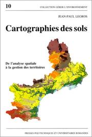
ISBN: 2880742986 9782880742980 Year: 1996 Volume: 10 Publisher: Lausanne: Presses polytechniques et universitaires romandes,
Abstract | Keywords | Export | Availability | Bookmark
 Loading...
Choose an application
- Reference Manager
- EndNote
- RefWorks (Direct export to RefWorks)
Cartographie --- Cartographie pédologique --- Pédologie --- Sols --- Informatique --- Aménagement --- Soil --- cartography --- Collecte de données --- data collection --- Système d'information géographique --- Geographical information systems --- Application des ordinateurs --- computer applications --- Modèle --- Models --- Méthodologie --- methodology --- Aménagement du territoire --- Land use planning --- Recherche interdisciplinaire --- Interdisciplinary research --- 528.94 --- 631.47 --- 711.142 --- 912:631.4 --- Thematic cartography. Topical cartography --- Surveying, classification and utilization of land. Soil profiles. Litter. Humus. Topsoil. Subsoil etc. Micropedology --- Planologie: grondclassificatie; bodemkartering --- Maps. Atlasses: soils --- Geografie --- Cartografie --- Toepassingen. --- 711.142 Planologie: grondclassificatie; bodemkartering --- 631.47 Surveying, classification and utilization of land. Soil profiles. Litter. Humus. Topsoil. Subsoil etc. Micropedology --- 528.94 Thematic cartography. Topical cartography --- Cartographie pédologique --- Pédologie --- Aménagement --- Soil surveys --- Cartography --- Remote sensing --- Soil surveys - Remote sensing --- Cartographie pédologique - Informatique --- Cartographie des sols
| Listing 1 - 2 of 2 |
Sort by
|

 Search
 Feedback
 About UniCat
  Help
Help News
News