| Listing 1 - 10 of 168 | << page >> |
Sort by
|

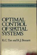
ISBN: 9780045190188 0045190186 Year: 1984 Publisher: London: Allen and Unwin,
Abstract | Keywords | Export | Availability | Bookmark
 Loading...
Choose an application
- Reference Manager
- EndNote
- RefWorks (Direct export to RefWorks)
Book
ISBN: 1394244428 Year: 2024 Publisher: Newark : John Wiley & Sons, Incorporated,
Abstract | Keywords | Export | Availability | Bookmark
 Loading...
Choose an application
- Reference Manager
- EndNote
- RefWorks (Direct export to RefWorks)
This book explores the transformative potential of AI-driven spatial computing, focusing on its impact on business and technology. It examines key technologies like virtual reality (VR), augmented reality (AR), and artificial intelligence (AI), highlighting their convergence and the resulting opportunities for innovation. The authors discuss the evolution of spatial computing from science fiction to business reality, offering insights into its applications and benefits in various sectors. They emphasize the importance of leadership and strategic foresight in navigating this new era, while also addressing ethical considerations and risks. The book aims to guide business leaders and technologists in leveraging spatial computing to enhance user experiences and drive organizational success.
Book
ISBN: 3515058257 Year: 1992 Publisher: Stuttgart Steiner
Abstract | Keywords | Export | Availability | Bookmark
 Loading...
Choose an application
- Reference Manager
- EndNote
- RefWorks (Direct export to RefWorks)
Farm produce --- Spatial systems --- Marketing
Book
Year: 2012 Publisher: Denver, CO : U.S. Geological Survey,
Abstract | Keywords | Export | Availability | Bookmark
 Loading...
Choose an application
- Reference Manager
- EndNote
- RefWorks (Direct export to RefWorks)
Geospatial data --- Geographic information systems --- Spatial systems.
Book
ISBN: 1628705361 1281934429 9786611934422 981279428X 9789812794284 9781628705362 9812383379 9789812383372 9789812383372 9812383379 Year: 2003 Publisher: Singapore : World Scientific,
Abstract | Keywords | Export | Availability | Bookmark
 Loading...
Choose an application
- Reference Manager
- EndNote
- RefWorks (Direct export to RefWorks)
Vibration is a natural phenomenon that occurs in a variety of engineering systems. In many circumstances, vibration greatly affects the nature of engineering design as it often dictates limiting factors in the performance of the system. The conventional treatment is to redesign the system or to use passive damping. The former could be a costly exercise, while the latter is only effective at higher frequencies. Active control techniques have emerged as viable technologies to fill this low-frequency gap. This book is concerned with the study of feedback controllers for vibration control of flexi
Spatial systems. --- Vibration. --- Cycles --- Mechanics --- Sound --- Systems, Spatial --- System analysis
Book
ISBN: 1315120100 1351646419 1498722172 Year: 2017 Publisher: Boca Raton : CRC Press,
Abstract | Keywords | Export | Availability | Bookmark
 Loading...
Choose an application
- Reference Manager
- EndNote
- RefWorks (Direct export to RefWorks)
"Traditional methods for handling spatial data are encumbered by the assumption of separate origins for horizontal and vertical measurements, but modern measurement systems operate in a 3-D spatial environment. The 3-D Global Spatial Data Model: Principles and Applications, Second Edition maintains a new model for handling digital spatial data, the global spatial data model or GSDM. The GSDM preserves the integrity of three-dimensional spatial data while also providing additional benefits such as simpler equations, worldwide standardization, and the ability to track spatial data accuracy with greater specificity and convenience. This second edition expands to new topics that satisfy a growing need in the GIS, professional surveyor, machine control, and Big Data communities while continuing to embrace the earth center fixed coordinate system as the fundamental point of origin of one, two, and three-dimensional data sets. Ideal for both beginner and advanced levels, this book also provides guidance and insight on how to link to the data collected and stored in legacy systems."--Provided by publisher.
Spatial data infrastructures --- Spatial systems. --- Three-dimensional imaging. --- Mathematics.

ISBN: 0826340229 1552384535 1429411546 Year: 2006 Publisher: Calgary [Alta.] : University of Calgary Press,
Abstract | Keywords | Export | Availability | Bookmark
 Loading...
Choose an application
- Reference Manager
- EndNote
- RefWorks (Direct export to RefWorks)
Space and Spatial Analysis in Archaeology is made up of thirty-seven contributions based on and developed from papers presented at the 2001 Chacmool Conference, An Odyssey of Space, one of the first and largest meetings to focus on this increasingly important aspect of archaeological research. The papers discuss studies undertaken in a number of different archaeological settings and incorporate a broad range of methodological and theoretical approaches to spatial analysis. They reflect the roots of spatial archaeology in approaches such as settlement pattern analysis and also look at innovative new directions in the field, such as landscape archaeology and space syntax studies. This range of focus provides a valuable snapshot of the state of spatial research in archaeology as it enters the twenty-first century and reflects its increasing breadth and popularity among archaeological researchers.
Social archaeology --- Spatial systems --- Archaeological geology --- Landscape archaeology --- Archaeoastronomy
Book
ISBN: 0416309704 0416309801 9780416309805 Year: 1981 Publisher: London Methuen
Abstract | Keywords | Export | Availability | Bookmark
 Loading...
Choose an application
- Reference Manager
- EndNote
- RefWorks (Direct export to RefWorks)
Geography --- Geography. --- Spatial systems. --- Géographie --- Systèmes spatiaux --- Spatial systems --- Geografie --- Geografische Informatie Systemen --- Modelleren. --- Géographie --- Systèmes spatiaux --- Systems, Spatial --- System analysis --- Cosmography --- Earth sciences --- World history

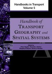
ISSN: 14727889 ISBN: 0080441084 161583253X 9780080441085 Year: 2004 Volume: 5 Publisher: Amsterdam Elsevier
Abstract | Keywords | Export | Availability | Bookmark
 Loading...
Choose an application
- Reference Manager
- EndNote
- RefWorks (Direct export to RefWorks)
Transport systems, the vital arteries of modern societies and economies, shape our world and are shaped by it. The subject of this volume is the dynamic interactions between transport and the physical, economic, and human geographies it weaves through. Transport plays a central role in economic development and growth. It profoundly affects the socio-economic characteristics and spatial form of urban centres and rural areas alike. A new transport link can bring increases in population, in employment, in industrial activity, in wealth. In turn, these changes can lead to demands for further transport improvements. All these factors are explored in the section on Transport and Spatial Form. Sections on Land-use/Transportation Modelling and Data then discuss how to obtain appropriate data and model these transport-geographic phenomena. The past decade has seen substantial research efforts devoted to improving transport modelling techniques, and the state of the art is described here. GIS and GPS are powerful technologies with a wide range of potential applications in this field, in which great advances have been made in recent years.Each therefore has a whole section devoted to it, both to established applications and to those yet to be fully exploited. While all these and the section on Network Analysis may be regarded as core areas, topics on the frontiers are also covered in this comprehensive volume, with sections on Spatial Cognition, GeoSimulation, and Time Use. Each chapter was specially commissioned from an acknowledged world expert on its topic. Each offers an overview and useful insights to those familiar with the area as well as those new to it. Systematic and thorough in its creation, current and accessible in its content, and authoritative and international in its authorship, the "Handbook of Transport Geography and Spatial Systems" will be the definitive reference work on this important subject.

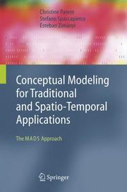
ISBN: 3540301534 9783540301530 3642067646 9786610620616 1280620617 354030326X Year: 2006 Publisher: Berlin Springer
Abstract | Keywords | Export | Availability | Bookmark
 Loading...
Choose an application
- Reference Manager
- EndNote
- RefWorks (Direct export to RefWorks)
From environmental management to land planning and geo-marketing, the number of application domains that may greatly benefit from using data enriched with spatio-temporal features is expanding very rapidly. Unfortunately, development of new spatio-temporal applications is hampered by the lack of conceptual design methods suited to cope with the additional complexity of spatio-temporal data. This complexity is obviously due to the particular semantics of space and time, but also to the need for multiple representations of the same reality to address the diversity of requirements from highly heterogeneous user communities. Conceptual design methods are also needed to facilitate the exchange and reuse of existing data sets, a must in geographical data management due to the high collection costs of the data. Yet, current practice in areas like geographical information systems or moving objects databases does not include conceptual design methods very well, if at all. This book shows that a conceptual design approach for spatio-temporal databases is both feasible and easy to apprehend. While providing a firm basis through extensive discussion of traditional data modeling concepts, the major focus of the book is on modeling spatial and temporal information. Parent, Spaccapietra and Zimányi provide a detailed and comprehensive description of an approach that fills the gap between application conceptual requirements and system capabilities, covering both data modeling and data manipulation features. The ideas presented summarize several years of research on the characteristics and description of space, time, and perception. In addition to the authors' own data modeling approach, MADS (Modeling of Application Data with Spatio-temporal features), the book also surveys alternative data models and approaches (from industry and academia) that target support of spatio-temporal modeling. The reader will acquire intimate knowledge of both the traditional and innovative features
Database design --- Temporal databases --- Spatial systems --- Database management --- Mathematical models --- Database design. --- Database management. --- Temporal databases. --- Mathematical models. --- Information systems --- Spatial systems - Mathematical models
| Listing 1 - 10 of 168 | << page >> |
Sort by
|

 Search
 Feedback
 About UniCat
  Help
Help News
News