| Listing 1 - 10 of 11 | << page >> |
Sort by
|
Book
ISBN: 9780306419928 0306419920 Year: 1986 Publisher: New York (N.Y.): Plenum,
Abstract | Keywords | Export | Availability | Bookmark
 Loading...
Choose an application
- Reference Manager
- EndNote
- RefWorks (Direct export to RefWorks)
Book
ISBN: 0309272459 9780309272452 Year: 2022 Publisher: Washington, D.C. : National Academies Press,
Abstract | Keywords | Export | Availability | Bookmark
 Loading...
Choose an application
- Reference Manager
- EndNote
- RefWorks (Direct export to RefWorks)
Book
ISSN: 03796566 ISBN: 9290923350 9789290923350 Year: 1996 Volume: 1184
Abstract | Keywords | Export | Availability | Bookmark
 Loading...
Choose an application
- Reference Manager
- EndNote
- RefWorks (Direct export to RefWorks)
Spectrometer. --- Geophysics --- Atmospheric physics --- Oceanography --- Remote sensing. --- Geophysics - Remote sensing. --- Atmospheric physics - Remote sensing. --- Oceanography - Remote sensing.
Book
ISBN: 0853125988 0470201487 9780470201480 9780853125983 Year: 1985 Publisher: Chichester Ellis Horwood
Abstract | Keywords | Export | Availability | Bookmark
 Loading...
Choose an application
- Reference Manager
- EndNote
- RefWorks (Direct export to RefWorks)
Oceanography --- Astronautics in oceanography --- Remote sensing --- -Oceanography, Physical --- Oceanology --- Physical oceanography --- Thalassography --- Earth sciences --- Marine sciences --- Ocean --- -Remote sensing --- -Oceanography --- Oceanography, Physical --- Oceanography - Remote sensing

ISBN: 9027716080 9400971656 940097163X 9789027716088 Year: 1982 Volume: 106 Publisher: Dordrecht ; Boston ; Lancaster : D. Reidel,
Abstract | Keywords | Export | Availability | Bookmark
 Loading...
Choose an application
- Reference Manager
- EndNote
- RefWorks (Direct export to RefWorks)
Oceanography --- Remote sensing --- Congresses --- Oceanography - Remote sensing - Congresses --- OCEANOLOGIE PHYSIQUE ET CHIMIQUE --- SCIENCES DE LA TERRE --- GENERALITES --- PHOTOGEOLOGIE, TELEDETECTION --- GEOMORPHOLOGIE GENERALE --- COTIER --- OCEANOGRAPHY --- REMOTE SENSING

ISBN: 9780444828927 0444828923 9780080538044 0080538045 1281034339 9781281034335 9786611034337 6611034331 Year: 1997 Volume: 7 62 Publisher: Amsterdam ; New York : Elsevier,
Abstract | Keywords | Export | Availability | Bookmark
 Loading...
Choose an application
- Reference Manager
- EndNote
- RefWorks (Direct export to RefWorks)
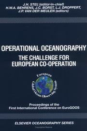
GOOS is an international programme for a permanent global framework of observations, modelling and analysis of ocean variables which are needed to support operational services around the world. The EuroGOOS strategy has two streams: the first is to improve the quality of marine information in European home waters, and the second is to collaborate with similar organisations in other continents to create a new global ocean observing and modelling system that will provide the open ocean forecasts needed to achieve the best possible performance by local marine information services everywhere.
Oceanography --- Remote sensing --- Congresses. --- Congresses --- Remote sensing. --- Remote-sensing imagery --- Remote sensing systems --- Remote terrain sensing --- Sensing, Remote --- Terrain sensing, Remote --- Aerial photogrammetry --- Aerospace telemetry --- Detectors --- Space optics --- Oceanography - Remote sensing - Congresses
Book
ISBN: 3642320147 9786613944108 3642320155 1283631652 Year: 2012 Publisher: Berlin ; Heidelberg : Springer,
Abstract | Keywords | Export | Availability | Bookmark
 Loading...
Choose an application
- Reference Manager
- EndNote
- RefWorks (Direct export to RefWorks)
Dead-Reckoning aided with Doppler velocity measurement has been the most common method for underwater navigation for small vehicles. Unfortunately DR requires frequent position recalibrations and underwater vehicle navigation systems are limited to periodic position update when they surface. Finally standard Global Positioning System (GPS) receivers are unable to provide the rate or precision required when used on a small vessel. To overcome this, a low cost high rate motion measurement system for an Unmanned Surface Vehicle (USV) with underwater and oceanographic purposes is proposed. The proposed onboard system for the USV consists of an Inertial Measurement Unit (IMU) with accelerometers and rate gyros, a GPS receiver, a flux-gate compass, a roll and tilt sensor and an ADCP. Interfacing all the sensors proved rather challenging because of their different characteristics. The proposed data fusion technique integrates the sensors and develops an embeddable software package, using real time data fusion methods, for a USV to aid in navigation and control as well as controlling an onboard Acoustic Doppler Current Profiler (ADCP). While ADCPs non-intrusively measure water flow, the vessel motion needs to be removed to analyze the data and the system developed provides the motion measurements and processing to accomplish this task.
Oceanographic instruments. --- Oceanography -- Remote sensing. --- Ships -- Remote sensing. --- Vehicles, Remotely piloted -- Control. --- Wave-motion, Theory of. --- Oceanographic instruments --- Earth & Environmental Sciences --- Mechanical Engineering --- Engineering & Applied Sciences --- Mechanical Engineering - General --- Marine Science --- Oceanography --- Underwater navigation. --- Remote sensing. --- Navigation, Underwater --- Navigation (Underwater) --- Submarine navigation --- Engineering. --- Oceanography. --- Computer-aided engineering. --- Control engineering. --- Control. --- Signal, Image and Speech Processing. --- Computer-Aided Engineering (CAD, CAE) and Design. --- Navigation
Book
ISBN: 3540244301 3540683224 Year: 2010 Publisher: Berlin, Heidelberg : Springer Berlin Heidelberg : Imprint: Springer,
Abstract | Keywords | Export | Availability | Bookmark
 Loading...
Choose an application
- Reference Manager
- EndNote
- RefWorks (Direct export to RefWorks)
The remote sensing of oceans from space has developed rapidly since 1978 when the first dedicated ocean viewing sensors were launched. In 1991 the first European Space Agency remote sensing satellite carried sensors primarily for the ocean, heralding the widespread use of satellite date by oceanographes. In the mid 1990's the US/French TOPEX-Poseidon mission revolutionised the performance of satellite altimetry and since 1997 NASA's SeaWiFs mission has delivered operational measurements of ocean colour. The new millennium has seen the launch of several very large remote sensing platforms ans a number of smaller missions by ESA, NASA and NASDA, providing almost comprehensive worldwide measurements of sea surface waves and wind, temperature, colour, currents and other ocean properties. The increasing availability of so much satellite data has undoubtedly changed the way the science of oceanography has developed. The unique perspective provided by satellites has revealed previously undetected ocean phenomena, cast new light on old problems and opened the way for new fields of oceanographic study.
Artificial satellites in oceanography. --- Astronautics in oceanography. --- Oceanography -- Remote sensing. --- Oceanography --- Artificial satellites in oceanography --- Physics --- Earth & Environmental Sciences --- Physical Sciences & Mathematics --- Cosmic Physics --- Marine Science --- Remote sensing --- Remote sensing. --- Earth sciences. --- Geophysics. --- Hydrogeology. --- Oceanography. --- Ecotoxicology. --- Earth Sciences. --- Geophysics/Geodesy. --- Physical geography. --- Hydraulic engineering. --- Environmental toxicology. --- Ecotoxicology --- Pollutants --- Pollution --- Environmental health --- Toxicology --- Engineering, Hydraulic --- Engineering --- Fluid mechanics --- Hydraulics --- Shore protection --- Geography --- Oceanography, Physical --- Oceanology --- Physical oceanography --- Thalassography --- Earth sciences --- Marine sciences --- Ocean --- Geohydrology --- Geology --- Hydrology --- Groundwater --- Geological physics --- Terrestrial physics

ISBN: 9780387683003 9780387366289 0387366288 0387563938 9786612833908 0387683003 1282833901 3540563938 Year: 2010 Volume: 41 Publisher: New York, NY : Springer New York : Imprint: Springer,
Abstract | Keywords | Export | Availability | Bookmark
 Loading...
Choose an application
- Reference Manager
- EndNote
- RefWorks (Direct export to RefWorks)
The book presents a wealth of material about the polar oceans, more specifically the ice-covered areas and peripheral seas. It provides a detailed history of the changing climate of the polar oceans as observed by satellite sensors in the last three decades. The satellite research data show spatial distributions of surface temperature, sea ice, albedo, chlorophyll concentration, clouds, ocean color and sea level pressure. The book discusses remote sensing techniques and algorithms used to transform digital data to geophysical parameters, to process and analyze the data, the limitations of these data and the enormous potential in the use of this data. The main goal of the book is the presentation of results from studies of the time evolution of polar surfaces as observed by satellite sensors and their relevance to the study of cryospheric and ocean processes and climate change. The book contains about 150 satellite images of surface parameters which reveal that from month to month and from one year to another the Earth is changing. Although the historical record of about three decades of continuous satellite observation is relatively short, these measurements have provided useful insights into the current state of the polar environment and have served as a powerful tool for studying the processes that govern the Earth’s climate system. The advent of even more sophisticated technology, including international ventures like the Global Earth Observation System of all Systems (GEOSS), will speed the progress. The advances in understanding of the Earth’s climate engine, including the crucial role played by the polar oceans, have been tremendous, and people look forward to being able to forecast effectively the state of the planet in the immediate and foreseeable future.
Earth Sciences. --- Oceanography. --- Meteorology/Climatology. --- Climate Change. --- Geography. --- Meteorology. --- Climatic changes. --- Géographie --- Météorologie --- Océanographie --- Climat --- Changements --- Oceanography --- Artificial satellites in oceanography --- Remote sensing --- Polar regions --- Artificial satellites in oceanography. --- Polar regions. --- Remote sensing. --- Atmospheric Sciences. --- Climate Change/Climate Change Impacts. --- Changes, Climatic --- Changes in climate --- Climate change --- Climate change science --- Climate changes --- Climate variations --- Climatic change --- Climatic changes --- Climatic fluctuations --- Climatic variations --- Global climate changes --- Global climatic changes --- Climatology --- Climate change mitigation --- Teleconnections (Climatology) --- Oceanography, Physical --- Oceanology --- Physical oceanography --- Thalassography --- Earth sciences --- Marine sciences --- Ocean --- Environmental aspects --- Rewriting systems (Computer science) --- Congresses --- Atmospheric sciences. --- Climate change. --- Atmospheric sciences --- Atmosphere --- Cold regions --- Global environmental change --- Oceanography - Remote sensing
Book
ISBN: 3642129676 3642432360 9786612981692 3642129684 1282981692 Year: 2011 Publisher: Berlin, Heidelberg : Springer Berlin Heidelberg : Imprint: Springer,
Abstract | Keywords | Export | Availability | Bookmark
 Loading...
Choose an application
- Reference Manager
- EndNote
- RefWorks (Direct export to RefWorks)
The book collects the lectures delivered during the 7th International Summer School on Atmospheric and Oceanic Sciences (ISSAOS) titled “Integrated Ground-Based Observing Systems Applications for Climate, Meteorology, and Civil Protection”. The book aims to contribute to the scientific understanding of basic concepts and applications of integrated ground-based observing systems. The first part describes most common instrumentations with their strength and limitations; strategic plans for the deployment of an observation site are discussed, together with an overview of techniques for integrating heterogeneous data. The second part introduces cutting-edge applications, including assimilation in numerical weather prediction, climate benchmarking, air quality monitoring, and meteo/hydrological warnings.
Atmosphere -- Remote sensing. --- Oceanography -- Remote sensing. --- Remote sensing --- Geography --- Earth & Environmental Sciences --- Cartography --- Geography-General --- Remote sensing. --- Aerial photography in geography. --- Geography, Aerial --- Geography. --- Meteorology. --- Geographical information systems. --- Remote Sensing/Photogrammetry. --- Geographical Information Systems/Cartography. --- Environmental Monitoring/Analysis. --- Remote-sensing imagery --- Remote sensing systems --- Remote terrain sensing --- Sensing, Remote --- Terrain sensing, Remote --- Aerial photogrammetry --- Aerospace telemetry --- Detectors --- Space optics --- Monitoring/Environmental Analysis. --- Geographical information systems --- GIS (Information systems) --- Information storage and retrieval systems --- Environmental monitoring. --- Biomonitoring (Ecology) --- Ecological monitoring --- Environmental quality --- Monitoring, Environmental --- Applied ecology --- Environmental engineering --- Pollution --- Aerology --- Atmospheric science --- Measurement --- Monitoring
| Listing 1 - 10 of 11 | << page >> |
Sort by
|

 Search
 Feedback
 About
About Help
Help News
News