| Listing 1 - 10 of 12 | << page >> |
Sort by
|
Book
ISBN: 9780128225745 0128225742 9780128225769 0128225769 Year: 2021 Publisher: Amsterdam Elsevier
Abstract | Keywords | Export | Availability | Bookmark
 Loading...
Choose an application
- Reference Manager
- EndNote
- RefWorks (Direct export to RefWorks)
Mass-wasting. --- Mass movement (Soil mechanics) --- Earth movements

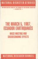
ISBN: 0309044448 9786610203840 1280203846 0309595134 0585148643 9780585148649 9780309044448 9781280203848 6610203849 9780309595131 Year: 1991 Publisher: Washington, D.C. National Academy Press
Abstract | Keywords | Export | Availability | Bookmark
 Loading...
Choose an application
- Reference Manager
- EndNote
- RefWorks (Direct export to RefWorks)
Earthquakes --- Mass-wasting --- Social aspects --- Economic aspects --- Mass movement (Soil mechanics) --- Quakes (Earthquakes) --- Earth movements --- Natural disasters --- Seismology
Book
ISBN: 1789858240 1789858232 Year: 2020 Publisher: [Place of publication not identified] : IntechOpen,
Abstract | Keywords | Export | Availability | Bookmark
 Loading...
Choose an application
- Reference Manager
- EndNote
- RefWorks (Direct export to RefWorks)
Landslides. --- Mass-wasting. --- Mass movement (Soil mechanics) --- Earth movements --- Land slides --- Landsliding --- Landslips --- Slides (Landslides) --- Mass-wasting
Book
ISBN: 0306408880 1461333644 1461333628 Year: 1982 Volume: 6 Publisher: New York, NY London : Plenum Press,
Abstract | Keywords | Export | Availability | Bookmark
 Loading...
Choose an application
- Reference Manager
- EndNote
- RefWorks (Direct export to RefWorks)
Aardverschuivingen --- Bottom deposits (Oceanography) --- Bottom sediments (Oceanography) --- Deep-sea deposits --- Deposits [Deep-sea ] --- Erdrutsche --- Glissements de terrain --- Grondverschuivingen --- Land slides --- Landslides --- Mariene sedimenten --- Marine deposits --- Marine sediments --- Mass movement (Soil mechanics) --- Mass-wasting --- Mouvements de masse (mécanique des sols) --- Mouvements de terrain --- Mouvements gravitationnels --- Sediments [Mariene ] --- Sediments marins --- Earthquakes. --- Geology. --- Mer --- Sediments

ISBN: 0774802049 Year: 1985 Publisher: Vancouver University of British Columbia press
Abstract | Keywords | Export | Availability | Bookmark
 Loading...
Choose an application
- Reference Manager
- EndNote
- RefWorks (Direct export to RefWorks)
Frozen ground --- Sols gelés --- Mackay, J. Ross --- Ice --- Mass-wasting --- Mackay, J. R., --- Mass movement (Soil mechanics) --- Earth movements --- Frozen water --- Frost --- Physical geography --- Water --- Frozen soil --- Cryosphere --- Soils --- Cryopedology --- Mackay, J. R. --- Frozen ground. --- Ice. --- Mass-wasting. --- Sols gelés --- MacKay, John Ross,
Book
ISBN: 0813741106 Year: 1995 Publisher: Boulder : Geological Society of America,
Abstract | Keywords | Export | Availability | Bookmark
 Loading...
Choose an application
- Reference Manager
- EndNote
- RefWorks (Direct export to RefWorks)
552.52 --- Slopes (Soil mechanics) --- Clay soils --- -Shale --- Mass-wasting --- #Hist.Geol. --- Mass movement (Soil mechanics) --- Earth movements --- Sedimentary rocks --- Clayey soils --- Soils, Clay --- Clay --- Soils --- Soil mechanics --- Argillaceous rocks. Non-crystalline schists. Shales. Clays. Clayslates. Mud --- Stability --- Conferences - Meetings --- 552.52 Argillaceous rocks. Non-crystalline schists. Shales. Clays. Clayslates. Mud --- Shale --- #Hist.Geol
Book

ISBN: 3319009710 3319009729 Year: 2014 Publisher: Cham : Springer International Publishing : Imprint: Springer,
Abstract | Keywords | Export | Availability | Bookmark
 Loading...
Choose an application
- Reference Manager
- EndNote
- RefWorks (Direct export to RefWorks)
Submarine mass movements are a hidden geohazard with large destructive potential for submarine installations and coastal areas. This hazard and associated risk is growing in proportion with increasing population of coastal urban agglomerations, industrial infrastructure, and coastal tourism. Also, the intensified use of the seafloor for natural resource production, and deep sea cables constitutes an increasing risk. Submarine slides may alter the coastline and bear a high tsunamogenic potential. There is a potential link of submarine mass wasting with climate change, as submarine landslides can uncover and release large amounts greenhouse gases, mainly methane, that are now stored in marine sediments. The factors that govern the stability of submarine slopes against failure, the processes that lead to slope collapses and the collapse processes by themselves need to be better understood in order to foresee and prepare society for potentially hazardous events. This book volume consists of a collection of cutting edge scientific research by international experts in the field, covering geological, geophysical, engineering and environmental aspects of submarine slope failures. The focus is on understanding the full spectrum of challenges presented by this major coastal and offshore geohazard.
Submarine geology. --- Mass-wasting. --- Mass movement (Soil mechanics) --- Geological oceanography --- Geology, Submarine --- Marine geology --- Earth sciences. --- Sedimentology. --- Oceanography. --- Geotechnical engineering. --- Physical geography. --- Earth Sciences. --- Physical Geography. --- Geotechnical Engineering & Applied Earth Sciences. --- Earth movements --- Geology --- Petrology --- Geography --- Oceanography, Physical --- Oceanology --- Physical oceanography --- Thalassography --- Earth sciences --- Marine sciences --- Ocean --- Engineering, Geotechnical --- Geotechnics --- Geotechnology --- Engineering geology
Book

ISBN: 3319209787 3319209795 Year: 2016 Publisher: Cham : Springer International Publishing : Imprint: Springer,
Abstract | Keywords | Export | Availability | Bookmark
 Loading...
Choose an application
- Reference Manager
- EndNote
- RefWorks (Direct export to RefWorks)
This book is a comprehensive collection of state-of-the-art studies of seafloor slope instability and their societal implications. The volume captures the most recent and exciting scientific progress made in this research field. As the world’s climate and energy needs change, the conditions under which slope instability occurs, and needs to be considered, are also changing. The science and engineering of submarine – or more widely subaqueous – mass movements is greatly benefiting from advances in seafloor and sub-seafloor surveying technologies. Ultra-high-resolution seafloor mapping and 3D seismic reflection cubes are becoming commonly available datasets that are dramatically increasing our knowledge of the mechanisms and controls of subaqueous slope failure. Monitoring of slope deformation, repeat surveying and deep drilling, on the other hand, are emerging as important new techniques for understanding the temporal scales of slope instability. In essence, rapid advances in technology are being readily incorporated into scientific research and as a result, our understanding of submarine mass movements is increasing at a very fast rate. The volume also marks the beginning of the third IGCP project for the submarine mass movement research community, IGCP-640 S4SLIDE (Significance of Modern and Ancient Submarine Slope LandSLIDEs). The Submarine Mass Movements and Their Consequences symposium is the biannual meeting under the IGCP umbrella.
Marine Science --- Earth & Environmental Sciences --- Mass-wasting --- Submarine geology --- Oceanography --- Sedimentology --- Mass movement (Soil mechanics) --- Earth movements --- Oceanography. --- Physical geography. --- Sedimentology. --- Geology. --- Physical Geography. --- Geotechnical Engineering & Applied Earth Sciences. --- Natural Hazards. --- Geognosy --- Geoscience --- Earth sciences --- Natural history --- Petrology --- Geography --- Oceanography, Physical --- Oceanology --- Physical oceanography --- Thalassography --- Marine sciences --- Ocean --- Geotechnical engineering. --- Natural disasters. --- Natural calamities --- Disasters --- Engineering, Geotechnical --- Geotechnics --- Geotechnology --- Engineering geology
Book
ISBN: 9781786203823 1786203820 Year: 2019 Publisher: London : The Geological Society of London
Abstract | Keywords | Export | Availability | Bookmark
 Loading...
Choose an application
- Reference Manager
- EndNote
- RefWorks (Direct export to RefWorks)
Submarine geology --- Landslides --- Mass-wasting --- Geological oceanography --- Geology, Submarine --- Marine geology --- Geology --- Mass movement (Soil mechanics) --- Earth movements --- Land slides --- Landsliding --- Landslips --- Slides (Landslides) --- Submarine geology. --- Landslides. --- Mass-wasting. --- Mouvements de masse (mécanique des sols) --- Géologie sous-marine. --- Glissements de terrain. --- Mouvements de masse (mécanique des sols) --- Géologie sous-marine.
Book
ISBN: 3642427782 3642254942 9786613704351 3642254950 1280793961 Year: 2012 Publisher: Berlin ; Heidelberg : Springer,
Abstract | Keywords | Export | Availability | Bookmark
 Loading...
Choose an application
- Reference Manager
- EndNote
- RefWorks (Direct export to RefWorks)
Terrestrial mass movements (i.e. cliff collapses, soil creeps, mudflows, landslides etc.) are severe forms of natural disasters mostly occurring in mountainous terrain, which is subjected to specific geological, geomorphological and climatological conditions, as well as to human activities. It is a challenging task to accurately define the position, type and activity of mass movements for the purpose of creating inventory records and potential vulnerability maps. Remote sensing techniques, in combination with Geographic Information System tools, allow state-of-the-art investigation of the degree of potential mass movements and modeling surface processes for hazard and risk mapping. Similarly, through statistical prediction models, future mass-movement-prone areas can be identified and damages can to a certain extent be minimized. Issues of scale and selection of morphological attributes for the scientific analysis of mass movements call for new developments in data modeling and spatio-temporal GIS analysis. The book is a product of a cooperation between the editors and several contributing authors, addressing current issues and recent developments in GI technology and mass movements research. Its fundamental treatment of this technology includes data modeling, topography, geology, geomorphology, remote sensing, artificial neural networks, binomial regression, fuzzy logic, spatial statistics and analysis, and scientific visualization. Both theoretical and practical issues are addressed.
Geographic information systems. --- Mass-wasting -- Remote sensing. --- Geology --- Geography --- Earth & Environmental Sciences --- Cartography --- Dynamic & Structural Geology --- Mass-wasting --- Remote sensing. --- Geographical information systems --- GIS (Information systems) --- Mass movement (Soil mechanics) --- Geography. --- Geophysics. --- Geographical information systems. --- Physical geography. --- Geographical Information Systems/Cartography. --- Geophysics/Geodesy. --- Physical Geography. --- Remote Sensing/Photogrammetry. --- Information storage and retrieval systems --- Earth movements --- Remote-sensing imagery --- Remote sensing systems --- Remote terrain sensing --- Sensing, Remote --- Terrain sensing, Remote --- Aerial photogrammetry --- Aerospace telemetry --- Detectors --- Space optics --- Geological physics --- Terrestrial physics --- Earth sciences --- Physics
| Listing 1 - 10 of 12 | << page >> |
Sort by
|

 Search
 Feedback
 About UniCat
  Help
Help News
News