| Listing 1 - 10 of 11 | << page >> |
Sort by
|
Book
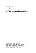
ISBN: 0444700080 Year: 1986 Publisher: Amsterdam,New York : North-Holland,
Abstract | Keywords | Export | Availability | Bookmark
 Loading...
Choose an application
- Reference Manager
- EndNote
- RefWorks (Direct export to RefWorks)

ISBN: 0070407630 Year: 1992 Publisher: London MacGraw-Hill
Abstract | Keywords | Export | Availability | Bookmark
 Loading...
Choose an application
- Reference Manager
- EndNote
- RefWorks (Direct export to RefWorks)

ISBN: 0077077679 Year: 1993 Publisher: London McGraw-Hill
Abstract | Keywords | Export | Availability | Bookmark
 Loading...
Choose an application
- Reference Manager
- EndNote
- RefWorks (Direct export to RefWorks)

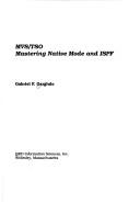
ISBN: 0894353152 Year: 1990 Publisher: Wellesley QED Information Sciences
Abstract | Keywords | Export | Availability | Bookmark
 Loading...
Choose an application
- Reference Manager
- EndNote
- RefWorks (Direct export to RefWorks)

ISBN: 0070066639 Year: 1998 Publisher: New York (N.Y.): McGraw-Hill
Abstract | Keywords | Export | Availability | Bookmark
 Loading...
Choose an application
- Reference Manager
- EndNote
- RefWorks (Direct export to RefWorks)
Operating systems (Computers) --- IBM MVS. --- UNIX (Computer file)

ISBN: 0471504351 Year: 1991 Publisher: Chichester Wiley
Abstract | Keywords | Export | Availability | Bookmark
 Loading...
Choose an application
- Reference Manager
- EndNote
- RefWorks (Direct export to RefWorks)
Assembly languages (Electronic computers) --- IBM computers --- Programming --- IBM MVS

ISBN: 0201145022 0201145014 9780201145014 9780201145021 Year: 1984 Publisher: Reading (Mass.): Addison-Wesley
Abstract | Keywords | Export | Availability | Bookmark
 Loading...
Choose an application
- Reference Manager
- EndNote
- RefWorks (Direct export to RefWorks)
Computer architecture. Operating systems --- Unix --- OS (operating system) --- Vax --- computerbesturingssystemen --- systeemprogrammatuur --- DOS (disk operating system) --- Operating systems (Computers) --- 681.3*D4 --- Besturingssystemen --- Computer operating systems --- Computers --- Disk operating systems --- Systems software --- Operating systems--See also {681.3*C} --- Operating systems --- Operating systems (Computers). --- 681.3*D4 Operating systems--See also {681.3*C} --- Mvs --- Vm
Book
ISBN: 303928181X 3039281801 Year: 2020 Publisher: MDPI - Multidisciplinary Digital Publishing Institute
Abstract | Keywords | Export | Availability | Bookmark
 Loading...
Choose an application
- Reference Manager
- EndNote
- RefWorks (Direct export to RefWorks)
The book presents a collection of papers focused on recent progress in key areas of photogrammetry for environmental research. Applications oriented to the understanding of natural phenomena and quantitative processes using dataset from photogrammetry (from satellite to unmanned aerial vehicle images) and terrestrial laser scanning, also by a diachronic approach, are reported. The book covers topics of interest of many disciplines from geography, geomorphology, engineering geology, geotechnology, including landscape description and coastal studies. Mains issues faced by the book are related to applications on coastal monitoring, using multitemporal aerial images, and investigations on geomorphological hazard by the joint use of proximal photogrammetry, terrestrial and aerial laser scanning aimed to the reconstruction of detailed surface topography and successive 2D/3D numerical simulations for rock slope stability analyses. Results reported in the book bring into evidence the fundamental role of multitemporal surveys and reliable reconstruction of morphologies from photogrammetry and laser scanning as support to environmental researches.
damage --- n/a --- plain area --- UAS --- photogrammetry --- geological hazard --- ZY3-02 --- UAV --- Remote sensing --- geohazards --- declassified satellite imagery --- TLS --- rock slope stability --- field work --- Pleiades --- georelief --- landslide mapping --- talus cones --- coastline --- unmanned aerial vehicle --- SfM photogrammetry --- beach monitoring --- LiDAR --- poplar plantation --- air photos --- canopy height --- remote sensing --- monitoring --- torrential rainfall --- SfM-MVS --- rockfall runout --- rockfall hazard --- SfM --- Lefkada Island --- slope stability --- coastal observatory
Book
ISBN: 1282717235 9786612717239 3110230151 3110230143 Year: 2009 Publisher: Berlin : de Gruyter,
Abstract | Keywords | Export | Availability | Bookmark
 Loading...
Choose an application
- Reference Manager
- EndNote
- RefWorks (Direct export to RefWorks)
After 1945, the Soviet secret services made a significant contribution to the formation of the GDR along Soviet lines. Mass arrests and ""purges"" accompanied the activities of the military branches of the NKVD-MVD and MGB. This source work, opening with a well-researched introduction to the historical context, is the first in the German language to examine the role of the Soviet secret police in the Soviet occupied zone and subsequently the GDR. Documented are the NKVD-MGB's formation, field of activity and daily routines.
Espionage, Soviet. --- Military intelligence -- Soviet Union. --- Military intelligence. --- Soviet Union. --- Germany --- Criminology, Penology & Juvenile Delinquency --- Social Welfare & Social Work --- Regions & Countries - Europe --- Social Sciences --- History & Archaeology --- History, Modern --- Germany (East) --- Foreign relations --- History --- World history --- MWD --- MVD --- MVS --- MVS SRSR --- M.V.D. --- MVD SSSR --- M.V.D. S.S.S.R. --- Russia (1923- U.S.S.R.). --- НКВД --- NKVD --- Н.К.В.Д. --- N.K.V.D. --- НКВД СССР --- NKVD SSSR --- NKWD --- NKWD ZSRR --- НКВС --- NKVS --- Germany (Democratic Republic, 1949- ) --- Deutsche Demokratische Republik --- Tyske demokratiske republik --- Democratic German Republic --- German Democratic Republic --- East German Democratic Republic --- East Germany (Democratic Republic) --- DDR --- Germanskai︠a︡ Demokraticheskai︠a︡ Respublika --- Nĕmecká demokratická republika --- NDR --- Nimet︠s︡ʹka Demokratychna Respublika --- GDR --- Niemiecka Republika Demokratyczna --- NRD --- Német Demokratikus Köztársaság --- NDK --- Tyska demokratiska republiken --- Östtyskland --- Republica Democrată Germană --- Repubblica democratica tedesca --- Germany (Democratic Republic) --- D.D.R. --- N.D.R. --- G.D.R. --- N.R.D. --- N.D.K. --- República Democrática Alemana --- RDA --- R.D.A. --- Ostdeutschland --- Eastern Germany --- Cộng hòa dân chủ Đức --- Germany (Territory under Allied occupation, 1945-1955) --- Germany (Territory under Allied occupation, 1945-1955 : British Zone) --- Germany (Territory under Allied occupation, 1945-1955 : French Zone) --- Germany (Territory under Allied occupation, 1945-1955 : Russian Zone) --- Germany (Territory under Allied occupation, 1945-1955 : U.S. Zone) --- Germany (West)
Book
Year: 2022 Publisher: Basel MDPI - Multidisciplinary Digital Publishing Institute
Abstract | Keywords | Export | Availability | Bookmark
 Loading...
Choose an application
- Reference Manager
- EndNote
- RefWorks (Direct export to RefWorks)
The Special Issue collects papers showing the progress made in key areas of photogrammetry and remote sensing such as modern and/or forthcoming sensors, improvements in data processing strategies and assessment of their reliability, application of innovations as proof of the contribution offered in the observation of the natural and built environment with better understanding of phenomena at required spatial scale.
Technology: general issues --- History of engineering & technology --- VHR tri-stereo satellite imagery --- digital elevation model --- isolated objects --- dense image matching --- change detection --- natural disasters --- deep learning --- threshold selection --- optical flow estimation --- Structure from Motion (SfM) --- 3D reconstruction --- noise estimation --- point clouds --- roughness --- surface reconstruction --- mesh model --- visibility constraints --- volumetric methods --- dense point cloud --- multiple view stereo (MVS) --- dense image matching (DIM) --- photogrammetry --- computer vision --- Copernicus --- Sentinel-1 --- Sentinel-2 --- InSAR --- damage proxy map --- Beirut --- Lebanon --- explosion --- radiometric calibration --- modeling --- geometric error --- high-precision calibration --- preprocessing --- enhancement --- point cloud --- image processing --- image histogram --- UAV --- camera calibration --- GNSS-assisted block orientation --- dome effect --- Monte Carlo simulation --- soil moisture content --- artificial neural network --- sample optimization --- synthetic aperture radar --- optical remote sensing image --- VHR tri-stereo satellite imagery --- digital elevation model --- isolated objects --- dense image matching --- change detection --- natural disasters --- deep learning --- threshold selection --- optical flow estimation --- Structure from Motion (SfM) --- 3D reconstruction --- noise estimation --- point clouds --- roughness --- surface reconstruction --- mesh model --- visibility constraints --- volumetric methods --- dense point cloud --- multiple view stereo (MVS) --- dense image matching (DIM) --- photogrammetry --- computer vision --- Copernicus --- Sentinel-1 --- Sentinel-2 --- InSAR --- damage proxy map --- Beirut --- Lebanon --- explosion --- radiometric calibration --- modeling --- geometric error --- high-precision calibration --- preprocessing --- enhancement --- point cloud --- image processing --- image histogram --- UAV --- camera calibration --- GNSS-assisted block orientation --- dome effect --- Monte Carlo simulation --- soil moisture content --- artificial neural network --- sample optimization --- synthetic aperture radar --- optical remote sensing image
| Listing 1 - 10 of 11 | << page >> |
Sort by
|

 Search
 Feedback
 About UniCat
  Help
Help News
News