| Listing 1 - 4 of 4 |
Sort by
|
Book
ISBN: 9780691128917 Year: 2012 Publisher: Princeton, N.J. Princeton University Press
Abstract | Keywords | Export | Availability | Bookmark
 Loading...
Choose an application
- Reference Manager
- EndNote
- RefWorks (Direct export to RefWorks)
"A severe thunderstorm morphs into a tornado that cuts a swath of destruction through Oklahoma. How do we study the storm's mutation into a deadly twister? Avian flu cases are reported in China. How do we characterize the spread of the flu, potentially preventing an epidemic? The way to answer important questions like these is to analyze the spatial and temporal characteristics--origin, rates, and frequencies--of these phenomena. This comprehensive text introduces advanced undergraduate students, graduate students, and researchers to the statistical and algebraic methods used to analyze spatiotemporal data in a range of fields, including climate science, geophysics, ecology, astrophysics, and medicine. Gidon Eshel begins with a concise yet detailed primer on linear algebra, providing readers with the mathematical foundations needed for data analysis. He then fully explains the theory and methods for analyzing spatiotemporal data, guiding readers from the basics to the most advanced applications. This self-contained, practical guide to the analysis of multidimensional data sets features a wealth of real-world examples as well as sample homework exercises and suggested exams"--
Book
ISBN: 9781405107112 9781405107105 Year: 2010 Publisher: Malden, Mass. : Wiley-Blackwell,
Abstract | Keywords | Export | Availability | Bookmark
 Loading...
Choose an application
- Reference Manager
- EndNote
- RefWorks (Direct export to RefWorks)
This comprehensive textbook offers a conceptual and practical introduction to research methodology, data collection, and techniques used in both human and physical geography. It explores a full range of contemporary geographic techniques, including statistics, mathematical analysis, GIS, and remote sensing.
Geography --- Géographie --- Research --- Methodology. --- Recherche --- Méthodologie --- 910.2 --- Kinds and techniques of geographical exploration. Field work. Exploration and travels --- Géographie --- Méthodologie --- Cosmography --- Earth sciences --- World history --- Research&delete& --- Methodology

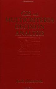
ISBN: 0471329444 9780471329442 Year: 1999 Publisher: New York (N.Y.): Wiley,
Abstract | Keywords | Export | Availability | Bookmark
 Loading...
Choose an application
- Reference Manager
- EndNote
- RefWorks (Direct export to RefWorks)
Geographic information systems. --- Decision making. --- Systèmes d'information géographique --- Prise de décision --- #SBIB:35H24 --- #SBIB:35H412 --- 910.2 --- Deciding --- Decision (Psychology) --- Decision analysis --- Decision processes --- Making decisions --- Management --- Management decisions --- Choice (Psychology) --- Problem solving --- Geographical information systems --- GIS (Information systems) --- Information storage and retrieval systems --- Informatiemanagement bij de overheid --- Beleidscyclus: vaststelling, besluitvorming --- Kinds and techniques of geographical exploration. Field work. Exploration and travels --- Decision making --- Geography --- Environmental Sciences and Forestry. Remote Sensing and Geographical Information Systems --- Geographical Information Systems --- Geographical Information Systems. --- Systèmes d'information géographique --- Prise de décision --- Geographic information systems
Book
ISBN: 9038208626 9789038208626 Year: 2005 Publisher: Gent Academia Press
Abstract | Keywords | Export | Availability | Bookmark
 Loading...
Choose an application
- Reference Manager
- EndNote
- RefWorks (Direct export to RefWorks)
In een eerste hoofdstuk wordt GIS - waarvan de S in het Engels zowel kan staan voor science als systems - als een wetenschap en een techniek gedefinieerd ; verder wordt de evolutie van GIS geschetst en wordt de relatie van GIS tot andere ruimtelijke wetenschappen en technieken gegeven. Het tweede hoofdstuk bespreekt de basisbegrippen die van belang zijn om de ruimte te modelleren in een digitale omgeving : gegevensmodellen, componenten van GIS, schaal en generalisatie en de verschillende methodes van geolokalisatie. Het derde hoofdstuk behandelt de datastructuren zowel in bredere zin als specifiek voor een geografisch informatiesysteem. In het vierde hoofstuk wordt de opbouw van sets van digitale geografische gegevens besproken. De correcte en efficiënte aanlevering van geografische informatie is de belangrijkste stap voor men enige analyse kan doen. Met de beschikbaarheid over betrouwbare en toegankelijke informatie staat of valt de toepasbaarheid van de ruimtelijke analyse op de geografische gegevens.
Barthes, Roland --- GIS (geografisch informatiesysteem) --- Quantitative methods in social research --- Information systems --- Geodesy. Cartography --- GIS --- geografie --- 910.2 --- 681.3*H21 --- informatiesystemen --- 911 --- 681.3*H21 Logical design: data models; normal forms; schema and subschema (Database management) --- Logical design: data models; normal forms; schema and subschema (Database management) --- Kinds and techniques of geographical exploration. Field work. Exploration and travels --- geografie, theoretische geografie --- Essay(s) --- 840-4 --- 840-4 Franse literatuur: essay --- Franse literatuur: essay --- 91 --- 681.324 --- gis --- geodesie --- xml (extensible markup language) --- gml (geography markup language) --- svg (scalable vector graphics) --- (zie ook: geografisch informatiesysteem) --- Aardrijkskunde --- Computertoepassingen --- Cartografie --- Franse literatuur --- Filosofie --- Applicatie --- Oudheid --- China --- Romeinse Rijk --- Hellenisme --- Griekenland --- Hellas --- Film --- Literatuur --- Muziek --- Schilderkunst --- Tekenkunst --- Vlaanderen --- Vlaams --- Emigratie --- Vrouw --- Barthes, R. --- Барт, Ролан --- Bart, Rolan --- Baruto, Roran --- בארת, רולאן --- بارت، رولان --- ロラン・バルト --- Luolan Bate --- 羅蘭・巴特 --- Theoretische informatica --- Geografische informatiesystemen
| Listing 1 - 4 of 4 |
Sort by
|

 Search
 Feedback
 About UniCat
  Help
Help News
News