| Listing 1 - 10 of 13 | << page >> |
Sort by
|
Book
ISBN: 1607814706 9781607814702 9781607814696 1607814692 Year: 2016 Publisher: Salt Lake City
Abstract | Keywords | Export | Availability | Bookmark
 Loading...
Choose an application
- Reference Manager
- EndNote
- RefWorks (Direct export to RefWorks)
Glacial epoch. --- Extinct mammals --- Ice Age --- Geology, Stratigraphic --- Extinct vertebrates --- Mammals --- Great Basin --- Basin and Range Province --- Intermontane region --- Intermountain Region (U.S.) --- Intermountain West (U.S.) --- History.

ISBN: 0874175801 9780874175806 0874175429 9780874175424 Year: 2003 Publisher: Reno University of Nevada Press
Abstract | Keywords | Export | Availability | Bookmark
 Loading...
Choose an application
- Reference Manager
- EndNote
- RefWorks (Direct export to RefWorks)
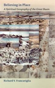
"Believing in Place is a reflection on the ways that human needs and spiritual traditions can shape our perceptions of the land. That the Great Basin has inspired such a complex variety of responses is partly due to its enigmatic vastness and isolation, partly to the remarkable range of peoples who have found themselves in the region. Using not only the materials of traditional geography but folklore, anthropology, Native American and Euro-American religion, contemporary politics, and New Age philosophies, Francaviglia has produced a timely investigation of the role of human conceptions of place in that space we call the Great Basin."--Jacket.
Religion and geography. --- Geography and religion --- Geography --- Great Basin --- Basin and Range Province --- Intermontane region --- Intermountain Region (U.S.) --- Intermountain West (U.S.) --- Description and travel. --- Social life and customs. --- Religious life and customs.
Book
ISBN: 1469618672 9781469618678 9781469619835 1469619830 9781469618661 1469618664 9798890846907 Year: 2014 Publisher: The University of North Carolina Press
Abstract | Keywords | Export | Availability | Bookmark
 Loading...
Choose an application
- Reference Manager
- EndNote
- RefWorks (Direct export to RefWorks)
Relicts of a Beautiful Sea: Survival, Extinction, and Conservation in a Desert World
Conservation biology --- Desert ecology --- Toads --- Salamanders --- Ecology --- Nature conservation --- Deserts --- Arid regions ecology --- Xeric ecology --- Anura --- Caudata --- Urodela --- Amphibians --- Great Basin --- Basin and Range Province --- Intermontane region --- Intermountain Region (U.S.) --- Intermountain West (U.S.) --- Climate.
Book
ISBN: 1607816814 1607816806 9781607816812 9781607816805 Year: 2019 Publisher: Salt Lake City
Abstract | Keywords | Export | Availability | Bookmark
 Loading...
Choose an application
- Reference Manager
- EndNote
- RefWorks (Direct export to RefWorks)
"Cultural Resource Management (CRM) refers to the discovery, evaluation, and preservation of culturally significant sites, focusing on but not limited to the archaeological and historical. CRM stems from the National Historic Preservation Act, passed in 1966. In 1986, archaeologists reviewed the practice of CRM in the Great Basin. They concluded that it mainly was a system of finding, flagging, and avoiding -- a means of keeping sites and artifacts safe. Success was measured by counting the number of sites recorded and acres surveyed"--Provided by publisher.
Cultural property --- Cultural property, Protection of --- Cultural resources management --- Cultural policy --- Historic preservation --- Protection. --- Protection --- Government policy --- Great Basin --- Antiquities --- Collection and preservation. --- Cultural policy. --- Basin and Range Province --- Intermontane region --- Intermountain Region (U.S.) --- Intermountain West (U.S.)

ISBN: 0674020995 9780674020993 0674022904 9780674022904 0674022904 9780674022904 9780674027206 0674027205 0674262093 9780674262096 Year: 2009 Publisher: Cambridge, MA
Abstract | Keywords | Export | Availability | Bookmark
 Loading...
Choose an application
- Reference Manager
- EndNote
- RefWorks (Direct export to RefWorks)
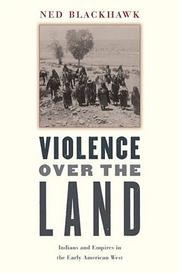
In this ambitious book that ranges across the Great Basin, Blackhawk places Native peoples at the center of a dynamic story as he chronicles two centuries of Indian and imperial history that shaped the American West. This book is a passionate reminder of the high costs that the making of American history occasioned for many indigenous peoples.--
Indians of North America --- American aborigines --- American Indians --- First Nations (North America) --- Indians of the United States --- Indigenous peoples --- Native Americans --- North American Indians --- History. --- Wars --- Culture --- Ethnology --- Great Basin --- Basin and Range Province --- Intermontane region --- Intermountain Region (U.S.) --- Intermountain West (U.S.) --- History

ISBN: 0874175879 9780874175875 0874175038 9780874175035 Year: 2002 Publisher: Reno University of Nevada Press
Abstract | Keywords | Export | Availability | Bookmark
 Loading...
Choose an application
- Reference Manager
- EndNote
- RefWorks (Direct export to RefWorks)
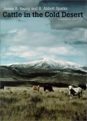
Grazing --- Range ecology --- Ranch life --- Ranchers --- Beef cattle --- Agricultural systems --- Animal feeding --- Range management --- Pastures --- Rangelands --- Rangeland ecology --- Ecology --- Farm life --- Frontier and pioneer life --- Ranchmen --- Stockmen (Animal industry) --- Farmers --- Steers --- Cattle --- Ranching --- Environmental aspects --- History --- Harrell, Jasper, --- Sparks, John, --- Harrell, Barley, --- Great Basin --- Basin and Range Province --- Intermontane region --- Intermountain Region (U.S.) --- Intermountain West (U.S.)
Book
ISBN: 9780826358240 0826358241 9780826358233 Year: 2017 Publisher: Albuquerque
Abstract | Keywords | Export | Availability | Bookmark
 Loading...
Choose an application
- Reference Manager
- EndNote
- RefWorks (Direct export to RefWorks)
Cartography --- Cartography, Primitive --- Chartography --- Map-making --- Mapmaking --- Mapping (Cartography) --- Mathematical geography --- Surveying --- Map projection --- Maps --- History --- Fremont, John Charles, --- Miera y Pacheco, Bernardo de --- Pacheco, Bernardo de Miera y --- De Miera y Pacheco, Bernardo --- Frémont, J. C. --- Frémont, John C. --- Discovery and exploration --- Great Basin --- Basin and Range Province --- Intermontane region --- Intermountain Region (U.S.) --- Intermountain West (U.S.) --- Historical geography

ISBN: 0874174775 9780874174779 0874176182 9780874176186 Year: 2000 Publisher: Reno, [Nevada] ; Las Vegas, [Nevada] : University of Nevada Press,
Abstract | Keywords | Export | Availability | Bookmark
 Loading...
Choose an application
- Reference Manager
- EndNote
- RefWorks (Direct export to RefWorks)
What Barry Lopez did in expanding our vision of the frozen North in Arctic Dreams, William Fox has done in broadening our perceptions of the desert expanses of the West's Great Basin. Roughly a quarter of a million acres of land spanning much of Utah and most of Nevada, the Great Basin is the highest and driest of the American deserts, a vast empty tract on the nineteenth-century maps of our continent. Explorers and cartographers found it imponderable; pioneers and settlers found it uninhabitable. And today the Great Basin remains a largely unknown and forbidding landscape, one that continues to exercise a powerful influence on human desire and imagination. The Void, the Grid, & the Sign guides us to a place so unusual and disorienting that it can overcome rationality and become the locus for our most fanciful and fearsome projections: mythical rivers, mammoth artistic earthworks, alien spaceships, jet-propelled race cars, and weapons of mass annihilation. In The Void, Fox walks us through this landscape, investigating our responses to the Great Basin's appearance -- a pattern of mountains and valleys on a scale so large, so empty and undifferentiated by shape and form and color, that the visual and cognitive expectations of the human mind are confounded and impaired. The Grid focuses on the evolution of cartography in the nineteenth century and the explorations of John Charles Fremont in his search for the legendary Buenaventura River. Fox invites us on a Great Basin road trip, tracing the net of maps, section markers, railroads, telegraph lines, and highways that humans have thrown across the void throughout history. The Sign considers the language and the metaphors we continue to place around and over the void, revealing the Great Basin as a vast palimpsest where the neon-lined boulevards of Las Vegas overlay and interplay with millennia-old petroglyphs and pictographs. Through vivid and arresting prose drawing from the disciplines of natural history, art history, cognitive psychology, western history, archaeology and anthropology, The Void, the Grid, & the Sign traverses the knowns and the unknowns of the Great Basin, offering a tour de force of inquiry and thought.
Cartography --- Natural history --- Human geography --- Great Basin --- Cartography, Primitive --- Chartography --- Map-making --- Mapmaking --- Mapping (Cartography) --- Mathematical geography --- Surveying --- Map projection --- Maps --- History, Natural --- Natural science --- Physiophilosophy --- Biology --- Science --- Anthropo-geography --- Anthropogeography --- Geographical distribution of humans --- Social geography --- Anthropology --- Geography --- Human ecology --- History. --- Geography. --- Fox, William L., --- Travel --- Basin and Range Province --- Intermontane region --- Intermountain Region (U.S.) --- Intermountain West (U.S.) --- Discovery and exploration. --- Description and travel.

ISBN: 0674047435 0674036719 9780674036710 9780674047433 9780674027671 0674027671 0674263340 9780674263345 Year: 2009 Publisher: Cambridge, MA
Abstract | Keywords | Export | Availability | Bookmark
 Loading...
Choose an application
- Reference Manager
- EndNote
- RefWorks (Direct export to RefWorks)
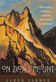
On Zion's Mount shows how, paradoxically, the Mormons created their homeland at the expense of the local Indians-and how they expressed their sense of belonging by investing Mt. Timpanogos with "Indian" meaning.
Ute Indians --- Mormons --- Frontier and pioneer life --- Landscape assessment --- Indians in popular culture --- Popular culture --- Latter-Day Saints --- Christians --- History. --- Timpanogos, Mount (Utah) --- Utah Lake (Utah) --- Utah --- Great Basin --- Basin and Range Province --- Intermontane region --- Intermountain Region (U.S.) --- Intermountain West (U.S.) --- Mount Timpanogos (Utah) --- Wasatch Range (Utah and Idaho) --- Description and travel. --- Latter Day Saints --- Brighamite Mormons --- Church of Christ (Temple Lot) members --- Church of Jesus Christ of Latter-day Saints members --- Church of Jesus Christ (Strangites) members --- Hedrikites --- Josephite Mormons --- Reorganized Church of Jesus Christ of Latter Day Saints members --- Reorganized Mormons --- RLDS Mormons --- Strangite Mormons --- Temple Lot Mormons --- Utah Mormons
Book
ISBN: 0860544931 Year: 1987 Publisher: Oxford BAR
Abstract | Keywords | Export | Availability | Bookmark
 Loading...
Choose an application
- Reference Manager
- EndNote
- RefWorks (Direct export to RefWorks)
Paleo-Indians --- Indians of North America --- Human ecology --- Hunting and gathering societies --- Indiens du paléolithique --- Indiens d'Amérique --- Ecologie humaine --- Chasseurs-cueilleurs --- Food. --- Antiquities. --- Alimentation --- Antiquités --- Great Basin --- Grand Bassin --- -Indians of North America --- -Human ecology --- -Hunting and gathering societies --- -Food gathering societies --- Gathering and hunting societies --- Hunter-gatherers --- Hunting, Primitive --- Ethnology --- Subsistence hunting --- Ecology --- Environment, Human --- Human beings --- Human environment --- Ecological engineering --- Human geography --- Nature --- American aborigines --- American Indians --- First Nations (North America) --- Indians of the United States --- Indigenous peoples --- Native Americans --- North American Indians --- Paleo-Americans --- Paleo-Amerinds --- Paleoamericans --- Paleoamerinds --- Paleoindians --- Stone age --- Indians --- Prehistoric peoples --- Food --- Antiquities --- Social aspects --- Effect of environment on --- Effect of human beings on --- Culture --- -Basin and Range Province --- Intermontane region --- Intermountain Region (U.S.) --- Intermountain West (U.S.) --- -Food --- -Antiquities --- Indiens du paléolithique --- Indiens d'Amérique --- Antiquités --- Food gathering societies
| Listing 1 - 10 of 13 | << page >> |
Sort by
|

 Search
 Feedback
 About UniCat
  Help
Help News
News