| Listing 1 - 10 of 11 | << page >> |
Sort by
|
Book
ISBN: 2854283368 9782854283365 Year: 1993 Publisher: Toulouse: Cépaduès,
Abstract | Keywords | Export | Availability | Bookmark
 Loading...
Choose an application
- Reference Manager
- EndNote
- RefWorks (Direct export to RefWorks)
Map
ISBN: 8831758039 Year: 1993 Publisher: Venezia : Firenze : Marsilio ; Assessorato all'urbanistica ed edlizia privata del Comune di Firenze,
Abstract | Keywords | Export | Availability | Bookmark
 Loading...
Choose an application
- Reference Manager
- EndNote
- RefWorks (Direct export to RefWorks)
Cartography --- Cartographie --- History. --- Histoire --- Florence (Italy) --- Florence (Italie) --- Maps. --- Remote-sensing images. --- Plans --- Images-satellite

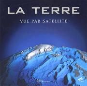
ISBN: 2732428981 Year: 2002 Publisher: Paris : Editions de La Martinière,
Abstract | Keywords | Export | Availability | Bookmark
 Loading...
Choose an application
- Reference Manager
- EndNote
- RefWorks (Direct export to RefWorks)
Space photography --- Photographie spatiale --- Earth (Planet) --- Terre --- Pictorial works --- Remote-sensing images --- Ouvrages illustrés --- Images-satellite --- Ouvrages illustrés
Book
ISBN: 9782738124883 2738124887 Year: 2010 Publisher: Paris: Odile Jacob,
Abstract | Keywords | Export | Availability | Bookmark
 Loading...
Choose an application
- Reference Manager
- EndNote
- RefWorks (Direct export to RefWorks)
Book
ISBN: 9783774939646 3774939640 Year: 2015 Publisher: Bonn : Habelt,
Abstract | Keywords | Export | Availability | Bookmark
 Loading...
Choose an application
- Reference Manager
- EndNote
- RefWorks (Direct export to RefWorks)
Aerial photography in archaeology --- Remote-sensing images --- Photographie aérienne en archéologie --- Images-satellite --- Congresses --- Congrès --- Conferences - Meetings --- Photographie aérienne en archéologie --- Congrès --- Congresses.
Book
ISBN: 9782100712847 2100712845 Year: 2014 Publisher: Paris: Dunod,
Abstract | Keywords | Export | Availability | Bookmark
 Loading...
Choose an application
- Reference Manager
- EndNote
- RefWorks (Direct export to RefWorks)
S'arracher de la surface de la Terre pour la voir d'en haut n'est plus un rêve. Des instruments sophistiqués portés par des satellites produisent des flux de données qui, insérées dans des processus d'information, contribuent à la connaissance du «système Terre».Cet ouvrage décrit l'aide que l'observation satellitaire nous apporte dans des domaines comme la gestion des milieux naturels, la prévention des risques ou l'action après les catastrophes.Après un panorama rétrospectif, il trace la construction des données depuis la conception de la mesure jusqu'à son interprétation pour une insertion dans des systèmes opérationnels.Des enquêtes sociologiques esquissent certaines difficultés qu'il faudrait surmonter pour un usage élargi des données satellites. À l'aide d'exemples concrets comme la cartographie d'urgence ou la veille sur l'eau, le lecteur comprend comment l'observation depuis l'espace offre des ressources cognitives pour habiter la Terre en en prenant soin
Book
ISSN: 15673200 ISBN: 9789048188017 9789048188000 9048188008 Year: 2012 Volume: 16 Publisher: Dordrecht: Springer,
Abstract | Keywords | Export | Availability | Bookmark
 Loading...
Choose an application
- Reference Manager
- EndNote
- RefWorks (Direct export to RefWorks)
This book provides a state-of-the-art overview of satellite archaeology and it is an invaluable volume for archaeologists, scientists, and managers interested in using satellite Earth Observation (EO) to improve the traditional approach for archaeological investigation, protection and management of Cultural Heritage. The recent increasing development of EO techniques and the tremendous advances in Information and Communication Technologies (ICT) have resulted primarily in Cultural Heritage applications. The book focuses on new challenging prospects for the use of EO in archaeology not only for probing the subsurface to unveil sites and artifacts, but also for the management and valorization as well as for the monitoring and preservation of cultural resources. The book provides a first-class understanding of this revolutionary scenario which was unthinkable several years ago. The book offers: (i) an excellent collection of outstanding articles focusing on satellite data processing, analysis and interpretation for archaeological applications, (ii) impressive case studies, (iii) striking examples of the high potential of the integration of multi-temporal, multi-scale, multi-sensors techniques. Each chapter is composed as an authoritative contribution to help the reader grasp the value of its content. The authors are renowned experts from the international scientific community. Audience: This book will be of interest to scientists in remote sensing applied to archeology, geoarcheology, paleo-environment, paleo-climate and cultural heritage.
Multidisciplinary collective works --- Sociology of cultural policy --- Geodesy. Cartography --- Computer. Automation --- Archeology --- beeldverwerking --- cultureel erfgoed --- fotogrammetrie --- interdisciplinair onderzoek --- remote sensing --- archeologie --- Archaeology --- Imaging systems in archaeology --- Remote-sensing images. --- Archéologie --- Imagerie en archéologie --- Images-satellite --- Remote sensing --- Methodology --- Télédétection --- Méthodologie --- Remote-sensing images --- Archaeology - Remote sensing

ISBN: 291176238X 9782911762383 Year: 2002 Publisher: Paris : Ecole des Mines de Paris,
Abstract | Keywords | Export | Availability | Bookmark
 Loading...
Choose an application
- Reference Manager
- EndNote
- RefWorks (Direct export to RefWorks)
Multisensor data fusion --- Image processing --- Remote-sensing images. --- Fusion multicapteurs --- Traitement d'images --- Images-satellite --- Remote-sensing images --- Images, Remote-sensing --- Satellite images --- Side-looking airborne radar images --- SLAR (Side-looking airborne radar) --- Cartographic materials --- Pictorial data processing --- Picture processing --- Processing, Image --- Imaging systems --- Optical data processing --- Data fusion --- Multi-sensor fusion --- Sensor fusion --- Signal processing --- Sensor networks
Book
ISBN: 9781935408284 9781935408413 1935408410 1935408283 Year: 2013 Publisher: Brooklyn, NY : Zone Books,
Abstract | Keywords | Export | Availability | Bookmark
 Loading...
Choose an application
- Reference Manager
- EndNote
- RefWorks (Direct export to RefWorks)
Remote-sensing images --- Global positioning system --- Aerial photography. --- Images-satellite --- GPS --- Photographie aérienne --- Political aspects --- Social aspects --- Aspect politique --- Aspect social --- 528.9 --- 681.3*H4 --- 528.28 --- 630*587 --- 528.8 --- Cartography. Mapping (textual documents) --- Information systems applications (GIS etc.) --- Astro-geodetic determination of position. Geographical coordinates. GPS --- Aerial photography and photogrammetry --- Remote sensing. Teledetection --- 528.28 Astro-geodetic determination of position. Geographical coordinates. GPS --- 681.3*H4 Information systems applications (GIS etc.) --- 528.9 Cartography. Mapping (textual documents) --- 528.8 Remote sensing. Teledetection --- Photographie aérienne --- Remote-sensing images. --- Political aspects.

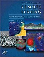
ISBN: 9780123694072 0123694078 1493300725 9786611050504 1281050504 0080480586 6611050507 9780080480589 9781281050502 Year: 2007 Publisher: Burlington (Mass.): Academic press,
Abstract | Keywords | Export | Availability | Bookmark
 Loading...
Choose an application
- Reference Manager
- EndNote
- RefWorks (Direct export to RefWorks)
Remote sensing is a technology that engages electromagnetic sensors to measure and monitor changes in the earth's surface and atmosphere. Normally this is accomplished through the use of a satellite or aircraft. This book, in its 3rd edition, seamlessly connects the art and science of earth remote sensing with the latest interpretative tools and techniques of computer-aided image processing. Newly expanded and updated, this edition delivers more of the applied scientific theory and practical results that helped the previous editions earn wide acclaim and become classroom and industry standa
Image processing. --- Remote sensing. --- Remote-sensing images. --- Traitement d'images --- Télédétection --- Images-satellite --- 528.8 --- 681.3*I4 --- Remote sensing. Teledetection --- Image processing: image displays; image processing software (Computing methododologies) --- 681.3*I4 Image processing: image displays; image processing software (Computing methododologies) --- 528.8 Remote sensing. Teledetection --- Image processing --- Remote-sensing images --- Pictorial data processing --- Picture processing --- Processing, Image --- Imaging systems --- Optical data processing --- Images, Remote-sensing --- Satellite images --- Side-looking airborne radar images --- SLAR (Side-looking airborne radar) --- Cartographic materials --- Earth Sciences --- General and Others
| Listing 1 - 10 of 11 | << page >> |
Sort by
|

 Search
 Feedback
 About UniCat
  Help
Help News
News