| Listing 1 - 10 of 23 | << page >> |
Sort by
|
Book
ISBN: 1424408466 1424408458 1509089381 9781509089383 Year: 2007 Publisher: IEEE
Abstract | Keywords | Export | Availability | Bookmark
 Loading...
Choose an application
- Reference Manager
- EndNote
- RefWorks (Direct export to RefWorks)
Book
ISBN: 9811657343 9811657351 Year: 2022 Publisher: Singapore : Springer,
Abstract | Keywords | Export | Availability | Bookmark
 Loading...
Choose an application
- Reference Manager
- EndNote
- RefWorks (Direct export to RefWorks)
Remote-sensing images --- Earth sciences --- Remote sensing --- Earth (Planet) --- Observations --- Images, Remote-sensing --- Satellite images --- Side-looking airborne radar images --- SLAR (Side-looking airborne radar) --- Cartographic materials --- Earth
Book
ISBN: 1628700777 1849951063 9781628700770 9781849951067 9781849950466 1849950466 9781439894446 1439894442 Year: 2012 Publisher: Caithness, Scotland : Whittles Publishing,
Abstract | Keywords | Export | Availability | Bookmark
 Loading...
Choose an application
- Reference Manager
- EndNote
- RefWorks (Direct export to RefWorks)
A comprehensive guide to the characteristics and use of high resolution optical images from satellite-borne sensors. It addresses the problems and issues surrounding the generation of high quality information and also provides a review of planned sensors. It is written by a team of acknowledged international experts and is the only comprehensive text on the subject.
Book
ISBN: 9783030823276 Year: 2022 Publisher: Cham Springer International Publishing :Imprint: Springer
Abstract | Keywords | Export | Availability | Bookmark
 Loading...
Choose an application
- Reference Manager
- EndNote
- RefWorks (Direct export to RefWorks)

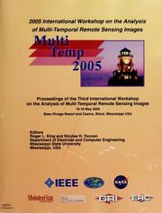
ISBN: 0780391187 1509099085 9781509099085 Year: 2005 Publisher: [Place of publication not identified] IEEE
Abstract | Keywords | Export | Availability | Bookmark
 Loading...
Choose an application
- Reference Manager
- EndNote
- RefWorks (Direct export to RefWorks)
Remote sensing --- Remote-sensing images --- Image processing --- Geography-General --- Geography --- Earth & Environmental Sciences --- Remote-sensing imagery --- Remote sensing systems --- Remote terrain sensing --- Sensing, Remote --- Terrain sensing, Remote --- Aerial photogrammetry --- Aerospace telemetry --- Detectors --- Space optics --- Images, Remote-sensing --- Satellite images --- Side-looking airborne radar images --- SLAR (Side-looking airborne radar) --- Cartographic materials --- Digital techniques
Book
ISBN: 9811364249 9811364230 Year: 2019 Publisher: Singapore : Springer Singapore : Imprint: Springer,
Abstract | Keywords | Export | Availability | Bookmark
 Loading...
Choose an application
- Reference Manager
- EndNote
- RefWorks (Direct export to RefWorks)
Thanks to recent advances in sensors, communication and satellite technology, data storage, processing and networking capabilities, satellite image acquisition and mining are now on the rise. In turn, satellite images play a vital role in providing essential geographical information. Highly accurate automatic classification and decision support systems can facilitate the efforts of data analysts, reduce human error, and allow the rapid and rigorous analysis of land use and land cover information. Integrating Machine Learning (ML) technology with the human visual psychometric can help meet geologists’ demands for more efficient and higher-quality classification in real time. This book introduces readers to key concepts, methods and models for satellite image analysis; highlights state-of-the-art classification and clustering techniques; discusses recent developments and remaining challenges; and addresses various applications, making it a valuable asset for engineers, data analysts and researchers in the fields of geographic information systems and remote sensing engineering.
Telecommunication. --- Computer vision. --- Signal, Image and Speech Processing. --- Communications Engineering, Networks. --- Image Processing and Computer Vision. --- Remote-sensing images. --- Images, Remote-sensing --- Satellite images --- Side-looking airborne radar images --- SLAR (Side-looking airborne radar) --- Cartographic materials --- Machine vision --- Vision, Computer --- Artificial intelligence --- Image processing --- Pattern recognition systems --- Electric communication --- Mass communication --- Telecom --- Telecommunication industry --- Telecommunications --- Communication --- Information theory --- Telecommuting
Book
ISBN: 9780470742389 Year: 2012 Publisher: Chichester Wiley-Blackwell
Abstract | Keywords | Export | Availability | Bookmark
 Loading...
Choose an application
- Reference Manager
- EndNote
- RefWorks (Direct export to RefWorks)
Image processing --- Remote-sensing images --- Remote sensing --- 528.8 --- Digital image processing --- Digital electronics --- 528.8 Remote sensing. Teledetection --- Remote sensing. Teledetection --- Images, Remote-sensing --- Satellite images --- Side-looking airborne radar images --- SLAR (Side-looking airborne radar) --- Cartographic materials --- Digital techniques --- Data processing

ISBN: 291176238X 9782911762383 Year: 2002 Publisher: Paris : Ecole des Mines de Paris,
Abstract | Keywords | Export | Availability | Bookmark
 Loading...
Choose an application
- Reference Manager
- EndNote
- RefWorks (Direct export to RefWorks)
Multisensor data fusion --- Image processing --- Remote-sensing images. --- Fusion multicapteurs --- Traitement d'images --- Images-satellite --- Remote-sensing images --- Images, Remote-sensing --- Satellite images --- Side-looking airborne radar images --- SLAR (Side-looking airborne radar) --- Cartographic materials --- Pictorial data processing --- Picture processing --- Processing, Image --- Imaging systems --- Optical data processing --- Data fusion --- Multi-sensor fusion --- Sensor fusion --- Signal processing --- Sensor networks
Book
ISBN: 3036567941 303656795X Year: 2023 Publisher: Basel : MDPI - Multidisciplinary Digital Publishing Institute,
Abstract | Keywords | Export | Availability | Bookmark
 Loading...
Choose an application
- Reference Manager
- EndNote
- RefWorks (Direct export to RefWorks)
This reprint exists to solve high complexity issues in remote sensing data processing, geochemical data analysis, geophysical data analysis and appropriate applications of GIS techniques for data fusion designed for mineral and hydrocarbon exploration. This reprint contains updated and informative knowledge of remote sensing imagery, geochemistry, geophysics and geospatial techniques that can assist in delineating the signatures and patterns linked to deep-seated, covered, blind, or buried mineral deposits and onshore oil slick detection, offshore oil spill monitoring and hydrocarbon exploration. It includes several color figures for remotely-sensed recognition of mineralization-related footprints. Additionally, this reprint comprehends several interactive flowcharts for describing the procedures explained therein.
Remote-sensing images. --- Remote sensing. --- Remote-sensing imagery --- Remote sensing systems --- Remote terrain sensing --- Sensing, Remote --- Terrain sensing, Remote --- Aerial photogrammetry --- Aerospace telemetry --- Detectors --- Space optics --- Images, Remote-sensing --- Satellite images --- Side-looking airborne radar images --- SLAR (Side-looking airborne radar) --- Cartographic materials
Book
ISBN: 9783319120812 3319120808 9783319120805 3319120816 Year: 2015 Publisher: Cham : Springer International Publishing : Imprint: Springer,
Abstract | Keywords | Export | Availability | Bookmark
 Loading...
Choose an application
- Reference Manager
- EndNote
- RefWorks (Direct export to RefWorks)
This thesis transforms satellite precipitation estimation through the integration of a multi-sensor, multi-channel approach to current precipitation estimation algorithms, and provides more accurate readings of precipitation data from space. Using satellite data to estimate precipitation from space overcomes the limitation of ground-based observations in terms of availability over remote areas and oceans as well as spatial coverage. However, the accuracy of satellite-based estimates still need to be improved. The approach introduced in this thesis takes advantage of the recent NASA satellites in observing clouds and precipitation. In addition, machine-learning techniques are also employed to make the best use of remotely-sensed "big data." The results provide a significant improvement in detecting non-precipitating areas and reducing false identification of precipitation.
Earth Sciences. --- Atmospheric Sciences. --- Geophysics and Environmental Physics. --- Meteorology. --- Environmental Physics. --- Geography. --- Physical geography. --- Géographie --- Géographie physique --- Infrared detectors. --- Precipitation (Meteorology) -- Remote sensing. --- Earth & Environmental Sciences --- Meteorology & Climatology --- Clouds. --- Remote-sensing images. --- Images, Remote-sensing --- Multispectral scanning images --- Satellite images --- Side-looking airborne radar images --- SLAR (Side-looking airborne radar) --- Aerology --- Earth sciences. --- Atmospheric sciences. --- Geophysics. --- Environmental sciences. --- Earth sciences --- Atmosphere --- Cartographic materials --- Meteorology --- Atmospheric science --- Geography --- Environmental science --- Science --- Geological physics --- Terrestrial physics --- Physics --- Atmospheric sciences
| Listing 1 - 10 of 23 | << page >> |
Sort by
|

 Search
 Feedback
 About UniCat
  Help
Help News
News