| Listing 1 - 8 of 8 |
Sort by
|
Book
ISBN: 2225804028 9782225804021 Year: 1984 Publisher: Paris : Masson,
Abstract | Keywords | Export | Availability | Bookmark
 Loading...
Choose an application
- Reference Manager
- EndNote
- RefWorks (Direct export to RefWorks)
GG Structural geology --- RMCA --- Tectonique --- Traites

ISBN: 079234460X Year: 1997 Publisher: Dordrecht : Kluwer,
Abstract | Keywords | Export | Availability | Bookmark
 Loading...
Choose an application
- Reference Manager
- EndNote
- RefWorks (Direct export to RefWorks)
Granite. --- Granite --- GG Structural geology --- Granitic rocks --- Igneous rocks

ISBN: 0691050708 9780691050706 Year: 2005 Publisher: Princeton : Princeton University Press,
Abstract | Keywords | Export | Availability | Bookmark
 Loading...
Choose an application
- Reference Manager
- EndNote
- RefWorks (Direct export to RefWorks)
Science and civilization --- Science et civilisation --- Wetenschap en beschaving --- Earthquakes --- Seismology --- History --- Social aspects --- Environmental aspects --- GG Structural --- Earthquakes - History --- Earthquakes - Social aspects --- Earthquakes - Environmental aspects --- Seismology - History
Book
ISBN: 3938616407 Year: 2006 Publisher: Göttingen Universität
Abstract | Keywords | Export | Availability | Bookmark
 Loading...
Choose an application
- Reference Manager
- EndNote
- RefWorks (Direct export to RefWorks)
RBINS-SYMPOSIUM --- Conferences - Meetings --- GG Structural geology --- RMCA --- Crystalline rocks --- Geology, Structural --- Morphotectonics --- Plate tectonics --- Tectonic geomorphology --- Rocks, Crystalline --- Geomorphology --- Rocks
Book
ISBN: 3540058281 0387058281 3642486118 3642486096 9783540058281 9780387058283 Year: 1972 Publisher: Berlin: New York: Springer,
Abstract | Keywords | Export | Availability | Bookmark
 Loading...
Choose an application
- Reference Manager
- EndNote
- RefWorks (Direct export to RefWorks)
Rock deformation --- Pictorial works --- Pictorial works. --- GG Structural geology --- 551.244 --- Uplift. Subsidence. Compression. Tension --- 551.244 Uplift. Subsidence. Compression. Tension --- #Hist.Geol --- Deformation, Rock --- Deformations (Mechanics) --- Geology, Structural --- Roches --- Microtectonique. --- Petrofabric analysis. --- Déformation. --- Rock deformation - Pictorial works --- Rock deformation.
Book
ISBN: 9781862392601 1862392609 Year: 2008 Publisher: London : The Geological Society,
Abstract | Keywords | Export | Availability | Bookmark
 Loading...
Choose an application
- Reference Manager
- EndNote
- RefWorks (Direct export to RefWorks)
Communication in geology. --- Natural disasters. --- Land use, Urban --- Environmental aspects. --- Communication in geology --- Natural disasters --- GG Structural geology --- RMCA F3 --- Natural calamities --- Disasters --- Urban land use --- Cities and towns --- Urban economics --- Urban policy --- Urban renewal --- Geology --- Environmental aspects
Book
ISBN: 271590021X 9782715900219 Year: 1985 Volume: 7 Publisher: Orleans BRGM
Abstract | Keywords | Export | Availability | Bookmark
 Loading...
Choose an application
- Reference Manager
- EndNote
- RefWorks (Direct export to RefWorks)
GG Structural geology --- GG Ore Geology --- RMCA --- 528.8 --- 550.81 --- 550.81 Geological prospecting. Simplest exploration methods. Geomorphological investigations while prospecting --- Geological prospecting. Simplest exploration methods. Geomorphological investigations while prospecting --- 528.8 Remote sensing. Teledetection --- Remote sensing. Teledetection --- GG Cartography --- Astronautics in earth sciences. --- Astronautics in earth sciences --- Earth sciences --- Remote sensing --- Remote sensing. --- Earth sciences - Remote sensing

ISBN: 9783540310549 3540310541 354031055X 3540654224 Year: 2006 Publisher: Berlin, Heidelberg : Springer Berlin Heidelberg : Imprint: Springer,
Abstract | Keywords | Export | Availability | Bookmark
 Loading...
Choose an application
- Reference Manager
- EndNote
- RefWorks (Direct export to RefWorks)
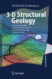
Geological structures are three dimensional, yet are typically represented by, and - terpreted from, outcrop maps and structure contour maps, both of which are curved two-dimensional surfaces. Maps plus serial sections, called 2½-D, provide a closer approach to three dimensionality. Computer technology now makes it possible for geological interpretations to be developed from the beginning in a fully three dim- sional environment. Fully 3-D geological models allow significantly better interpre- tions and interpretations that are much easier to share with other geologists and with the general public. This book provides an overview of techniques for constructing structural interpretations in 2-D, 2½-D and 3-D environments; for interpolating - tween and extrapolating beyond the control points; and for validating the final int- pretation. The underlying philosophy is that structures are three-dimensional solid bodies and that data from throughout the structure, whether in 2-D or 3-D format, should be integrated into an internally consistent 3-D interpretation. It is assumed that most users of this book will do their work on a computer. C- sequently, the book provides quantitative structural methods and techniques that are designed for use with spreadsheets, mapping software, and three-dimensional c- puter-graphics programs. The book is also intended to provide the background for understanding what interpretive software, for example, a computer contouring p- gram, does automatically. Most techniques are presented in both a traditional format appropriate for paper, pencil, and a pocket calculator, and in quantitative format for use with spreadsheets and computer-graphics or computer-aided-design programs.
Geology, Structural --- Maps --- Data processing --- Geological mapping. --- Data processing. --- Geology. --- Geology, Structural. --- Structural Geology. --- Geotechnical Engineering & Applied Earth Sciences. --- Geotectonics --- Structural geology --- Tectonics (Geology) --- Physical geology --- Geognosy --- Geoscience --- Earth sciences --- Natural history --- GG Structural geology --- cartography --- Geology --- Photointerpretation --- Structural geology. --- Geotechnical engineering. --- Engineering, Geotechnical --- Geotechnics --- Geotechnology --- Engineering geology --- Geological mapping --- Geologic mapping --- Cartography --- Maps&delete& --- Geology, Structural - Maps - Data processing
| Listing 1 - 8 of 8 |
Sort by
|

 Search
 Feedback
 About UniCat
  Help
Help News
News