| Listing 1 - 4 of 4 |
Sort by
|

ISBN: 0470843373 Year: 2002 Publisher: Chichester Wiley
Abstract | Keywords | Export | Availability | Bookmark
 Loading...
Choose an application
- Reference Manager
- EndNote
- RefWorks (Direct export to RefWorks)
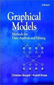
The concept of modelling using graph theory has its origin in several scientific areas, notably statistics, physics, genetics, and engineering. The use of graphical models in applied statistics has increased considerably over recent years and the theory has been greatly developed and extended. This book provides a self-contained introduction to the learning of graphical models from data, and is the first to include detailed coverage of possibilistic networks - a relatively new reasoning tool that allows the user to infer results from problems with imprecise data. One major advantage of graphical modelling is that specialised techniques that have been developed in one field can be transferred into others easily. The methods described here are applied in a number of industries, including a recent quality testing programme at a major car manufacturer. Provides a self-contained introduction to learning relational, probabilistic and possibilistic networks from data Each concept is carefully explained and illustrated by examples Contains all necessary background, including modeling under uncertainty, decomposition of distributions, and graphical representation of decompositions Features applications of learning graphical models from data, and problems for further research Includes a comprehensive bibliography An essential reference for graduate students of graphical modelling, applied statistics, computer science and engineering, as well as researchers and practitioners who use graphical models in their work.
Artificial intelligence. Robotics. Simulation. Graphics --- Mathematical statistics --- Data mining --- Exploration de données (Informatique) --- Statistique mathématique --- Graphic methods --- Méthodes graphiques --- 681.3*I26 --- 681.3*H28 --- -wiskundige statistiek --- 519.2 --- Mathematics --- Statistical inference --- Statistics, Mathematical --- Statistics --- Probabilities --- Sampling (Statistics) --- Algorithmic knowledge discovery --- Factual data analysis --- KDD (Information retrieval) --- Knowledge discovery in data --- Knowledge discovery in databases --- Mining, Data --- Database searching --- Learning: analogies; concept learning; induction; knowledge acquisition; language acquisition; parameter learning (Artificial intelligence)--See also {681.3*K32} --- Database applications (Data mining- Image databases - Scientific databases - Spatial databases and GIS - Statistical databases) --- Probability. Mathematical statistics --- Statistical methods --- Data mining. --- Basic Sciences. Statistics --- Graphic methods. --- Statistical Analysis --- Statistical Analysis. --- 519.2 Probability. Mathematical statistics --- 681.3*I26 Learning: analogies; concept learning; induction; knowledge acquisition; language acquisition; parameter learning (Artificial intelligence)--See also {681.3*K32} --- wiskundige statistiek

ISBN: 0521448662 0521384168 Year: 1990 Publisher: Cambridge Cambridge University Press
Abstract | Keywords | Export | Availability | Bookmark
 Loading...
Choose an application
- Reference Manager
- EndNote
- RefWorks (Direct export to RefWorks)
A spatial data set is a data set in which each observation is referenced to a site or area. Within both the social and environmental sciences, much of the data collected is within a spatial context and requires statistical analysis for interpretation. The purpose of this book, therefore, is to describe to students and research workers in the social and environmental sciences the current methods available for the analyses of spatial data. Methods described include data description, map interpolation, exploratory and explanatory analyses. The book also examines how spatial referencing raises a distinctive set of issues for the data analyst and recognizes the need to test underlying statistical assumptions. Further, methods for detecting problems, assessing their seriousness and taking appropriate action are discussed.
MET Methods & Techniques --- mathematical methods --- methods & techniques --- modelling --- multivariate --- pattern --- population --- population geography --- spatial analysis --- statistical methods --- statistics --- Population geography --- Spatial analysis (Statistics) --- 504 --- 57.087.1 --- 681.3*H28 --- 57.087.1 Biometry. Statistical study and treatment of biological data --- Biometry. Statistical study and treatment of biological data --- 504 Environment. Environmental science --- Environment. Environmental science --- Analysis, Spatial (Statistics) --- Correlation (Statistics) --- Spatial systems --- Demography --- Human geography --- Statistical methods --- Database applications (Data mining- Image databases - Scientific databases - Spatial databases and GIS - Statistical databases) --- Sociology of environment --- Quantitative methods in social research --- Spatial analysis (Statistics). --- Geografie --- Statistical methods. --- Geografische Informatie Systemen --- Modelleren. --- Analyse spatiale (Statistique) --- Géographie de la population --- Méthodes statistiques --- Recherche quantitative --- Technique de l'environnement
Book
ISBN: 9783642138393 9783642138409 9783642138416 Year: 2010 Publisher: Berlin Heidelberg Springer Berlin Heidelberg
Abstract | Keywords | Export | Availability | Bookmark
 Loading...
Choose an application
- Reference Manager
- EndNote
- RefWorks (Direct export to RefWorks)
The ILP conference series has been the premier forum for work on logic-based approaches to machine learning for almost two decades. The 19th International Conference on Inductive Logic Programming, which was organized in Leuven, July2-4,2009,continuedthistraditionbutalsoreachedouttoothercommunities as it was colocated with SRL-2009 - the International Workshop on Statistical RelationalLearning,andMLG-2009-the7thInternationalWorkshoponMining andLearningwithGraphs. While thesethreeseriesofeventseachhavetheirown focus,emphasis andtradition,they essentiallysharethe problemthatis studied: learning about structured data in the form of graphs, relational descriptions or logic. The colocation of the events was intended to increase the interaction between the three communities. There was a single program with joint invited and tutorial speakers, a panel, regular talks and poster sessions. The invited speakers and tutorial speakers were James Cussens, Jason Eisner, Jure Leskovec, Raymond Mooney, Scott Sanner, and Philip Yu. The panel featured Karsten Borgwardt, Luc De Raedt, Pedro Domingos, Paolo Frasconi, Thomas Gart ¨ ner, Kristian Kersting, Stephen Muggleton, and C. David Page. Video-recordings of these talks can be found atwww. videolectures. net. The overall program featured 30 talks presented in two parallel tracks and 53 posters. The talks and posters were selected on the basis of an extended abstract. These abstracts can be found at http:// dtai. cs. kuleuven. be/ilp-mlg-srl/. Inaddition,asinpreviousyears,a- lectionofthepapersofILP2009havebeenpublishedinavolumeintheLectures Notes in Arti?cial Intelligence seriesandinaspecialissueoftheMachine Lea- ing Journal.
Artificial intelligence. Robotics. Simulation. Graphics --- Induction (Logic) --- Logic programming --- 681.3*F1 <063> --- 681.3*F41 <063> --- 681.3*H28 <063> --- 681.3*H3 <063> --- 681.3*I23 <063> --- 681.3*J2 <063> --- Inductive logic --- Logic, Inductive --- Logic --- Reasoning --- 681.3*I23 <063> Deduction and theorem proving: answer/reason extraction; reasoning; resolution; metatheory; mathematical induction; logic programming (Artificial intelligence)--Congressen --- Deduction and theorem proving: answer/reason extraction; reasoning; resolution; metatheory; mathematical induction; logic programming (Artificial intelligence)--Congressen --- 681.3*J2 <063> Physical sciences and engineering (Computer applications)--Congressen --- Physical sciences and engineering (Computer applications)--Congressen --- Computation by abstract devices--Congressen --- Mathematical logic: computability theory; computational logic; lambda calculus; logic programming; mechanical theorem proving; model theory; proof theory;recursive function theory--See also {681.3*F11}; {681.3*I22}; {681.3*I23}--Congressen --- Database applications (Data mining- Image databases - Scientific databases - Spatial databases and GIS - Statistical databases) --- --Information storage and retrieval--Congressen --- Conferences - Meetings

ISBN: 0231100264 0231505019 Year: 1998 Publisher: New York : Columbia University Press,
Abstract | Keywords | Export | Availability | Bookmark
 Loading...
Choose an application
- Reference Manager
- EndNote
- RefWorks (Direct export to RefWorks)
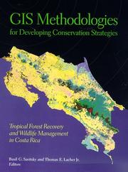
Tropical habitats may contain more than a third of the world's plant and animal species; Costa Rica alone is home to one of the highest levels of biodiversity per unit area in the world, and stands at center stage in worldwide conservation efforts. Within such regions, the use of state-of-the-art digital mapping technologies-sophisticated techniques that are relatively inexpensive and accessible-represents the future of conservation planning and policy. These methods, which employ satellites to obtain visual data on landscapes, allow environmental scientists to monitor encroachment on indigenous territories, trace park boundaries through unmarked wilderness, and identify wildlife habitats in regions where humans have limited access.Focusing on the rich biodiversity of Costa Rica, the contributors demonstrate the use of geographic information systems (GIS) to enhance conservation efforts. They give an overview of the spatial nature of conservation and management and the current status of digital mapping in Costa Rica; a review of the basic principles behind digital mapping technologies; a series of case studies using these technologies at a variety of scales and for a range of conservation and management activities; and the results of the Costa Rican gap analysis project. GIS Methodologies for Developing Conservation Strategies provides powerful tools for those involved in decision-making about the natural environment, particularly in developing nations like Costa Rica where such technologies have not yet been widely adopted. For specialists in such areas as geography, conservation biology, and wildlife and natural resource management, the combination of conceptual background and case examples make the book a crucial addition to the literature.
Forêt tropicale humide --- Tropical rain forests --- Animal sauvage --- wild animals --- Plante sauvage --- Wild plants --- Conservation des ressources --- Resource conservation --- Système d'information géographique --- Geographical information systems --- Développement durable --- Sustainable development --- Costa Rica --- Wildlife conservation --- Forest conservation --- Geographic information systems --- Digital mapping --- 681.3*H28 --- 528.9 --- 502.35 --- 681.3*H4 --- <728.6> --- Computer cartography --- Computer mapping --- Digitized mapping --- Cartography --- GIS (Information systems) --- Information storage and retrieval systems --- Conservation of forests --- Forest preservation --- Forests and forestry --- Preservation of forests --- Nature conservation --- Deforestation --- Animal conservation --- Animals --- Conservation of wildlife --- Preservation of wildlife --- Protection of wildlife --- Species conservation --- Species preservation --- Species protection --- Wildlife preservation --- Wildlife protection --- Wildlife resources conservation --- Wildlife resources preservation --- Wildlife resources protection --- Conservation of natural resources --- Endangered species --- Wildlife management --- Remote sensing. --- Database applications (Data mining- Image databases - Scientific databases - Spatial databases and GIS - Statistical databases) --- Cartography. Mapping (textual documents) --- Conservation management in general. Monitoring --- Information systems applications (GIS etc.) --- Geography --- Conservation --- Control --- Earth & Environmental Sciences --- Ecology --- Remote sensing --- Digital mapping. --- Environmental Sciences and Forestry. Remote Sensing and Geographical Information Systems --- Geographical Information Systems --- Geographical Information Systems. --- <728.6> Costa Rica --- 681.3*H4 Information systems applications (GIS etc.) --- 502.35 Conservation management in general. Monitoring --- 528.9 Cartography. Mapping (textual documents)
| Listing 1 - 4 of 4 |
Sort by
|

 Search
 Feedback
 About UniCat
  Help
Help News
News