
 Search
 Feedback
 About UniCat
  Help
Help News
News
| Listing 1 - 10 of 13 | << page >> |
Sort by
|
ISBN: 0471276995 9780471276999 Year: 1980 Volume: 1 Publisher: Chichester: Wiley,
Abstract | Keywords | Export | Availability | Bookmark
 Loading...
Choose an application
- Reference Manager
- EndNote
- RefWorks (Direct export to RefWorks)
Cartography --- Digital mapping --- Data processing --- Digital mapping. --- Data processing. --- Cartographie --- Cartography - Data processing
ISBN: 0713158654 9780713158656 Year: 1976 Publisher: London: Edward Arnold,
Abstract | Keywords | Export | Availability | Bookmark
Loading...Choose an application
- Reference Manager
- EndNote
- RefWorks (Direct export to RefWorks)
Programming --- Cartography --- Computer programming. --- Cartographie --- Programmation (Informatique) --- Data processing. --- Informatique --- Computer programming --- Data processing --- -Computer programming --- Computers --- Electronic computer programming --- Electronic data processing --- Electronic digital computers --- Programming (Electronic computers) --- Coding theory --- Cartography, Primitive --- Chartography --- Map-making --- Mapmaking --- Mapping (Cartography) --- Mathematical geography --- Surveying --- Map projection --- Maps --- Cartography - Data processing
Book
ISBN: 3540527117 3642842178 3642842151 9783540527114 Year: 1990 Volume: 65 Publisher: Berlin : Springer,
Abstract | Keywords | Export | Availability | Bookmark
Loading...Choose an application
- Reference Manager
- EndNote
- RefWorks (Direct export to RefWorks)
Navigation --- Cartography --- Digital mapping --- Data processing --- Congresses. --- Navigation, Primitive --- Locomotion --- Orientation --- Nautical astronomy --- Naval art and science --- Pilots and pilotage --- Cartography, Primitive --- Chartography --- Map-making --- Mapmaking --- Mapping (Cartography) --- Mathematical geography --- Surveying --- Map projection --- Maps --- Data processing&delete& --- Congresses --- Navigation - Data processing - Congresses. --- Cartography - Data processing - Congresses. --- Digital mapping - Congresses.
Book
ISBN: 0444627170 0444627138 1306213088 9780444627131 9780444627179 9781306213080 Year: 2014 Volume: 5 Publisher: Amsterdam Boston
Abstract | Keywords | Export | Availability | Bookmark
Loading...Choose an application
- Reference Manager
- EndNote
- RefWorks (Direct export to RefWorks)
Cybercartography is a new paradigm for maps and mapping in the information era. Defined as ""the organization, presentation, analysis and communication of spatially referenced information on a wide variety of topics of interest to society,"" cybercartography is presented in an interactive, dynamic, multisensory format with the use of multimedia and multimodal interfaces. Developments in the Theory and Practice of Cybercartography: Applications and Indigenous Mapping examines some of the recent developments in the theory and practice of cybercartography and the substantial cha
Multimedia cartography. --- Cartography --- World Wide Web. --- Data processing. --- W3 (World Wide Web) --- Web (World Wide Web) --- World Wide Web (Information retrieval system) --- WWW (World Wide Web) --- Hypertext systems --- Multimedia systems --- Internet --- Mapping, Multimedia --- Multimedia mapping --- 528.9 --- 528.9 Cartography. Mapping (textual documents) --- Cartography. Mapping (textual documents) --- Multimedia cartography --- Data processing --- Cartography - Data processing
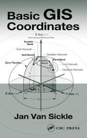
ISBN: 0415302161 9780415302166 Year: 2004 Publisher: Boca Raton: CRC,
Abstract | Keywords | Export | Availability | Bookmark
Loading...Choose an application
- Reference Manager
- EndNote
- RefWorks (Direct export to RefWorks)
Système d'information géographique --- Geographical information systems --- Mathématique --- mathematics --- Sao Tomé-et-Principe --- Sao Tome and Principe --- Geographic information systems. --- Grids (Cartography) --- Environmental Sciences and Forestry. Remote Sensing and Geographical Information Systems --- Data processing. --- Geographical Information Systems --- Geographical Information Systems. --- Geographic information systems --- Data processing --- Grids (Cartography) - Data processing --- Systeme coordonne
Book
ISSN: 21951705 ISBN: 3642122884 3642122892 1283697297 Year: 2013 Publisher: New York : Springer,
Abstract | Keywords | Export | Availability | Bookmark
Loading...Choose an application
- Reference Manager
- EndNote
- RefWorks (Direct export to RefWorks)
This book is a selection of chapters evolved from papers on completed research submitted to GeoCart’2010 / the 1st ICA Regional Symposium on Cartography for Australasia and Oceania, held in Auckland, New Zealand, 1st -3rd September 2010. All of the chapters have been updated and revised thoroughly. They have been blind peer reviewed by two referees of international research standing in geospatial science, mostly in the subdisciplines of cartography and geovisualisation. The book features cutting edge topics such geovisual analytics, mobile / Web 2.0 mapping, spatiotemporal representation, cognitive cartography, historical mapping and 3D technology.
Cartography -- Data processing. --- Geographic information systems. --- Geospatial data. --- Cartography --- Geographic information systems --- Geospatial data --- Geography --- Earth & Environmental Sciences --- Data processing --- Data processing. --- Data, Geospatial --- Geographical information systems --- GIS (Information systems) --- Geography. --- Geographical information systems. --- Geographical Information Systems/Cartography. --- Information storage and retrieval systems
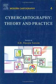
ISBN: 9780444516299 0444516298 9780080472300 0080472303 9786610966035 1280966033 Year: 2005 Volume: 4 Publisher: Amsterdam ; Boston : Elsevier,
Abstract | Keywords | Export | Availability | Bookmark
Loading...Choose an application
- Reference Manager
- EndNote
- RefWorks (Direct export to RefWorks)
For generations, the map has been central to how societies function all over the world. Cybercartography is a new paradigm for maps and mapping in the information era. Defined as "the organization, presentation, analysis and communication of spatially referenced information on a wide variety of topics of interest to society,? cybercartography is presented in an interactive, dynamic, multisensory format with the use of multimedia and multimodal interfaces. Cybercartography: Theory and Practice examines the major elements of cybercartography and emphasizes the importance of intera
Multimedia cartography --- Cartography --- World Wide web --- Cartographie multimédia --- Cartographie --- Web --- Data processing --- Informatique --- Multimedia cartography. --- World Wide Web. --- W3 (World Wide Web) --- Web (World Wide Web) --- World Wide Web (Information retrieval system) --- WWW (World Wide Web) --- Hypertext systems --- Multimedia systems --- Internet --- Mapping, Multimedia --- Multimedia mapping --- Data processing. --- Cartography - Data processing --- Cartographie - Informatique
Book
ISBN: 1430261099 1430261102 Year: 2013 Publisher: New York : Apress,
Abstract | Keywords | Export | Availability | Bookmark
Loading...Choose an application
- Reference Manager
- EndNote
- RefWorks (Direct export to RefWorks)
Geospatial mapping applications have become hugely popular in recent years. With smart-phone and tablet numbers snow-balling this trend looks set to continue well into the future. Indeed, it is true to say that in today’s mobile world location-aware apps are becoming the norm rather than the exception. In Microsoft Mapping author Ray Rischpater showcases Microsoft's Bing Maps API and demonstrates how its integration features make it by far the strongest mapping candidate for business that are already using Windows 8 or the .NET Framework. Whether you want to build a new app from scratch of add a few modest geospatial features to your existing website Ray's carefully chosen examples will provide you with both the inspiration and the code you need to achieve your goals.
Cartography -- Data processing. --- Cartography. --- Computer science. --- Microsoft Office. --- Engineering & Applied Sciences --- Computer Science --- Cartography --- Maps --- Data processing. --- Plans --- Computer Science. --- Computer Science, general. --- Informatics --- Science --- Cartographic materials --- Geography --- Microsoft software. --- Microsoft .NET Framework. --- Software engineering. --- Microsoft and .NET. --- Software Engineering/Programming and Operating Systems. --- Computer software engineering --- Engineering --- Computer software --- Dot Net (Software framework) --- Microsoft .NET --- Microsoft .NET software framework --- .NET Framework --- C# (Computer program language) --- Geographic information systems.
ISBN: 0803947526 9780803947528 1412983339 1452216320 058521669X Year: 1992 Volume: 87 Publisher: Newbury Park: Sage,
Abstract | Keywords | Export | Availability | Bookmark
Loading...Choose an application
- Reference Manager
- EndNote
- RefWorks (Direct export to RefWorks)
Information systems --- Geodesy. Cartography --- Estatistica aplicada as ciencias sociais --- Geografische informatiesystemen. --- Cartografie. --- Databanken. --- Automatisering. --- Systèmes d'information géographique. --- Cartographie --- Geographic information systems. --- Cartography --- Systèmes d'information géographique --- Informatique. --- Data processing. --- Informatique --- #SBIB:303H71 --- #SBIB:303H10 --- Geographic information systems --- -Cartography, Primitive --- Chartography --- Map-making --- Mapmaking --- Mapping (Cartography) --- Mathematical geography --- Surveying --- Map projection --- Maps --- Geographical information systems --- GIS (Information systems) --- Information storage and retrieval systems --- Methoden sociale wetenschappen: voorstelling van gegevens --- Methoden en technieken: algemene handboeken en reeksen --- Data processing --- Geography --- Earth & Environmental Sciences --- Geography-General --- -Methoden sociale wetenschappen: voorstelling van gegevens --- Systèmes d'information géographique. --- Systèmes d'information géographique --- Cartography - Data processing
ISBN: 0133509273 9780133509274 Year: 1990 Publisher: Englewood Cliffs (N.J.): Prentice Hall,
Abstract | Keywords | Export | Availability | Bookmark
Loading...Choose an application
- Reference Manager
- EndNote
- RefWorks (Direct export to RefWorks)
Artificial intelligence. Robotics. Simulation. Graphics --- Geographic information systems. --- Cartography --- Systèmes d'information géographique --- Cartographie --- Data processing. --- Informatique --- -Geographic information systems --- 681.3*H4 --- Geographical information systems --- GIS (Information systems) --- Information storage and retrieval systems --- Cartography, Primitive --- Chartography --- Map-making --- Mapmaking --- Mapping (Cartography) --- Mathematical geography --- Surveying --- Map projection --- Maps --- Data processing --- Information systems applications (GIS etc.) --- Geography --- Environmental Sciences and Forestry. Remote Sensing and Geographical Information Systems --- Geographical Information Systems --- Geographical Information Systems. --- 681.3*H4 Information systems applications (GIS etc.) --- Systèmes d'information géographique --- Geographic information systems --- Cartography - Data processing.
| Listing 1 - 10 of 13 | << page >> |
Sort by
|