| Listing 1 - 2 of 2 |
Sort by
|
Book
ISBN: 9780226126968 9780226127019 022612696X 022612701X Year: 2016 Publisher: Chicago, Ill. University of Chicago Press
Abstract | Keywords | Export | Availability | Bookmark
 Loading...
Choose an application
- Reference Manager
- EndNote
- RefWorks (Direct export to RefWorks)
Hundreds of exceptional cartographic images are scattered throughout medieval and early modern Arabic, Persian, and Turkish manuscript collections. The plethora of copies created around the Islamic world over the course of eight centuries testifies to the enduring importance of these medieval visions for the Muslim cartographic imagination. With Medieval Islamic Maps, historian Karen C. Pinto brings us the first in-depth exploration of medieval Islamic cartography from the mid-tenth to the nineteenth century. Pinto focuses on the distinct tradition of maps known collectively as the Book of Roads and Kingdoms (Kitab al-Masalik wa al-Mamalik, or KMMS), examining them from three distinct angles-iconography, context, and patronage. She untangles the history of the KMMS maps, traces their inception and evolution, and analyzes them to reveal the identities of their creators, painters, and patrons, as well as the vivid realities of the social and physical world they depicted. In doing so, Pinto develops innovative techniques for approaching the visual record of Islamic history, explores how medieval Muslims perceived themselves and their world, and brings Middle Eastern maps into the forefront of the study of the history of cartography.
Cartography --- Geography, Arab --- History --- Islam --- Geodesy. Cartography --- anno 500-1499 --- Beja (African people). --- Cartography. --- Geography, Arab. --- Geography, Medieval. --- Iṣṭakhrī, Ibrāhīm ibn Muḥammad, --- Islamic Empire. --- Cartography - Islamic countries - History --- Arab geography --- Geography, Arabic --- Geography, Medieval --- Cartography, Primitive --- Chartography --- Map-making --- Mapmaking --- Mapping (Cartography) --- Mathematical geography --- Surveying --- Map projection --- Maps --- History.

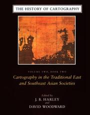
ISBN: 0226316335 9780226316338 0226316351 9780226316352 0226316378 9780226316376 0226907287 9780226907284 0226907333 9780226907338 0226907341 9780226907345 9780226907321 0226907325 0226907325 9780226184760 9780226184777 9780226534695 9780226534701 9780226534718 9780226184753 9780226339221 0226184773 0226184765 0226184757 Year: 1994 Volume: 2 Publisher: Chicago The University of Chicago Press
Abstract | Keywords | Export | Availability | Bookmark
 Loading...
Choose an application
- Reference Manager
- EndNote
- RefWorks (Direct export to RefWorks)
Since its launch in 1987, the History of Cartography series has garnered critical acclaim and sparked a new generation of interdisciplinary scholarship. Cartography in the European Enlightenment, the highly anticipated fourth volume, offers a comprehensive overview of the cartographic practices of Europeans, Russians, and the Ottomans, both at home and in overseas territories, from 1650 to 1800. The social and intellectual changes that swept Enlightenment Europe also transformed many of its mapmaking practices. A new emphasis on geometric principles gave rise to improved tools for measuring and mapping the world, even as large-scale cartographic projects became possible under the aegis of powerful states. Yet older mapping practices persisted: Enlightenment cartography encompassed a wide variety of processes for making, circulating, and using maps of different types. The volume’s more than four hundred encyclopedic articles explore the era’s mapping, covering topics both detailed—such as geodetic surveying, thematic mapping, and map collecting—and broad, such as women and cartography, cartography and the economy, and the art and design of maps. Copious bibliographical references and nearly one thousand full-color illustrations complement the detailed entries.
Geodesy. Cartography --- anno 500-1499 --- Prehistory --- Antiquity --- Cartography --- Cartographie --- Cartografie. --- History. --- Histoire. --- Cartography, Prehistoric --- 912 "04/14" --- 912 <09> <4> --- 912 <3> --- Cartography, Primitive --- Chartography --- Map-making --- Mapmaking --- Mapping (Cartography) --- Mathematical geography --- Surveying --- Map projection --- Maps --- Prehistoric cartography --- History --- Cartografie. Kaarten. Plattegronden. Atlassen--Middeleeuwen --- Cartografie. Kaarten. Plattegronden. Atlassen--Geschiedenis van ...--Europa --- Cartografie. Kaarten. Plattegronden. Atlassen--Plaatsaanduiding van de Oude Wereld --- 912 <09> <5> --- Cartografie. Kaarten. Plattegronden. Atlassen--Geschiedenis van ...--Azië --- 912 "15" --- Cartografie. Kaarten. Plattegronden. Atlassen--16e eeuw. Periode 1500-1599 --- 912 <09> <6> --- 912 <09> <7> --- 912 <09> <94> --- 912 <09> <98/99> --- Cartografie. Kaarten. Plattegronden. Atlassen--Geschiedenis van ...--Afrika --- Cartografie. Kaarten. Plattegronden. Atlassen--Geschiedenis van ...--Noord-Amerika. Midden-Amerika --- Cartografie. Kaarten. Plattegronden. Atlassen--Geschiedenis van ...--Australië --- Cartografie. Kaarten. Plattegronden. Atlassen--Geschiedenis van ...--Poolgebieden --- Africa --- Pacific Islands --- America --- Australia --- Arctica --- South Asia --- Asia --- Cartography - Europe - History --- anno 1400-1499 --- anno 1500-1599 --- Europe --- 912 <09> --- 912 --- Cartografie. Kaarten. Plattegronden. Atlassen--Geschiedenis van --- Cartografie. Kaarten. Plattegronden. Atlassen --- Cartography - Islamic countries - History. --- Cartography - South Asia - History. --- Cartography - History. --- anno 1600-1699 --- anno 1700-1799
| Listing 1 - 2 of 2 |
Sort by
|

 Search
 Feedback
 About UniCat
  Help
Help News
News