| Listing 1 - 1 of 1 |
Sort by
|

ISBN: 2503514723 9782503514727 Year: 2006 Volume: 4 Publisher: Turnhout Brepols
Abstract | Keywords | Export | Availability | Bookmark
 Loading...
Choose an application
- Reference Manager
- EndNote
- RefWorks (Direct export to RefWorks)
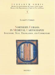
The territory discussed in this book represents the farthest northern and northeast regions of the world known to ancient and medieval geographers and corresponds to modern-day Scandinavia, Russia, Eastern Europe, and countries east of the Caspian Sea. They figured prominently in cartography of the Middle Ages. The mythical island of Scandza, the land of the Amazons, the apocalyptic tribes of Gog and Magog, and other traditional symbols of chaos and barbarity existed side by side and often merged with new knowledge about people, cities, and states. Originally published in Russian, this book offers an analysis of 198 western European and Byzantine maps that date between the eighth and thirteenth centuries and contain information about het north and northeast of the known world.
Geodesy. Cartography --- anno 500-1499 --- Geography, Medieval --- Cartography --- Géographie médiévale --- Cartographie --- History --- Histoire --- Eurasia --- Eurasie --- Maps --- Cartes --- Early maps. --- History. --- Europe, Eastern --- Geography, Medieval. --- 912 "04/14" --- 912 <09> <4-11> --- 912 <09> <4-17> --- Cartografie. Kaarten. Plattegronden. Atlassen--Middeleeuwen --- Cartografie. Kaarten. Plattegronden. Atlassen--Geschiedenis van ...--Oost-Europa --- Cartografie. Kaarten. Plattegronden. Atlassen--Geschiedenis van ...--Noord-Europa --- Géographie médiévale --- Early maps --- Atlases, Historical --- Historical atlases --- Middle Ages --- Geography --- Medieval geography --- Maps, Early --- East Europe --- Eastern Europe --- Cartography - History. --- Geography, Medieval - History. --- Geography, Medieval - Maps. --- Cartography - History --- Geography, Medieval - Maps --- Europe, Eastern - Maps
| Listing 1 - 1 of 1 |
Sort by
|

 Search
 Feedback
 About UniCat
  Help
Help News
News