
 Search
 Feedback
 About UniCat
  Help
Help News
News
| Listing 1 - 4 of 4 |
Sort by
|
ISBN: 0632041129 Year: 2000 Publisher: Oxford Blackwell science
Abstract | Keywords | Export | Availability | Bookmark
 Loading...
Choose an application
- Reference Manager
- EndNote
- RefWorks (Direct export to RefWorks)
574.62 --- 574.52 --- 639.2.052.3 --- Fishery hydrobiology --- Hydrobionts: effects of hydrological and hydrochemical factors. --- Seas or oceans --- Fisheries --- Environmental Sciences and Forestry. Ecology --- Environmental aspects. --- Aquatic Ecology --- Marine Ecology --- Marine Ecology. --- 639.2.052.3 Seas or oceans --- 574.52 Hydrobionts: effects of hydrological and hydrochemical factors. --- 574.62 Fishery hydrobiology --- Environmental aspects --- Hydrobionts: effects of hydrological and hydrochemical factors
ISBN: 1597269522 1417543884 9781417543885 9781559633239 1559633239 9781559633246 1559633247 9781597269520 Year: 2003 Publisher: Washington Island Press
Abstract | Keywords | Export | Availability | Bookmark
Loading...Choose an application
- Reference Manager
- EndNote
- RefWorks (Direct export to RefWorks)
Fisheries --- Marine ecology --- Biological oceanography --- Marine ecosystems --- Ocean --- Aquatic ecology --- Ecology --- <261.1> --- 504.42 --- 574.5 --- 639.2.052.3 --- 639.2.052.3 Seas or oceans --- Seas or oceans --- 574.5 Hydrobiology. Aquatic biocoenoses and ecosystems. Food chains --- Hydrobiology. Aquatic biocoenoses and ecosystems. Food chains --- <261.1> Noordelijke Atlantische Oceaan --- Noordelijke Atlantische Oceaan --- Ocean and sea environment. Including : sea floor, sea water
ISBN: 9780632050987 0632050985 Year: 2001 Publisher: Oxford : Blackwell,
Abstract | Keywords | Export | Availability | Bookmark
Loading...Choose an application
- Reference Manager
- EndNote
- RefWorks (Direct export to RefWorks)
639.2.052.3 --- 574.62 --- Saltwater fishes --- Sea fishes --- Fish management --- Fisheries management --- Fishery resources --- Aquatic resources --- Fish counting towers --- Overfishing --- Seas or oceans --- Fishery hydrobiology --- 574.62 Fishery hydrobiology --- 639.2.052.3 Seas or oceans --- Fisheries --- Fishery management --- Marine fishes --- Wildlife management --- Fishes --- Marine animals --- Environmental aspects --- Ecology --- Management --- Fishery management. --- Environmental aspects. --- Ecology. --- Fisheries. --- Marine fishes - Ecology --- Fisheries - Environmental aspects --- Oceans and seas
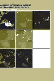
ISBN: 0415284635 Year: 2002 Publisher: London : Taylor and Francis
Abstract | Keywords | Export | Availability | Bookmark
Loading...Choose an application
- Reference Manager
- EndNote
- RefWorks (Direct export to RefWorks)
Geographic Information Systems in Oceanography and Fisheries provides a thorough examination of marine GIS applications that include a high variety of methods and sophisticated approaches in coastal, continental shelf, and deep ocean studies. It presents new innovative approaches of using GIS in the examination of the dynamic relations that characterize the marine world, including marine GIS macro routines for the development of Oceanography and Fisheries GIS tools and applications. Some application examples include: the mapping of fish production data (catch and landings); the identification of essential fish habitats; and the mapping of species migration corridors.
Fishery management --- Oceanography --- Geografie --- Geographic information systems. --- Geografische Informatie Systemen --- Toepassingen. --- 551.46 --- 57.087.2 --- 639.2.052.3 --- 681.3*H4 --- 639.2.052.3 Seas or oceans --- Seas or oceans --- 57.087.2 Graphic recording techniques. Charting, mapping techniques (in biology) --- Graphic recording techniques. Charting, mapping techniques (in biology) --- 551.46 Physical oceanography. Submarine topography. Ocean floor --- Physical oceanography. Submarine topography. Ocean floor --- Oceanography, Physical --- Oceanology --- Physical oceanography --- Thalassography --- Earth sciences --- Marine sciences --- Ocean --- Fish management --- Fisheries --- Fisheries management --- Fishery resources --- Aquatic resources --- Wildlife management --- Fish counting towers --- Overfishing --- Geographic information systems --- Computer science--Information systems applications (GIS etc.) --- Management
| Listing 1 - 4 of 4 |
Sort by
|