| Listing 1 - 10 of 10 |
Sort by
|
Book
ISBN: 9781444330625 9781444330618 Year: 2010 Publisher: Hoboken, NJ : Milton Keynes : Wiley-Blackwell The Open university,
Abstract | Keywords | Export | Availability | Bookmark
 Loading...
Choose an application
- Reference Manager
- EndNote
- RefWorks (Direct export to RefWorks)
"The understanding of Earth processes and environments over geological time is highly dependent upon both the experience that can only be gained through doing fieldwork, and the collection of reliable data and appropriate samples in the field. This textbook explains the main data gathering techniques used by geologists in the field and the reasons for these, with emphasis throughout on how to make effective field observations and record these in suitable formats. Equal weight is given to assembling field observations from igneous, metamorphic and sedimentary rock types. There are also substantial chapters on producing a field notebook, collecting structural information, recording fossil data and constructing geological maps. The volume is in a robust and handy size, with colour coded chapters for ease of use and quick reference in the field. This textbook is designed for students, amateur enthusiasts and professionals who have a background in geology and wish to collect field data on rocks and geological features. Teaching aspects of this textbook include: step-by-step guides to essential practical skills such as using a compass-clinometer, drawing a geological map and making a field sketch; tricks of the trade, checklists, flow charts and short worked examples; over 200 illustrations of a wide range of field notes, maps and geological features; appendices with the commonly used rock description and classification diagrams; a supporting website hosted by Wiley Blackwell"
Book
ISBN: 9022825256 Year: 1975 Publisher: Bussum Unieboek
Abstract | Keywords | Export | Availability | Bookmark
 Loading...
Choose an application
- Reference Manager
- EndNote
- RefWorks (Direct export to RefWorks)
Physical geography --- Geology. Earth sciences --- aarde (astronomie) --- 550.81 --- 528.7 --- 912 <100> --- Geological prospecting. Simplest exploration methods. Geomorphological investigations while prospecting --- Photogrammetry: aerial, terrestrial. Methods, instruments --- Cartografie. Kaarten. Plattegronden. Atlassen--Wereld. Internationaal. Alle landen gezamenlijk --- 528.7 Photogrammetry: aerial, terrestrial. Methods, instruments --- 550.81 Geological prospecting. Simplest exploration methods. Geomorphological investigations while prospecting
Book
ISBN: 271590021X 9782715900219 Year: 1985 Volume: 7 Publisher: Orleans BRGM
Abstract | Keywords | Export | Availability | Bookmark
 Loading...
Choose an application
- Reference Manager
- EndNote
- RefWorks (Direct export to RefWorks)
GG Structural geology --- GG Ore Geology --- RMCA --- 528.8 --- 550.81 --- 550.81 Geological prospecting. Simplest exploration methods. Geomorphological investigations while prospecting --- Geological prospecting. Simplest exploration methods. Geomorphological investigations while prospecting --- 528.8 Remote sensing. Teledetection --- Remote sensing. Teledetection --- GG Cartography --- Astronautics in earth sciences. --- Astronautics in earth sciences --- Earth sciences --- Remote sensing --- Remote sensing. --- Earth sciences - Remote sensing
Book
ISBN: 2715900481 Year: 1984 Publisher: Orléans Editions du Bureau de recherches géologiques et minières
Abstract | Keywords | Export | Availability | Bookmark
 Loading...
Choose an application
- Reference Manager
- EndNote
- RefWorks (Direct export to RefWorks)
550.81 --- Geology --- -Geological mapping --- -Geologic mapping --- Cartography --- Geognosy --- Geoscience --- Earth sciences --- Natural history --- Geological prospecting. Simplest exploration methods. Geomorphological investigations while prospecting --- Remote sensing --- -Congresses --- Congresses --- Conferences - Meetings --- -Geological prospecting. Simplest exploration methods. Geomorphological investigations while prospecting --- 550.81 Geological prospecting. Simplest exploration methods. Geomorphological investigations while prospecting --- -550.81 Geological prospecting. Simplest exploration methods. Geomorphological investigations while prospecting --- Geologic mapping --- Geological mapping --- Remote sensing&delete& --- SCIENCES DE LA TERRE --- GENERALITES --- PHOTOGEOLOGIE, TELEDETECTION --- COMPTE RENDUS D'ACTIVITE --- GEOMORPHOLOGIE --- PHOTOINTERPRETATION ET TELEDETECTION --- TECHNIQUES D'ETUDE --- INTERPRETATION D'ANALYSES --- TECHNIQUES D'ETUDE DE LABORATOIRE --- GEOLOGIE APPLIQUEE --- PROSPECTION GISEMENTS --- CONGRES, COLLOQUES...

ISBN: 0471962155 9780471962151 Year: 1996 Publisher: Chichester Wiley
Abstract | Keywords | Export | Availability | Bookmark
 Loading...
Choose an application
- Reference Manager
- EndNote
- RefWorks (Direct export to RefWorks)
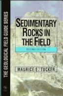
This handy pocket-sized guide shows how to achieve successful fieldwork on sedimentary rocks, paying particular detail to the precision and accuracy of recording detail. Various sedimentary rock-types, textures and all the basic field techniques required are clearly described. Thoroughly revised to incorporate up-to-date information, this 3rd edition will be of use to all students and professionals with a geological background. Features include: New sections on safety in the field, the use of GPS in sedimentary studies, core description, fossils as depth indicators and facies models. Improved illustrations and a new updated layout.
Rocks, Sedimentary. --- Petrology --- Fieldwork. --- 550.81 --- -Rocks, Sedimentary --- 550.8.04 --- 552.5 --- Rocks, Sedimentary --- Rocks --- Lithology --- Petrography --- Physical geology --- Geological prospecting. Simplest exploration methods. Geomorphological investigations while prospecting --- Fieldwork --- Observations. Geophysical field survey --- Sedimentary rocks --- 552.5 Sedimentary rocks --- 550.8.04 Observations. Geophysical field survey --- 550.81 Geological prospecting. Simplest exploration methods. Geomorphological investigations while prospecting --- Roches sédimentaires --- 551.3 --- External geodynamics (exogenous processes) --- 551.3 External geodynamics (exogenous processes) --- Roches sédimentaires --- Sedimentary rocks. --- Petrology - Fieldwork.
Book
ISBN: 2715900139 9782715900134 Year: 1982 Volume: 4 Publisher: Orléans : B.R.G.M. (Bureau de Recherches Géologiques et Minières),
Abstract | Keywords | Export | Availability | Bookmark
 Loading...
Choose an application
- Reference Manager
- EndNote
- RefWorks (Direct export to RefWorks)
Granite --- Intrusions (Geology) --- GG Ore Geology --- RMCA --- 528.8 --- 550.81 --- Remote sensing. Teledetection --- Geological prospecting. Simplest exploration methods. Geomorphological investigations while prospecting --- 550.81 Geological prospecting. Simplest exploration methods. Geomorphological investigations while prospecting --- 528.8 Remote sensing. Teledetection --- Intrusive bodies --- Pluton --- Geology, Structural --- Granitic rocks --- Igneous rocks --- GEOCHIMIE --- PHENOMENES MAGMATIQUES --- VOLCANOLOGIE --- MANIFESTATIONS VOLCANIQUES ACTUELLES --- EUROPE OCCIDENTALE --- FRANCE --- GEOLOGIE REGIONALE --- PETROLOGIE ROCHES IGNEES --- ETUDE REGIONALE --- GENESE --- ROCHES IGNEES ACIDES

ISBN: 0216929032 0216929040 0849371422 9780849371424 9780216929043 9780216929036 Year: 1991 Publisher: Glasgow: Blackie,
Abstract | Keywords | Export | Availability | Bookmark
 Loading...
Choose an application
- Reference Manager
- EndNote
- RefWorks (Direct export to RefWorks)
This book, written specifically for civil engineers, provides a comprehensive coverage of geological maps and sections.
Geology --- Engineering geology --- Maps. --- Géologie --- Cartographie --- cartography --- Méthodologie --- methodology --- Génie civil --- Civil engineering --- Stratigraphie --- Stratigraphy --- Construction --- England --- 550.81 --- -Geology --- -#Hist.Geol. --- Geognosy --- Geoscience --- Earth sciences --- Natural history --- Engineering --- Geology, Economic --- Geological prospecting. Simplest exploration methods. Geomorphological investigations while prospecting --- Maps --- 550.81 Geological prospecting. Simplest exploration methods. Geomorphological investigations while prospecting --- #Hist.Geol --- Geological maps --- Geology - Maps. --- Engineering geology - Maps. --- Geological sections --- Ingenieur civil --- Coupe geologique --- Carte geologique
Book
ISBN: 9010102165 Year: 1976 Publisher: Amsterdam Elsevier
Abstract | Keywords | Export | Availability | Bookmark
 Loading...
Choose an application
- Reference Manager
- EndNote
- RefWorks (Direct export to RefWorks)
landmeten --- waterpassen --- detailmeting --- geodetisch instrument --- oppervlaktemeting --- waterpassing --- (zie ook: waterpas) --- #BIBC:bibl.Reekmans --- kadaster --- topografie (landmeetkunde) --- 550.81 --- 528.4 --- 528.37 --- Landmeten --- Waterpassen --- 528.4 Field surveying. Land surveying. Cadastral survey. Topography. Engineering survey. Special fields of surveying --- Field surveying. Land surveying. Cadastral survey. Topography. Engineering survey. Special fields of surveying --- 550.81 Geological prospecting. Simplest exploration methods. Geomorphological investigations while prospecting --- Geological prospecting. Simplest exploration methods. Geomorphological investigations while prospecting --- Principles of leveling

ISBN: 2901026087 Year: 1980 Publisher: Paris : Société nationale Elf-Aquitaine,
Abstract | Keywords | Export | Availability | Bookmark
 Loading...
Choose an application
- Reference Manager
- EndNote
- RefWorks (Direct export to RefWorks)
55 <44> --- 55 <234.12> --- 550.81 --- <448.1/.7> --- <447> --- Earth sciences. Geology. Meteorology etc.--Frankrijk --- Earth sciences. Geology. Meteorology etc.--Pyreneeën --- Geological prospecting. Simplest exploration methods. Geomorphological investigations while prospecting --- Languedoc --- Zuidwest-Frankrijk. Aquitaine --- Geology. --- 550.81 Geological prospecting. Simplest exploration methods. Geomorphological investigations while prospecting --- 55 <234.12> Earth sciences. Geology. Meteorology etc.--Pyreneeën --- 55 <44> Earth sciences. Geology. Meteorology etc.--Frankrijk --- ZINC --- PLOMB --- MATIERES UTILES --- ELEMENTS CHIMIQUES --- GEOLOGIE APPLIQUEE --- GEOGRAPHIE INDUSTRIELLE ET MINIERE --- SYSTEMATIQUE DES RESSOURCES NATURELLES --- MASSIF CENTRAL (FRANCE) --- CEVENNES (FRANCE) --- EUROPE OCCIDENTALE --- FRANCE --- GEOLOGIE REGIONALE --- CEVENNES

ISBN: 0198233655 9780198233657 0198233663 Year: 1998 Publisher: Oxford University of Oxford. Agricultural economics research institute
Abstract | Keywords | Export | Availability | Bookmark
 Loading...
Choose an application
- Reference Manager
- EndNote
- RefWorks (Direct export to RefWorks)
V
Geography --- Information systems --- Geographic information systems --- environment --- Modèle --- Models --- Information processing --- Cartographie --- cartography --- Satellite --- Satellites --- Application des ordinateurs --- computer applications --- Système d'information géographique --- Geographical information systems --- 550.81 --- 681.3*H4 --- Geological prospecting. Simplest exploration methods. Geomorphological investigations while prospecting --- Information systems applications (GIS etc.) --- 681.3*H4 Information systems applications (GIS etc.) --- 550.81 Geological prospecting. Simplest exploration methods. Geomorphological investigations while prospecting --- GIS (Information systems) --- Information storage and retrieval systems --- Geographic information systems. --- Environmental Sciences and Forestry. Remote Sensing and Geographical Information Systems --- Geographical Information Systems.
| Listing 1 - 10 of 10 |
Sort by
|

 Search
 Feedback
 About UniCat
  Help
Help News
News