| Listing 1 - 10 of 62 | << page >> |
Sort by
|
Book
ISBN: 902200631X Year: 1977 Publisher: Wageningen : Stichting voor bodemkartering,
Abstract | Keywords | Export | Availability | Bookmark
 Loading...
Choose an application
- Reference Manager
- EndNote
- RefWorks (Direct export to RefWorks)
Geomorphological mapping --- -528.9 --- Cartography --- Cartography. Mapping (textual documents) --- 528.9 Cartography. Mapping (textual documents) --- 528.9
Book
ISBN: 9038204337 Year: 2002 Publisher: Gent Academia
Abstract | Keywords | Export | Availability | Bookmark
 Loading...
Choose an application
- Reference Manager
- EndNote
- RefWorks (Direct export to RefWorks)

ISBN: 0415096669 0415096650 Year: 1992 Publisher: London Routledge
Abstract | Keywords | Export | Availability | Bookmark
 Loading...
Choose an application
- Reference Manager
- EndNote
- RefWorks (Direct export to RefWorks)
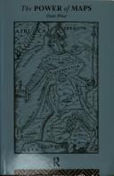
Denis Wood shows how maps are not impartial reference objects, but rather instruments of communication, persuasion, and power. Like paintings, they express a point of view. By connecting us to a reality that could not exist in the absence of maps--a world of property lines and voting rights, taxation districts and enterprise zones--they embody and project the interests of their creators. The pretence of objective, "scientific" map-making is demolished as the author explores how maps can change the way we see our world. Sampling the scope of maps available today, illustrations include Peter Gould's AIDS map, Tom Van Sant's map of the earth, U.S. Geological Survey maps, and a child's drawing of the world. The power of maps was published in conjunction with an exhibition at the Cooper Hewitt Museum, the Smithsonian Institution's National Museum of Design.
Cartografie --- Cartographie --- Cartography --- Cartography [Primitive ] --- Chartography --- Mapping (Cartography) --- 912 --- 528.9 --- 528.9 Cartography. Mapping (textual documents) --- Cartography. Mapping (textual documents) --- Cartografie. Kaarten. Plattegronden. Atlassen

ISBN: 0226389537 9780226389530 Year: 2006 Publisher: Chicago (Ill.) : University of Chicago press,
Abstract | Keywords | Export | Availability | Bookmark
 Loading...
Choose an application
- Reference Manager
- EndNote
- RefWorks (Direct export to RefWorks)
A novel work in the history of cartography, 'The Sovereign Map' argues that maps are as much about thinking as seeing, as much about the art of persuasion as the science of geography. As a classicist, Christian Jacob brings a fresh eye to his subject& which includes maps from Greek Antiquity to the twentieth century& and provides a theoretical approach to investigating the power of maps to inform, persuade, and inspire the imagination. Beginning with a historical overview of maps and their creation& from those traced in the dirt by primitive hands to the monumental Dutch atlases and ornate maps on Italian palace walls& Jacob goes on to consider the visual components of cartography: the decorative periphery, geometric grid, topographical lines, dots, details of iconographic figures, and many other aspects. Considering text on maps& titles, toponyms, legends, and keys& Jacob proposes that writing can both clarify and interfere with a map's visual presentation. Finally Jacob examines the role of the viewer in decoding a map's meaning and the role of society in defining the power of maps as authoritative depictions of space. Innovative in its philosophical motivation and its interdisciplinary approach to looking at and writing about maps, 'The Sovereign Map' is eagerly awaited by scholars from many different fields.
912 <036> --- 528.9 --- 528.9 Cartography. Mapping (textual documents) --- Cartography. Mapping (textual documents) --- Cartografie. Kaarten. Plattegronden. Atlassen--Gidsen. Inleidingen --- Historische Cartografie. --- Cartography --- Geografie --- History. --- Cartografie --- Maps --- History
Multi
ISBN: 9062754635 Year: 1988 Publisher: Delft Delft university press
Abstract | Keywords | Export | Availability | Bookmark
 Loading...
Choose an application
- Reference Manager
- EndNote
- RefWorks (Direct export to RefWorks)
Book
Year: 1969 Publisher: Brussel Paleis der Academiën
Abstract | Keywords | Export | Availability | Bookmark
 Loading...
Choose an application
- Reference Manager
- EndNote
- RefWorks (Direct export to RefWorks)
Astronomie --- Sciences pures --- Sterrenkunde --- Zuivere wetenschappen --- Cartografie --- 528.9 (493) "1570 : 1880 "
Book
ISBN: 9064696098 9789064696091 Year: 1983 Publisher: Alphen aan den Rijn : Canaletto,
Abstract | Keywords | Export | Availability | Bookmark
 Loading...
Choose an application
- Reference Manager
- EndNote
- RefWorks (Direct export to RefWorks)
912 <09> <492> --- 911.375 <09> <492> --- 912 <26> --- 528.9 <492> --- Cartography --- -528.9 --- 528.9 Cartography. Mapping (textual documents) --- Cartography. Mapping (textual documents) --- Cartography, Primitive --- Chartography --- Map-making --- Mapmaking --- Mapping (Cartography) --- Mathematical geography --- Surveying --- Map projection --- Maps --- 528.9 <492> Cartography. Mapping (textual documents)--Nederland --- Cartography. Mapping (textual documents)--Nederland --- Cartografie. Kaarten. Plattegronden. Atlassen--Geschiedenis van ...--Nederland --- Steden. Studie van stedelijke vestiging. Geografie van steden. Stadsgeografie--Geschiedenis van ...--Nederland --- Cartografie. Kaarten. Plattegronden. Atlassen--Oceanen. Zeeën. Zeestraten en zeeverbindingen --- History --- -528.9 <492> --- 528.9 --- History of the Netherlands --- History of the Low Countries --- Geodesy. Cartography --- anno 1800-1999 --- History. --- Cartography - Netherlands - History

ISBN: 0471555797 9780471555797 Year: 1995 Publisher: New York, NY : John Wiley,
Abstract | Keywords | Export | Availability | Bookmark
 Loading...
Choose an application
- Reference Manager
- EndNote
- RefWorks (Direct export to RefWorks)
Geodesy. Cartography --- Cartography --- 912 --- 528.9 --- Cartography, Primitive --- Chartography --- Map-making --- Mapmaking --- Mapping (Cartography) --- Mathematical geography --- Surveying --- Map projection --- Maps --- Cartografie. Kaarten. Plattegronden. Atlassen --- Cartography. Mapping (textual documents) --- Cartography. --- 528.9 Cartography. Mapping (textual documents) --- Cartographie --- Infographie --- Acqui 2006 --- Topographie

ISBN: 3700543921 Year: 1975 Publisher: Wien : Franz Deuticke,
Abstract | Keywords | Export | Availability | Bookmark
 Loading...
Choose an application
- Reference Manager
- EndNote
- RefWorks (Direct export to RefWorks)
Cartography. --- Cartography --- 912 <031> --- 528.9 --- Cartography, Primitive --- Chartography --- Map-making --- Mapmaking --- Mapping (Cartography) --- Mathematical geography --- Surveying --- Map projection --- Maps --- Cartografie. Kaarten. Plattegronden. Atlassen--Encyclopedieën. Lexica --- Cartography. Mapping (textual documents) --- 528.9 Cartography. Mapping (textual documents)

ISBN: 0712345361 Year: 1999 Publisher: London British library
Abstract | Keywords | Export | Availability | Bookmark
 Loading...
Choose an application
- Reference Manager
- EndNote
- RefWorks (Direct export to RefWorks)
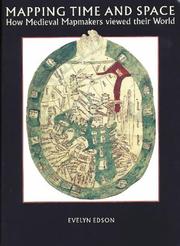
Medieval world maps have been viewed in the past as quaint, amusing and simply wrong This text studies differently, showing that the medieval world view, as expressed in maps, was not only a matter of measuring space, but of placing the Earth in a philosophical and religious setting. A major component of this setting was the passage of time, and many medieval maps show a narrative of human spiritual development: creation, the giving of the law, the coming of Christ, and the Last Judgement. Viewing medieval maps, not as isolated pieces of parchment, but in the context of the manuscripts in which they appear (not necessarily geographies, but more often calendar manuscripts, scientific treatises and histories) reveals the roles played in medieval thought, and how, in turn, medieval thinking determined the form and content of maps.
912 "04/14" --- 528.9 --- 091:912 --- Cartografie. Kaarten. Plattegronden. Atlassen--Middeleeuwen --- Cartography. Mapping (textual documents) --- Handschriftenkunde. Handschriftencatalogi-:-Cartografie. Kaarten. Plattegronden. Atlassen --- 091:912 Handschriftenkunde. Handschriftencatalogi-:-Cartografie. Kaarten. Plattegronden. Atlassen --- 528.9 Cartography. Mapping (textual documents)
| Listing 1 - 10 of 62 | << page >> |
Sort by
|

 Search
 Feedback
 About UniCat
  Help
Help News
News