
 Search
 Feedback
 About UniCat
  Help
Help News
News
| Listing 1 - 10 of 10 |
Sort by
|
Book
ISBN: 0713133708 Year: 1977 Publisher: London Arnold
Abstract | Keywords | Export | Availability | Bookmark
 Loading...
Choose an application
- Reference Manager
- EndNote
- RefWorks (Direct export to RefWorks)
528 --- Geodesy. Surveying. Photogrammetry. Cartography --- Surveying. --- Geografie --- Topografie --- Algemeen. --- 528 Geodesy. Surveying. Photogrammetry. Cartography
Book
ISBN: 0470218452 Year: 1992 Publisher: Harlow : Longman scientific and technical,
Abstract | Keywords | Export | Availability | Bookmark
Loading...Choose an application
- Reference Manager
- EndNote
- RefWorks (Direct export to RefWorks)
528 --- landmeten --- geodesie --- cartografie --- Landmeetkunde --- 528 Geodesy. Surveying. Photogrammetry. Cartography --- Geodesy. Surveying. Photogrammetry. Cartography --- Surveying. --- Surveying --- Surveys. --- Instruments.
Book
ISBN: 972565319X Year: 2001
Abstract | Keywords | Export | Availability | Bookmark
Loading...Choose an application
- Reference Manager
- EndNote
- RefWorks (Direct export to RefWorks)
528
---
912 <09>
---
#BIBC:ruil
ISBN: 0582301335 Year: 1989 Publisher: New York, NY : Longman,
Abstract | Keywords | Export | Availability | Bookmark
Loading...Choose an application
- Reference Manager
- EndNote
- RefWorks (Direct export to RefWorks)
528 --- 912 --- 655.28.026 --- 528.9 --- Geodesy. Surveying. Photogrammetry. Cartography --- Cartografie. Kaarten. Plattegronden. Atlassen --- Zetten van specifiek drukwerk. Krantzetten.Zetten van commercieel drukwerk. Zetten van postzegels --- Cartography. Mapping (textual documents) --- 528.9 Cartography. Mapping (textual documents) --- 528 Geodesy. Surveying. Photogrammetry. Cartography --- Color in cartography --- Couleur en cartographie. --- Cartography --- Cartographie. --- Topographical drawing. --- Dessin topographique.
Book
ISBN: 2225819688 Year: 1990 Publisher: Paris : Masson,
Abstract | Keywords | Export | Availability | Bookmark
Loading...Choose an application
- Reference Manager
- EndNote
- RefWorks (Direct export to RefWorks)
Photography --- Equipment --- methods --- Vision --- Photography, Stereoscopic --- Three-dimensional display systems --- Stereophotography --- Stereoscopic photography --- Photography, Stereoscopic. --- #WAAR:didaktiek --- 528 --- 3-D display systems --- 3D display systems --- Display systems, Three-dimensional --- Information display systems --- Three-dimensional imaging --- 528 Geodesy. Surveying. Photogrammetry. Cartography --- Geodesy. Surveying. Photogrammetry. Cartography --- Three-dimensional display systems. --- Geometrie --- Photographie stereoscopique
ISBN: 0226534170 0226534162 9780226534176 Year: 1993 Volume: *5 Publisher: Chicago (Ill.): University of Chicago press,
Abstract | Keywords | Export | Availability | Bookmark
Loading...Choose an application
- Reference Manager
- EndNote
- RefWorks (Direct export to RefWorks)
Writers know only too well how long it can take--and how awkward it can be--to describe spatial relationships with words alone. And while a map might not always be worth a thousand words, a good one can help writers communicate an argument or explanation clearly, succinctly, and effectively. In his acclaimed 'How to Lie with Maps,' Mark Monmonier showed how maps can distort facts. In 'Mapping it Out: Expository Cartography for the Humanities and Social Sciences,' he shows authors and scholars how they can use expository cartography--the visual, two-dimensional organization of information--to heighten the impact of their books and articles. This concise, practical book is an introduction to the fundamental principles of graphic logic and design, from the basics of scale to the complex mapping of movement or change. Monmonier helps writers and researchers decide when maps are most useful and what formats work best in a wide range of subject areas, from literary criticism to sociology. He demonstrates, for example, various techniques for representing changes and patternsdifferent typefaces and how they can either clarify or confuse informationand the effectiveness of less traditional map forms, such as visibility base maps, frame-rectangle symbols, and complementary scatterplot designs for conveying complex spatial relationships. There is also a wealth of practical information on map compilation, cartobibliographies, copyright and permissions, facsimile reproduction, and the evaluation of source materials. Appendixes discuss the benefits and limitations of electronic graphics and pen-and-ink drafting, and how to work with a cartographic illustrator. Clearly written, and filled with real-world examples, 'Mapping it Out' demystifies mapmaking for anyone writing in the humanities and social sciences. "A useful guide to a subject most people probably take too much for granted. It shows how map makers translate abstract data into eye-catching cartograms, as they are
Cartografie --- Cartographie --- Cartography --- Cartography [Primitive ] --- Chartography --- Mapping (Cartography) --- 528 --- 655.28.026 --- 528.9 --- Geodesy. Surveying. Photogrammetry. Cartography --- Zetten van specifiek drukwerk. Krantzetten. Zetten van commercieel drukwerk. Zetten van postzegels --- Cartography. Mapping (textual documents) --- Cartography. --- Humanities --- Social sciences --- Geografie --- Graphic methods. --- Algemeen. --- 528.9 Cartography. Mapping (textual documents) --- 528 Geodesy. Surveying. Photogrammetry. Cartography --- Behavioral sciences --- Human sciences --- Sciences, Social --- Social science --- Social studies --- Civilization --- Learning and scholarship --- Classical education --- Cartography, Primitive --- Map-making --- Mapmaking --- Mathematical geography --- Surveying --- Map projection --- Maps --- Graphic methods --- Humanities - Graphic methods --- Social sciences - Graphic methods
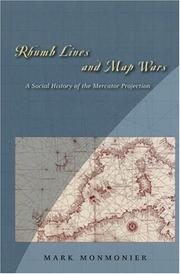
ISBN: 0226534316 Year: 2004 Publisher: Chicago and London The University of Chicago press
Abstract | Keywords | Export | Availability | Bookmark
Loading...Choose an application
- Reference Manager
- EndNote
- RefWorks (Direct export to RefWorks)
An account of the controversies surrounding Flemish cartographer Gerard Mercator's legacy. Examines the limitations and uses of Mercator's clever method of portraying the earth on a flat surface while taking into account the earth's actual roundness.
528 --- 912 <09> --- Geodesy. Surveying. Photogrammetry. Cartography --- Cartografie. Kaarten. Plattegronden. Atlassen--Geschiedenis van ... --- Cartography --- Loxodrome. --- Mercator projection (Cartography) --- Navigation. --- Peters projection (Cartography) --- Geografie --- Social aspects. --- Cartografie --- Historische Cartografie. --- Mercator projection (Cartography). --- Peters projection (Cartography). --- Cartography - Social aspects. --- Cartography -- Social aspects. --- Geography --- Earth & Environmental Sciences --- 528 Geodesy. Surveying. Photogrammetry. Cartography --- Loxodrome --- Navigation --- Peters Projektion (Cartography) --- Map projection --- Navigation, Primitive --- Locomotion --- Orientation --- Nautical astronomy --- Naval art and science --- Pilots and pilotage --- Helix, Spherical --- Loxodromic spiral --- Rhumb-line --- Spherical helix --- Spiral, Loxodromic --- Curves --- Sphere --- Cartography, Primitive --- Chartography --- Map-making --- Mapmaking --- Mapping (Cartography) --- Mathematical geography --- Surveying --- Maps --- Social aspects --- Cartografie. Kaarten. Plattegronden. Atlassen--Geschiedenis van .. --- Cartografie. Kaarten. Plattegronden. Atlassen--Geschiedenis van . --- Cartografie. Kaarten. Plattegronden. Atlassen--Geschiedenis van
ISBN: 0226767469 Year: 1993 Publisher: Chicago, IL ; London : University of Chicago Press,
Abstract | Keywords | Export | Availability | Bookmark
Loading...Choose an application
- Reference Manager
- EndNote
- RefWorks (Direct export to RefWorks)
528 --- 912 --- 094:912 --- Map projection --- -528.9 --- Mathematical geography --- Projection --- Cartography --- Surfaces, Representation of --- Geodesy. Surveying. Photogrammetry. Cartography --- Cartografie. Kaarten. Plattegronden. Atlassen --- Oude en merkwaardige drukken. Kostbare en zeldzame boeken. Preciosa en rariora-:-Cartografie. Kaarten. Plattegronden. Atlassen --- History --- Cartography. Mapping (textual documents) --- History. --- 528.9 Cartography. Mapping (textual documents) --- 094:912 Oude en merkwaardige drukken. Kostbare en zeldzame boeken. Preciosa en rariora-:-Cartografie. Kaarten. Plattegronden. Atlassen --- 528 Geodesy. Surveying. Photogrammetry. Cartography --- 528.9 --- Cartographie --- Carthographie --- Projections --- Infographie --- Geodesie --- Lieu geographique --- Histoire - geodesie --- Histoire
Book
ISBN: 8488699492 Year: 2001 Publisher: Madrid Caja Duero Biblioteca Nacional
Abstract | Keywords | Export | Availability | Bookmark
Loading...Choose an application
- Reference Manager
- EndNote
- RefWorks (Direct export to RefWorks)
912 <09> <460>
---
094.2 <460 MADRID>
---
912 <09> <7>
---
912 <09> <8>
---
912.643
---
528
---
Cartography
---
-Maps
---
-#BIBC:ruil
Book
ISBN: 9786612005046 1282005049 0226355934 9780226355931 0226355918 9780226355917 0226355926 9781282005044 Year: 2009 Publisher: Chicago : University of Chicago Press,
Abstract | Keywords | Export | Availability | Bookmark
Loading...Choose an application
- Reference Manager
- EndNote
- RefWorks (Direct export to RefWorks)
For anyone who has looked at a map of the United States and wondered how Texas and Oklahoma got their Panhandles, or flown over the American heartland and marveled at the vast grid spreading out in all directions below, American Boundaries will yield a welcome treasure trove of insight. The first book to chart the country's growth using the boundary as a political and cultural focus, Bill Hubbard's masterly narrative begins by explaining how the original thirteen colonies organized their borders and decided that unsettled lands should be held in trust for the common benef
Surveying --- U.S. states --- American states (United States) --- States of the United States --- United States states --- Cities and towns --- City surveying --- Land surveying --- Engineering --- Geodesy --- Geomatics --- Public lands --- History. --- United States geography. --- United States --- West (U.S.) --- American West --- Trans-Mississippi West (U.S.) --- United States, Western --- Western States (U.S.) --- Western United States --- ABŞ --- ABSh --- Ameerika Ühendriigid --- America (Republic) --- Amerika Birlăshmish Shtatlary --- Amerika Birlăşmi Ştatları --- Amerika Birlăşmiş Ştatları --- Amerika ka Kelenyalen Jamanaw --- Amerika Qūrama Shtattary --- Amerika Qŭshma Shtatlari --- Amerika Qushma Shtattary --- Amerika (Republic) --- Amerikai Egyesült Államok --- Amerikanʹ Veĭtʹsėndi︠a︡vks Shtattnė --- Amerikări Pĕrleshu̇llĕ Shtatsem --- Amerikas Forenede Stater --- Amerikayi Miatsʻyal Nahangner --- Ameriketako Estatu Batuak --- Amirika Carékat --- AQSh --- Ar. ha-B. --- Arhab --- Artsot ha-Berit --- Artzois Ha'bris --- Bí-kok --- Ē.P.A. --- EE.UU. --- Egyesült Államok --- ĒPA --- Estados Unidos --- Estados Unidos da América do Norte --- Estados Unidos de América --- Estaos Xuníos --- Estaos Xuníos d'América --- Estatos Unitos --- Estatos Unitos d'America --- Estats Units d'Amèrica --- Ètats-Unis d'Amèrica --- États-Unis d'Amérique --- Fareyniḳṭe Shṭaṭn --- Feriene Steaten --- Feriene Steaten fan Amearika --- Forente stater --- FS --- Hēnomenai Politeiai Amerikēs --- Hēnōmenes Politeies tēs Amerikēs --- Hiwsisayin Amerikayi Miatsʻeal Tērutʻiwnkʻ --- Istadus Unidus --- Jungtinės Amerikos valstybės --- Mei guo --- Mei-kuo --- Meiguo --- Mî-koet --- Miatsʻyal Nahangner --- Miguk --- Na Stàitean Aonaichte --- NSA --- S.U.A. --- SAD --- Saharat ʻAmērikā --- SASht --- Severo-Amerikanskie Shtaty --- Severo-Amerikanskie Soedinennye Shtaty --- Si︠e︡vero-Amerikanskīe Soedinennye Shtaty --- Sjedinjene Američke Države --- Soedinennye Shtaty Ameriki --- Soedinennye Shtaty Severnoĭ Ameriki --- Soedinennye Shtaty Si︠e︡vernoĭ Ameriki --- Spojené staty americké --- SShA --- Stadoù-Unanet Amerika --- Stáit Aontaithe Mheiriceá --- Stany Zjednoczone --- Stati Uniti --- Stati Uniti d'America --- Stâts Unîts --- Stâts Unîts di Americhe --- Steatyn Unnaneysit --- Steatyn Unnaneysit America --- SUA (Stati Uniti d'America) --- Sŭedineni amerikanski shtati --- Sŭedinenite shtati --- Tetã peteĩ reko Amérikagua --- U.S. --- U.S.A. --- United States of America --- Unol Daleithiau --- Unol Daleithiau America --- Unuiĝintaj Ŝtatoj de Ameriko --- US --- USA --- Usono --- Vaeinigte Staatn --- Vaeinigte Staatn vo Amerika --- Vereinigte Staaten --- Vereinigte Staaten von Amerika --- Verenigde State van Amerika --- Verenigde Staten --- VS --- VSA --- Wááshindoon Bikéyah Ałhidadiidzooígíí --- Wilāyāt al-Muttaḥidah --- Wilāyāt al-Muttaḥidah al-Amirīkīyah --- Wilāyāt al-Muttaḥidah al-Amrīkīyah --- Yhdysvallat --- Yunaeted Stet --- Yunaeted Stet blong Amerika --- ZDA --- Združene države Amerike --- Zʹi︠e︡dnani Derz︠h︡avy Ameryky --- Zjadnośone staty Ameriki --- Zluchanyi︠a︡ Shtaty Ameryki --- Zlucheni Derz︠h︡avy --- ZSA --- Η.Π.Α. --- Ηνωμένες Πολιτείες της Αμερικής --- Америка (Republic) --- Американь Вейтьсэндявкс Штаттнэ --- Америкӑри Пӗрлешӳллӗ Штатсем --- САЩ --- Съединените щати --- Злучаныя Штаты Амерыкі --- ولايات المتحدة --- ولايات المتّحدة الأمريكيّة --- ولايات المتحدة الامريكية --- 미국 --- Boundaries --- Territorial expansion. --- Geography. --- Annexations --- 528 --- 912 <73> --- 528 Geodesy. Surveying. Photogrammetry. Cartography --- Geodesy. Surveying. Photogrammetry. Cartography --- Public lands&delete& --- History --- Cartografie. Kaarten. Plattegronden. Atlassen--Verenigde Staten van Amerika. VSA. USA --- Spojené obce severoamerické --- États-Unis --- É.-U. --- ÉU --- geography, united states, american west, frontier, borders, boundaries, history, politics, nonfiction, panhandle, texas, oklahoma, colonies, settlement, ohio, surveyors, farmland, heartland, agriculture, homesteading, grid system, public lands, surveying, territory, land use, development, expansion, exploration, manifest destiny, montana, national domain.
| Listing 1 - 10 of 10 |
Sort by
|