| Listing 1 - 10 of 49 | << page >> |
Sort by
|
Book
ISBN: 2851082906 9782851082909 Year: 1981 Publisher: Paris Chêne
Abstract | Keywords | Export | Availability | Bookmark
 Loading...
Choose an application
- Reference Manager
- EndNote
- RefWorks (Direct export to RefWorks)
Comparative religion --- 091 =912 --- 091.31 --- Handschriftenkunde. Handschriftencatalogi--Oudindisch. Sanskriet --- Verluchte handschriften --- 091.31 Verluchte handschriften --- 091 =912 Handschriftenkunde. Handschriftencatalogi--Oudindisch. Sanskriet --- Cosmologie jaina --- Inde --- Civilisation
Book
ISBN: 0722973535 0835673537 9780835673532 9780722973530 Year: 1976 Volume: 103 Publisher: Madras Adyar library and research centre
Abstract | Keywords | Export | Availability | Bookmark
 Loading...
Choose an application
- Reference Manager
- EndNote
- RefWorks (Direct export to RefWorks)
Manuscripts, Sanskrit --- Manuscripts --- Manuscripts, Vedic --- 091 =912 --- 091 <540 MADRAS> --- Handschriftenkunde. Handschriftencatalogi--Oudindisch. Sanskriet --- Handschriftenkunde. Handschriftencatalogi--India--MADRAS --- 091 <540 MADRAS> Handschriftenkunde. Handschriftencatalogi--India--MADRAS --- 091 =912 Handschriftenkunde. Handschriftencatalogi--Oudindisch. Sanskriet --- Manuscripts, Sanskrit - Catalogs --- Manuscripts - India - Catalogs --- Manuscripts, Vedic - Catalogs

ISBN: 0712345361 Year: 1999 Publisher: London British library
Abstract | Keywords | Export | Availability | Bookmark
 Loading...
Choose an application
- Reference Manager
- EndNote
- RefWorks (Direct export to RefWorks)
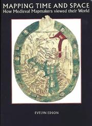
Medieval world maps have been viewed in the past as quaint, amusing and simply wrong This text studies differently, showing that the medieval world view, as expressed in maps, was not only a matter of measuring space, but of placing the Earth in a philosophical and religious setting. A major component of this setting was the passage of time, and many medieval maps show a narrative of human spiritual development: creation, the giving of the law, the coming of Christ, and the Last Judgement. Viewing medieval maps, not as isolated pieces of parchment, but in the context of the manuscripts in which they appear (not necessarily geographies, but more often calendar manuscripts, scientific treatises and histories) reveals the roles played in medieval thought, and how, in turn, medieval thinking determined the form and content of maps.
912 "04/14" --- 528.9 --- 091:912 --- Cartografie. Kaarten. Plattegronden. Atlassen--Middeleeuwen --- Cartography. Mapping (textual documents) --- Handschriftenkunde. Handschriftencatalogi-:-Cartografie. Kaarten. Plattegronden. Atlassen --- 091:912 Handschriftenkunde. Handschriftencatalogi-:-Cartografie. Kaarten. Plattegronden. Atlassen --- 528.9 Cartography. Mapping (textual documents)
Book
ISBN: 3515028439 3515030220 3515054049 9783515102773 Year: 1985 Publisher: Wiesbaden Steiner
Abstract | Keywords | Export | Availability | Bookmark
 Loading...
Choose an application
- Reference Manager
- EndNote
- RefWorks (Direct export to RefWorks)
091 =912 --- 091 <43> --- 091 =912 Handschriftenkunde. Handschriftencatalogi--Oudindisch. Sanskriet --- Handschriftenkunde. Handschriftencatalogi--Oudindisch. Sanskriet --- 091 <43> Handschriftenkunde. Handschriftencatalogi--Duitsland voor 1945 en na 1989 --- Handschriftenkunde. Handschriftencatalogi--Duitsland voor 1945 en na 1989 --- Manuscripts, Sanskrit

ISBN: 3598104782 3111518558 Year: 1983 Publisher: München Saur
Abstract | Keywords | Export | Availability | Bookmark
 Loading...
Choose an application
- Reference Manager
- EndNote
- RefWorks (Direct export to RefWorks)
Cartography --- History --- 912 <063> --- 091:912 --- -Cartography, Primitive --- Chartography --- Map-making --- Mapmaking --- Mapping (Cartography) --- Mathematical geography --- Surveying --- Map projection --- Maps --- Cartografie. Kaarten. Plattegronden. Atlassen--Congressen --- Handschriftenkunde. Handschriftencatalogi-:-Cartografie. Kaarten. Plattegronden. Atlassen --- -Congresses --- Conferences - Meetings --- -Cartografie. Kaarten. Plattegronden. Atlassen--Congressen --- 091:912 Handschriftenkunde. Handschriftencatalogi-:-Cartografie. Kaarten. Plattegronden. Atlassen --- -091:912 Handschriftenkunde. Handschriftencatalogi-:-Cartografie. Kaarten. Plattegronden. Atlassen --- Cartography, Primitive --- History&delete& --- Congresses --- Cartographie --- Histoire
Book
ISBN: 9789061942603 Year: 2010 Volume: 10 Publisher: 't Goy-Houten HES en De Graaf
Abstract | Keywords | Export | Availability | Bookmark
 Loading...
Choose an application
- Reference Manager
- EndNote
- RefWorks (Direct export to RefWorks)
Summary: Part 10 of the Utrecht Studies of the History of Cartography (EXPLOKART). The Vereenigde Oostindische Compagnie (Dutch East India Company) was for a period of 200 years responsible for the navigation material for the journey between the Netherlands and the Far East and the inter-Asian trade. In this book with the help of recovered archive materials a never published before overview is given of chart material that was used on a VOC-ship. All navigation charts of the VOC in the 17th and 18th century, drawn on vellum (of which many were traced in foreign collections), are described and analysed in an illustrated cartobibliography. In a supplement extracts of the "groot-journalen" of the "Kamer Amsterdam" are published. These give an unique view of the total expenses of the VOC on navigation. The extensive introduction gives more information on the history of the VOC, the chart makers, the routes, the navigation and the instruments.
Geodesy. Cartography --- Verenigde Oost-Indische Compagnie --- anno 1600-1699 --- anno 1700-1799 --- 912 "16" --- 912 "17" --- 091:912 --- Cartografie. Kaarten. Plattegronden. Atlassen--17e eeuw. Periode 1600-1699 --- Cartografie. Kaarten. Plattegronden. Atlassen--18e eeuw. Periode 1700-1799 --- Handschriftenkunde. Handschriftencatalogi-:-Cartografie. Kaarten. Plattegronden. Atlassen --- Nautical charts --- Nederlandsche Oost-Indische Compagnie --- History --- 091:912 Handschriftenkunde. Handschriftencatalogi-:-Cartografie. Kaarten. Plattegronden. Atlassen
Book
ISBN: 0712348778 9780712348775 Year: 2006 Publisher: London British Library
Abstract | Keywords | Export | Availability | Bookmark
 Loading...
Choose an application
- Reference Manager
- EndNote
- RefWorks (Direct export to RefWorks)
'Mapping paradise' is a history of the cartography of paradise that journeys from the beginning of Christianity to the present day. Instead of dismissing the medieval belief in a paradise on earth as a picturesque legend and the cartography of paradise as an example of the period’s many superstitions, Alessandro Scafi explores the intellectual conditions that made the medieval mapping of paradise possible. The challenge for mapmakers, Scafi argues, was to make visible a place that was geographically inaccessible and yet real, remote in time and yet still the scene of an essential episode of the history of salvation. Mapping paradise also accounts for the transformations, in both theological doctrine and cartographical practice, that brought about the decline of the belief in a terrestrial paradise and the emergence of the new historical and regional mapping of the Garden of Eden that began at the time of the Reformation and still continues today.
Christian religion --- Geodesy. Cartography --- 233.13 --- 236.6 --- 912 <15> --- 091:912 --- 912:2 --- Paradijs. Eden --- Hemel. Paradijs. Uitverkorenen. Triomferende Kerk --- Cartografie. Kaarten. Plattegronden. Atlassen--Kosmos --- Handschriftenkunde. Handschriftencatalogi-:-Cartografie. Kaarten. Plattegronden. Atlassen --- Cartografie. Kaarten. Plattegronden. Atlassen-:-Godsdienst. Theologie --- 091:912 Handschriftenkunde. Handschriftencatalogi-:-Cartografie. Kaarten. Plattegronden. Atlassen --- 236.6 Hemel. Paradijs. Uitverkorenen. Triomferende Kerk --- 233.13 Paradijs. Eden

ISBN: 0712302328 9780712302326 Year: 1991 Publisher: London Harvey
Abstract | Keywords | Export | Availability | Bookmark
 Loading...
Choose an application
- Reference Manager
- EndNote
- RefWorks (Direct export to RefWorks)
Geodesy. Cartography --- anno 500-1499 --- 912 "04/14" --- 912 <26> --- 091:912 --- Cartografie. Kaarten. Plattegronden. Atlassen--Middeleeuwen --- Cartografie. Kaarten. Plattegronden. Atlassen--Oceanen. Zeeën. Zeestraten en zeeverbindingen --- Handschriftenkunde. Handschriftencatalogi-:-Cartografie. Kaarten. Plattegronden. Atlassen --- 091:912 Handschriftenkunde. Handschriftencatalogi-:-Cartografie. Kaarten. Plattegronden. Atlassen --- Geography [Medieval ] --- History --- Cartes geographiques --- Cartographie --- Moyen age
Book
ISBN: 9788439375760 Year: 2007 Publisher: Barcelona Institut cartogràfic de Catalunya
Abstract | Keywords | Export | Availability | Bookmark
 Loading...
Choose an application
- Reference Manager
- EndNote
- RefWorks (Direct export to RefWorks)
912 <26> --- 912:551.46 --- 912 "13/14" --- 091:912 --- Cartografie. Kaarten. Plattegronden. Atlassen--Oceanen. Zeeën. Zeestraten en zeeverbindingen --- Kaarten. Atlassen: oceanen --- Cartografie. Kaarten. Plattegronden. Atlassen--?"13/14" --- Handschriftenkunde. Handschriftencatalogi-:-Cartografie. Kaarten. Plattegronden. Atlassen --- 091:912 Handschriftenkunde. Handschriftencatalogi-:-Cartografie. Kaarten. Plattegronden. Atlassen --- 912:551.46 Kaarten. Atlassen: oceanen
Book
ISBN: 0835674711 072297471X 9780835674713 9780722974711 Year: 1972 Volume: 100 Publisher: Madras Adyar library and research centre
Abstract | Keywords | Export | Availability | Bookmark
 Loading...
Choose an application
- Reference Manager
- EndNote
- RefWorks (Direct export to RefWorks)
Manuscripts, Sanskrit --- Manuscripts --- Manuscripts, Vedic --- Vedas --- 091 =912 --- 091 <540 MADRAS> --- Handschriftenkunde. Handschriftencatalogi--Oudindisch. Sanskriet --- Handschriftenkunde. Handschriftencatalogi--India--MADRAS --- 091 <540 MADRAS> Handschriftenkunde. Handschriftencatalogi--India--MADRAS --- 091 =912 Handschriftenkunde. Handschriftencatalogi--Oudindisch. Sanskriet --- Manuscripts, Sanskrit - Catalogs --- Manuscripts - India - Catalogs --- Manuscripts, Vedic - Catalogs
| Listing 1 - 10 of 49 | << page >> |
Sort by
|

 Search
 Feedback
 About UniCat
  Help
Help News
News