
 Search
 Feedback
 About UniCat
  Help
Help News
News
| Listing 1 - 10 of 11 | << page >> |
Sort by
|
Book
Year: 1892 Publisher: Stockholm : Norstedt,
Abstract | Keywords | Export | Availability | Bookmark
 Loading...
Choose an application
- Reference Manager
- EndNote
- RefWorks (Direct export to RefWorks)
Book
Year: 1892 Publisher: Torino : Clausen,
Abstract | Keywords | Export | Availability | Bookmark
Loading...Choose an application
- Reference Manager
- EndNote
- RefWorks (Direct export to RefWorks)
Book
Year: 1926 Publisher: Stuttgart : Selbstverlag des Herausgebers,
Abstract | Keywords | Export | Availability | Bookmark
Loading...Choose an application
- Reference Manager
- EndNote
- RefWorks (Direct export to RefWorks)
Book
ISBN: 9780824895044 9780824895068 0824895061 0824895053 Year: 2024 Publisher: Honolulu University of Hawaiʻi Press
Abstract | Keywords | Export | Availability | Bookmark
Loading...Choose an application
- Reference Manager
- EndNote
- RefWorks (Direct export to RefWorks)
"When European missionaries arrived in East Asia in the sixteenth century, they entered ongoing conversations about cosmology and world geography. Soon after, intellectuals in Ming China, Edo Japan, and Joseon Korea selectively encompassed elements of the late Renaissance worldview, leading to the creation of new artifacts that mitigated old and new knowledge in creative ways. Simultaneously, missionaries and their collaborators transcribed, replicated, and recombined from East Asian artifacts and informed European audiences about the newly discovered lands known as the "Far East." All these new artifacts enjoyed long afterlives that ensured the continuous remapping of the world in the following decades and centuries. Focusing on artifacts, this expansively illustrated volume tells the story of a meeting of worldviews. Tracing the connections emanating from each artifact, the authors illuminate how every map, globe, or book was shaped by the intellectual, social, and material cultures of East Asia, while connecting multiple global centers of learning and print culture. Crossing both historical and historiographical boundaries reveals how this series of artifacts embody a continuous and globally connected process of mapping the world, rather than a grand encounter between East and West. As such, this book rewrites the narrative surrounding the so-called "Ricci Maps," which assumes that one Jesuit missionary brought scientific cartography to East Asia by translating and adapting a Renaissance world map. It argues for a revision of that narrative by emphasizing process and connectivity, displacing the European missionary and "his map" as central actors that supposedly bridged a formidable civilizational divide between Europe and China. Rather than a single map authored by a European missionary, a series of materially different artifacts were created as a result of discussions between the Jesuit Matteo Ricci and his Chinese contacts during the last decades of Ming rule. Each of these gave rise to the production of new artifacts that embodied broader intellectual conversations. By presenting eleven original chapters by Asian, European, and American scholars, this work covers an extensive range of artifacts and crosses boundaries between China, Japan, Korea, and the global pathways that connected them to the other end of the Eurasian landmass"--
World maps, Manuscript --- Early maps --- Cartography --- History
Book
ISBN: 0802079458 Year: 1996 Publisher: Toronto University of Toronto press
Abstract | Keywords | Export | Availability | Bookmark
Loading...Choose an application
- Reference Manager
- EndNote
- RefWorks (Direct export to RefWorks)
Cartography --- Early maps --- Geography, Medieval --- World maps, Manuscript --- History --- Ricardus,
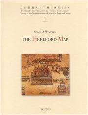
ISBN: 2503510566 9782503510569 Year: 2001 Volume: 1 Publisher: Turnhout Brepols
Abstract | Keywords | Export | Availability | Bookmark
Loading...Choose an application
- Reference Manager
- EndNote
- RefWorks (Direct export to RefWorks)
Geodesy. Cartography --- anno 1300-1399 --- Cartografie --- Cartographie --- Geschiedenis van de Middeleeuwen --- Histoire du Moyen Age --- Historische bronnen --- Mythes et légendes --- Sagen en legenden --- Sources historiques --- Geography, Medieval --- Cartography --- Early maps. --- World maps, Manuscript . --- World maps --- Géographie médiévale --- Cartes anciennes --- Cartes du monde manuscrites --- Cartes du monde --- Maps --- History. --- Early works to 1800. --- Cartes --- Histoire --- Ouvrages avant 1800 --- Ricardus, --- World maps, Manuscript. --- Symbols. --- 912 "04/14" --- 912 <100> --- 091 <41 HEREFORD> --- Early maps --- -World maps, Manuscript --- Manuscript maps --- Geography --- Medieval geography --- Maps, Early --- Cartografie. Kaarten. Plattegronden. Atlassen--Middeleeuwen --- Cartografie. Kaarten. Plattegronden. Atlassen--Wereld. Internationaal. Alle landen gezamenlijk --- Handschriftenkunde. Handschriftencatalogi--Verenigd Koninkrijk van Groot-Brittannië en Noord-Ierland--HEREFORD --- -Symbols --- History --- Ricardus de Bello --- 091 <41 HEREFORD> Handschriftenkunde. Handschriftencatalogi--Verenigd Koninkrijk van Groot-Brittannië en Noord-Ierland--HEREFORD --- Géographie médiévale --- World maps, Manuscript --- Maps&delete& --- Symbols --- Richard, --- Bataylle, Richard de la, --- Batayl, Richard de, --- Geography, Medieval - Maps - Symbols. --- GEOGRAPHIE HISTORIQUE --- CARTOGRAPHIE --- CARTES DU MONDE --- MOYEN AGE --- 14E SIECLE --- OUVRAGES AVANT 1800
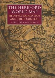
ISBN: 0712347607 Year: 2006 Publisher: London British library
Abstract | Keywords | Export | Availability | Bookmark
Loading...Choose an application
- Reference Manager
- EndNote
- RefWorks (Direct export to RefWorks)
The famous Hereford world map dates from around 1300. Setting the Hereford map in context, P. D. A. Harvey and his 24 collaborators present many aspects of these maps for historians, geographers, students of art history, theologians, and everyone interested in the way medieval people thought and the way they saw their world.
Geodesy. Cartography --- anno 1200-1499 --- Geography, Medieval. --- World maps, Manuscript. --- World maps --- Early maps. --- Géographie médiévale --- Cartes du monde manuscrites --- Cartes du monde --- Cartes anciennes --- Early works to 1800. --- Ouvrages avant 1800 --- Ricardus, --- 912 "04/14" --- 091 <41 HEREFORD> --- 912 <100> --- Cartografie. Kaarten. Plattegronden. Atlassen--Middeleeuwen --- Handschriftenkunde. Handschriftencatalogi--Verenigd Koninkrijk van Groot-Brittannië en Noord-Ierland--HEREFORD --- Cartografie. Kaarten. Plattegronden. Atlassen--Wereld. Internationaal. Alle landen gezamenlijk --- 091 <41 HEREFORD> Handschriftenkunde. Handschriftencatalogi--Verenigd Koninkrijk van Groot-Brittannië en Noord-Ierland--HEREFORD --- Géographie médiévale --- Early maps --- Geography, Medieval --- World maps, Manuscript --- Manuscript maps --- Geography --- Medieval geography --- Maps, Early --- History --- Richard, --- Bataylle, Richard de la, --- Batayl, Richard de,
Book
ISBN: 9788494199110 8494199110 Year: 2014 Publisher: Burgos : Siloé arte y bibliofilia,
Abstract | Keywords | Export | Availability | Bookmark
Loading...Choose an application
- Reference Manager
- EndNote
- RefWorks (Direct export to RefWorks)
Manuscript maps --- World maps, Manuscript --- Manuscript maps --- Manuscripts, Medieval --- Geography, Medieval --- Cartography --- Cartes manuscrites --- Cartes du monde manuscrites --- Cartes manuscrites --- Manuscrits médiévaux --- Géographie médiévale --- Cartographie --- Early works to 1800 --- Early works to 1800. --- Illustrations --- Illustrations --- Maps. --- History --- Ouvrages avant 1800 --- Ouvrages avant 1800 --- Illustrations --- Illustrations --- Cartes --- Histoire --- Beatus, --- Manuscripts.
Book
ISBN: 0226333035 9780226333038 Year: 2008 Publisher: Chicago University of Chicago press
Abstract | Keywords | Export | Availability | Bookmark
Loading...Choose an application
- Reference Manager
- EndNote
- RefWorks (Direct export to RefWorks)
Until the entire world was mapped, terra incognita was not a metaphor. It existed and was acknowledged to exist. Yet the very acknowledgement of terra incognita raises a problem in the words themselves: without knowledge of it, how can land be represented? This study examines how unknown lands were represented from late Antiquity to 1600 - on maps, and in a variety of written texts, including poetry, treatises, political tracts, legal documents and travel narratives? 'Terra incognita' is the history of a non place, of lands conjured by the scientific imagination, which nevertheless drove exploration, and which continued to shape the world map, even as they slowly vanished from it.
Early maps. --- Cosmography --- World maps, Manuscript --- Geography, Medieval --- Cartes anciennes --- Cosmographie --- Cartes du monde manuscrites --- Géographie médiévale --- Early works to 1800. --- History --- Maps. --- Ouvrages avant 1800 --- Histoire --- Cartes --- 912 "04/14" --- 912 "15" --- 912 <100> --- Cartography. Maps. Atlasses--Middeleeuwen --- Cartografie. Kaarten. Plattegronden. Atlassen--16e eeuw. Periode 1500-1599 --- Cartografie. Kaarten. Plattegronden. Atlassen--Wereld. Internationaal. Alle landen gezamenlijk --- Géographie médiévale --- Early maps --- Manuscript maps --- Atlases, Historical --- Historical atlases --- Middle Ages --- Maps, Early --- Geography
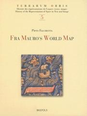
ISBN: 2503517269 9782503517261 Year: 2006 Volume: 5 Publisher: Turnhout Brepols
Abstract | Keywords | Export | Availability | Bookmark
Loading...Choose an application
- Reference Manager
- EndNote
- RefWorks (Direct export to RefWorks)
Cartografie --- Cartographie --- Geschiedenis van de Middeleeuwen --- Histoire du Moyen Age --- Historische bronnen --- Mythes et légendes --- Sagen en legenden --- Sources historiques --- Geography, Medieval --- Cartography --- Early maps. --- World maps, Manuscript. --- World maps --- Géographie médiévale --- Cartes anciennes --- Cartes du monde manuscrites --- Cartes du monde --- Maps. --- History. --- Early works to 1800. --- Cartes --- Histoire --- Ouvrages avant 1800 --- Mauro, --- World maps. --- 912 <09> <100> --- 912 "14" --- Cartografie. Kaarten. Plattegronden. Atlassen--Geschiedenis van ...--Wereld. Internationaal. Alle landen gezamenlijk --- Cartografie. Kaarten. Plattegronden. Atlassen--15e eeuw. Periode 1400-1499 --- Géographie médiévale --- Early maps --- Maps --- Globes --- Maps, Early --- Geography --- Cartography, Primitive --- Chartography --- Map-making --- Mapmaking --- Mapping (Cartography) --- Mathematical geography --- Surveying --- Map projection --- History --- Cartography - Maps.
| Listing 1 - 10 of 11 | << page >> |
Sort by
|