
 Search
 Feedback
 About UniCat
  Help
Help News
News
| Listing 1 - 10 of 13 | << page >> |
Sort by
|
Book
Abstract | Keywords | Export | Availability | Bookmark
 Loading...
Choose an application
- Reference Manager
- EndNote
- RefWorks (Direct export to RefWorks)
Geodesy. Cartography --- anno 1400-1499 --- 912 "14" --- 093 --- 762 --- 655.3.026 --- Cartografie. Kaarten. Plattegronden. Atlassen--15e eeuw. Periode 1400-1499 --- Incunabelen. Incunabelkunde --- Diepdruktechnieken in de grafische kunst --- Drukken van specifiek drukwerk. Drukken van kranten, postzegels, kaarten, commercieel drukwerk --- 762 Diepdruktechnieken in de grafische kunst --- 093 Incunabelen. Incunabelkunde --- Early maps --- Catalogs and collections
Book
ISBN: 9726621844 9789726621843 Year: 1990 Volume: 22 Publisher: Lisboa Gradiva
Abstract | Keywords | Export | Availability | Bookmark
Loading...Choose an application
- Reference Manager
- EndNote
- RefWorks (Direct export to RefWorks)
912 "14" --- 912 "15" --- 912 <100> --- 528.221 --- Cartografie. Kaarten. Plattegronden. Atlassen--15e eeuw. Periode 1400-1499 --- Cartografie. Kaarten. Plattegronden. Atlassen--16e eeuw. Periode 1500-1599 --- Cartografie. Kaarten. Plattegronden. Atlassen--Wereld. Internationaal. Alle landen gezamenlijk --- Geometric (static) methods. Use of longitudinal and latitudinal measurements --- 528.221 Geometric (static) methods. Use of longitudinal and latitudinal measurements
Book
ISBN: 2503523781 9782503523781 Year: 2011 Volume: 8 Publisher: Turnhout : Brepols,
Abstract | Keywords | Export | Availability | Bookmark
Loading...Choose an application
- Reference Manager
- EndNote
- RefWorks (Direct export to RefWorks)
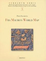
Fra Mauro's mappamundi, drawn around 1450 in the monastery of San Michele on Murano in the lagoon of Venice, is among the most relevant compendia of knowledge of the Earth and the Cosmos of the fifteenth century. By examining literary, visual, textual and archival evidences, some long considered lost, this book places the map within the larger context of Venetian culture in the fifteenth century. It provides a detailed analysis of both its main sources (auctores veteres such as Pliny, Solinus, Ptolemy, and novi, like Albert the Great, Thomas Aquinas, Marco Polo and Niccolò de' Conti) as well as of the composite networks of contemporary knowledge (scholasticism, humanism, monastic culture, as well as more technical skills such as marine cartography and mercantile practices), investigating the way they combine in the epistemological unity of the imago mundi. More a work on intellectual history than cartography, the book constructs a complex set of frameworks within which to situate Fra Mauro's monumental effort. These range from the cultural history of the reception of the world map from the fifteenth to the nineteenth centuries to the analysis of the material conditions under which map-makers such as Fra Mauro worked; from the history of ideas, especially of natural philosophy to the links between world representations and travel literature. It also addresses the Venetian reception of Ptolemy's Geography, the interactions between Venetian art, theology and cosmography and the complexities of the Venetian vernacular. The books develops a multi-tiered approach, in which different elements of the rich cultural context in which this world map was created, interact with each other, each casting a new light on the encyclopaedic work being analyzed.
912 "14" --- 912 <100> --- Cartografie. Kaarten. Plattegronden. Atlassen--15e eeuw. Periode 1400-1499 --- Cartografie. Kaarten. Plattegronden. Atlassen--Wereld. Internationaal. Alle landen gezamenlijk --- Mauro [Fra] --- Geodesy. Cartography --- Cartographers --- Cartography --- World maps --- Maps --- Mapmakers --- Earth scientists --- History --- Mauro, --- Venice (Italy) --- Mauro, fra (....-1459?) --- Cartographie --- Cartographes --- Cartes du monde --- Critique et interprétation --- 15e siècle --- Italie --- Venice (italie)
Book
ISBN: 0674071611 0674068076 9780674068070 9780674071612 9780674066489 0674066480 Year: 2013 Publisher: Cambridge, MA
Abstract | Keywords | Export | Availability | Bookmark
Loading...Choose an application
- Reference Manager
- EndNote
- RefWorks (Direct export to RefWorks)
In 1482, the Florentine humanist and statesman Francesco Berlinghieri produced the Geographia, a book of over one hundred folio leaves describing the world in Italian verse, inspired by the ancient Greek geography of Ptolemy. The poem, divided into seven books (one for each day of the week the author "travels" the known world), is interleaved with lavishly engraved maps to accompany readers on this journey. Sean Roberts demonstrates that the Geographia represents the moment of transition between printing and manuscript culture, while forming a critical base for the rise of modern cartography. Simultaneously, the use of the Geographia as a diplomatic gift from Florence to the Ottoman Empire tells another story. This exchange expands our understanding of Mediterranean politics, European perceptions of the Ottomans, and Ottoman interest in mapping and print. The envoy to the Sultan represented the aspirations of the Florentine state, which chose not to bestow some other highly valued good, such as the city's renowned textiles, but instead the best example of what Florentine visual, material, and intellectual culture had to offer.
Cartography --- Cartography, Primitive --- Chartography --- Map-making --- Mapmaking --- Mapping (Cartography) --- Mathematical geography --- Surveying --- Map projection --- Maps --- History --- Berlinghieri, Francesco, --- Ptolemy, --- Europe --- Turkey --- Ottoman Empire --- Council of Europe countries --- Eastern Hemisphere --- Eurasia --- 912 "14" --- 912 <45> --- Cartografie. Kaarten. Plattegronden. Atlassen--15e eeuw. Periode 1400-1499 --- Cartografie. Kaarten. Plattegronden. Atlassen--Italië --- Geodesy. Cartography --- Graphic arts --- Berlinghieri, Francesco --- Florence --- Istanbul [city] --- Ottoman Empire, 1288-1918
Book
ISBN: 2877140482 9782877140485 Year: 1990 Publisher: Paris Bookking international
Abstract | Keywords | Export | Availability | Bookmark
Loading...Choose an application
- Reference Manager
- EndNote
- RefWorks (Direct export to RefWorks)
912 <100> --- 912 "14" --- 094 PTOLEMAEUS, CLAUDIUS --- 091 <45 NAPOLI> --- Cartografie. Kaarten. Plattegronden. Atlassen--Wereld. Internationaal. Alle landen gezamenlijk --- Cartografie. Kaarten. Plattegronden. Atlassen--15e eeuw. Periode 1400-1499 --- Oude en merkwaardige drukken. Kostbare en zeldzame boeken. Preciosa en rariora--PTOLEMAEUS, CLAUDIUS --- Handschriftenkunde. Handschriftencatalogi--Italië--NAPOLI --- 091 <45 NAPOLI> Handschriftenkunde. Handschriftencatalogi--Italië--NAPOLI --- 094 PTOLEMAEUS, CLAUDIUS Oude en merkwaardige drukken. Kostbare en zeldzame boeken. Preciosa en rariora--PTOLEMAEUS, CLAUDIUS
Book
ISBN: 9789004304536 9789004307278 9004307273 9004304533 9004304533 Year: 2015 Publisher: Boston
Abstract | Keywords | Export | Availability | Bookmark
Loading...Choose an application
- Reference Manager
- EndNote
- RefWorks (Direct export to RefWorks)
In Apocalyptic Cartography: Thematic Maps and the End of the World in a Fifteenth-Century Manuscript , Chet Van Duzer and Ilya Dines analyse Huntington Library HM 83, an unstudied manuscript produced in Lübeck, Germany. The manuscript contains a rich collection of world maps produced by an anonymous but strikingly original cartographer. These include one of the earliest programs of thematic maps, and a remarkable series of maps that illustrate the transformations that the world was supposed to undergo during the Apocalypse. The authors supply detailed discussion of the maps and transcriptions and translations of the Latin texts that explain the maps. Copies of the maps in a fifteenth-century manuscript in Wolfenbüttel prove that this unusual work did circulate. A brief article about this book on the website of National Geographic can be found here .
Book history --- Geodesy. Cartography --- anno 1400-1499 --- Thematic maps --- Manuscripts, Medieval --- End of the world --- Cartes thématiques --- Manuscrits médiévaux --- Fin du monde --- History --- Maps --- Histoire --- Cartes --- Henry E. Huntington Library and Art Gallery. --- 912 "14" --- 912:930 --- 912 <100> --- 091:228 --- Cartografie. Kaarten. Plattegronden. Atlassen--15e eeuw. Periode 1400-1499 --- Cartografie. Kaarten. Plattegronden. Atlassen-:-Geschiedwetenschap. Hulpwetenschappen der geschiedenis --- Cartografie. Kaarten. Plattegronden. Atlassen--Wereld. Internationaal. Alle landen gezamenlijk --- Handschriftenkunde. Handschriftencatalogi-:-Apocalyps --- 091:228 Handschriftenkunde. Handschriftencatalogi-:-Apocalyps --- Cartes thématiques --- Manuscrits médiévaux --- Huntington Library, Art Museum, and Botanical Gardens. --- Maps.
Book
ISBN: 3326002742 9783326002743 Year: 1990 Volume: 8 Publisher: Berlin Deutscher Verlag der Wissenschaften
Abstract | Keywords | Export | Availability | Bookmark
Loading...Choose an application
- Reference Manager
- EndNote
- RefWorks (Direct export to RefWorks)
Cartography --- History. --- 911.375 <09> <43> --- 912 <09> <43> --- 912 "14" --- 912 "15" --- -Cartography, Primitive --- Chartography --- Map-making --- Mapmaking --- Mapping (Cartography) --- Mathematical geography --- Surveying --- Map projection --- Maps --- Steden. Studie van stedelijke vestiging. Geografie van steden. Stadsgeografie--Geschiedenis van ...--Duitsland voor 1945 en na 1989 --- Cartografie. Kaarten. Plattegronden. Atlassen--Geschiedenis van ...--Duitsland voor 1945 en na 1989 --- Cartografie. Kaarten. Plattegronden. Atlassen--15e eeuw. Periode 1400-1499 --- Cartografie. Kaarten. Plattegronden. Atlassen--16e eeuw. Periode 1500-1599 --- History --- -Steden. Studie van stedelijke vestiging. Geografie van steden. Stadsgeografie--Geschiedenis van ...--Duitsland voor 1945 en na 1989 --- Cartography - Germany - Saxony - History. --- -History
ISBN: 2503517269 9782503517261 Year: 2006 Volume: 5 Publisher: Turnhout : Venezia : Brepols Biblioteca Nazionale Marciana,
Abstract | Keywords | Export | Availability | Bookmark
Loading...Choose an application
- Reference Manager
- EndNote
- RefWorks (Direct export to RefWorks)
Cartografie --- Cartographie --- Geschiedenis van de Middeleeuwen --- Histoire du Moyen Age --- Historische bronnen --- Mythes et légendes --- Sagen en legenden --- Sources historiques --- Geography, Medieval --- Cartography --- Early maps. --- World maps, Manuscript. --- World maps --- Géographie médiévale --- Cartes anciennes --- Cartes du monde manuscrites --- Cartes du monde --- Maps. --- History. --- Early works to 1800. --- Cartes --- Histoire --- Ouvrages avant 1800 --- Mauro, --- World maps. --- 912 <09> <100> --- 912 "14" --- Cartografie. Kaarten. Plattegronden. Atlassen--Geschiedenis van ...--Wereld. Internationaal. Alle landen gezamenlijk --- Cartografie. Kaarten. Plattegronden. Atlassen--15e eeuw. Periode 1400-1499 --- Géographie médiévale --- Early maps --- Maps --- Globes --- Maps, Early --- Geography --- Cartography, Primitive --- Chartography --- Map-making --- Mapmaking --- Mapping (Cartography) --- Mathematical geography --- Surveying --- Map projection --- History --- Cartography - Maps.
Book
ISBN: 1879281007 Year: 1990 Publisher: Milwaukee Golda Meir Library
Abstract | Keywords | Export | Availability | Bookmark
Loading...Choose an application
- Reference Manager
- EndNote
- RefWorks (Direct export to RefWorks)
912 "14" --- 912 "15" --- 912 <09> <7> --- 980.02 --- 094:970/980 --- Early maps --- -Geography --- -Cosmography --- Earth sciences --- World history --- Maps, Early --- Geography --- Cartografie. Kaarten. Plattegronden. Atlassen--15e eeuw. Periode 1400-1499 --- Cartografie. Kaarten. Plattegronden. Atlassen--16e eeuw. Periode 1500-1599 --- Cartografie. Kaarten. Plattegronden. Atlassen--Geschiedenis van ...--Noord-Amerika. Midden-Amerika --- Geschiedenis van Zuid-Amerika:--exploratie; Spaanse en Portugese koloniale tijd --- Oude en merkwaardige drukken. Kostbare en zeldzame boeken. Preciosa en rariora-:-Geschiedenis van Noord-Amerika en Zuid-Amerika --- Exhibitions --- History --- -Exhibitions --- Columbus, Christopher --- -Colón, Cristóbal --- Colombo, Cristoforo --- Ko-lun-pu --- Gelunbu --- Colomb, Christophe --- Colón y Fontanarrosa, Cristóbal --- Fontanarrosa, Cristóbal Colón y --- Kolumbus, Kryštof --- Kolombos, Kʻristapʻor --- Kolompos, Kʻristapʻor --- Kolumb, Khristofor --- Kolumb, Krzysztof --- Kolumbo, Kristof --- Kolumbus, Christoph --- Kolomb, Kristof --- Ḳolon, Ḳrisṭobal --- Colombo, Christovam --- Colombo, Cristóvão --- Colom --- Colom, Cristòfor --- Colom, Cristóbal --- Ḳolumbus, Ḳrisṭof --- Columbus, Ch. --- Kholupus, Khristov --- Kolampacu --- Colonne, Cristoforo --- קאלומבוס, קריסטאף --- קאלומבוס, קריסטופר --- קולומבוס --- Kolomvos, Christophoros --- Americas --- New World --- Western Hemisphere --- Discovery and exploration --- -Maps --- -Exhibitions. --- -Sources --- -Cartografie. Kaarten. Plattegronden. Atlassen--15e eeuw. Periode 1400-1499 --- 094:970/980 Oude en merkwaardige drukken. Kostbare en zeldzame boeken. Preciosa en rariora-:-Geschiedenis van Noord-Amerika en Zuid-Amerika --- 980.02 Geschiedenis van Zuid-Amerika:--exploratie; Spaanse en Portugese koloniale tijd --- -Colomb, Christophe --- Colombus, Christophorus --- Columbus, Christoffel --- Colón, Cristóbal --- -Maps, Early --- Cosmography --- History&delete& --- Exhibitions. --- America --- Maps --- Sources --- Cartes
Book
ISBN: 9780230231641 Year: 2010 Volume: *9 Publisher: New York ; Basingstoke Palgrave Macmillan
Abstract | Keywords | Export | Availability | Bookmark
Loading...Choose an application
- Reference Manager
- EndNote
- RefWorks (Direct export to RefWorks)
History of Europe --- Geodesy. Cartography --- anno 1500-1599 --- 912 "14" --- 912 "15" --- 656.61 --- 912 <4> --- Cartografie. Kaarten. Plattegronden. Atlassen--15e eeuw. Periode 1400-1499 --- Cartografie. Kaarten. Plattegronden. Atlassen--16e eeuw. Periode 1500-1599 --- Transport by sea. Maritime navigation, shipping --- Cartografie. Kaarten. Plattegronden. Atlassen--Europa --- 656.61 Transport by sea. Maritime navigation, shipping --- Cartography --- Discoveries in geography --- Early maps --- Humanism --- Ships --- Vessels (Ships) --- Boats and boating --- Shipbuilding --- Philosophy --- Classical education --- Classical philology --- Philosophical anthropology --- Renaissance --- Maps, Early --- Geography --- Discoveries, Maritime --- Discovery and exploration --- Exploration and discovery --- Explorations in geography --- Exploring expeditions --- Geographical discoveries --- Geographical discovery --- Maritime discoveries --- Voyages and travels --- Explorers --- Geographical discoveries in literature --- Cartography, Primitive --- Chartography --- Map-making --- Mapmaking --- Mapping (Cartography) --- Mathematical geography --- Surveying --- Map projection --- Maps --- History
| Listing 1 - 10 of 13 | << page >> |
Sort by
|