| Listing 1 - 6 of 6 |
Sort by
|

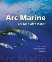
ISBN: 9781589480179 1589480171 Year: 2007 Publisher: Redlands, Calif. : ESRI Press,
Abstract | Keywords | Export | Availability | Bookmark
 Loading...
Choose an application
- Reference Manager
- EndNote
- RefWorks (Direct export to RefWorks)
Book
ISBN: 1589485300 9781589485303 Year: 2019 Publisher: Redlands, California : Esri Press,
Abstract | Keywords | Export | Availability | Bookmark
 Loading...
Choose an application
- Reference Manager
- EndNote
- RefWorks (Direct export to RefWorks)
Geographic information systems. --- Système d'information géographique. --- Science --- Sciences --- Methodology. --- Méthodologie.

ISBN: 0748408622 0748408703 Year: 2000 Publisher: London : Taylor and Francis,
Abstract | Keywords | Export | Availability | Bookmark
 Loading...
Choose an application
- Reference Manager
- EndNote
- RefWorks (Direct export to RefWorks)
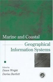
Marine and coastal applications are finally gaining wide acceptance in scientific as well as GIS communities, and cover the fields of deep sea geology, chemistry and biology, and coastal geology, biology, engineering and resource management. Comprising rigorous contributions from a group of leading scholars in marine and coastal GIS, this book will inspire and stimulate continued research in this important new application domain.Launched as a project to mark the UN International Year of the Ocean (1998), and supported by the International Geographical Union's Commission on Coastal Systems, Marine and Coastal Geographical Information Systems covers progress and research in the marine and coastal relms, in the areas of theory, applications and empirical results. It is the first book of its kind to address basic and applied scientific problems in deep sea and coastal science using GIS and remote sensing technologies. It is designed for GIS and remote sensing specialists, but also for those with an interest in oceans, lakes and shores. Coverage ranges from the seafloor spreading centres to Exclusive Economic Zones to microscale coastal habitats; and techniques included in submersibles, computer modelling, image display, 3-D temporal data visualisation, and development and application of new algorithms and spatial data structures. It illustrates the broad usage of GIS, image processing, and computer modelling in deep sea and coastalenvironments, and also addresses important institutional issues arising out of the use of these technologies.
Coasts --- Geografie --- Marine sciences --- Oceanography --- Submarine geology --- Geographic information systems. --- Geografische Informatie Systemen --- Toepassingen. --- Geographic information systems. --- Geographic information systems. --- Geographic information systems.
Book
ISBN: 9781615208159 Year: 2011 Publisher: Hershey Information Science Reference
Abstract | Keywords | Export | Availability | Bookmark
 Loading...
Choose an application
- Reference Manager
- EndNote
- RefWorks (Direct export to RefWorks)
"This book examines state-of-the-art developments in coastal informatics (e.g., data portals, data/ metadata vocabularies and ontologies, metadata creation/ extraction/ cross-walking tools, geographic and information management systems, grid computing) and coastal mapping (particularly via Internet map servers and web-based geographical information and analysis)"--Provided by publisher.
Coastal mapping --- Coasts --- Management information systems --- Geographic information systems
Book
ISBN: 9781589485877 1589485874 Year: 2020 Publisher: Redlands, California : Esri Press,
Abstract | Keywords | Export | Availability | Bookmark
 Loading...
Choose an application
- Reference Manager
- EndNote
- RefWorks (Direct export to RefWorks)
Science --- Geographic information systems. --- Système d'information géographique. --- Sciences --- Science. --- Methodology. --- Méthodologie.
Book
ISBN: 9781589486713 1589486714 Year: 2021 Publisher: Redlands, California : Esri Press,
Abstract | Keywords | Export | Availability | Bookmark
 Loading...
Choose an application
- Reference Manager
- EndNote
- RefWorks (Direct export to RefWorks)
Geographic information systems. --- Science --- Système d'information géographique. --- Sciences --- Methodology. --- Méthodologie. --- ArcGIS.
| Listing 1 - 6 of 6 |
Sort by
|

 Search
 Feedback
 About UniCat
  Help
Help News
News