
 Search
 Feedback
 About UniCat
  Help
Help News
News
| Listing 1 - 10 of 14 | << page >> |
Sort by
|
ISBN: 0520914368 0585108579 9780520914360 9780585108575 0520084209 9780520084209 Year: 1995 Publisher: Berkeley, Calif. University of California Press
Abstract | Keywords | Export | Availability | Bookmark
 Loading...
Choose an application
- Reference Manager
- EndNote
- RefWorks (Direct export to RefWorks)
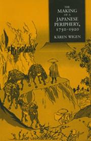
Contending that Japan's industrial and imperial revolutions were also geographical revolutions, Kären Wigen's interdisciplinary study analyzes the changing spatial order of the countryside in early modern Japan. Her focus, the Ina Valley, served as a gateway to the mountainous interior of central Japan. Using methods drawn from historical geography and economic development, Wigen maps the valley's changes--from a region of small settlements linked in an autonomous economic zone, to its transformation into a peripheral part of the global silk trade, dependent on the state. Yet the processes that brought these changes--industrial growth and political centralization--were crucial to Japan's rise to imperial power. Wigen's elucidation of this makes her book compelling reading for a broad audience.
Regions & Countries - Asia & the Middle East --- History & Archaeology --- East Asia --- Ina Valley (Japan) --- Ina Basin (Japan) --- Ina Bonchi (Japan) --- Ina-dani (Japan) --- Inadani (Japan) --- History. --- J3436.80 --- J4000.70 --- J4000.60 --- Japan: Geography and local history -- Chūbu -- Nagano prefecture -- cities, districts, towns and villages --- Japan: Social history, history of civilization -- Kindai (1850s- ), bakumatsu, Meiji, Taishō --- Japan: Social history, history of civilization -- Kinsei, Edo, Tokugawa period, early modern (1600-1867) --- Japan --- History, 1185-1945 --- HISTORY / Asia / General. --- History, 1185-1945.
Book
ISBN: 9786612697692 1282697692 0520945808 9780520945807 9781282697690 9780520259188 0520259181 6612697695 Year: 2010 Publisher: Berkeley University of California Press
Abstract | Keywords | Export | Availability | Bookmark
Loading...Choose an application
- Reference Manager
- EndNote
- RefWorks (Direct export to RefWorks)
Kären Wigen probes regional cartography, choerography, and statecraft to redefine restoration (ishin) in modern Japanese history. As developed here, that term designates not the quick coup d'état of 1868 but a three-centuries-long project of rehabilitating an ancient map for modern purposes. Drawing on a wide range of geographical documents from Shinano (present-day Nagano Prefecture), Wigen argues that both the founder of the Tokugawa Shogunate (1600-1868) and the reformers of the Meiji era (1868-1912) recruited the classical map to serve the cause of administrative reform. Nor were they alone; provincial men of letters played an equally critical role in bringing imperial geography back to life in the countryside. To substantiate these claims, Wigen traces the continuing career of the classical court's most important unit of governance-the province-in central Honshu.
Cartography --- History. --- Nagano-ken (Japan) --- Japan --- Historical geography. --- Administrative and political divisions --- Maps --- administrative reform. --- asia scholars. --- asian studies. --- cartographers. --- cartography. --- classical maps. --- coup detat. --- early modern japan. --- geographical documents. --- government impact. --- historical geography. --- historical. --- honshu. --- imperial geography. --- ishin. --- japan. --- japanese countryside. --- japanese geography. --- japanese history. --- map rehabilitation. --- maps. --- meiji era. --- nagano prefecture. --- political history. --- regional cartography. --- restoration. --- shinano. --- tokugawa shogunate.
ISBN: 1280080256 9786613520241 0520918592 9780520918597 0520207424 9780520207424 0520207432 9780520207431 9781280080258 Year: 1997 Publisher: Berkeley University of California Press
Abstract | Keywords | Export | Availability | Bookmark
Loading...Choose an application
- Reference Manager
- EndNote
- RefWorks (Direct export to RefWorks)
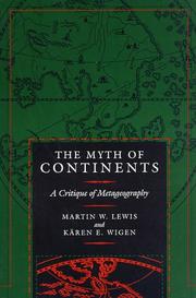
In this thoughtful and engaging critique, geographer Martin W. Lewis and historian Kären Wigen reexamine the basic geographical divisions we take for granted, and challenge the unconscious spatial frameworks that govern the way we perceive the world. Arguing that notions of East vs. West, First World vs. Third World, and even the sevenfold continental system are simplistic and misconceived, the authors trace the history of such misconceptions. Their up-to-the-minute study reflects both on the global scale and its relation to the specific continents of Europe, Asia, and Africa-actually part of one contiguous landmass.The Myth of Continents sheds new light on how our metageographical assumptions grew out of cultural concepts: how the first continental divisions developed from classical times; how the Urals became the division between the so-called continents of Europe and Asia; how countries like Pakistan and Afghanistan recently shifted macroregions in the general consciousness.This extremely readable and thought-provoking analysis also explores the ways that new economic regions, the end of the cold war, and the proliferation of communication technologies change our understanding of the world. It stimulates thinking about the role of large-scale spatial constructs as driving forces behind particular worldviews and encourages everyone to take a more thoughtful, geographically informed approach to the task of describing and interpreting the human diversity of the planet.
Geographical perception. --- Geopolitics. --- World politics --- Environmental perception --- Maps, Mental --- Mental maps --- Perceptual cartography --- Perceptual maps --- Perception --- Orientation (Psychology) --- Space perception --- Geography --- Perception géographique --- Géographie --- History --- Histoire --- Geodesy. Cartography --- History as a science --- Geografie --- Sociale en economische geografie --- Algemeen. --- Geographical perception --- academic. --- afghanistan. --- analysis. --- asia. --- cold war. --- continental divide. --- continents. --- criticism. --- critique. --- economic. --- economy. --- europe. --- first world. --- geographical. --- geography. --- global. --- government. --- historian. --- historical. --- international issues. --- international. --- law and order. --- macroregions. --- misconception. --- myth. --- pakistan. --- philosophy. --- regional. --- scholarly. --- third world. --- world issues.
Book
ISBN: 9780520259188 Year: 2010 Volume: 17 Publisher: Berkeley ; Los Angeles ; London University of California Press
Abstract | Keywords | Export | Availability | Bookmark
Loading...Choose an application
- Reference Manager
- EndNote
- RefWorks (Direct export to RefWorks)
"A Malleable Map is a striking example of what a historically deep, learned, and meticulous examination of maps and geographical place-making can teach us. Wigen's compelling analysis and stunning graphics set a new standard for understanding the production of spatial identity." "In this highly original work, author Karen Wigen takes the reader on an exciting journey across the elaborate history and colorful techniques of Japanese cartography. Through a series of wonderful stories, we learn of the progression of fudoki and kuniezu, early mapping to gazetteers, modern techniques of mapping, statistical yearbooks, and newspapers. The author has a talent for stating her inferences and conclusions while leaving the reader much room and motivation to think forward. This is truly a fascinating work. And, of course, the maps are gorgeous." In this pathbreaking book, Karen Wigen probes regional cartography, chorography, and statecraft to redefine restoration (ishin) in modern Japanese history. As developed here, that term designates not the quick coup d'etat of 1868 but a three-centuries-long project of rehabilitating an ancient map for modern purposes. Drawing on a wide range of geographical documents from Shinano (present-day Nagano Prefecture), Wigen argues that both the founder of the Tokugawa Shogunate (1600-1868) and the reformers of the Meiji era (1868-1912) recruited the classical map to serve the cause of administrative reform. Nor were they alone: provincial men of letters played an equally critical role in bringing imperial geography back to life in the countryside. To substantiate these claims, Wigen traces the continuing career of the classical court's most important unit of governance--the province--in central Honshu. Her meticulous study of Shinano recasts the Meiji Restoration as a geographical process and challenges Western theories about the spatial dynamics of modernization. --Book Jacket.
Cartography --- History --- Nagano-ken (Japan) --- Japan --- Nihon --- Nippon --- Iapōnia --- Zhāpān --- I︠A︡ponii︠a︡ --- Yapan --- Japon --- Japão --- Japam --- Mư̄ang Yīpun --- Prathēt Yīpun --- Yīpun --- Jih-pen --- Riben --- Government of Japan --- 日本 --- 日本国 --- Nipponkoku --- Nippon-koku --- Nihonkoku --- Nihon-koku --- State of Japan --- Япония --- Japani --- اليابان --- al-Yābān --- يابان --- Yābān --- Japonsko --- Giappone --- Japonia --- Japonya --- Nagano, Japan (Prefecture) --- Nagano (Japan : Prefecture) --- Historical geography. --- History. --- Administrative and political divisions --- J3436 --- J7120 --- Japan: Geography and local history -- Chūbu -- Nagano prefecture (Shinano) --- Japan: Science and technology -- astronomy -- Earth, geodesy, cartography --- Jepun --- Yapon --- Yapon Ulus --- I︠A︡pon --- Япон --- I︠A︡pon Uls --- Япон Улс
Book
ISBN: 9780226073057 Year: 2016 Publisher: Chicago University of Chicago press
Abstract | Keywords | Export | Availability | Bookmark
Loading...Choose an application
- Reference Manager
- EndNote
- RefWorks (Direct export to RefWorks)
ISBN: 9780824830274 082483027X 0824864247 1435666178 Year: 2007 Volume: *1 Publisher: Honolulu University of Hawai'i press
Abstract | Keywords | Export | Availability | Bookmark
Loading...Choose an application
- Reference Manager
- EndNote
- RefWorks (Direct export to RefWorks)
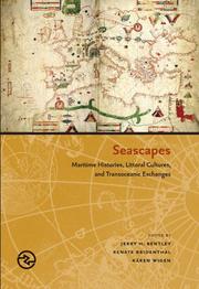
Shipping --- World history --- anno 1800-1999 --- anno 1500-1799 --- History, Modern --- Navigation --- History
Book
ISBN: 9780226718590 022671859X 9780226718620 022671862X Year: 2020 Publisher: Chicago (Ill.): University of Chicago press,
Abstract | Keywords | Export | Availability | Bookmark
Loading...Choose an application
- Reference Manager
- EndNote
- RefWorks (Direct export to RefWorks)
"The new field of spatial history has been driven by digital mapping tools that can readily show change over time in space. But long before such software became available, mapmakers regularly represented time in sophisticated and nuanced ways in supposedly static maps, and even those maps presented as historical snapshot illustrate the centrality of time to what we think of as primarily a spatial medium. In this collection, an array of today's leading scholars consider how mapmakers in a variety of contexts depicted time in their creations--from Aztecs documenting the founding of Tenochtitlan, to early modern Japanese reconstructing nostalgic landscapes before Western encroachments, to nineteenth-century Americans grappling with the new concept of deep time. The book includes a theoretical salvo and defense of traditional paper maps by William Rankin--himself a distinguished digital mapmaker--and includes more than 100 maps and related visuals, all in full color"--
Cartography --- Time in cartography --- History --- Geodesy. Cartography --- Geography --- World history --- Cartographie --- Histoire --- Histoire. --- Cartography - History - Congresses --- Time in cartography - Congresses
Periodical
Year: 2003
Abstract | Keywords | Export | Availability | Bookmark
Loading...Choose an application
- Reference Manager
- EndNote
- RefWorks (Direct export to RefWorks)
Book

ISBN: 9780824840365 Year: 2005 Publisher: Honolulu
Abstract | Keywords | Export | Availability | Bookmark
Loading...Choose an application
- Reference Manager
- EndNote
- RefWorks (Direct export to RefWorks)
Book
ISBN: 9781782381747 Year: 2005 Publisher: New York Oxford
Abstract | Keywords | Export | Availability | Bookmark
Loading...Choose an application
- Reference Manager
- EndNote
- RefWorks (Direct export to RefWorks)
| Listing 1 - 10 of 14 | << page >> |
Sort by
|