| Listing 1 - 4 of 4 |
Sort by
|
Book
ISBN: 132213359X 3319002023 3319002031 Year: 2014 Publisher: Cham : Springer International Publishing : Imprint: Springer,
Abstract | Keywords | Export | Availability | Bookmark
 Loading...
Choose an application
- Reference Manager
- EndNote
- RefWorks (Direct export to RefWorks)
Research in the field of automated generalisation has faced new challenges in recent years as a result of technological developments in web-based processing, new visualisation paradigms and access to very large volumes of multi-source data generated by sensors and humans. In these contexts, map generalisation needs to underpin ‘on-demand mapping’, a form of mapping that responds to individual user requirements in the thematic selection and visualisation of geographic information. It is this new impetus that drives the research of the ICA Commission on Generalisation and Multiple Representation (for example through its annual workshops, biannual tutorials and publications in international journals). This book has a coherent structure, each chapter focusing on core concepts and tasks in the map generalisation towards on-demand mapping. Each chapter presents a state-of-the-art review, together with case studies that illustrate the application of pertinent generalisation methodologies. The book addresses issues from data gathering to multi scaled outputs. Thus there are chapters devoted to defining user requirements in handling specifications, and in the application and evaluation of map generalisation algorithms. It explores the application of generalisation methodologies in the context of growing volumes of data and the increasing popularity of user generated content.
Geography --- Earth & Environmental Sciences --- Cartography --- Methodology. --- Geography. --- Geographical information systems. --- Geographical Information Systems/Cartography. --- Geographical information systems --- GIS (Information systems) --- Information storage and retrieval systems
Digital
ISBN: 9783319002033 Year: 2014 Publisher: Cham Springer International Publishing
Abstract | Keywords | Export | Availability | Bookmark
 Loading...
Choose an application
- Reference Manager
- EndNote
- RefWorks (Direct export to RefWorks)
Research in the field of automated generalisation has faced new challenges in recent years as a result of technological developments in web-based processing, new visualisation paradigms and access to very large volumes of multi-source data generated by sensors and humans. In these contexts, map generalisation needs to underpin ‘on-demand mapping’, a form of mapping that responds to individual user requirements in the thematic selection and visualisation of geographic information. It is this new impetus that drives the research of the ICA Commission on Generalisation and Multiple Representation (for example through its annual workshops, biannual tutorials and publications in international journals). This book has a coherent structure, each chapter focusing on core concepts and tasks in the map generalisation towards on-demand mapping. Each chapter presents a state-of-the-art review, together with case studies that illustrate the application of pertinent generalisation methodologies. The book addresses issues from data gathering to multi scaled outputs. Thus there are chapters devoted to defining user requirements in handling specifications, and in the application and evaluation of map generalisation algorithms. It explores the application of generalisation methodologies in the context of growing volumes of data and the increasing popularity of user generated content.
Geodesy. Cartography --- Geography --- geodesie --- GIS (geografisch informatiesysteem) --- geografie

ISBN: 9780080453743 0080453740 9780080524740 0080524745 9786611022952 1281022950 Year: 2007 Publisher: Oxford : Elsevier,
Abstract | Keywords | Export | Availability | Bookmark
 Loading...
Choose an application
- Reference Manager
- EndNote
- RefWorks (Direct export to RefWorks)
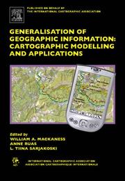
Theoretical and Applied Solutions in Multi Scale MappingUsers have come to expect instant access to up-to-date geographical information, with global coverage--presented at widely varying levels of detail, as digital and paper products; customisable data that can readily combined with other geographic information. These requirements present an immense challenge to those supporting the delivery of such services (National Mapping Agencies (NMA), Government Departments, and private business. Generalisation of Geographic Information: Cartographic Modelling and Applications pro
Geodesy. Cartography --- Computer. Automation --- Digital mapping. --- Geographic information systems. --- Geographical information systems --- GIS (Information systems) --- Information storage and retrieval systems --- Computer cartography --- Computer mapping --- Digitized mapping --- Cartography --- Geography

ISBN: 9780080453743 0080453740 9780080524740 0080524745 Year: 2007 Publisher: Boston Published on behalf of the International Cartographic Association by Elsevier
Abstract | Keywords | Export | Availability | Bookmark
 Loading...
Choose an application
- Reference Manager
- EndNote
- RefWorks (Direct export to RefWorks)
The International Cartographic Association Series reflects the state of professional cartography from an international perspective, and provides information on the application of new and developing technologies. Definitive volumes relate to different types of published mapping at a variety of scales and intended for diverse uses. Relevant applications of remotely sensed imagery and information technology during map generation are discussed, as are the international needs for the implementation of spatial database transfer standards, together with clearly set-out and potentially applicable policies for the future. Generalisation of Geographic Information presents the theoretical advancments in the field, to show how developments have advanced solutions to the point that they are being incorporated into existing commercal solutions. It also provides an over view of future research challenges. The reader will gain a clear picture of the breadth of cognate disciplines contributing to this field, as well as a thorough understanding of how these various methodologies are being applied to the real world. * Emphasizes both theoretical and practical advancements and attempts to demonstrate the critical role of the practical in order to achieve the practical * Focuses on vector based models due to their dominance in the field of automated mapping * Provides an strong footing for those contemplating research in automated mapping for the first time.
| Listing 1 - 4 of 4 |
Sort by
|

 Search
 Feedback
 About UniCat
  Help
Help News
News