
 Search
 Feedback
 About UniCat
  Help
Help News
News
| Listing 1 - 8 of 8 |
Sort by
|
ISBN: 0471026093 9780471026099 Year: 1979 Publisher: New York, NY : John Wiley,
Abstract | Keywords | Export | Availability | Bookmark
 Loading...
Choose an application
- Reference Manager
- EndNote
- RefWorks (Direct export to RefWorks)
Geophysics --- Remote sensing --- 528.2 --- Remote-sensing imagery --- Remote sensing systems --- Remote terrain sensing --- Sensing, Remote --- Terrain sensing, Remote --- Aerial photogrammetry --- Aerospace telemetry --- Detectors --- Space optics --- Figure of the Earth. Earth measurement. Mathematical geodesy. Physical geodesy. Astronomical geodesy --- Remote sensing. --- 528.2 Figure of the Earth. Earth measurement. Mathematical geodesy. Physical geodesy. Astronomical geodesy --- PHOTOS AERIENNES --- INTERPRETATION

ISBN: 0471577839 0471305758 9780471305750 9780471577836 Year: 1994 Publisher: New York (N.Y.): Wiley
Abstract | Keywords | Export | Availability | Bookmark
Loading...Choose an application
- Reference Manager
- EndNote
- RefWorks (Direct export to RefWorks)
Remote sensing --- Télédétection --- 528.8 --- 528.77 --- #KVIV:BB --- #ABIB:kand --- Remote-sensing imagery --- Remote sensing systems --- Remote terrain sensing --- Sensing, Remote --- Terrain sensing, Remote --- Aerial photogrammetry --- Aerospace telemetry --- Detectors --- Space optics --- Remote sensing. Teledetection --- Interpretation of aerial photograms --- Remote sensing. --- Geografie --- Remote Sensing --- Remote Sensing Algemeen. --- 528.77 Interpretation of aerial photograms --- 528.8 Remote sensing. Teledetection --- Télédétection
Book
ISBN: 0471845175 Year: 1987 Publisher: New York : John Wiley & Sons,
Abstract | Keywords | Export | Availability | Bookmark
Loading...Choose an application
- Reference Manager
- EndNote
- RefWorks (Direct export to RefWorks)
Remote sensing. --- Traitement d'images --- Remote sensing --- Télédétection --- Hydrology --- Hydrologie. --- Techniques numériques. --- Equipment and supplies --- Appareils et matériel. --- Télédétection --- Techniques numériques. --- Appareils et matériel.
Book
ISBN: 047185462X Year: 1987 Publisher: New York (N.Y.): Wiley
Abstract | Keywords | Export | Availability | Bookmark
Loading...Choose an application
- Reference Manager
- EndNote
- RefWorks (Direct export to RefWorks)
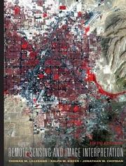
From recent developments in digital image processing to the next generation of satellite systems, this book provides a comprehensive introduction to the field of remote sensing and image interpretation. This book is discipline neutral, so readers in any field of study can gain a clear understanding of these systems and their virtually unlimited applications.
ISBN: 0471255157 9780471255154 Year: 2000 Publisher: New York, N.Y. : John Wiley & Sons,
Abstract | Keywords | Export | Availability | Bookmark
Loading...Choose an application
- Reference Manager
- EndNote
- RefWorks (Direct export to RefWorks)
Remote sensing --- Remote sensing. --- Environmental Sciences and Forestry. Remote Sensing and Geographical Information Systems --- Remote Sensing and Geographical Information Systems (General) --- Remote Sensing and Geographical Information Systems (General). --- Télédétection. --- Remote-sensing images --- Imagerie satellitaire --- Thermography --- Thermographie --- Télédétection.
Book
ISBN: 9781118343289 111834328X Year: 2015 Publisher: Hoboken (N.J.) : Wiley,
Abstract | Keywords | Export | Availability | Bookmark
Loading...Choose an application
- Reference Manager
- EndNote
- RefWorks (Direct export to RefWorks)
Remote sensing. --- Télédétection --- 528.8 --- Remote-sensing imagery --- Remote sensing systems --- Remote terrain sensing --- Sensing, Remote --- Terrain sensing, Remote --- Aerial photogrammetry --- Aerospace telemetry --- Detectors --- Space optics --- Remote sensing. Teledetection --- 528.8 Remote sensing. Teledetection --- Remote sensing --- Télédétection --- TECHNOLOGY & ENGINEERING / Remote Sensing & Geographic Information Systems. --- Environmental Sciences and Forestry. Remote Sensing and Geographical Information Systems -- Remote Sensing and Geographical Information Systems (General) --- ALLW.
ISBN: 0471152277 0471451525 9780471152279 9780471451525 Year: 2004 Publisher: Hoboken : Wiley,
Abstract | Keywords | Export | Availability | Bookmark
Loading...Choose an application
- Reference Manager
- EndNote
- RefWorks (Direct export to RefWorks)
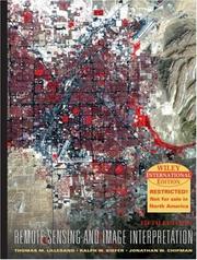
From recent developments in digital image processing to the next generation of satellite systems, this book provides a comprehensive introduction to the field of remote sensing and image interpretation. This book is discipline neutral, so readers in any field of study can gain a clear understanding of these systems and their virtually unlimited applications.
Remote sensing. --- Système d'information géographique --- Geographical information systems --- Photogrammétrie --- Photogrammetry --- Photointerpretation --- Collecte de données --- data collection --- Traitement des données --- Data processing --- Environmental Sciences and Forestry. Remote Sensing and Geographical Information Systems --- Remote Sensing and Geographical Information Systems (General) --- remote sensing --- gps (global positioning system) (global position system) --- digitale beeldverwerking --- gis --- fotogrammetrie --- (zie ook: geografisch informatiesysteem) --- Remote Sensing and Geographical Information Systems (General).

ISBN: 9780470052457 0470052457 Year: 2008 Publisher: Hoboken : John Wiley & Sons,
Abstract | Keywords | Export | Availability | Bookmark
Loading...Choose an application
- Reference Manager
- EndNote
- RefWorks (Direct export to RefWorks)
| Listing 1 - 8 of 8 |
Sort by
|