| Listing 1 - 3 of 3 |
Sort by
|

ISBN: 128113029X 9786611130299 3540367314 3540367306 364243309X Year: 2007 Publisher: Berlin ; New York : Springer,
Abstract | Keywords | Export | Availability | Bookmark
 Loading...
Choose an application
- Reference Manager
- EndNote
- RefWorks (Direct export to RefWorks)
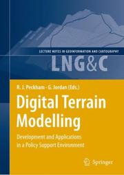
This book presents a set of papers on Digital Terrain Modelling for Policy Support which aims to be informative and stimulating for both developers and users of digital terrain models. It should also be useful for professi- als who are interested in the wider aspects of the applications of terrain models in support for policies and decision making. There is an increasing demand for regional and continental scale data for use in environmental modelling and spatial analysis to support envir- mental policy development and implementation. Important environmental processes act at regional and continental scales, for example climatic change inducing floods and soil erosion, and management of these pr- esses for the sustainable development of society requires policies to be - plied at the corresponding scales. One of the most important factors inf- encing these environmental processes which act on the earth’s surface is the surface topography, hence the need for extensive, harmonised digital terrain models.
Relief models --- Digital mapping. --- Geodatabases. --- Data processing. --- Geography. --- Earth sciences. --- Computers. --- Geographical information systems. --- Geographical Information Systems/Cartography. --- Earth Sciences, general. --- Information Systems and Communication Service. --- Geographical information systems --- GIS (Information systems) --- Information storage and retrieval systems --- Automatic computers --- Automatic data processors --- Computer hardware --- Computing machines (Computers) --- Electronic brains --- Electronic calculating-machines --- Electronic computers --- Hardware, Computer --- Computer systems --- Cybernetics --- Machine theory --- Calculators --- Cyberspace --- Geosciences --- Environmental sciences --- Physical sciences --- Cosmography --- Earth sciences --- World history --- Geography --- Digital geographical databases --- GDBs (Geodatabases) --- Geographic databases --- Geographic information databases --- Geographic information system databases --- Geographic information systems databases --- Geographical databases --- Geographical information system databases --- Geographical information systems databases --- GIS databases --- GIS geodatabases --- Geographic information systems --- Geoinformatics --- Object-oriented databases --- Relational databases --- Computer cartography --- Computer mapping --- Digitized mapping --- Cartography --- Modeling, Topographical --- Relief-maps --- Terrain models --- Topographical modeling --- Models and modelmaking --- Databases --- Models --- Information systems.
Digital
ISBN: 9783540367314 Year: 2007 Publisher: Berlin, Heidelberg Springer-Verlag Berlin Heidelberg
Abstract | Keywords | Export | Availability | Bookmark
 Loading...
Choose an application
- Reference Manager
- EndNote
- RefWorks (Direct export to RefWorks)
Geodesy. Cartography --- Geology. Earth sciences --- Information systems --- Computer. Automation --- geodesie --- ICT (informatie- en communicatietechnieken) --- GIS (geografisch informatiesysteem) --- informatica --- informatiesystemen --- geologie
Book
ISBN: 9783540367314 Year: 2007 Publisher: Berlin Heidelberg Springer Berlin Heidelberg
Abstract | Keywords | Export | Availability | Bookmark
 Loading...
Choose an application
- Reference Manager
- EndNote
- RefWorks (Direct export to RefWorks)
This book presents a set of papers on Digital Terrain Modelling for Policy Support which aims to be informative and stimulating for both developers and users of digital terrain models. It should also be useful for professi- als who are interested in the wider aspects of the applications of terrain models in support for policies and decision making. There is an increasing demand for regional and continental scale data for use in environmental modelling and spatial analysis to support envir- mental policy development and implementation. Important environmental processes act at regional and continental scales, for example climatic change inducing floods and soil erosion, and management of these pr- esses for the sustainable development of society requires policies to be - plied at the corresponding scales. One of the most important factors inf- encing these environmental processes which act on the earth's surface is the surface topography, hence the need for extensive, harmonised digital terrain models.
Geodesy. Cartography --- Geology. Earth sciences --- Information systems --- Computer. Automation --- geodesie --- ICT (informatie- en communicatietechnieken) --- GIS (geografisch informatiesysteem) --- informatica --- informatiesystemen --- geologie
| Listing 1 - 3 of 3 |
Sort by
|

 Search
 Feedback
 About UniCat
  Help
Help News
News