| Listing 1 - 10 of 18 | << page >> |
Sort by
|
Article
Abstract | Keywords | Export | Availability | Bookmark
 Loading...
Choose an application
- Reference Manager
- EndNote
- RefWorks (Direct export to RefWorks)
Book
ISBN: 9350440865 1441652191 Year: 2008 Publisher: New Delhi [India] : Pragun Publication,
Abstract | Keywords | Export | Availability | Bookmark
 Loading...
Choose an application
- Reference Manager
- EndNote
- RefWorks (Direct export to RefWorks)
The Indian subcontinent is vulnerable to drought, floods, cyclones and earthquakes. Landslides, avalanche and forest fires also occur frequently. Among the 32 States/Union Territories in the country, 22 are multi-disaster prone. As much as 40 million hectare of land in the country has been identified as flood prone, and on an average 18.6 million hectare of land is flooded annually. About 57% of area of the country is vulnerable to seismic activity. 18% of country's total area is drought prone, approximately 50 million people are annually affected by drought and about 68% of total sown area of

ISBN: 0781726301 Year: 2001 Publisher: Philadelphia Lippincott Williams & Wilkins
Abstract | Keywords | Export | Availability | Bookmark
 Loading...
Choose an application
- Reference Manager
- EndNote
- RefWorks (Direct export to RefWorks)
Book
ISBN: 178332256X 9781783322565 Year: 2012 Publisher: New Delhi Alpha Science International
Abstract | Keywords | Export | Availability | Bookmark
 Loading...
Choose an application
- Reference Manager
- EndNote
- RefWorks (Direct export to RefWorks)
This textbook provides updated information on materials and other aspects of concrete. It covers all types of concretes: normal, high strength, self compacting concrete, light weight. It provides guidelines on production, placement, compaction, curing and testing. This Handbook consolidates in a single volume various types of concrete, experience and insights of experts of concrete technology and will help in production of durable, economical and sustainable concrete.
Concrete --- Beton --- Building materials --- E-books
Book
ISBN: 3030786757 9783030786755 3030786749 Year: 2021 Publisher: Cham, Switzerland : Springer,
Abstract | Keywords | Export | Availability | Bookmark
 Loading...
Choose an application
- Reference Manager
- EndNote
- RefWorks (Direct export to RefWorks)
Nuclear isomers. --- Isomerism (Nuclear physics) --- Isomers, Nuclear --- Isomers (Nuclear physics) --- Nuclear physics --- Nuclides --- Research. --- Nuclear research

ISBN: 0781726301 Year: 2000 Publisher: Philadelphia Lippincott Williams & Wilkins
Abstract | Keywords | Export | Availability | Bookmark
 Loading...
Choose an application
- Reference Manager
- EndNote
- RefWorks (Direct export to RefWorks)
Book
ISBN: 3030428451 3030428443 Year: 2020 Publisher: Cham : Springer International Publishing : Imprint: Springer,
Abstract | Keywords | Export | Availability | Bookmark
 Loading...
Choose an application
- Reference Manager
- EndNote
- RefWorks (Direct export to RefWorks)
This books documents the salient characters of the tectonic evolution of the Indian subcontinent. It showcases the well investigated subcontinent of Gondwana. The book is linked to an updated geological and tectonic map of this region on 1:12,000,000 in scale. The Indian subcontinent displays almost uninterrupted and unique the geological history since about Eo-Archean (~3800 Ma) to recent, with the development of many Proterozoic deformed and metamorphosed fold belts around Archean nuclei, and enormously thick undeformed platform deposits. After their stabilization during late Proterozoic, the subcontinent underwent Paleozoic rifting and deposition of coal-bearing thick sequences, followed by enormously-thick outpouring of Deccan volcanics as a consequence of huge mantle plume. The youngest event in its evolution is the Cenozoic Himalayan Orogenic Mountains, spanning the area between Nanga Parbat and Namcha Barwah; a part of which extends both in Pakistan and Myanmar.
Geophysics. --- Structural geology. --- Geographical information systems. --- Geophysics/Geodesy. --- Structural Geology. --- Geographical Information Systems/Cartography. --- Geographical information systems --- GIS (Information systems) --- Information storage and retrieval systems --- Geotectonics --- Structural geology --- Tectonics (Geology) --- Physical geology --- Geological physics --- Terrestrial physics --- Earth sciences --- Physics --- Geography --- Plate tectonics.

ISBN: 194453430X 9781944534301 9788170088530 Year: 2016 Publisher: New Delhi
Abstract | Keywords | Export | Availability | Bookmark
 Loading...
Choose an application
- Reference Manager
- EndNote
- RefWorks (Direct export to RefWorks)
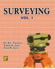
This volume is one of the two which offer a comprehensive course in those parts of theory and practice of Plane and Geodetic surveying that are most commonly used by Civil Engineers. The first volume covers in 24 chapters, the most common surveying operations. Each topic introduced is thoroughly described, the theory is rigorously developed, and a large number of numerical examples are included to illustrate its application. General statements of important principles and methods are almost invariably given by practical illustration. Apart from illustrations of old and conventional instruments, emphasis has been placed on new or modern instruments, both for ordinary as well as precise work. A good deal of space has been given to instrumental adjustments with thorough discussion of geometrical principles in each case. Many new advanced problems have also been added which will prove useful for competitive examinations.
Book
ISBN: 1944534318 9781944534318 9788170088837 Year: 2016 Publisher: New Delhi
Abstract | Keywords | Export | Availability | Bookmark
 Loading...
Choose an application
- Reference Manager
- EndNote
- RefWorks (Direct export to RefWorks)
This Volume is continuation with Volume I, and deals with advanced topics of plane and Geodetic Surveying. The book contains sixteen chapters, including four chapters on Field Astronomy, Photogrammetric Surveying, Electro-Magnetic Distance Measurement (EDM) and Remote Sensing. Along with conventional instruments, the book also contains illustrations and descriptions of the most modern and advanced measuring instruments such as Wild T-2, T-3 and T-4 theodolites, Electronic theodolites, Distomats and Total Station.
Digital
ISBN: 9783030428457 Year: 2020 Publisher: Cham Springer International Publishing
Abstract | Keywords | Export | Availability | Bookmark
 Loading...
Choose an application
- Reference Manager
- EndNote
- RefWorks (Direct export to RefWorks)
This books documents the salient characters of the tectonic evolution of the Indian subcontinent. It showcases the well investigated subcontinent of Gondwana. The book is linked to an updated geological and tectonic map of this region on 1:12,000,000 in scale. The Indian subcontinent displays almost uninterrupted and unique the geological history since about Eo-Archean (~3800 Ma) to recent, with the development of many Proterozoic deformed and metamorphosed fold belts around Archean nuclei, and enormously thick undeformed platform deposits. After their stabilization during late Proterozoic, the subcontinent underwent Paleozoic rifting and deposition of coal-bearing thick sequences, followed by enormously-thick outpouring of Deccan volcanics as a consequence of huge mantle plume. The youngest event in its evolution is the Cenozoic Himalayan Orogenic Mountains, spanning the area between Nanga Parbat and Namcha Barwah; a part of which extends both in Pakistan and Myanmar.
Geophysics --- Geology. Earth sciences --- Geography --- GIS (geografisch informatiesysteem) --- geologie --- geofysica
| Listing 1 - 10 of 18 | << page >> |
Sort by
|

 Search
 Feedback
 About UniCat
  Help
Help News
News