| Listing 1 - 5 of 5 |
Sort by
|

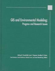
ISBN: 0470236779 Year: 1996 Publisher: New York (N.Y.) : Wiley,
Abstract | Keywords | Export | Availability | Bookmark
 Loading...
Choose an application
- Reference Manager
- EndNote
- RefWorks (Direct export to RefWorks)

ISBN: 0471735450 9780471735458 Year: 2005 Publisher: Hoboken (N.J.) : Wiley,
Abstract | Keywords | Export | Availability | Bookmark
 Loading...
Choose an application
- Reference Manager
- EndNote
- RefWorks (Direct export to RefWorks)
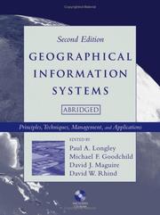
Praise for the Second Edition: -International Journal of Geographical Information Science -Australian Geographical Studies -Annals of the Association of American Geographers -Transactions in GIS Since the publication of the First Edition of Geographical Information Systems in 1991, the "Big Book" of GIS has become the definitive work on the science, application, and practice of GIS. This new Abridged Second Edition of Geographical Information Systems brings this definitive reference to a whole new audience, with a streamlined format, a new chapter covering recent developments in GIS, and the full text of the Second Edition of Geographical Information Systems, seventy-two chapters in all, on the accompanying CD-ROM in searchable PDF format. Unmatched in scope by any other reference on the subject, Geographical Information Systems, Second Edition provides crucial background on basic GIS concepts and addresses the radical shifts and changes that have taken place in GIS technology and its uses. Included in this Abridged Edition are twenty-four chapters covering topics as diverse as issues of space and time in GIS, problems with data quality, uncertainty and error detection, spatial analysis, developments in GIS architecture and spatial databases, GIS data collection, data transformation and linkage, implementing GIS and using it as a management tool, and the societal and legal implications of GIS and spatial information. This affordable Abridged Edition provides a convenient reader for students taking any of a wide range of GIS courses, and serves as a concise reference for professionals working with GIS.
Geografie --- Geographic information systems. --- Geografische Informatie Systemen --- Algemeen.

ISBN: 9781905886609 1905886608 Year: 2007 Publisher: Leicester : Matador,
Abstract | Keywords | Export | Availability | Bookmark
 Loading...
Choose an application
- Reference Manager
- EndNote
- RefWorks (Direct export to RefWorks)
Book
ISBN: 0470721448 0470721456 9780470721445 9780470721452 Year: 2010 Publisher: Hoboken, N.J. : Wiley ;,
Abstract | Keywords | Export | Availability | Bookmark
 Loading...
Choose an application
- Reference Manager
- EndNote
- RefWorks (Direct export to RefWorks)
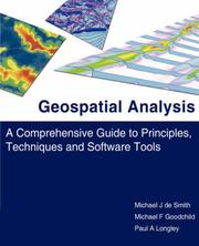
Effective use of today's powerful GIS technology requires an understanding of the science of problemsolving that underpins it. -- Since the first edition was published a decade ago, this book has led the way, with its focus on the scientific principles that underpin GIS usage. It has also Provided through, up-to-date coverage of GIS Procedures, techniques and Public Policy applications. This unique combination of science, technology and practical problem solving has made this book a bestseller across a broad spectrum of disciplines. -- This fully updated 3rd edition continues to deliver on these strengths. --Book Jacket.
Geographic information systems. --- Environmental Sciences and Forestry. Remote Sensing and Geographical Information Systems --- Geographical Information Systems. --- 681.3*H4 --- Information systems applications (GIS etc.) --- GIS --- cartografie --- 681.3*H4 Information systems applications (GIS etc.) --- Geographic information systems --- 528.9 --- Geographical information systems --- GIS (Information systems) --- Information storage and retrieval systems --- 528.9 Cartography. Mapping (textual documents) --- Cartography. Mapping (textual documents) --- Geography --- Artificial intelligence. Robotics. Simulation. Graphics --- Geodesy. Cartography --- Problem solving.

ISBN: 0387951296 0387988890 9780387988894 9780387951294 Year: 2001 Publisher: New York (N.Y.) : Springer,
Abstract | Keywords | Export | Availability | Bookmark
 Loading...
Choose an application
- Reference Manager
- EndNote
- RefWorks (Direct export to RefWorks)
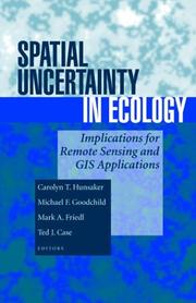
The huge growth in the use of geographic information systems, remote sensing platforms and spatial databases have made accurate spatial data more available for ecological and environmental models. Unfortunately, there has been too little analysis of the appropriate use of this data and the role of uncertainty in resulting ecological models. This is the first book to take an ecological perspective on uncertainty in spatial data. It applies principles and techniques from geography and other disciplines to ecological research. It brings the tools of cartography, cognition, spatial statistics, remote sensing and computer sciences to the ecologist using spatial data. After describing the uses of spatial data in ecological research, the authors discuss how to account for the effects of uncertainty in various methods of analysis. Carolyn T. Hunsaker is a research ecologist in the USDA Forest Service in Fresno, California. Michael F. Goodchild is Professor of Geography at the University of California, Santa Barbara. Mark A. Friedl is Assistant Professor in the Department of Geography and the Center for Remote Sensing at Boston University. Ted J. Case is Professor of Biology at the University of California, San Diego.
Spatial ecology --- Uncertainty (Information theory). --- Geografie --- Mathematical models. --- Landschapskunde --- Ecologie. --- Uncertainty (Information theory) --- Mathematical models --- Spatial ecology - Mathematical models
| Listing 1 - 5 of 5 |
Sort by
|

 Search
 Feedback
 About UniCat
  Help
Help News
News