
 Search
 Feedback
 About UniCat
  Help
Help News
News
| Listing 1 - 8 of 8 |
Sort by
|
Book
ISBN: 9780226605685 022660568X 9780226605548 022660554X Year: 2019 Publisher: Chicago (Ill.): University of Chicago press,
Abstract | Keywords | Export | Availability | Bookmark
 Loading...
Choose an application
- Reference Manager
- EndNote
- RefWorks (Direct export to RefWorks)
Over the past four decades, the volumes published in the landmark History of Cartography series have both chronicled and encouraged scholarship about maps and mapping practices across time and space. As the current director of the project that has produced these volumes, Matthew H. Edney has a unique vantage point for understanding what “cartography” has come to mean and include. In this book Edney disavows the term cartography, rejecting the notion that maps represent an undifferentiated category of objects for study. Rather than treating maps as a single, unified group, he argues, scholars need to take a processual approach that examines specific types of maps—sea charts versus thematic maps, for example—in the context of the unique circumstances of their production, circulation, and consumption. To illuminate this bold argument, Edney chronicles precisely how the ideal of cartography that has developed in the West since 1800 has gone astray. By exposing the flaws in this ideal, his book challenges everyone who studies maps and mapping practices to reexamine their approach to the topic. The study of cartography will never be the same.
Cartography --- Cartography, Primitive --- Chartography --- Map-making --- Mapmaking --- Mapping (Cartography) --- Mathematical geography --- Surveying --- Map projection --- Maps --- Philosophy --- Philosophy&delete& --- History --- 74.31 history of cartography. --- Cartographie --- Philosophy. --- History. --- Philosophie. --- Histoire. --- Cartography - Philosophy --- Cartography - Philosophy - History
Book
Year: 2010 Publisher: London Routledge
Abstract | Keywords | Export | Availability | Bookmark
Loading...Choose an application
- Reference Manager
- EndNote
- RefWorks (Direct export to RefWorks)
cartography [discipline] --- Smith, John --- Passe, van de, Simon --- New England
ISBN: 0226184862 9780226184869 0226184870 0226184889 9780226184876 9780226184883 Year: 1997 Publisher: Chicago London University of Chicago Press
Abstract | Keywords | Export | Availability | Bookmark
Loading...Choose an application
- Reference Manager
- EndNote
- RefWorks (Direct export to RefWorks)
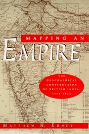
In this fascinating history of the British surveys of India, Matthew H. Edney relates how imperial Britain used modern survey techniques to not only create and define the spatial image of its Empire, but also to legitimate its colonialist activities. "There is much to be praised in this book. It is an excellent history of how India came to be painted red in the nineteenth century. But more importantly, Mapping an Empire sets a new standard for books that examine a fundamental problem in the history of European imperialism."-D. Graham Burnett, Times Literary Supplement "Mapping an Empire is undoubtedly a major contribution to the rapidly growing literature on science and empire, and a work which deserves to stimulate a great deal of fresh thinking and informed research."-David Arnold, Journal of Imperial and Commonwealth History "This case study offers broadly applicable insights into the relationship between ideology, technology and politics. . . . Carefully read, this is a tale of irony about wishful thinking and the limits of knowledge."-Publishers Weekly
Cartography --- Cartography, Primitive --- Chartography --- Map-making --- Mapmaking --- Mapping (Cartography) --- Mathematical geography --- Surveying --- Map projection --- Maps --- History. --- East India Company --- English Company Trading to the East-Indies --- Governor and Company of Merchants of London, Trading into the East Indies --- United Company of Merchants of England, Trading to the East Indies --- English East India Company --- East India Company (English) --- East India Tea Company --- East-India Companie --- United East India Company --- Compagnie des Indes orientales d'Angleterre --- Compagnie unie de marchands d'Angleterre commerçans aux Indes orientales --- Tung Yin-tu kung ssu --- Honourable East-India Company --- Sharikat al-Hind al-Sharqīyah al-Barīṭānīyah --- Engelse Oost-Indische Maatschappy --- Kumpanī-i Hind-i Sharqī --- کمپنى هند شرقى --- History --- Īsṭa Iṇḍiyā Kampanī --- empire, maps, cartography, india, british colony, geography, surveying, land use, colonialism, imperialism, science, literature, literary theory, history, victorian, england, technology, politics, ideology, nonfiction, observation, representation, mapmaking, madras, triangulation, archive, space, rationality, reason, great trigonometrical survey, james rennel, george everest, civilization, atlas, territory, place, administration, measurement, military, soldiers, subcontinent.
Book
ISBN: 093956131X Year: 2001 Volume: 1 Publisher: Portland Osher Map Library and Smith Center for Cartographic Education
Abstract | Keywords | Export | Availability | Bookmark
Loading...Choose an application
- Reference Manager
- EndNote
- RefWorks (Direct export to RefWorks)
Book history --- Geodesy. Cartography --- anno 1600-1699 --- 912 <09> <492> --- 912 "16" --- 912 <100> --- World maps --- Maps --- Globes --- Cartografie. Kaarten. Plattegronden. Atlassen--Geschiedenis van ...--Nederland --- Cartografie. Kaarten. Plattegronden. Atlassen--17e eeuw. Periode 1600-1699 --- Cartografie. Kaarten. Plattegronden. Atlassen--Wereld. Internationaal. Alle landen gezamenlijk --- Keere, Pieter van den --- book history --- Keere, Pieter van den, --- Van den Keere, Pieter. --- Kaerius, Petrus
ISBN: 0226316335 9780226316338 0226316351 9780226316352 0226316378 9780226316376 0226907287 9780226907284 0226907333 9780226907338 0226907341 9780226907345 9780226907321 0226907325 0226907325 9780226184760 9780226184777 9780226534695 9780226534701 9780226534718 9780226184753 9780226339221 0226184773 0226184765 0226184757 Year: 2020 Volume: 2 Publisher: Chicago: University of Chicago press,
Abstract | Keywords | Export | Availability | Bookmark
Loading...Choose an application
- Reference Manager
- EndNote
- RefWorks (Direct export to RefWorks)
Since its launch in 1987, the History of Cartography series has garnered critical acclaim and sparked a new generation of interdisciplinary scholarship. Cartography in the European Enlightenment, the highly anticipated fourth volume, offers a comprehensive overview of the cartographic practices of Europeans, Russians, and the Ottomans, both at home and in overseas territories, from 1650 to 1800. The social and intellectual changes that swept Enlightenment Europe also transformed many of its mapmaking practices. A new emphasis on geometric principles gave rise to improved tools for measuring and mapping the world, even as large-scale cartographic projects became possible under the aegis of powerful states. Yet older mapping practices persisted: Enlightenment cartography encompassed a wide variety of processes for making, circulating, and using maps of different types. The volume’s more than four hundred encyclopedic articles explore the era’s mapping, covering topics both detailed—such as geodetic surveying, thematic mapping, and map collecting—and broad, such as women and cartography, cartography and the economy, and the art and design of maps. Copious bibliographical references and nearly one thousand full-color illustrations complement the detailed entries.
Geodesy. Cartography --- anno 500-1499 --- Prehistory --- Antiquity --- Cartography --- Cartographie --- Cartografie. --- History. --- Histoire. --- Cartography, Prehistoric --- 912 "04/14" --- 912 <09> <4> --- 912 <3> --- Cartography, Primitive --- Chartography --- Map-making --- Mapmaking --- Mapping (Cartography) --- Mathematical geography --- Surveying --- Map projection --- Maps --- Prehistoric cartography --- History --- Cartografie. Kaarten. Plattegronden. Atlassen--Middeleeuwen --- Cartografie. Kaarten. Plattegronden. Atlassen--Geschiedenis van ...--Europa --- Cartografie. Kaarten. Plattegronden. Atlassen--Plaatsaanduiding van de Oude Wereld --- 912 <09> <5> --- Cartografie. Kaarten. Plattegronden. Atlassen--Geschiedenis van ...--Azië --- 912 "15" --- Cartografie. Kaarten. Plattegronden. Atlassen--16e eeuw. Periode 1500-1599 --- 912 <09> <6> --- 912 <09> <7> --- 912 <09> <94> --- 912 <09> <98/99> --- Cartografie. Kaarten. Plattegronden. Atlassen--Geschiedenis van ...--Afrika --- Cartografie. Kaarten. Plattegronden. Atlassen--Geschiedenis van ...--Noord-Amerika. Midden-Amerika --- Cartografie. Kaarten. Plattegronden. Atlassen--Geschiedenis van ...--Australië --- Cartografie. Kaarten. Plattegronden. Atlassen--Geschiedenis van ...--Poolgebieden --- Africa --- Pacific Islands --- America --- Australia --- Arctica --- South Asia --- Asia --- Cartography - Europe - History --- anno 1400-1499 --- anno 1500-1599 --- Europe --- 912 <09> --- 912 --- Cartografie. Kaarten. Plattegronden. Atlassen--Geschiedenis van --- Cartografie. Kaarten. Plattegronden. Atlassen --- Cartography - Islamic countries - History. --- Cartography - South Asia - History. --- Cartography - History. --- anno 1600-1699 --- anno 1700-1799
Periodical

ISBN: 9780226184753 Year: 2020 Publisher: Chicago, Ill. The University of Chicago Press
Abstract | Keywords | Export | Availability | Bookmark
Loading...Choose an application
- Reference Manager
- EndNote
- RefWorks (Direct export to RefWorks)
Book
ISBN: 9780824895051 Year: 2024 Publisher: Honolulu
Abstract | Keywords | Export | Availability | Bookmark
Loading...Choose an application
- Reference Manager
- EndNote
- RefWorks (Direct export to RefWorks)
Digital
ISBN: 9780824895051 Year: 2024 Publisher: Honolulu, Hawaii University of Hawaii Press
Abstract | Keywords | Export | Availability | Bookmark
Loading...Choose an application
- Reference Manager
- EndNote
- RefWorks (Direct export to RefWorks)
| Listing 1 - 8 of 8 |
Sort by
|