| Listing 1 - 10 of 10 |
Sort by
|
Book
ISBN: 9021505754 Year: 1976 Publisher: Amsterdam Kosmos
Abstract | Keywords | Export | Availability | Bookmark
 Loading...
Choose an application
- Reference Manager
- EndNote
- RefWorks (Direct export to RefWorks)
children [people by age group] --- gipsgieten --- kinderen --- handenarbeid
Book
ISBN: 9088908206 Year: 2019 Publisher: Leiden : Sidestone Press,
Abstract | Keywords | Export | Availability | Bookmark
 Loading...
Choose an application
- Reference Manager
- EndNote
- RefWorks (Direct export to RefWorks)
The majority of humanity have lived out their lives in a 'rural' context, and even in our increasingly urbanised world almost half of the global population still live in rural areas. In the European Iron Age, the vast mass of the population clearly lived in small hamlets and farmsteads, and this overarching 'rurality' is important for understanding these societies. While there has been a pronounced focus in recent archaeological research on patterns of centralisation and urbanisation, there is a need to reincorporate 'rural life' or rurality into these discussions of how people lived. This boo.

ISBN: 071340972X Year: 1989 Publisher: London B.T. Batsford
Abstract | Keywords | Export | Availability | Bookmark
 Loading...
Choose an application
- Reference Manager
- EndNote
- RefWorks (Direct export to RefWorks)
Book
Abstract | Keywords | Export | Availability | Bookmark
 Loading...
Choose an application
- Reference Manager
- EndNote
- RefWorks (Direct export to RefWorks)

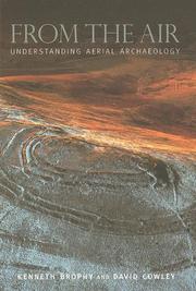
ISBN: 0752431307 Year: 2005 Publisher: Stroud Tempus
Abstract | Keywords | Export | Availability | Bookmark
 Loading...
Choose an application
- Reference Manager
- EndNote
- RefWorks (Direct export to RefWorks)
Book
ISBN: 9781472464385 9781315259659 9781351949682 9781138307230 Year: 2016 Publisher: Aldershot [etc.] Ashgate
Abstract | Keywords | Export | Availability | Bookmark
 Loading...
Choose an application
- Reference Manager
- EndNote
- RefWorks (Direct export to RefWorks)
"The study of conflict archaeology has developed rapidly over the last decade, fuelled in equal measure by technological advances and creative analytical frameworks. Nowhere is this truer than in the inter-disciplinary fields of archaeological practice that combine traditional sources such as historical photographs and maps with 3D digital topographic data from Airborne Laser Scanning (ALS) and large scale geophysical prospection. For twentieth-century conflict landscapes and their surviving archaeological remains, these developments have encouraged a shift from a site oriented approach towards landscape-scaled research. With case studies ranging from the Western Front to the Cold War, Ireland to Russia, this volume demonstrates how an aerial perspective can both support and challenge traditional archaeological and historical analysis, providing an innovative new means of engaging with the material culture of conflict and commemoration"--Priovided by publisher.
Military archaeology --- Landscape archaeology --- Aerial photography in archaeology --- Military history, Modern --- Material culture --- War memorials --- Archéologie militaire --- Archéologie du paysage --- Photographie aérienne en archéologie --- Histoire militaire --- Culture matérielle --- Monuments aux morts --- Case studies --- History --- Etudes de cas --- Histoire --- Europe --- Australia --- Australie --- Antiquities. --- Antiquités --- Archéologie militaire --- Archéologie du paysage --- Photographie aérienne en archéologie --- Culture matérielle --- Antiquités --- Case studies.
Book
ISBN: 1842175165 1782971106 9781842175163 Year: 2012 Publisher: Oxford: Oxbow books,
Abstract | Keywords | Export | Availability | Bookmark
 Loading...
Choose an application
- Reference Manager
- EndNote
- RefWorks (Direct export to RefWorks)
Airborne Laser Scanning (ALS), or lidar, is an enormously important innovation for data collection and interpretation in archaeology. The application of archaeological 3D data deriving from sources including ALS, close-range photogrammetry and terrestrial and photogrammetric scanners has grown exponentially over the last decade. Such data present numerous possibilities and challenges, from ensuring that applications remain archaeologically relevant, to developing practices that integrate the manipulation and interrogation of complex digital datasets with the skills of archaeological observation and interpretation. This volume addresses the implications of multi-scaled topographic data for contemporary archaeological practice in a rapidly developing field, drawing on examples of ongoing projects and reflections on best practice.Twenty papers from across Europe explore the implications of these digital 3D datasets for the recording and interpretation of archaeological topography, whether at the landscape, site or artefact scale. The papers illustrate the variety of ways in which we engage with archaeological topography through 3D data, from discussions of its role in landscape archaeology, to issues of context and integration, and to the methodological challenges of processing, visualisation and manipulation. Critical reflection on developing practice and implications for cultural resource management and research contextualize the case studies and applications, illustrating the diverse and evolving roles played by multi-scalar topographic data in contemporary archaeology
Archaeological surveying --- Topographical surveying --- Optical radar in archaeology. --- Three-dimensional imaging in archaeology. --- Laser use in. --- Three-dimensional archaeological imaging --- Archaeology --- Lasers --- Optical radar in archaeology --- Three-dimensional imaging in archaeology --- Prospection archéologique --- Topographie --- Imagerie tridimensionnelle en archéologie --- Archaeological surveying y --- Prospection archéologique. --- Topographie. --- Lidar. --- Imagerie en archéologie. --- Prospection archéologique. --- Imagerie en archéologie.
Book
ISBN: 9789639911208 9639911208 Year: 2011 Volume: 5 3 Publisher: Bruxelles: Europae archaeologiae consilium,
Abstract | Keywords | Export | Availability | Bookmark
 Loading...
Choose an application
- Reference Manager
- EndNote
- RefWorks (Direct export to RefWorks)
Geografie --- Landschapskunde --- Archeologie.
Book
ISBN: 9781842179819 1842179810 Year: 2010 Publisher: Oxford, UK : Oakville, CT : Oxbow Books [Distributed in the US by] David Brown Book Co.,
Abstract | Keywords | Export | Availability | Bookmark
 Loading...
Choose an application
- Reference Manager
- EndNote
- RefWorks (Direct export to RefWorks)
Archaeology and history. --- Archaeology --- Aerial photographs. --- Historic preservation. --- Landscape changes. --- Landscape protection. --- Methodology. --- Archaeology and history --- Aerial photographs --- Historic preservation --- Landscape changes --- Landscape protection --- Methodology --- Beautification of the landscape --- Conservation of landscapes --- Conservation of scenic beauty --- Conservation of scenic resources --- Landscape --- Natural beauty conservation --- Preservation of natural scenery --- Preservation of scenic resources --- Protection of landscapes --- Protection of scenic beauty --- Protection of scenic resources --- Scenery preservation --- Environmental protection --- Nature conservation --- Environmentally sensitive areas --- Landscape assessment --- Regional planning --- Change, Landscape --- Geomorphology --- Preservation, Historic --- Preservationism (Historic preservation) --- Cultural property --- Historical archaeology --- History and archaeology --- History --- Air photos --- Airphotos --- Photographs --- Conservation --- Protection
Book
ISBN: 9789088908187 9088908184 9088908192 9789088908194 Year: 2019 Publisher: Leiden : Sidestone Press,
Abstract | Keywords | Export | Availability | Bookmark
 Loading...
Choose an application
- Reference Manager
- EndNote
- RefWorks (Direct export to RefWorks)
The majority of humanity have lived out their lives in a 'rural' context, and even in our increasingly urbanised world almost half of the global population still live in rural areas. In the European Iron Age, the vast mass of the population clearly lived in small hamlets and farmsteads, and this overarching 'rurality' is important for understanding these societies. While there has been a pronounced focus in recent archaeological research on patterns of centralisation and urbanisation, there is a need to reincorporate 'rural life' or rurality into these discussions of how people lived.
Land settlement --- Landscapes --- Land use, Rural --- Landscape archaeology --- Iron age --- Archaeology --- Cultural landscapes --- Rural land use --- Land use --- Agriculture --- Countryside --- Landscape --- Natural scenery --- Scenery --- Scenic landscapes --- Nature --- Resettlement --- Settlement of land --- Colonies --- Human settlements --- History --- Eisenzeit. --- Iron age. --- Land settlement. --- Land use, Rural. --- Landscape archaeology. --- Landscapes. --- Siedlungsarchäologie. --- To 1500. --- Europe.
| Listing 1 - 10 of 10 |
Sort by
|

 Search
 Feedback
 About UniCat
  Help
Help News
News