| Listing 1 - 5 of 5 |
Sort by
|
Book
ISBN: 9780367571917 9781138054431 Year: 2020 Publisher: London CRC Press
Abstract | Keywords | Export | Availability | Bookmark
 Loading...
Choose an application
- Reference Manager
- EndNote
- RefWorks (Direct export to RefWorks)
Book
ISBN: 1315181525 1498731554 148223047X 9781482230475 9781498731553 9781315181523 9781498731546 9781351722308 1351722301 9781351722551 1351722557 Year: 2017 Publisher: Boca Raton
Abstract | Keywords | Export | Availability | Bookmark
 Loading...
Choose an application
- Reference Manager
- EndNote
- RefWorks (Direct export to RefWorks)
Oceanography --- Coastal zone management --- Coastal mapping. --- Geoinformatics. --- Oceanography, Physical --- Oceanology --- Physical oceanography --- Thalassography --- Earth sciences --- Marine sciences --- Ocean --- Computer science --- Charting, Coastal --- Coast mapping --- Coastal charting --- Coastal zone mapping --- Coastline mapping --- Coasts --- Cartography --- Coast ecosystem management --- Coastal ecosystem management --- Coastal management --- Coastal resource management --- Coastal resources management --- Coastal zone ecosystem management --- CRM (Coastal resource management) --- Zone management, Coastal --- Ecosystem management --- Natural resources --- Regional planning --- Coastal engineering --- Remote sensing. --- Geographic information systems. --- Data processing --- Charting --- Mapping --- Management

ISBN: 0748408622 0748408703 Year: 2000 Publisher: London : Taylor and Francis,
Abstract | Keywords | Export | Availability | Bookmark
 Loading...
Choose an application
- Reference Manager
- EndNote
- RefWorks (Direct export to RefWorks)
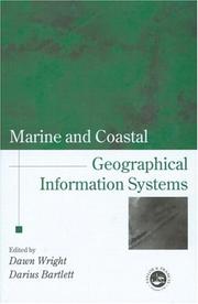
Marine and coastal applications are finally gaining wide acceptance in scientific as well as GIS communities, and cover the fields of deep sea geology, chemistry and biology, and coastal geology, biology, engineering and resource management. Comprising rigorous contributions from a group of leading scholars in marine and coastal GIS, this book will inspire and stimulate continued research in this important new application domain.Launched as a project to mark the UN International Year of the Ocean (1998), and supported by the International Geographical Union's Commission on Coastal Systems, Marine and Coastal Geographical Information Systems covers progress and research in the marine and coastal relms, in the areas of theory, applications and empirical results. It is the first book of its kind to address basic and applied scientific problems in deep sea and coastal science using GIS and remote sensing technologies. It is designed for GIS and remote sensing specialists, but also for those with an interest in oceans, lakes and shores. Coverage ranges from the seafloor spreading centres to Exclusive Economic Zones to microscale coastal habitats; and techniques included in submersibles, computer modelling, image display, 3-D temporal data visualisation, and development and application of new algorithms and spatial data structures. It illustrates the broad usage of GIS, image processing, and computer modelling in deep sea and coastalenvironments, and also addresses important institutional issues arising out of the use of these technologies.
Coasts --- Geografie --- Marine sciences --- Oceanography --- Submarine geology --- Geographic information systems. --- Geografische Informatie Systemen --- Toepassingen. --- Geographic information systems. --- Geographic information systems. --- Geographic information systems.

ISBN: 0415319722 Year: 2005 Publisher: Boca Raton (Fla.) : CRC press,
Abstract | Keywords | Export | Availability | Bookmark
 Loading...
Choose an application
- Reference Manager
- EndNote
- RefWorks (Direct export to RefWorks)
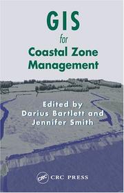
A comprehensive and up-to-date overview of the recent state of coastal zone GIS applications, this book critically examines the intellectual and organizational contexts of coastal GIS. The book discusses recent developments and specific applications that can be used to help marine and environmental scientists enhance their skills. The techniques presented teach GIS applications in a coastal setting, including shoreline mapping, ship borne data collection techniques, coastal decision making with GIS, and more. The authors, international experts, cover a broad range of topics using a logical organization, which lends the entire book a flow and structure lacking in many multi-authored texts.
Coast changes --- Coastal mapping --- Coastal zone management --- Geografie --- Geographic information systems --- Geografische Informatie Systemen --- Toepassingen.

ISBN: 9780367393977 9780415319720 Year: 2019 Publisher: Boca Raton : CRC Press,
Abstract | Keywords | Export | Availability | Bookmark
 Loading...
Choose an application
- Reference Manager
- EndNote
- RefWorks (Direct export to RefWorks)
Coast changes. --- Littoraux --- Coastal mapping. --- Cartographie marine. --- Geographic information systems. --- Système d'information géographique. --- Géomatique. --- Modifications
| Listing 1 - 5 of 5 |
Sort by
|

 Search
 Feedback
 About
About Help
Help News
News