| Listing 1 - 10 of 17 | << page >> |
Sort by
|
Book
ISBN: 1570830533 Year: 1997 Publisher: American society for photogrammetry and remote sensing
Abstract | Keywords | Export | Availability | Bookmark
 Loading...
Choose an application
- Reference Manager
- EndNote
- RefWorks (Direct export to RefWorks)
Landsat satellites --- Remote sensing --- Scientific satellites

ISBN: 0471294063 9780471294061 Year: 1998 Publisher: New York (N.Y.): Wiley,
Abstract | Keywords | Export | Availability | Bookmark
 Loading...
Choose an application
- Reference Manager
- EndNote
- RefWorks (Direct export to RefWorks)
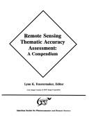
ISBN: 1570830029 9781570830020 Year: 1994 Publisher: Bethesda American Society for Photogrammetry and Remote Sensing
Abstract | Keywords | Export | Availability | Bookmark
 Loading...
Choose an application
- Reference Manager
- EndNote
- RefWorks (Direct export to RefWorks)
Remote sensing --- Remote sensing. --- Environmental Sciences and Forestry. Remote Sensing and Geographical Information Systems --- Congresses. --- Evaluation. --- Remote Sensing. --- Remote-sensing imagery --- Remote sensing systems --- Remote terrain sensing --- Sensing, Remote --- Terrain sensing, Remote --- Aerial photogrammetry --- Aerospace telemetry --- Detectors --- Space optics --- Evaluation
Book
ISBN: 1570830827 9781570830822 Year: 2007 Publisher: Bethesda (Md.) : American Society for Photogrammetry and Remote Sensing,
Abstract | Keywords | Export | Availability | Bookmark
 Loading...
Choose an application
- Reference Manager
- EndNote
- RefWorks (Direct export to RefWorks)
Digital mapping. --- Geografie --- Photogrammetrie --- Algemeen. --- DEM (computer program).
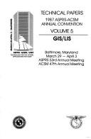
ISBN: 0944426832 0944426867 0944426875 0944426859 0944426883 9780944426845 9780944426876 9780944426838 9780944426869 0944426840 9780944426852 9780944426883 Year: 1992 Publisher: Bethesda, MD, USA : American Society for Photogrammetry and Remote Sensing : American Congress on Surveying and Mapping,
Abstract | Keywords | Export | Availability | Bookmark
 Loading...
Choose an application
- Reference Manager
- EndNote
- RefWorks (Direct export to RefWorks)
Surveying --- Photogrammetry --- Remote sensing --- Cartography --- Télédétection --- Cartographie --- Congresses. --- Congrès --- 528.8 --- 528.7 --- 502.53 --- 528.9 --- 681.3*H4 --- Remote sensing. Teledetection --- Photogrammetry: aerial, terrestrial. Methods, instruments --- The unbalanced or disturbed nature complex as a whole. Global change --- Cartography. Mapping (textual documents) --- Information systems applications (GIS etc.) --- 681.3*H4 Information systems applications (GIS etc.) --- 528.9 Cartography. Mapping (textual documents) --- 502.53 The unbalanced or disturbed nature complex as a whole. Global change --- 528.7 Photogrammetry: aerial, terrestrial. Methods, instruments --- 528.8 Remote sensing. Teledetection --- Télédétection --- Congrès

ISBN: 1570830134 Year: 1994 Publisher: Bethesda American society for photogrammetry and remote sensing
Abstract | Keywords | Export | Availability | Bookmark
 Loading...
Choose an application
- Reference Manager
- EndNote
- RefWorks (Direct export to RefWorks)
681.3*H4 --- Information systems applications (GIS etc.) --- 681.783.32 --- 681.3*I4 --- 57.087.3 --- 630*58 --- 504 --- Aerial photogrammetric equipment --- Image processing: image displays; image processing software (Computing methododologies) --- Photographic methods and techniques. Cinematography. Registration and interpretation of biological images --- Surveying and mapping. Aerial survey. Forest inventories --- Environment. Environmental science --- Conferences - Meetings --- MET Methods & Techniques --- methods & techniques --- photography --- resource monitoring --- symposium proceedings --- 504 Environment. Environmental science --- 630*58 Surveying and mapping. Aerial survey. Forest inventories --- 57.087.3 Photographic methods and techniques. Cinematography. Registration and interpretation of biological images --- 681.3*I4 Image processing: image displays; image processing software (Computing methododologies) --- 681.783.32 Aerial photogrammetric equipment --- 681.3*H4 Information systems applications (GIS etc.) --- Geographic information systems --- Congresses
Periodical
ISSN: 00991112 00991112 Year: 1975 Volume: 76/9 76/9 Publisher: Falls Church, (Va.): American society of photogrammetry,
Abstract | Keywords | Export | Availability | Bookmark
 Loading...
Choose an application
- Reference Manager
- EndNote
- RefWorks (Direct export to RefWorks)
Photographic surveying --- Aerial photography --- Photogrammetry --- Remote sensing --- Phototopographie --- Photographie aérienne --- Photogrammétrie --- Teledetection --- 528.7 --- 528.8 --- 55 --- 55 Aardwetenschappen. Geowetenschappen. Geologie. Meteorologie. Weerkunde --- Aardwetenschappen. Geowetenschappen. Geologie. Meteorologie. Weerkunde --- 55 Earth sciences. Geology. Meteorology etc. --- Earth sciences. Geology. Meteorology etc. --- 528.7 Photogrammetry: aerial, terrestrial. Methods, instruments --- Photogrammetry: aerial, terrestrial. Methods, instruments --- 528.8 Remote sensing. Teledetection --- Remote sensing. Teledetection --- Periodicals --- Photographic surveying. --- Aerial photography. --- Photogrammetry. --- Remote sensing. --- Photography [Aerial ] --- Photographic surveying - Periodicals --- Aerial photography - Periodicals --- Photogrammetry - Periodicals --- Remote sensing - Periodicals. --- Phototopographie - Periodiques --- Photographie aérienne - Périodiques --- Photogrammétrie - Périodiques --- Teledetection - Periodiques
Book
ISBN: 0840356730 Year: 1990 Publisher: Iowa : Kendall Hunt Publishing,
Abstract | Keywords | Export | Availability | Bookmark
 Loading...
Choose an application
- Reference Manager
- EndNote
- RefWorks (Direct export to RefWorks)
Geografie --- Photogrammetrie --- Algemeen.
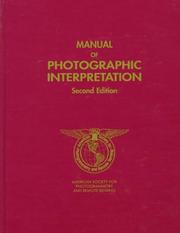
ISBN: 1570830398 Year: 1997 Publisher: Bethesda (Md.) : American Society for Photogrammetry and Remote Sensing,
Abstract | Keywords | Export | Availability | Bookmark
 Loading...
Choose an application
- Reference Manager
- EndNote
- RefWorks (Direct export to RefWorks)
Periodical
Year: 1987 Publisher: Falls Church, VA : American Society for Photogrammetry and Remote Sensing,
Abstract | Keywords | Export | Availability | Bookmark
 Loading...
Choose an application
- Reference Manager
- EndNote
- RefWorks (Direct export to RefWorks)
| Listing 1 - 10 of 17 | << page >> |
Sort by
|

 Search
 Feedback
 About UniCat
  Help
Help News
News