Book
ISBN: 0851570720 Year: 1969 Publisher: London Bingley
Abstract | Keywords | Export | Availability | Bookmark
 Loading...
Choose an application
- Reference Manager
- EndNote
- RefWorks (Direct export to RefWorks)
Cartography. --- Geografie --- Cartografie --- Algemeen. --- Cartography --- Cartography, Primitive --- Chartography --- Map-making --- Mapmaking --- Mapping (Cartography) --- Mathematical geography --- Surveying --- Map projection --- Maps
Periodical
ISSN: 2185646X Year: 1963 Publisher: Tokyo-to : Nihon Kokusai Chizu Gakkai
Abstract | Keywords | Export | Availability | Bookmark
 Loading...
Choose an application
- Reference Manager
- EndNote
- RefWorks (Direct export to RefWorks)
Cartography --- Cartografie. --- Cartography. --- Cartography, Primitive --- Chartography --- Map-making --- Mapmaking --- Mapping (Cartography) --- Mathematical geography --- Surveying --- Map projection --- Maps
Book
ISBN: 9781138831025 1138831026 9780367581046 0367581043 9781315736822 9781317568209 1315736829 1317568222 1317568214 Year: 2018 Publisher: Milton Park, Abingdon, Oxon ;New York, NY Routledge
Abstract | Keywords | Export | Availability | Bookmark
 Loading...
Choose an application
- Reference Manager
- EndNote
- RefWorks (Direct export to RefWorks)
Geodesy. Cartography --- Cartography --- Cartographie --- Cartography, Primitive --- Chartography --- Map-making --- Mapmaking --- Mapping (Cartography) --- Mathematical geography --- Surveying --- Map projection --- Maps --- 528.6
Book
ISBN: 9781138613959 1138613959 Year: 2021 Publisher: Boca Raton ; London : CRC Press,
Abstract | Keywords | Export | Availability | Bookmark
 Loading...
Choose an application
- Reference Manager
- EndNote
- RefWorks (Direct export to RefWorks)
"This fourth edition serves as an excellent introduction to general cartographic principles and as an examination of the best ways to optimize the visualization and use of spatio-temporal data. It incorporates all the changes and new developments in the world of maps such as open street maps and GPS-based crowdsourcing, the use of new web mapping technology, and adds new case studies and examples. Printed in full color, this fully-revised edition provides students with the knowledge and skills needed to read and understand maps and mapping changes, and offers professional cartographers an updated reference with the latest developments in cartography"--
Cartography. --- Cartographie --- Cartography --- Cartography, Primitive --- Chartography --- Map-making --- Mapmaking --- Mapping (Cartography) --- Mathematical geography --- Surveying --- Map projection --- Maps --- 528.6
Book
ISBN: 9535150057 9535106899 Year: 2012 Publisher: Rijeka [Croatia] : InTech,
Abstract | Keywords | Export | Availability | Bookmark
 Loading...
Choose an application
- Reference Manager
- EndNote
- RefWorks (Direct export to RefWorks)
The terrestrial space is the place of interaction of natural and social systems. The cartography is an essential tool to understand the complexity of these systems, their interaction and evolution. This brings the cartography to an important place in the modern world. The book presents several contributions at different areas and activities showing the importance of the cartography to the perception and organization of the territory. Learning with the past or understanding the present the use of cartography is presented as a way of looking to almost all themes of the knowledge.
Cartography. --- Cartography, Primitive --- Chartography --- Map-making --- Mapmaking --- Mapping (Cartography) --- Mathematical geography --- Surveying --- Map projection --- Maps --- Human geography
Book
ISBN: 9004245669 9789004245662 9789004245600 900424560X Year: 2013 Publisher: Boston
Abstract | Keywords | Export | Availability | Bookmark
 Loading...
Choose an application
- Reference Manager
- EndNote
- RefWorks (Direct export to RefWorks)
The Arab Gulf States possess more than half of the planet’s crude oil reserves, and their gas reserves are immense. The transition from being rental economies to producing economies has caused rapid and significant changes, including the influx of foreign (Arab and Asian) manual laborers, and spectacular urban development, particularly along the coast. This Atlas of the Gulf States contains more than 150 maps and graphs based on recent data. It offers a survey of the history and economic and urban development of the Gulf region. For Iraq, Kuwait, Saudi Arabia, Qatar, Bahrain, the United Arab Emirates, Oman, and Iran, this atlas offers detailed maps, plans and statistics for the relevant provinces as well as the most important cities. This Atlas is an updated translation from the French edition (2011), with a more extensive bibliography and an index.
Arabian Peninsula --- Arabia --- Cartography --- Maps --- Cartography, Primitive --- Chartography --- Map-making --- Mapmaking --- Mapping (Cartography) --- Mathematical geography --- Surveying --- Map projection

ISBN: 1135766665 1280243503 9786610243501 020333955X 9780203339558 9780714685403 0714685402 9780714656519 0714656518 6610243506 0714656518 9781135766610 9781135766658 9781135766665 9780415594981 1135766657 Year: 2005 Publisher: London RoutledgeCurzon
Abstract | Keywords | Export | Availability | Bookmark
 Loading...
Choose an application
- Reference Manager
- EndNote
- RefWorks (Direct export to RefWorks)
This book is a historical study of the survey and mapping system of Palestine under the British Mandate. It traces the background and the reasoning behind the establishment of the survey programme, examines the foundations upon which the system was based, and strives to understand the motivation of those who implemented it. This study shows that the roots of the modern survey system of Palestine are to be sought in the Balfour Declaration and its implications regarding land in Palestine. The land issue was at the core of the mapping of Mandatory Palestine, and it remains as a core issue at the
Cartography --- Cartography, Primitive --- Chartography --- Map-making --- Mapmaking --- Mapping (Cartography) --- Mathematical geography --- Surveying --- Map projection --- Maps --- History --- Palestine --- Holy Land --- Surveys.
Book
ISBN: 9780367729387 9781138346154 1138346152 9780429437441 0429437447 9780429794056 0429794053 9780429794049 0429794045 9780429794063 0429794061 0367729385 Year: 2020 Publisher: Oxon: Routledge,
Abstract | Keywords | Export | Availability | Bookmark
 Loading...
Choose an application
- Reference Manager
- EndNote
- RefWorks (Direct export to RefWorks)
"Object-Oriented Cartography provides an innovative perspective on the changing nature of maps and cartographic study. Through a renewed theoretical reading of contemporary cartography, this book acknowledges the shifted interest from cartographic representation to mapping practice and proposes an alternative consideration of the 'thingness' of maps. Rather than asking how maps map onto reality, it explores the possibilities of a speculative-realist map theory by bringing cartographic objects to the foreground. Through a pragmatic perspective, this book focuses on both digital and nondigital maps and establishes an unprecedented dialogue between the field of map studies and object-oriented ontology. This dialogue is carried out through a series of reflections and case studies involving aesthetics and technology, ethnography and image theory, and narrative and photography. Proposing methods to further develop this kind of cartographic research, this book will be invaluable reading for researchers and graduate students in the fields of Cartography and Geohumanities"--
Cartography --- 528.6 --- Cartography, Primitive --- Chartography --- Map-making --- Mapmaking --- Mapping (Cartography) --- Mathematical geography --- Surveying --- Map projection --- Maps --- Philosophy --- Methodology
Periodical
ISSN: 21199825 Year: 2011 Publisher: Paris CFC
Abstract | Keywords | Export | Availability | Bookmark
 Loading...
Choose an application
- Reference Manager
- EndNote
- RefWorks (Direct export to RefWorks)
Earth Sciences --- Cartography --- Cartography. --- Cartography, Primitive --- Chartography --- Map-making --- Mapmaking --- Mapping (Cartography) --- Mathematical geography --- Surveying --- Map projection --- Maps

ISBN: 0898625890 Year: 1995 Publisher: New York, N.Y. Guilford
Abstract | Keywords | Export | Availability | Bookmark
 Loading...
Choose an application
- Reference Manager
- EndNote
- RefWorks (Direct export to RefWorks)
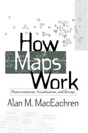
This book is the first systematic integration of cognitive and semiotic approaches to understanding maps as powerful, abstract, and synthetic spatial representations. Presenting a perspective built on four decades of cartographic research, it explores how maps work at multiple levels--from the cognitive to the societal--and provides a cohesive picture of how the many representational choices inherent in mapping interact with the processing of information and construction of knowledge. «MDUL»«MDNM»Utilizing this complex perspective, the author shows how the insights derived from a better understanding of maps can be used in future map design. Although computers now provide the graphic tools to produce maps of similar or better quality than previous manual techniques, they seldom incorporate the conceptual tools needed to make informed symbolization and design decisions. The search for these conceptual tools is the basis for «MDUL»How Maps Work«MDNM».
Geodesy. Cartography --- Cartography. --- Cartographie --- 912 --- Cartography --- Cartography, Primitive --- Chartography --- Map-making --- Mapmaking --- Mapping (Cartography) --- Mathematical geography --- Surveying --- Map projection --- Maps --- Cartografie. Kaarten. Plattegronden. Atlassen --- Geografie --- Cartografie --- Thematische Visualisatie.

 Search
 Feedback
 About UniCat
  Help
Help News
News