
 Search
 Feedback
 About UniCat
  Help
Help News
News
ISBN: 1281965995 9786611965990 0226534049 9780226534046 9781281965998 9780226534039 0226534030 6611965998 Year: 2008 Publisher: Chicago : University of Chicago Press,
Abstract | Keywords | Export | Availability | Bookmark
 Loading...
Choose an application
- Reference Manager
- EndNote
- RefWorks (Direct export to RefWorks)
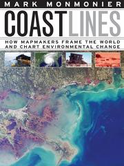
In the next century, sea levels are predicted to rise at unprecedented rates, causing flooding around the world, from the islands of Malaysia and the canals of Venice to the coasts of Florida and California. These rising water levels pose serious challenges to all aspects of coastal existence-chiefly economic, residential, and environmental-as well as to the cartographic definition and mapping of coasts. It is this facet of coastal life that Mark Monmonier tackles in Coast Lines. Setting sail on a journey across shifting landscapes, cartographic technology, and climate change, Monmonier reveals that coastlines are as much a set of ideas, assumptions, and societal beliefs as they are solid black lines on maps. Whether for sailing charts or property maps, Monmonier shows, coastlines challenge mapmakers to capture on paper a highly irregular land-water boundary perturbed by tides and storms and complicated by rocks, wrecks, and shoals. Coast Lines is peppered with captivating anecdotes about the frustrating effort to expunge fictitious islands from nautical charts, the tricky measurement of a coastline's length, and the contentious notions of beachfront property and public access. Combing maritime history and the history of technology, Coast Lines charts the historical progression from offshore sketches to satellite images and explores the societal impact of coastal cartography on everything from global warming to homeland security. Returning to the form of his celebrated Air Apparent, Monmonier ably renders the topic of coastal cartography accessible to both general readers and historians of science, technology, and maritime studies. In the post-Katrina era, when the map of entire regions can be redrawn by a single natural event, the issues he raises are more important than ever.
Coastal mapping. --- Environmental monitoring. --- Biomonitoring (Ecology) --- Ecological monitoring --- Environmental quality --- Monitoring, Environmental --- Applied ecology --- Environmental engineering --- Pollution --- Charting, Coastal --- Coast mapping --- Coastal charting --- Coastal zone mapping --- Coastline mapping --- Coasts --- Cartography --- Measurement --- Monitoring --- Charting --- Mapping --- mapmaking, cartography, geography, climate change, global warming, environment, nature, environmentalism, sea levels, flooding, natural disaster, extreme weather, malaysia, canals, venice, coasts, florida, california, coastline, technology, science, nonfiction, nautical charts, public access, beachfront property, tides, storms, shipwreck, shoals, satellite images, homeland security, maritime, environmental monitoring, coastal mapping.
ISBN: 0226534138 Year: 1999 Publisher: Chicago (Ill.) : University of Chicago press,
Abstract | Keywords | Export | Availability | Bookmark
Loading...Choose an application
- Reference Manager
- EndNote
- RefWorks (Direct export to RefWorks)
'Maps with the News' is a lively assessment of the role of cartography in American journalism. Tracing the use of maps in American news reporting from the eighteenth century to the 1980s, Mark Monmonier explores why and how journalistic maps have achieved such importance. "A most welcome and thorough investigation of a neglected aspect of both the history of cartography and modern cartographic practice."--'Mapline' "A well-written, scholarly treatment of journalistic cartography. . . . It is well researched, thoroughly indexed and referenced . . . amply illustrated."--Judith A. Tyner, 'Imago Mundi' "There is little doubt that 'Maps with the News' should be part of the training and on the desks of all those concerned with producing maps for mass consumption, and also on the bookshelves of all journalists, graphic artists, historians of cartography, and geographic educators."--W. G. V. Balchin, 'Geographical Journal' "A definitive work on journalistic cartography."--Virginia Chipperfield, 'Society of University Cartographers Bulletin'
ISBN: 1282904612 9786612904615 0226534324 9780226534329 0226534316 9780226534312 Year: 2004 Publisher: Chicago : ©2004 University of Chicago Press,
Abstract | Keywords | Export | Availability | Bookmark
Loading...Choose an application
- Reference Manager
- EndNote
- RefWorks (Direct export to RefWorks)
In Rhumb Lines and Map Wars, Mark Monmonier offers an insightful, richly illustrated account of the controversies surrounding Flemish cartographer Gerard Mercator's legacy. He takes us back to 1569, when Mercator announced a clever method of portraying the earth on a flat surface, creating the first projection to take into account the earth's roundness. As Monmonier shows, mariners benefited most from Mercator's projection, which allowed for easy navigation of the high seas with rhumb lines-clear-cut routes with a constant compass bearing-for true direction. But the projection's popularity among nineteenth-century sailors led to its overuse-often in inappropriate, non-navigational ways-for wall maps, world atlases, and geopolitical propaganda. Because it distorts the proportionate size of countries, the Mercator map was criticized for inflating Europe and North America in a promotion of colonialism. In 1974, German historian Arno Peters proffered his own map, on which countries were ostensibly drawn in true proportion to one another. In the ensuing "map wars" of the 1970's and 1980's, these dueling projections vied for public support-with varying degrees of success. Widely acclaimed for his accessible, intelligent books on maps and mapping, Monmonier here examines the uses and limitations of one of cartography's most significant innovations. With informed skepticism, he offers insightful interpretations of why well-intentioned clerics and development advocates rallied around the Peters projection, which flagrantly distorted the shape of Third World nations; why journalists covering the controversy ignored alternative world maps and other key issues; and how a few postmodern writers defended the Peters worldview with a self-serving overstatement of the power of maps. Rhumb Lines and Map Wars is vintage Monmonier: historically rich, beautifully written, and fully engaged with the issues of our time.
Mercator projection (Cartography) --- Cartography --- Loxodrome. --- Peters projection (Cartography) --- Navigation. --- Social aspects. --- maps, mapping, mapmaking, society, historical, academic, scholarly, research, illustrated, controversial, controversy, flemish, cartography, cartographer, gerard mercator, legacy, life story, 1500s, earth, flat, round, mariner, sea, seafaring, sailor, direction, compass, 19th, century, atlas, geopolitical, propaganda, colonialism, colonial, criticism, innovation.
ISBN: 0226534227 0226534235 9780226534220 9780226534237 Year: 1999 Publisher: Chicago University of Chicago press
Abstract | Keywords | Export | Availability | Bookmark
Loading...Choose an application
- Reference Manager
- EndNote
- RefWorks (Direct export to RefWorks)
Meteorology --- Weather forecasting --- Charts, diagrams, etc --- Technique
ISBN: 0226534278 Year: 2002 Publisher: Chicago (Ill.) : University of Chicago press,
Abstract | Keywords | Export | Availability | Bookmark
Loading...Choose an application
- Reference Manager
- EndNote
- RefWorks (Direct export to RefWorks)
Maps, as we know, help us find our way around. But they're also powerful tools for someone hoping to find 'you'. Widely available in electronic and paper formats, maps offer revealing insights into our movements and activities, even our likes and dislikes. In 'Spying with Maps', the "mapmatician" Mark Monmonier looks at the increased use of geographic data, satellite imagery, and location tracking across a wide range of fields such as military intelligence, law enforcement, market research, and traffic engineering. Could these diverse forms of geographic monitoring, he asks, lead to grave consequences for society? To assess this very real threat, he explains how geospatial technology works, what it can reveal, who uses it, and to what effect. Despite our apprehension about surveillance technology, 'Spying with Maps' is not a jeremiad, crammed with dire warnings about eyes in the sky and invasive tracking. Monmonier's approach encompasses both skepticism and the acknowledgment that geospatial technology brings with it unprecedented benefits to governments, institutions, and individuals, especially in an era of asymmetric warfare and bioterrorism. Monmonier frames his explanations of what this new technology is and how it works with the question of whether locational privacy is a fundamental right. Does the right to be left alone include not letting Big Brother (or a legion of Little Brothers) know where we are or where we've been? What sacrifices must we make for homeland security and open government? With his usual wit and clarity, Monmonier offers readers an engaging, even-handed introduction to the dark side of the new technology that surrounds us--from traffic cameras and weather satellites to personal GPS devices and wireless communications.
Electronic surveillance. --- Geografie --- Privacy, Right of. --- Remote sensing. --- Cartografie --- Kaartgebruik.
Book
ISBN: 1282584901 9786612584909 0226534634 Year: 2010 Publisher: Chicago ; London : University of Chicago Press,
Abstract | Keywords | Export | Availability | Bookmark
Loading...Choose an application
- Reference Manager
- EndNote
- RefWorks (Direct export to RefWorks)
Some maps help us find our way; others restrict where we go and what we do. These maps control behavior, regulating activities from flying to fishing, prohibiting students from one part of town from being schooled on the other, and banishing certain individuals and industries to the periphery. This restrictive cartography has boomed in recent decades as governments seek regulate activities as diverse as hiking, building a residence, opening a store, locating a chemical plant, or painting your house anything but regulation colors. It is this aspect of mapping-its power to prohibit-that celeb
Cartography --- Maps --- Cartography --- Maps --- Cartography --- Maps --- Social aspects. --- Social aspects. --- Economic aspects. --- Economic aspects. --- Political aspects. --- Political aspects.
ISBN: 2082115577 9782082115575 Year: 1993 Publisher: Paris: Flammarion,
Abstract | Keywords | Export | Availability | Bookmark
Loading...Choose an application
- Reference Manager
- EndNote
- RefWorks (Direct export to RefWorks)
Bedriegerij --- Bedrog --- Cartografie --- Cartographie --- Cartography --- Cartography [Primitive ] --- Chartography --- Chicanery --- Deceit --- Deception --- Listen --- Mapping (Cartography) --- Misleiding --- Ruses --- Subterfuge --- Tromperie --- Maps --- Cartes --- Analysis --- Analyse --- Cartographie. --- Tromperie. --- Cartes geographiques
ISBN: 0226534316 Year: 2004 Publisher: Chicago and London The University of Chicago press
Abstract | Keywords | Export | Availability | Bookmark
Loading...Choose an application
- Reference Manager
- EndNote
- RefWorks (Direct export to RefWorks)
An account of the controversies surrounding Flemish cartographer Gerard Mercator's legacy. Examines the limitations and uses of Mercator's clever method of portraying the earth on a flat surface while taking into account the earth's actual roundness.
528 --- 912 <09> --- Geodesy. Surveying. Photogrammetry. Cartography --- Cartografie. Kaarten. Plattegronden. Atlassen--Geschiedenis van ... --- Cartography --- Loxodrome. --- Mercator projection (Cartography) --- Navigation. --- Peters projection (Cartography) --- Geografie --- Social aspects. --- Cartografie --- Historische Cartografie. --- Mercator projection (Cartography). --- Peters projection (Cartography). --- Cartography - Social aspects. --- Cartography -- Social aspects. --- Geography --- Earth & Environmental Sciences --- 528 Geodesy. Surveying. Photogrammetry. Cartography --- Loxodrome --- Navigation --- Peters Projektion (Cartography) --- Map projection --- Navigation, Primitive --- Locomotion --- Orientation --- Nautical astronomy --- Naval art and science --- Pilots and pilotage --- Helix, Spherical --- Loxodromic spiral --- Rhumb-line --- Spherical helix --- Spiral, Loxodromic --- Curves --- Sphere --- Cartography, Primitive --- Chartography --- Map-making --- Mapmaking --- Mapping (Cartography) --- Mathematical geography --- Surveying --- Maps --- Social aspects --- Cartografie. Kaarten. Plattegronden. Atlassen--Geschiedenis van .. --- Cartografie. Kaarten. Plattegronden. Atlassen--Geschiedenis van . --- Cartografie. Kaarten. Plattegronden. Atlassen--Geschiedenis van
Book
ISBN: 9780226534688 9780226534671 0226534677 0226534685 Year: 2010 Publisher: Chicago ; London University of Chicago Press
Abstract | Keywords | Export | Availability | Bookmark
Loading...Choose an application
- Reference Manager
- EndNote
- RefWorks (Direct export to RefWorks)
Some maps help us find our way; others restrict where we go and what we do. These maps control behavior. This restrictive cartography has boomed in recent decades as governments seek regulate activities. It is this aspect of mapping —its power to prohibit— that Mark Monmonier tackles in No Dig, No Fly, No Go. Tracing the power of prohibitive mapping at multiple levels —from regional to international— and multiple dimensions —from property to cyberspace— Monmonier demonstrates how much boundaries influence our experience —from homeownership and voting to taxation and airline travel.
Cartography --- Maps --- Social aspects. --- Economic aspects. --- Political aspects. --- 32.019.51 --- 912 --- Massacommunicatie. Opinievorming. Politieke beinvloeding. Politieke manipulatie. Propaganda --- Cartografie. Kaarten. Plattegronden. Atlassen --- 32.019.51 Massacommunicatie. Opinievorming. Politieke beinvloeding. Politieke manipulatie. Propaganda --- Plans --- Cartographic materials --- Geography --- Cartography, Primitive --- Chartography --- Map-making --- Mapmaking --- Mapping (Cartography) --- Mathematical geography --- Surveying --- Map projection --- Economic aspects --- Political aspects --- Social aspects
Book
ISBN: 9780226435923 022643592X Year: 2018 Publisher: Chicago London University of Chicago Press
Abstract | Keywords | Export | Availability | Bookmark
Loading...Choose an application
- Reference Manager
- EndNote
- RefWorks (Direct export to RefWorks)
An instant classic when first published in 1991, How to Lie with Maps revealed how the choices mapmakers make—consciously or unconsciously—mean that every map inevitably presents only one of many possible stories about the places it depicts. The principles Mark Monmonier outlined back then remain true today, despite significant technological changes in the making and use of maps. The introduction and spread of digital maps and mapping software, however, have added new wrinkles to the ever-evolving landscape of modern mapmaking. Fully updated for the digital age, this new edition of How to Lie with Maps examines the myriad ways that technology offers new opportunities for cartographic mischief, deception, and propaganda. While retaining the same brevity, range, and humor as its predecessors, this third edition includes significant updates throughout as well as new chapters on image maps, prohibitive cartography, and online maps. It also includes an expanded section of color images and an updated list of sources for further reading.
Cartography. --- Cartographie. --- Deception. --- Tromperie. --- CARTOGRAPHY