
 Search
 Feedback
 About UniCat
  Help
Help News
News
| Listing 1 - 10 of 10 |
Sort by
|
Book
ISBN: 9789068094077 9068094076 Year: 2007 Publisher: Utrecht Koninklijk Nederlands aardrijkskundig genootschap
Abstract | Keywords | Export | Availability | Bookmark
 Loading...
Choose an application
- Reference Manager
- EndNote
- RefWorks (Direct export to RefWorks)
Cartography. --- Ormeling, Ferjan, --- Cartography --- Cartography, Primitive --- Chartography --- Map-making --- Mapmaking --- Mapping (Cartography) --- Mathematical geography --- Surveying --- Map projection --- Maps --- Ormeling, F. J., --- Ormeling, Ferdinand Jan,
ISBN: 0226629309 9780226629308 9786612538575 0226629325 1282538578 9780226629322 Year: 2007
Abstract | Keywords | Export | Availability | Bookmark
Loading...Choose an application
- Reference Manager
- EndNote
- RefWorks (Direct export to RefWorks)
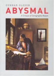
People rely on reason to think about and navigate the abstract world of human relations in much the same way they rely on maps to study and traverse the physical world. Starting from that simple observation, renowned geographer Gunnar Olsson offers in Abysmal an astonishingly erudite critique of the way human thought and action have become deeply immersed in the rhetoric of cartography and how this cartographic reasoning allows the powerful to map out other people's lives.A spectacular reading of Western philosophy, religion, and mythology that draws on early maps a
History of philosophy --- Geodesy. Cartography --- anno 1900-1999 --- Philosophy, Modern --- Cartography. --- Rhetoric. --- Reason. --- Mind --- Intellect --- Rationalism --- Language and languages --- Speaking --- Authorship --- Expression --- Literary style --- Cartography, Primitive --- Chartography --- Map-making --- Mapmaking --- Mapping (Cartography) --- Mathematical geography --- Surveying --- Map projection --- Maps --- Rhetoric
ISBN: 9780415306638 0415306620 0415306639 9780415306621 9780203417515 9781134400812 9781134400850 9781134400867 Year: 2007 Publisher: London Routledge
Abstract | Keywords | Export | Availability | Bookmark
Loading...Choose an application
- Reference Manager
- EndNote
- RefWorks (Direct export to RefWorks)
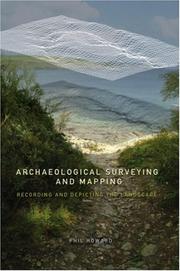
Archaeological surveying --- Archaeology --- Cartography --- Excavations (Archaeology) --- Surveying --- Cartography, Primitive --- Chartography --- Map-making --- Mapmaking --- Mapping (Cartography) --- Mathematical geography --- Map projection --- Maps --- Archeology --- Anthropology --- Auxiliary sciences of history --- History --- Antiquities --- Fieldwork --- Methodology
Book
ISBN: 9789040082924 Year: 2007 Publisher: Zwolle Waanders
Abstract | Keywords | Export | Availability | Bookmark
Loading...Choose an application
- Reference Manager
- EndNote
- RefWorks (Direct export to RefWorks)
Vingboons, Johannes --- Exhibitions --- Cartography --- Cartography, Primitive --- Chartography --- Map-making --- Mapmaking --- Mapping (Cartography) --- Mathematical geography --- Surveying --- Map projection --- Maps --- History --- Vinckeboons, Joan. --- Vingboons, Johan --- Vingboons, Joan --- Vingboom, Joan --- Vingboons, Ioan --- Vingboons, I. --- Boons, I. V. --- Vinckeboons, Johannes --- Vinckeboons, Jan --- Vingboons, Jan --- Vinckboons, Johannes --- Vinckboons, Jan --- Vinckeebon, Johannes
Multi
ISBN: 9782503520650 2503520650 Year: 2007 Volume: 7 Publisher: Turnhout: Brepols,
Abstract | Keywords | Export | Availability | Bookmark
Loading...Choose an application
- Reference Manager
- EndNote
- RefWorks (Direct export to RefWorks)
Cet ouvrage a pour but de montrer la survivance des idées médiévales dans la cartographie du XVIe siècle, sous plusieurs aspects originaux. Même si la découverte du Nouveau Monde introduisit d'évidents changements, l'influence de la description de l'orbis tripartitus médiéval reste sensible au XVIe siècle. Tandis que l'on aperçoit au seizième siècle la naissance de la cartographie scientifique, l'étude démontre la survivance des mirabilia (animaux exotiques et monstres humains) et de la figure de deux souverains fréquemment représentés sur les mappae mundi médiévales, Alexandre le Grand et Prêtre Jean.
Geodesy. Cartography --- anno 1400-1499 --- anno 1300-1399 --- anno 1200-1299 --- anno 1500-1599 --- Civilization, Medieval --- Geography, Medieval. --- Cartography --- Civilisation médiévale --- Géographie médiévale --- Cartographie --- Influence --- History. --- Histoire --- World maps --- Early maps --- 091:912 --- 912 <100> --- 912 "04/14" --- Handschriftenkunde. Handschriftencatalogi-:-Cartografie. Kaarten. Plattegronden. Atlassen --- Cartografie. Kaarten. Plattegronden. Atlassen--Wereld. Internationaal. Alle landen gezamenlijk --- Cartografie. Kaarten. Plattegronden. Atlassen--Middeleeuwen --- 091:912 Handschriftenkunde. Handschriftencatalogi-:-Cartografie. Kaarten. Plattegronden. Atlassen --- Civilisation médiévale --- Géographie médiévale --- Maps --- Globes --- Maps, Early --- Geography --- Cartography, Primitive --- Chartography --- Map-making --- Mapmaking --- Mapping (Cartography) --- Mathematical geography --- Surveying --- Map projection --- History --- Civilization [Medieval ] --- Geography [Medieval ] --- Cartography - Maps --- Influence médiévale --- 16e siècle
Book
ISBN: 9789061944898 9061944899 Year: 2007 Volume: 7 Publisher: `t Goy-Houten Hes & De Graaf Publishers
Abstract | Keywords | Export | Availability | Bookmark
Loading...Choose an application
- Reference Manager
- EndNote
- RefWorks (Direct export to RefWorks)
Geodesy. Cartography
---
anno 1400-1499
---
anno 1600-1699
---
anno 1500-1599
---
Africa
---
Cartography
---
Cartografie.
---
Kaarten (geografie)
---
History.
---
Afrika.
---
Maps
---
Discovery and exploration.
---
912 <09> <6>
---
912 "15"
---
912 "17"
---
910.4 <6>
---
Cartografie. Kaarten. Plattegronden. Atlassen--Geschiedenis van ...--Afrika
---
Cartografie. Kaarten. Plattegronden. Atlassen--16e eeuw. Periode 1500-1599
---
Cartografie. Kaarten. Plattegronden. Atlassen--18e eeuw. Periode 1700-1799
---
Ontdekkingsreizen. Reizen. Expedities. Reisverhalen--

ISBN: 9783540464020 9783540463993 Year: 2007 Publisher: Berlin Heidelberg Springer Berlin Heidelberg
Abstract | Keywords | Export | Availability | Bookmark
Loading...Choose an application
- Reference Manager
- EndNote
- RefWorks (Direct export to RefWorks)
This monograph describes a new family of algorithms for the simultaneous localization and mapping problem in robotics (SLAM). SLAM addresses the problem of acquiring an environment map with a roving robot, while simultaneously localizing the robot relative to this map. This problem has received enormous attention in the robotics community in the past few years, reaching a peak of popularity on the occasion of the DARPA Grand Challenge in October 2005, which was won by the team headed by the authors. The FastSLAM family of algorithms applies particle filters to the SLAM Problem, which provides new insights into the data association problem that is paramount in SLAM. The FastSLAM-type algorithms have enabled robots to acquire maps of unprecedented size and accuracy, in a number of robot application domains and have been successfully applied in different dynamic environments, including the solution to the problem of people tracking.
statistische kwaliteitscontrole --- Applied physical engineering --- robots --- automatisering --- systeemtheorie --- Statistical physics --- grafische vormgeving --- Artificial intelligence. Robotics. Simulation. Graphics --- systeembeheer --- regeltechniek --- industriële statistieken --- procesautomatisering --- Cartography --- Data transmission systems --- Mobile robots --- Robots --- 681.3*I29 --- Robot control --- Robotics --- Data communication systems --- Transmission of data --- Digital communications --- Electronic data processing --- Electronic systems --- Information theory --- Telecommunication systems --- Cartography, Primitive --- Chartography --- Map-making --- Mapmaking --- Mapping (Cartography) --- Mathematical geography --- Surveying --- Map projection --- Maps --- 681.3*I29 Robotics: manipulators; propelling mechanisms; sensors (Artificial intelli- gence) --- Robotics: manipulators; propelling mechanisms; sensors (Artificial intelli- gence) --- Control systems
Book
ISBN: 9789042919792 9042919795 Year: 2007 Volume: 9 Publisher: Leuven: Peeters,
Abstract | Keywords | Export | Availability | Bookmark
Loading...Choose an application
- Reference Manager
- EndNote
- RefWorks (Direct export to RefWorks)
Book history --- History of civilization --- Theory of knowledge --- anno 500-1499 --- Learning and scholarship --- Manuscripts, Latin (Medieval and modern) --- Manuscripts, English (Old) --- Cartography --- Savoir et érudition --- Manuscrits latins médiévaux et modernes --- Manuscrits anglais (vieil anglais) --- Cartographie --- History --- Histoire --- Encyclopedias and dictionaries --- Transmission of texts --- Encyclopédies et dictionnaires --- Transmission de textes --- History and criticism --- Histoire et critique --- 091:031 --- Encyclopedieen--(handschriften) --- 091:031 Encyclopedieen--(handschriften) --- Savoir et érudition --- Manuscrits latins médiévaux et modernes --- Encyclopédies et dictionnaires --- Medieval and modern Latin manuscripts --- Manuscripts, Medieval --- Anglo-Saxon manuscripts --- English manuscripts, Old --- Manuscripts, Anglo-Saxon --- Manuscripts, Old English --- Old English manuscripts --- Medieval learning and scholarship --- Education, Medieval --- Cartography, Primitive --- Chartography --- Map-making --- Mapmaking --- Mapping (Cartography) --- Mathematical geography --- Surveying --- Map projection --- Maps --- Medieval, 500-1500 --- Middle Ages, 500-1500 --- Learning and scholarship - History - Medieval, 500-1500 --- Manuscripts, Latin (Medieval and modern) - Europe --- Cartography - England - History - To 1500
ISBN: 1280852992 9786610852994 3540464026 3540463992 Year: 2007 Volume: v. 27 Publisher: Berlin, Heidelberg : Springer Berlin Heidelberg : Imprint: Springer,
Abstract | Keywords | Export | Availability | Bookmark
Loading...Choose an application
- Reference Manager
- EndNote
- RefWorks (Direct export to RefWorks)
This monograph describes a new family of algorithms for the simultaneous localization and mapping problem in robotics (SLAM). SLAM addresses the problem of acquiring an environment map with a roving robot, while simultaneously localizing the robot relative to this map. This problem has received enormous attention in the robotics community in the past few years, reaching a peak of popularity on the occasion of the DARPA Grand Challenge in October 2005, which was won by the team headed by the authors. The FastSLAM family of algorithms applies particle filters to the SLAM Problem, which provides new insights into the data association problem that is paramount in SLAM. The FastSLAM-type algorithms have enabled robots to acquire maps of unprecedented size and accuracy, in a number of robot application domains and have been successfully applied in different dynamic environments, including the solution to the problem of people tracking.
Robots --- Mobile robots. --- Data transmission systems. --- Cartography. --- Control systems. --- Cartography, Primitive --- Chartography --- Map-making --- Mapmaking --- Mapping (Cartography) --- Mathematical geography --- Surveying --- Map projection --- Maps --- Data communication systems --- Transmission of data --- Digital communications --- Electronic data processing --- Electronic systems --- Information theory --- Telecommunication systems --- Robot control --- Robotics --- Information Technology --- Artificial Intelligence --- Mathematical optimization. --- Engineering mathematics. --- Artificial intelligence. --- Computer vision. --- Robotics and Automation. --- Optimization. --- Mathematical and Computational Engineering. --- Control, Robotics, Mechatronics. --- Artificial Intelligence. --- Computer Imaging, Vision, Pattern Recognition and Graphics. --- AI (Artificial intelligence) --- Artificial thinking --- Electronic brains --- Intellectronics --- Intelligence, Artificial --- Intelligent machines --- Machine intelligence --- Thinking, Artificial --- Bionics --- Cognitive science --- Digital computer simulation --- Logic machines --- Machine theory --- Self-organizing systems --- Simulation methods --- Fifth generation computers --- Neural computers --- Engineering --- Engineering analysis --- Mathematical analysis --- Optimization (Mathematics) --- Optimization techniques --- Optimization theory --- Systems optimization --- Maxima and minima --- Operations research --- System analysis --- Machine vision --- Vision, Computer --- Artificial intelligence --- Image processing --- Pattern recognition systems --- Mathematics --- Robotics. --- Automation. --- Applied mathematics. --- Control engineering. --- Mechatronics. --- Optical data processing. --- Optical computing --- Visual data processing --- Integrated optics --- Photonics --- Computers --- Mechanical engineering --- Microelectronics --- Microelectromechanical systems --- Control engineering --- Control equipment --- Control theory --- Engineering instruments --- Automation --- Programmable controllers --- Automatic factories --- Automatic production --- Computer control --- Engineering cybernetics --- Factories --- Industrial engineering --- Mechanization --- Assembly-line methods --- Automatic control --- Automatic machinery --- CAD/CAM systems --- Optical equipment --- Automatic control.

ISBN: 1885923538 9781885923530 Year: 2007 Volume: 27 Publisher: Chicago University of Chicago. Oriental Institute Museum
Abstract | Keywords | Export | Availability | Bookmark
Loading...Choose an application
- Reference Manager
- EndNote
- RefWorks (Direct export to RefWorks)
This lavishly illustrated catalogue of the exhibit European Cartographers and the Ottoman World, 1500–1750: Maps from the Collection of O. J. Sopranos explores how mapmakers sought to document a new geography of the Near East that reconciled classical ideas and theories with the information collected and brought back by travelers and voyagers. The text is accompanied by images of illuminated manuscript charts and atlases, the earliest printed maps of the Ottoman Empire, and bird’s-eye views of cities that provided “arm-chair travelers” with the experience of knowing distant places.
912 <5-011>
---
912 <09> <560>
---
912 <09> <4-015>
---
910.4 <5-011>
---
912 <017.2>
---
Cartografie. Kaarten. Plattegronden. Atlassen--Nabije-Oosten. Midden-Oosten
---
Cartografie. Kaarten. Plattegronden. Atlassen--Geschiedenis van ...--Turkije
---
Cartografie. Kaarten. Plattegronden. Atlassen--Geschiedenis van ...--Middellandse-Zeegebied
---
Ontdekkingsreizen. Reizen. Expedities. Reisverhalen--
| Listing 1 - 10 of 10 |
Sort by
|