| Listing 1 - 10 of 59 | << page >> |
Sort by
|
Book
ISBN: 9788439375760 Year: 2007 Publisher: Barcelona Institut cartogràfic de Catalunya
Abstract | Keywords | Export | Availability | Bookmark
 Loading...
Choose an application
- Reference Manager
- EndNote
- RefWorks (Direct export to RefWorks)
912 <26> --- 912:551.46 --- 912 "13/14" --- 091:912 --- Cartografie. Kaarten. Plattegronden. Atlassen--Oceanen. Zeeën. Zeestraten en zeeverbindingen --- Kaarten. Atlassen: oceanen --- Cartografie. Kaarten. Plattegronden. Atlassen--?"13/14" --- Handschriftenkunde. Handschriftencatalogi-:-Cartografie. Kaarten. Plattegronden. Atlassen --- 091:912 Handschriftenkunde. Handschriftencatalogi-:-Cartografie. Kaarten. Plattegronden. Atlassen --- 912:551.46 Kaarten. Atlassen: oceanen
Book
ISBN: 9782035826251 203582625X Year: 2007 Publisher: Paris Larousse
Abstract | Keywords | Export | Availability | Bookmark
 Loading...
Choose an application
- Reference Manager
- EndNote
- RefWorks (Direct export to RefWorks)
Après une introduction sur la notion de géopolitique, une centaine de cartes pour comprendre les enjeux du monde contemporain : Etats-Unis : hyperpuissance, relations avec l'Otan, avec le monde musulman ; grandes nations ou régions : pays de l'Union européenne, Amérique latine, Russie, pays asiatiques ; points chauds : Afrique, Méditerranée, Balkans, monde musulman, etc.
Geopolitics --- Géopolitique --- 912 --- Cartografie. Kaarten. Plattegronden. Atlassen --- World politics --- Geopolitics - Maps
Book
ISBN: 9789074861281 9789074861274 Year: 2007 Publisher: Voorburg Asia Maior/Atlas Maior
Abstract | Keywords | Export | Availability | Bookmark
 Loading...
Choose an application
- Reference Manager
- EndNote
- RefWorks (Direct export to RefWorks)
912 <594> --- 912 <93> --- 912 "16" --- 912 "17" --- Cartografie. Kaarten. Plattegronden. Atlassen--Indonesië --- Cartografie. Kaarten. Plattegronden. Atlassen--Austraalazië. Melanesië --- Cartografie. Kaarten. Plattegronden. Atlassen--17e eeuw. Periode 1600-1699 --- Cartografie. Kaarten. Plattegronden. Atlassen--18e eeuw. Periode 1700-1799 --- Verenigde Oost-Indische Compagnie --- Madoera --- Verenigde Oostindische Compagnie --- Verenigde Oostindische Compagnie. --- Madura --- History of Asia --- Java --- Cartography --- Cities and towns --- Coasts --- Fortification --- Harbors --- History
Book
ISBN: 9789085710783 Year: 2007 Publisher: Diemen Uitgeverij Veen Magazines
Abstract | Keywords | Export | Availability | Bookmark
 Loading...
Choose an application
- Reference Manager
- EndNote
- RefWorks (Direct export to RefWorks)
Planten zijn de ware weldoeners op onze planeet. Ze zorgen onder meer voor zuurstof en voedsel en voorkomen erosie. In dit rijk geïllustreerde boek laten twee vooraanstaande botanici zien hoe planten functioneren. Hoe benutten ze het zonlicht, hoe halen ze vocht uit de bodem en hoe evolueren ze onder veranderende omstandigheden ? Hoe is het ze gelukt om het grootste deel van onze aarde te veroveren ? Het succes van de planten is te danken aan hun enorme verscheidenheid en aan hun vermogen om samen te werken met andere organismen. Maar planten zijn ook kwetsbaar. Veel soorten worden bedreigd. Ook daarom is de vraag hoe planten overleven uiterst actueel. (Bron: covertekst)
Plant ecology. Plant sociology --- Planten : fysiologie --- 581.1 --- 695.912 bloemen --- 695.912 bloementeelt --- 631.526.32 plantenrassen --- 631.526 plantensoorten --- 633/635 plantenteelt --- 581 --- Plantenfysiologie --- Plantkunde --- Symbiose --- Autotrofie --- Heterotrofie --- Planten

ISBN: 128114519X 9786611145194 0191516465 1429491981 9780191516467 9781429491983 6611145192 9780191001581 0191001589 9780191979903 0191979902 Year: 2007 Publisher: Oxford ; New York : Oxford University Press,
Abstract | Keywords | Export | Availability | Bookmark
 Loading...
Choose an application
- Reference Manager
- EndNote
- RefWorks (Direct export to RefWorks)
This fourth edition has been revised to bring it up to date with regard both to biblical scholarship and to archaeology and topography. The atlas provides a superb guide to the geography of the Holy Land throughout biblical history, from the Exodus period through to New Testament times.
Christianity. --- Christianity --- Religions --- Church history --- Bible --- Geography. --- Geography --- 091:22 --- 912:22 --- 912 <33> --- 913.3 --- 091:22 Bijbels--(handschriften) --- Bijbels--(handschriften) --- Kaarten. Atlassen: de bijbel --- Cartografie. Kaarten. Plattegronden. Atlassen--Oud-Palestina. Judea --- Aardrijkskunde van Palestina --- Biblia

ISBN: 9781589480261 1589480260 Year: 2007 Publisher: Redlands, Calif. : ESRI Press,
Abstract | Keywords | Export | Availability | Bookmark
 Loading...
Choose an application
- Reference Manager
- EndNote
- RefWorks (Direct export to RefWorks)
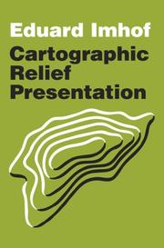
"The renowned Swiss cartographer, Eduard Imhof, devoted his career to raising the standards of map design. In 1965, his breakthrough book published in German, Kartographische Gelandedarstellung, filled a huge void in cartographic instruction. The book was translated into English in 1982 as Cartographic Relief Presentation, expanding its influence and reasserting Imhof's mission to improve the precision and readability of maps. Cartographic Relief Presentation was an expensive book with a limited press run that made it a rare find in recent years. Now, ESRI Press has reissued Eduard Imhof's masterpiece as an affordable volume for mapping professionals, scholars, scientists, students, and anyone interested in cartography." "This new edition of Cartographic Relief Presentation was edited for clarity and consistency but preserves Imhof's insightful commentary and analytical style. Color maps, aerial photographs, and instructive illustrations are faithfully reproduced. The book offers guidelines for properly rendering terrain in maps of all types and scales whether drawn by traditional means or with the aid of a computer. Cartographic Relief Presentation was among the essential mapping and graphical design books of the twentieth century. Its continuing relevance for the twenty-first century is assured with this publication."--Jacket.
Topographic maps --- 528 --- 912 --- Hypsographic maps --- Hypsometric maps --- Maps, Topographic --- Relief maps --- Topo maps --- Topographical maps --- Maps --- Cartografie --- Kaarten
Book
ISBN: 9789064698330 Year: 2007 Volume: 8 Publisher: Alphen aan den Rijn Canaletto/Repro Holland
Abstract | Keywords | Export | Availability | Bookmark
 Loading...
Choose an application
- Reference Manager
- EndNote
- RefWorks (Direct export to RefWorks)
912 "15"
---
912 <09> <492>
---
912 "16"
---
912 <100>
---
094.1 <492 AMSTERDAM>
---
Cartografie. Kaarten. Plattegronden. Atlassen--16e eeuw. Periode 1500-1599
---
Cartografie. Kaarten. Plattegronden. Atlassen--Geschiedenis van ...--Nederland
---
Cartografie. Kaarten. Plattegronden. Atlassen--17e eeuw. Periode 1600-1699
---
Cartografie. Kaarten. Plattegronden. Atlassen--Wereld. Internationaal. Alle landen gezamenlijk
---
Oude drukken: bibliografie--
Book
Abstract | Keywords | Export | Availability | Bookmark
 Loading...
Choose an application
- Reference Manager
- EndNote
- RefWorks (Direct export to RefWorks)
912 --- AA / International- internationaal --- 95 --- Cartografie. Kaarten. Plattegronden. Atlassen --- Cartografie. --- Cartographie. --- Cartography. --- 95 Cartografie. --- 95 Cartographie. --- 95 Cartography. --- Cartografie

ISBN: 2218717484 9782218717482 Year: 2007 Publisher: Paris Hatier
Abstract | Keywords | Export | Availability | Bookmark
 Loading...
Choose an application
- Reference Manager
- EndNote
- RefWorks (Direct export to RefWorks)
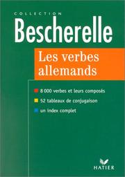
912 --- Woordenboeken - lexica --- German language --- Allemand (Langue) --- Verb --- Tables. --- Textbooks for foreign speakers --- French. --- Manuels pour francophones --- Verb. --- Conjugaison
Book
ISBN: 9789079076017 9789079076024 9789079076031 Year: 2007 Publisher: Boxtel Stichting Cultuurgeschiedenis Boxtel, Meierij "Hendrik Verhees"
Abstract | Keywords | Export | Availability | Bookmark
 Loading...
Choose an application
- Reference Manager
- EndNote
- RefWorks (Direct export to RefWorks)
Verhees, Hendrik --- 528.4 --- 912 <09> <492> --- 912 "17" --- 912 "18" --- Field surveying. Land surveying. Cadastral survey. Topography. Engineering survey. Special fields of surveying --- Cartografie. Kaarten. Plattegronden. Atlassen--Geschiedenis van ...--Nederland --- Cartografie. Kaarten. Plattegronden. Atlassen--18e eeuw. Periode 1700-1799 --- Cartografie. Kaarten. Plattegronden. Atlassen--19e eeuw. Periode 1800-1899 --- 528.4 Field surveying. Land surveying. Cadastral survey. Topography. Engineering survey. Special fields of surveying
| Listing 1 - 10 of 59 | << page >> |
Sort by
|

 Search
 Feedback
 About UniCat
  Help
Help News
News