| Listing 1 - 10 of 23 | << page >> |
Sort by
|

ISBN: 1280864087 9786610864089 3540372938 3540356061 Year: 2006 Publisher: Berlin : Beijing, China : Springer ; Tsinghua University Press,
Abstract | Keywords | Export | Availability | Bookmark
 Loading...
Choose an application
- Reference Manager
- EndNote
- RefWorks (Direct export to RefWorks)
Satellite remote sensing for Earth science data has been rapidly expanding during the last decade. Volume 1 of this two volume monograph covers missions/sensors, such as Sea-viewing Wide Field-of-view Sensor (SeaWiFS), Tropical Rainfall Measuring Mission (TRMM), Total Ozone Mapping Spectrometer (TOMS), Atmospheric Infrared Sounder (AIRS), and Advanced Microwave Sounding Unit (AMSU). It also discusses the NPOESS and NPP missions. Emphasis was placed on the recently launched Moderate Resolution Imaging Spectroradiometer (MODIS) on board of both Terra and Aqua. Some key MODIS science team members were invited to contribute several chapters. The core of this monograph arose from the workshop for Earth Science Satellite Remote Sensing held at George Mason University (GMU) in October 2002. Both volumes are designed to give scientists and graduate students with limited remote sensing background a thorough introduction to current and future NASA, NOAA and other Earth science remote sensing missions.
Remote sensing. --- Earth sciences --- Remote sensing --- Geology --- Equipment and supplies. --- Data processing. --- Remote-sensing imagery --- Remote sensing systems --- Remote terrain sensing --- Sensing, Remote --- Terrain sensing, Remote --- Aerial photogrammetry --- Aerospace telemetry --- Detectors --- Space optics
ISBN: 3540372946 3540356304 Year: 2006 Publisher: Berlin : Beijing, China : Springer ; Tsinghua University Press,
Abstract | Keywords | Export | Availability | Bookmark
 Loading...
Choose an application
- Reference Manager
- EndNote
- RefWorks (Direct export to RefWorks)
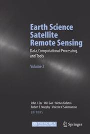
Earth science satellite remote sensing has been rapidly expanding during the last decade. Volume 2 of this two volume monograph provides information on the Earth science remote sensing data information and data format such as HDF-EOS, and tools. It evaluates the current data processing approaches and introduces data searching and ordering from different public domains. Further it explores the remote sensing and GIS migration products and WebGIS applications. The core of this book arose from the workshop for Earth Science Satellite Remote Sensing held at George Mason University (GMU) in October 2002. Both volumes are designed to give scientists and graduate students with limited remote sensing background a thorough introduction to current and future NASA, NOAA and other Earth science remote sensing.
Remote sensing. --- Earth sciences --- Remote sensing --- Geology --- Equipment and supplies. --- Data processing. --- Remote-sensing imagery --- Remote sensing systems --- Remote terrain sensing --- Sensing, Remote --- Terrain sensing, Remote --- Aerial photogrammetry --- Aerospace telemetry --- Detectors --- Space optics

ISBN: 1580539262 9781580539265 1580539254 9781580539258 Year: 2006 Publisher: Boston Artech House
Abstract | Keywords | Export | Availability | Bookmark
 Loading...
Choose an application
- Reference Manager
- EndNote
- RefWorks (Direct export to RefWorks)
Annotation
Radar. --- Remote sensing. --- Remote-sensing imagery --- Remote sensing systems --- Remote terrain sensing --- Sensing, Remote --- Terrain sensing, Remote --- Aerial photogrammetry --- Aerospace telemetry --- Detectors --- Space optics --- Electronic systems --- Pulse techniques (Electronics) --- Radio --- Remote sensing

ISBN: 1280609370 9786610609376 161583382X 0387286004 0387285792 Year: 2006 Publisher: New York : Springer Science+Business Media,
Abstract | Keywords | Export | Availability | Bookmark
 Loading...
Choose an application
- Reference Manager
- EndNote
- RefWorks (Direct export to RefWorks)
HYPERSPECTRAL DATA COMPRESSION presents the most recent results in the field of compression of remote sensing 3D data, with a focus on multispectral and hyperspectral imagery. This book is essential for researchers working across related fields including: multi-dimensional data compression, multispectral and hyperspectral data archives, remote sensing, scientific image processing, military and aerospace image processing, image segmentation, image classification, and target detection. .
Image compression. --- Remote sensing. --- Multispectral photography. --- Imaging, Multispectral --- MSI (Multispectral imaging) --- Multiband photography --- Multispectral photography --- Multispectral scanning --- Scanning, Multispectral --- Spectral imaging --- Remote-sensing imagery --- Remote sensing systems --- Remote terrain sensing --- Sensing, Remote --- Terrain sensing, Remote --- Aerial photogrammetry --- Aerospace telemetry --- Detectors --- Space optics --- Image data compression --- Data compression (Telecommunication) --- Multispectral imaging.
Book
ISBN: 9059660420 9789059660427 Year: 2006 Publisher: Rotterdam Millpress
Abstract | Keywords | Export | Availability | Bookmark
 Loading...
Choose an application
- Reference Manager
- EndNote
- RefWorks (Direct export to RefWorks)
Remote sensing --- GG Cartography --- 528.8 --- 630*587 --- 631.171 --- 631.171 Mechanization and automation of farming and agriculture --- Mechanization and automation of farming and agriculture --- 528.8 Remote sensing. Teledetection --- Remote sensing. Teledetection --- Remote-sensing imagery --- Remote sensing systems --- Remote terrain sensing --- Sensing, Remote --- Terrain sensing, Remote --- Aerial photogrammetry --- Aerospace telemetry --- Detectors --- Space optics --- Environmental aspects --- Aerial photography and photogrammetry --- Remote sensing - Europe - Congresses --- Remote sensing - Environmental aspects - Congresses
ISBN: 1280724641 9786610724642 0387444394 0387444343 1441942718 Year: 2006 Publisher: New York : Springer Science+Business,
Abstract | Keywords | Export | Availability | Bookmark
 Loading...
Choose an application
- Reference Manager
- EndNote
- RefWorks (Direct export to RefWorks)
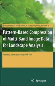
Pattern-Based Compression of Multi-Band Image Data for Landscape Analysis describes an integrated approach to using remotely sensed data in conjunction with geographic information systems (GIS) for landscape analysis. Remotely sensed data are compressed by compound segmentation so that the first level is an image-like raster map for GIS, and a second level affords approximate restoration. Pattern processing is implemented in software by PSIMAPP Progressively Segmented Image Modeling As Poly-Patterns. There are seven notable areas of advantage in this approach: Controlling and creating contrast for pictorial presentations. Classifying content for constructing categorical maps. Whereas digital image data are usually directed toward algorithmic assignment of image elements to candidate categories of content, this approach is equally applicable to assisting interactive interpretive assignment by a human analyst. Detecting difference between instances of imaging. Whereas conventional change detection is done in the signal domain, this approach supports dual pattern matching in signal and spatial domains. Advantage in contextual considerations. Having parsed patterns into collective components allows analysts to conduct comparatives in multiple modes. The components can be combined according to signal similarities and proximate positioning to generate generalized images that portray progressively more prominent patterning. The patterns can be treated as multivariate trends for removal to reach residuals that are regionalized in accordance with scenarios of spatial statistics. An entirely new arena of analysis is posed by pattern profiles of cumulated components over blocks at several scales. Compositional components of complexes can be considered in terms of chromaticity or ratio relations among signal sets by partial ordering and rank range runs. Informational compression for conveyance by computer media. The poly-pattern models occupy the equivalent of two single-byte signal bands along with tables of pattern properties. Although approximation in restoration might appear to be a drawback, it leads to the sixth aspect of advantage. Digital image data are often proprietary with strictures on distribution. Since the poly-pattern models do not provide capability for complete restoration, and in view of their numerous advantages, they become substantially different derivative products in much the same manner as a thematic map. Therefore, most of the proprietary concerns relative to the original data should be obviated. The interface between image analysis and GIS. GIS provides the popular platform for utilization of geo-spatial information. Since relatively few of the regular GIS users are image analysts, poly-pattern packaging facilitates broader access to image-based information.
Landscape ecology --- Remote sensing. --- Research --- Statistical methods. --- Data processing. --- Ecology --- Environmental sciences. --- Landscape ecology. --- Statistics. --- Environment, general. --- Remote Sensing/Photogrammetry. --- Landscape Ecology. --- Statistics for Life Sciences, Medicine, Health Sciences. --- Statistical analysis --- Statistical data --- Statistical methods --- Statistical science --- Mathematics --- Econometrics --- Environmental science --- Science --- Environment. --- Statistics . --- Remote-sensing imagery --- Remote sensing systems --- Remote terrain sensing --- Sensing, Remote --- Terrain sensing, Remote --- Aerial photogrammetry --- Aerospace telemetry --- Detectors --- Space optics --- Balance of nature --- Biology --- Bionomics --- Ecological processes --- Ecological science --- Ecological sciences --- Environment --- Environmental biology --- Oecology --- Environmental sciences --- Population biology

ISBN: 1280612584 9786610612581 1402039689 1402039670 9781402039676 9781402039683 9401784256 Year: 2006 Publisher: Dordrecht : Springer,
Abstract | Keywords | Export | Availability | Bookmark
 Loading...
Choose an application
- Reference Manager
- EndNote
- RefWorks (Direct export to RefWorks)
The aquatic coastal zone is one of the most challenging targets for environmental remote sensing. Properties such as bottom reflectance, spectrally diverse suspended sediments and phytoplankton communities, diverse benthic communities, and transient events that affect surface reflectance (coastal blooms, runoff, etc.) all combine to produce an optical complexity not seen in terrestrial or open ocean systems. Despite this complexity, remote sensing is proving to be an invaluable tool for "Case 2" waters. This book presents recent advances in coastal remote sensing with an emphasis on applied science and management. Case studies of the operational use of remote sensing in ecosystem studies, monitoring, and interfacing remote sensing/science/management are presented. Spectral signatures of phytoplankton and suspended sediments are discussed in detail with accompanying discussion of why blue water (Case 1) algorithms cannot be applied to Case 2 waters. Audience This book is targeted for scientists and managers interested in using remote sensing in the study or management of aquatic coastal environments. With only limited discussion of optics and theory presented in the book, such researchers might benefit from the detailed presentations of aquatic spectral signatures, and to operational management issues. While not specifically written for remote sensing scientists, it will prove to be a useful reference for this community for the current status of aquatic coastal remote sensing.
Remote sensing. --- Ecology. --- Remote-sensing imagery --- Remote sensing systems --- Remote terrain sensing --- Sensing, Remote --- Terrain sensing, Remote --- Aerial photogrammetry --- Aerospace telemetry --- Detectors --- Space optics --- Balance of nature --- Biology --- Bionomics --- Ecological processes --- Ecological science --- Ecological sciences --- Environment --- Environmental biology --- Oecology --- Environmental sciences --- Population biology --- Ecology --- Coastal ecology --- Aquatic biology. --- Environmental management. --- Algorithms. --- Remote Sensing/Photogrammetry. --- Freshwater & Marine Ecology. --- Environmental Management. --- Optics, Lasers, Photonics, Optical Devices. --- Algorism --- Algebra --- Arithmetic --- Environmental stewardship --- Stewardship, Environmental --- Management --- Hydrobiology --- Water biology --- Aquatic sciences --- Foundations --- Aquatic ecology . --- Lasers. --- Photonics. --- New optics --- Optics --- Light amplification by stimulated emission of radiation --- Masers, Optical --- Optical masers --- Light amplifiers --- Light sources --- Optoelectronic devices --- Nonlinear optics --- Optical parametric oscillators --- Aquatic biology

ISBN: 1280624671 9786610624676 140204030X 1402040296 Year: 2006 Publisher: Dordrecht : Springer,
Abstract | Keywords | Export | Availability | Bookmark
 Loading...
Choose an application
- Reference Manager
- EndNote
- RefWorks (Direct export to RefWorks)
Advances in space-borne remote sensing have significantly changed the mankind viewpoint how to observe our own Earth planet. Great amount of remote sensing data and images presents new resources to quantitatively describe and monitor our Earth environment, atmosphere, oceanic and land surfaces. In remote sensing, electromagnetic (EM) scattering, emission and wave propagation, as interaction with the Earth environment, lay the physical basis for understanding and extracting geoscientific information. Study of electromagnetic waves with remote sensing application has become an active and interdisciplinary area. This book presents some new progress on the theoretical and numerical approaches for information retrieval of the remote sensing via EM scattering and emission. We begin in Chapter 1 with the vector radiative transfer (VRT) theory for inhomogeneous scatter media. The VRT takes account of multiple scattering, emission and propagation of random scatter media, and quantitatively leads to insights of elucidating and understanding EM wave-terrain surface interaction. Meanwhile, it is extensively applicable to carrying out data interpretation and validation, and to solving the inverse problem, e.g. iteratively, physically or statistically. In Chapter 1, iterative solutions of multiple scattering and emission from inhomogeneous dense scatter media, and inhomogeneous non-spherical scatter media are discussed. Three-dimensional VRT equation (3D-VRT) for spatially inhomogeneous random scatter media for high resolution observation is also investigated. The polarimetric imagery of synthetic aperture radar (SAR) technology is one of most important advances in space-borne microwave remote sensing during recent decades.
Electromagnetic waves --- Remote sensing. --- Scattering. --- Remote-sensing imagery --- Remote sensing systems --- Remote terrain sensing --- Sensing, Remote --- Terrain sensing, Remote --- Aerial photogrammetry --- Aerospace telemetry --- Detectors --- Space optics --- Scattering (Physics) --- Computer engineering. --- Engineering. --- Electrical Engineering. --- Classical Electrodynamics. --- Complexity. --- Solid State Physics. --- Spectroscopy and Microscopy. --- Computers --- Construction --- Industrial arts --- Technology --- Design and construction --- Electrical engineering. --- Optics. --- Electrodynamics. --- Computational complexity. --- Solid state physics. --- Spectroscopy. --- Microscopy. --- Analysis, Microscopic --- Light microscopy --- Micrographic analysis --- Microscope and microscopy --- Microscopic analysis --- Optical microscopy --- Optics --- Analysis, Spectrum --- Spectra --- Spectrochemical analysis --- Spectrochemistry --- Spectroscopy --- Chemistry, Analytic --- Interferometry --- Radiation --- Wave-motion, Theory of --- Absorption spectra --- Light --- Spectroscope --- Physics --- Solids --- Complexity, Computational --- Electronic data processing --- Machine theory --- Dynamics --- Electric engineering --- Engineering --- Qualitative --- Spectrometry --- Analytical chemistry
Book
ISBN: 1280461705 9786610461707 1402040539 Year: 2006 Volume: 31 Publisher: Dordrecht : Springer,
Abstract | Keywords | Export | Availability | Bookmark
 Loading...
Choose an application
- Reference Manager
- EndNote
- RefWorks (Direct export to RefWorks)
The Near-Surface Layer of the Ocean provides a comprehensive account of the structure and dynamics of this important component of the ocean. The book develops the relevant physics and thermodynamics in depth. Detailed treatment is given to the surface microlayer, upper-ocean turbulence, fine thermohaline structure, coherent structures, high wind-speed regime, and to practical applications. Results of major air-sea interaction experiments (including those obtained with the participation of the authors) are used in the analysis. .
Oceanography. --- Earth sciences. --- Geosciences --- Environmental sciences --- Physical sciences --- Oceanography, Physical --- Oceanology --- Physical oceanography --- Thalassography --- Earth sciences --- Marine sciences --- Ocean --- Climatology. --- Atmospheric Sciences. --- Remote Sensing/Photogrammetry. --- Complex Systems. --- Classical and Continuum Physics. --- Atmospheric sciences. --- Remote sensing. --- Statistical physics. --- Dynamical systems. --- Continuum physics. --- Classical field theory --- Continuum physics --- Physics --- Continuum mechanics --- Dynamical systems --- Kinetics --- Mathematics --- Mechanics, Analytic --- Force and energy --- Mechanics --- Statics --- Mathematical statistics --- Remote-sensing imagery --- Remote sensing systems --- Remote terrain sensing --- Sensing, Remote --- Terrain sensing, Remote --- Aerial photogrammetry --- Aerospace telemetry --- Detectors --- Space optics --- Climate --- Climate science --- Climate sciences --- Science of climate --- Atmospheric science --- Atmospheric sciences --- Atmosphere --- Statistical methods
Book
ISBN: 1280716398 9786610716395 1402047231 Year: 2006 Publisher: Dordrecht ; [Great Britain] : Springer,
Abstract | Keywords | Export | Availability | Bookmark
 Loading...
Choose an application
- Reference Manager
- EndNote
- RefWorks (Direct export to RefWorks)
This volume is devoted to the Persistent Scatterer Technique, the latest development in radar interferometric data processing. Using this technique, millimetric displacements can be observed at hundreds of thousands of targets that are affected only slightly from temporal and geometric decorrelation, such as the walls and the roofs of houses, lamp posts, grates, window ledges, etc. All acquired data can be used by this technique, which enables the analysis of displacements since 1992 in any area world-wide, using the archived historical data of the ERS-1 and ERS-2 satellites. Data of other current and future sensors can also be processed using this technique. The original PS algorithm is revisited based on the main literature, and possible weak points are identified. The STUN (spatio-temporal unwrapping network) algorithm, developed to cope with these issues in a robust way, is presented and applied to two test sites. For the Berlin area, two data stacks of adjacent tracks are analyzed to assess the quality description provided by the STUN algorithm. For the Las Vegas test site, a combination of ERS and ENVISAT data is performed to estimate significant linear and seasonal displacements. Audience This book is of interest to scientists and professionals in geodesy and geophysics working with Radar Interferometry, studying urban displacements, earthquakes, or volcanoes.
Lasers. --- Photonics. --- Geophysics. --- Geotechnical engineering. --- Remote sensing. --- Statistical physics. --- Dynamical systems. --- Optics, Lasers, Photonics, Optical Devices. --- Geophysics/Geodesy. --- Geotechnical Engineering & Applied Earth Sciences. --- Remote Sensing/Photogrammetry. --- Complex Systems. --- Statistical Physics and Dynamical Systems. --- Dynamical systems --- Kinetics --- Mathematics --- Mechanics, Analytic --- Force and energy --- Mechanics --- Physics --- Statics --- Remote-sensing imagery --- Remote sensing systems --- Remote terrain sensing --- Sensing, Remote --- Terrain sensing, Remote --- Aerial photogrammetry --- Aerospace telemetry --- Detectors --- Space optics --- Engineering, Geotechnical --- Geotechnics --- Geotechnology --- Engineering geology --- Geological physics --- Terrestrial physics --- Earth sciences --- New optics --- Optics --- Light amplification by stimulated emission of radiation --- Masers, Optical --- Optical masers --- Light amplifiers --- Light sources --- Optoelectronic devices --- Nonlinear optics --- Optical parametric oscillators --- Mathematical statistics --- Statistical methods --- Interferometry.
| Listing 1 - 10 of 23 | << page >> |
Sort by
|

 Search
 Feedback
 About UniCat
  Help
Help News
News