| Listing 1 - 5 of 5 |
Sort by
|
Book

ISBN: 9783540372936 Year: 2006 Publisher: Berlin Heidelberg Springer Berlin Heidelberg
Abstract | Keywords | Export | Availability | Bookmark
 Loading...
Choose an application
- Reference Manager
- EndNote
- RefWorks (Direct export to RefWorks)
Satellite remote sensing for Earth science data has been rapidly expanding during the last decade. Volume 1 of this two volume monograph covers missions/sensors, such as Sea-viewing Wide Field-of-view Sensor (SeaWiFS), Tropical Rainfall Measuring Mission (TRMM), Total Ozone Mapping Spectrometer (TOMS), Atmospheric Infrared Sounder (AIRS), and Advanced Microwave Sounding Unit (AMSU). It also discusses the NPOESS and NPP missions. Emphasis was placed on the recently launched Moderate Resolution Imaging Spectroradiometer (MODIS) on board of both Terra and Aqua. Some key MODIS science team members were invited to contribute several chapters. The core of this monograph arose from the workshop for Earth Science Satellite Remote Sensing held at George Mason University (GMU) in October 2002. Both volumes are designed to give scientists and graduate students with limited remote sensing background a thorough introduction to current and future NASA, NOAA and other Earth science remote sensing missions.
Nature protection --- Space research --- Astrophysics --- Geodesy. Cartography --- Geophysics --- Geology. Earth sciences --- Air pollution. Air purification --- Computer. Automation --- astrofysica --- fotogrammetrie --- remote sensing --- informatica --- luchtverontreiniging --- natuurbescherming --- geologie --- ruimtevaart --- geofysica
Book

ISBN: 9783540372943 Year: 2006 Publisher: Berlin Heidelberg Springer Berlin Heidelberg
Abstract | Keywords | Export | Availability | Bookmark
 Loading...
Choose an application
- Reference Manager
- EndNote
- RefWorks (Direct export to RefWorks)
Earth science satellite remote sensing has been rapidly expanding during the last decade. Volume 2 of this two volume monograph provides information on the Earth science remote sensing data information and data format such as HDF-EOS, and tools. It evaluates the current data processing approaches and introduces data searching and ordering from different public domains. Further it explores the remote sensing and GIS migration products and WebGIS applications. The core of this book arose from the workshop for Earth Science Satellite Remote Sensing held at George Mason University (GMU) in October 2002. Both volumes are designed to give scientists and graduate students with limited remote sensing background a thorough introduction to current and future NASA, NOAA and other Earth science remote sensing.
Nature protection --- Space research --- Astrophysics --- Geodesy. Cartography --- Geophysics --- Geology. Earth sciences --- Air pollution. Air purification --- Computer. Automation --- astrofysica --- fotogrammetrie --- remote sensing --- informatica --- luchtverontreiniging --- natuurbescherming --- geologie --- ruimtevaart --- geofysica
Digital
ISBN: 9783540372936 Year: 2006 Publisher: Berlin, Heidelberg Tsinghua University Press, Beijing and Springer-Verlag GmbH Berlin Heidelberg
Abstract | Keywords | Export | Availability | Bookmark
 Loading...
Choose an application
- Reference Manager
- EndNote
- RefWorks (Direct export to RefWorks)
Nature protection --- Space research --- Astrophysics --- Geodesy. Cartography --- Geophysics --- Geology. Earth sciences --- Air pollution. Air purification --- Computer. Automation --- astrofysica --- fotogrammetrie --- remote sensing --- informatica --- luchtverontreiniging --- natuurbescherming --- geologie --- ruimtevaart --- geofysica
Digital
ISBN: 9783540372943 Year: 2006 Publisher: Berlin, Heidelberg Tsinghua University Press, Beijing and Springer-Verlag GmbH Berlin Heidelberg
Abstract | Keywords | Export | Availability | Bookmark
 Loading...
Choose an application
- Reference Manager
- EndNote
- RefWorks (Direct export to RefWorks)
Nature protection --- Space research --- Astrophysics --- Geodesy. Cartography --- Geophysics --- Geology. Earth sciences --- Air pollution. Air purification --- Computer. Automation --- astrofysica --- fotogrammetrie --- remote sensing --- informatica --- luchtverontreiniging --- natuurbescherming --- geologie --- ruimtevaart --- geofysica


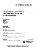
ISBN: 0819463515 Year: 2006 Publisher: Bellingham Society of photo-optical instrumentation engineers
Abstract | Keywords | Export | Availability | Bookmark
 Loading...
Choose an application
- Reference Manager
- EndNote
- RefWorks (Direct export to RefWorks)
Laser interferometers --- Measurement --- Optical measurements --- Physical measurements
| Listing 1 - 5 of 5 |
Sort by
|

 Search
 Feedback
 About UniCat
  Help
Help News
News