| Listing 1 - 1 of 1 |
Sort by
|

ISBN: 1281970166 1282809911 9786612809910 9786611970161 1770701702 1554882230 9781554882236 9781903365502 1903365503 1903365503 9781550025064 1550025066 Year: 2004 Publisher: Toronto [Ont.] Durdurn
Abstract | Keywords | Export | Availability | Bookmark
 Loading...
Choose an application
- Reference Manager
- EndNote
- RefWorks (Direct export to RefWorks)
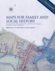
Maps for Family and Local History shows how three great land surveys can provide information on ancestral homes, as well as fascinating historical snapshots of specific areas. Covering 1836 to 1943, the Tithe, Valuation Office, and National Farm Surveys provide a wealth of information on rural and urban localities, on dwellings, settlements, and landscapes as well as the status of householders. The text gives the rationale behind the surveys and covers each in detail. Fully updated by map experts from The National Archives, this illustrated guide is the perfect companion to researchi
Public records --- Government records --- Public administration --- Records --- Archives --- Government information --- Great Britain. --- HMPRO --- H.M.P.R.O. --- PRO --- P.R.O. --- Public Record Office (Great Britain) --- Britisches Staatsarchiv --- Staatsarchiv (Great Britain) --- National Archives (Great Britain) --- England --- Wales --- Cambria --- Cymric --- Gwalia --- Cymru --- England and Wales --- Angleterre --- Anglii︠a︡ --- Inghilterra --- Engeland --- Inglaterra --- Anglija --- Genealogy --- Maps
| Listing 1 - 1 of 1 |
Sort by
|

 Search
 Feedback
 About UniCat
  Help
Help News
News