
 Search
 Feedback
 About UniCat
  Help
Help News
News
| Listing 1 - 10 of 36 | << page >> |
Sort by
|
ISBN: 0415246512 0415246504 Year: 2002 Publisher: Boca Raton (Fla) CRC
Abstract | Keywords | Export | Availability | Bookmark
 Loading...
Choose an application
- Reference Manager
- EndNote
- RefWorks (Direct export to RefWorks)
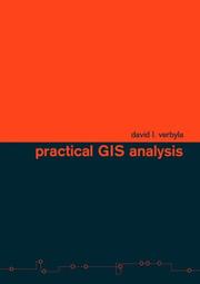
ISBN: 0415286093 Year: 2002 Publisher: London : Taylor and Francis,
Abstract | Keywords | Export | Availability | Bookmark
Loading...Choose an application
- Reference Manager
- EndNote
- RefWorks (Direct export to RefWorks)
The only practical guide for solving geo-spatial problems independent of specific GIS software and hardware, Practical GIS Analysis will teach how GIS tools work and how to use them to solve problems in both vector and grid GIS worlds. The book includes real-life applications from urban problems including real estate query, urban emergency response, address geocoding, resource allocation, groundwater analysis, auto accident analysis, and optimal path analysis. You can test your problem-solving abilities by trying the more than eighty GIS problems (and solutions) presented in this book. If you want to learn how GIS works, and what kinds of problems you can solve using it, this book is for you.
ISBN: 0415286085 Year: 2002 Publisher: London : Taylor and Francis,
Abstract | Keywords | Export | Availability | Bookmark
Loading...Choose an application
- Reference Manager
- EndNote
- RefWorks (Direct export to RefWorks)
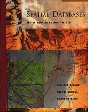
ISBN: 1558605886 0585456534 9780585456539 9781558605886 9780080517469 0080517463 9786611078034 1281078034 Year: 2002 Publisher: San Francisco Morgan Kaufmann Publishers
Abstract | Keywords | Export | Availability | Bookmark
Loading...Choose an application
- Reference Manager
- EndNote
- RefWorks (Direct export to RefWorks)
Spatial Databases is the first unified, in-depth treatment of special techniques for dealing with spatial data, particularly in the field of geographic information systems (GIS). This book surveys various techniques, such as spatial data models, algorithms, and indexing methods, developed to address specific features of spatial data that are not adequately handled by mainstream DBMS technology. The book also reviews commercial solutions to geographic data handling: ArcInfo, ArcView, and Smallworld GISs; and two extensions to the relational model, PostgreSQL and Orac
Information systems --- Geographic information systems. --- Environmental Sciences and Forestry. Remote Sensing and Geographical Information Systems --- Geographical Information Systems. --- Geographic information systems --- Geographical information systems --- GIS (Information systems) --- Information storage and retrieval systems --- Geography
ISBN: 0748409548 Year: 2002 Publisher: London : Taylor & Francis,
Abstract | Keywords | Export | Availability | Bookmark
Loading...Choose an application
- Reference Manager
- EndNote
- RefWorks (Direct export to RefWorks)
An online GIS removes the need to collate elements in a single database, but appropriate standards and protocols are necessary. Online GIS & Spatial Metadata covers the principles, techniques and standards for online GIS, including online spatial information and data warehousing. It examines the idea of metadata and outlines why it is important today and explains the underlying methodologies, including relevant standards, and the tools and skills needed to manage metadata. Finally, the subject is placed in the context of global GIS: putting data online; creating metadata; creating virtual data warehouses; geographical agents, and spatial data mining.
Information systems --- Computer architecture. Operating systems --- Geodesy. Cartography --- Geographic information systems. --- World Wide Web. --- Metadata. --- Environmental Sciences and Forestry. Remote Sensing and Geographical Information Systems --- Geographical Information Systems --- Geographical Information Systems.
ISBN: 079235978X Year: 2002 Publisher: Dordrecht : Kluwer academic,
Abstract | Keywords | Export | Availability | Bookmark
Loading...Choose an application
- Reference Manager
- EndNote
- RefWorks (Direct export to RefWorks)
This book treats statistical issues that are of relevance in spatial studies for remote sensing. It consists of contributions by international experts in this field. A brief overview of basic statistics is given, followed by physical aspects of remote sensing. Spatial statistics addresses classification of images by supervised and unsupervised procedures, estimation of spatial structures by variograms, interpolation, simulation, sampling and issues of scale. Geographical information systems allow the integration of remote sensing with other sources of information, concentrating on the concept of the pixel. Attention is also given to decision support for a wide variety of possible and important decisions. A single data set is used throughout the book. This book therefore provides an overview of the state of the art of spatial statistics for remote sensing, highlighting new frontiers in this rapidly developing field of science.
Dissertation
Year: 2002 Publisher: Leuven : KUL. Faculteit Landbouwkundige en Toegepaste Biologische Wetenschappen,
Abstract | Keywords | Export | Availability | Bookmark
Loading...Choose an application
- Reference Manager
- EndNote
- RefWorks (Direct export to RefWorks)
Forest resources --- Forest resources --- Forest management --- Forest management --- Plant cover --- Plant cover --- leaf area --- leaf area --- Models --- Models --- Geographical information systems --- Geographical information systems --- energy exchange --- energy exchange
Book
ISBN: 3933506190 Year: 2002 Publisher: München : Universitätsbuchhandlung Heinrich Frank,
Abstract | Keywords | Export | Availability | Bookmark
Loading...Choose an application
- Reference Manager
- EndNote
- RefWorks (Direct export to RefWorks)
Geographical information systems --- Geographical information systems --- Forest management --- Forest management --- Forestry equipment --- Forestry equipment --- Vehicles --- Vehicles --- Roads --- Roads --- forestry operations --- forestry operations --- work organization --- work organization
Book
ISBN: 0415282942 Year: 2002 Publisher: London : Taylor & Francis,
Abstract | Keywords | Export | Availability | Bookmark
Loading...Choose an application
- Reference Manager
- EndNote
- RefWorks (Direct export to RefWorks)

ISBN: 1589480228 Year: 2002 Publisher: Redlands : ESRI Press,
Abstract | Keywords | Export | Availability | Bookmark
Loading...Choose an application
- Reference Manager
- EndNote
- RefWorks (Direct export to RefWorks)
Geographical information systems --- cartography --- Economic geography --- human population --- Geography --- Geographie physique --- Geographie physique
| Listing 1 - 10 of 36 | << page >> |
Sort by
|