| Listing 1 - 7 of 7 |
Sort by
|
Book
ISBN: 0891188231 Year: 1996 Publisher: Madison SSSA
Abstract | Keywords | Export | Availability | Bookmark
 Loading...
Choose an application
- Reference Manager
- EndNote
- RefWorks (Direct export to RefWorks)
Soil profiles --- Soils --- Databases --- Congresses
Article
Abstract | Keywords | Export | Availability | Bookmark
 Loading...
Choose an application
- Reference Manager
- EndNote
- RefWorks (Direct export to RefWorks)
Soil --- Soil profiles --- Sampling --- cartography --- Soil resources --- Wallonie
Dissertation
Year: 1996 Publisher: Leuven : KUL, Faculteit Landbouwkundige en Toegepaste Biologische Wetenschappen,
Abstract | Keywords | Export | Availability | Bookmark
 Loading...
Choose an application
- Reference Manager
- EndNote
- RefWorks (Direct export to RefWorks)
Soil profiles --- Soil water regimes --- Soil water movement --- Mathematical models --- computer applications
Dissertation
Year: 1996 Publisher: Gembloux : Faculté Universitaire des Sciences Agronomiques de Gembloux. UER des Sciences du Sol et de la Terre,
Abstract | Keywords | Export | Availability | Bookmark
 Loading...
Choose an application
- Reference Manager
- EndNote
- RefWorks (Direct export to RefWorks)
Desert environment induces strong physical soil dispersion and a special type of weathering caused by hyper-acidic clay surfaces. Due to shallow moisture penetration these phenomena are mostly active in the top soil. Intense soil dispersion causes the formation of surface crusts, either vesicular or takyric, of a platy structure in the topsoil and the mobilisation and eluviation of clay and, to a lesser extent, of silt. Weathering induces in the top soil a relative accumulation of secondary Fe and Mn and a relative concentration of secondary Mn in relation to secondary Fe. The infiltration of aeolian dust in the top soil results in the shallow accumulation of clay and carbonates. It is shown that the pedogenic development of desert topsoils proceeds in three phases which are the stabilisation, the horizonation and the maturation phases. This development leads to the formation of various surface horizons assemblages depending on environmetal conditions. Diagnostic properties and typical surface horizons assemblages (epipedons) were defined in conformity with the morphogenetic approach. They were used to define for the FAO legend specific third level units that correspond to different desert soil surface conditions. These taxa have a good environmental and agronomic interpretative value. The use of the proposed diagnostic criteria also substitutes uneasy soil climate measurements with field observation and simple laboratory determinations. The Idimah area in Saudi Arabia served as a case study to illustrate the above mentioned concepts.
Clay soils --- Deserts --- Arid soils --- Calcium carbonate --- Wind erosion --- Geomorphology --- Soil degradation --- Soil classification --- Soil water regimes --- Soil profiles --- Saudi Arabia
Book
ISBN: 9080248215 Year: 1996 Publisher: Tilburg European centre for nature conservation
Abstract | Keywords | Export | Availability | Bookmark
 Loading...
Choose an application
- Reference Manager
- EndNote
- RefWorks (Direct export to RefWorks)
Geografie --- Landschapskunde --- Ecologie. --- biodiversity --- ecological factors --- economy --- land use --- landscape dynamics --- monitoring --- nature conservation --- privatization --- rural development --- symposium proceedings --- 631.47 --- 504.54 --- Surveying, classification and utilization of land. Soil profiles. Litter. Humus. Topsoil. Subsoil etc. Micropedology --- Landscape. Landscape ecology --- Conferences - Meetings --- 504.54 Landscape. Landscape ecology --- 631.47 Surveying, classification and utilization of land. Soil profiles. Litter. Humus. Topsoil. Subsoil etc. Micropedology

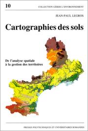
ISBN: 2880742986 9782880742980 Year: 1996 Volume: 10 Publisher: Lausanne: Presses polytechniques et universitaires romandes,
Abstract | Keywords | Export | Availability | Bookmark
 Loading...
Choose an application
- Reference Manager
- EndNote
- RefWorks (Direct export to RefWorks)
Cartographie --- Cartographie pédologique --- Pédologie --- Sols --- Informatique --- Aménagement --- Soil --- cartography --- Collecte de données --- data collection --- Système d'information géographique --- Geographical information systems --- Application des ordinateurs --- computer applications --- Modèle --- Models --- Méthodologie --- methodology --- Aménagement du territoire --- Land use planning --- Recherche interdisciplinaire --- Interdisciplinary research --- 528.94 --- 631.47 --- 711.142 --- 912:631.4 --- Thematic cartography. Topical cartography --- Surveying, classification and utilization of land. Soil profiles. Litter. Humus. Topsoil. Subsoil etc. Micropedology --- Planologie: grondclassificatie; bodemkartering --- Maps. Atlasses: soils --- Geografie --- Cartografie --- Toepassingen. --- 711.142 Planologie: grondclassificatie; bodemkartering --- 631.47 Surveying, classification and utilization of land. Soil profiles. Litter. Humus. Topsoil. Subsoil etc. Micropedology --- 528.94 Thematic cartography. Topical cartography --- Cartographie pédologique --- Pédologie --- Aménagement --- Soil surveys --- Cartography --- Remote sensing --- Soil surveys - Remote sensing --- Cartographie pédologique - Informatique --- Cartographie des sols
Book
ISBN: 2709913313 Year: 1996 Publisher: Paris : ORSTOM éditions,
Abstract | Keywords | Export | Availability | Bookmark
 Loading...
Choose an application
- Reference Manager
- EndNote
- RefWorks (Direct export to RefWorks)
631.47 --- 504.53 --- 631.92 --- 528.8 --- 681.3*H4 --- GG Cartography --- 681.3*H4 Information systems applications (GIS etc.) --- Information systems applications (GIS etc.) --- 528.8 Remote sensing. Teledetection --- Remote sensing. Teledetection --- 631.92 Geophysical effects of cultivation. Influence of agriculture on climate, soil, watercourses, erosion, landslips etc. --- Geophysical effects of cultivation. Influence of agriculture on climate, soil, watercourses, erosion, landslips etc. --- 504.53 Earth surface. Soil environment --- Earth surface. Soil environment --- 631.47 Surveying, classification and utilization of land. Soil profiles. Litter. Humus. Topsoil. Subsoil etc. Micropedology --- Surveying, classification and utilization of land. Soil profiles. Litter. Humus. Topsoil. Subsoil etc. Micropedology --- Conferences - Meetings --- Télédétection. --- Systèmes d'information géographique. --- Environnement --- Cartographie de l'environnement. --- Systèmes d'information. --- Système d'information géographique.
| Listing 1 - 7 of 7 |
Sort by
|

 Search
 Feedback
 About UniCat
  Help
Help News
News