
 Search
 Feedback
 About
About Help
Help News
News
| Listing 1 - 10 of 18 | << page >> |
Sort by
|
ISBN: 9780849368882 084936888X Year: 1990 Publisher: Boca Raton (Fla.): CRC,
Abstract | Keywords | Export | Availability | Bookmark
 Loading...
Choose an application
- Reference Manager
- EndNote
- RefWorks (Direct export to RefWorks)
Book
ISBN: 0773049851 9780773049857 Year: 1990 Publisher: Toronto: Copp Clark Pitman,
Abstract | Keywords | Export | Availability | Bookmark
Loading...Choose an application
- Reference Manager
- EndNote
- RefWorks (Direct export to RefWorks)
Book
ISBN: 5288004846 Year: 1990 Publisher: Leningrad Leningrad University Press
Abstract | Keywords | Export | Availability | Bookmark
Loading...Choose an application
- Reference Manager
- EndNote
- RefWorks (Direct export to RefWorks)
USR former USSR --- USSR --- medicinal plants --- area map --- floristics
Multi
ISBN: 2715917287 Year: 1990 Publisher: Orléans : BRGM,
Abstract | Keywords | Export | Availability | Bookmark
Loading...Choose an application
- Reference Manager
- EndNote
- RefWorks (Direct export to RefWorks)
Map added material --- Pietra-di-Verde (Haute-Corse ; région)
Book
Year: 1990 Publisher: Rockville, MD : Rockville, MDS : U.S. Department of Commerce, National Oceanic and Atmospheric Administration, National Ocean Service, Charting and Geodetic Services, For sale by the National Geodetic Information Center, NOAA.
Abstract | Keywords | Export | Availability | Bookmark
Loading...Choose an application
- Reference Manager
- EndNote
- RefWorks (Direct export to RefWorks)
Nets (Geodesy) --- Triangulation --- Map projection --- States. --- Data processing. --- United States --- Surveys.
Periodical
ISSN: 23309172 Year: 1990 Publisher: Bethesda, Md. : American Congress on Surveying and Mapping
Abstract | Keywords | Export | Availability | Bookmark
Loading...Choose an application
- Reference Manager
- EndNote
- RefWorks (Direct export to RefWorks)
Cartography --- Geographic information systems --- Cartographie --- Systèmes d'information géographique --- Cartography. --- Geographic information systems. --- Cartografie. --- Geographical information systems --- GIS (Information systems) --- Cartography, Primitive --- Chartography --- Map-making --- Mapmaking --- Mapping (Cartography) --- Information storage and retrieval systems --- Mathematical geography --- Surveying --- Map projection --- Maps --- Geography
Multi

ISBN: 2715920385 Year: 1990 Publisher: Orléans : BRGM,
Abstract | Keywords | Export | Availability | Bookmark
Loading...Choose an application
- Reference Manager
- EndNote
- RefWorks (Direct export to RefWorks)
Book
ISBN: 3540527117 3642842178 3642842151 9783540527114 Year: 1990 Volume: 65 Publisher: Berlin New York Tokyo Springer
Abstract | Keywords | Export | Availability | Bookmark
Loading...Choose an application
- Reference Manager
- EndNote
- RefWorks (Direct export to RefWorks)
Navigation --- Cartography --- Digital mapping --- Data processing --- Congresses. --- Navigation, Primitive --- Locomotion --- Orientation --- Nautical astronomy --- Naval art and science --- Pilots and pilotage --- Cartography, Primitive --- Chartography --- Map-making --- Mapmaking --- Mapping (Cartography) --- Mathematical geography --- Surveying --- Map projection --- Maps --- Data processing&delete& --- Congresses --- Navigation - Data processing - Congresses. --- Cartography - Data processing - Congresses. --- Digital mapping - Congresses.
ISBN: 1282851497 9786612851490 0773562257 9780773562257 0773507280 9780773507289 Year: 1990 Publisher: Montreal ; Buffalo : McGill-Queen's University Press,
Abstract | Keywords | Export | Availability | Bookmark
Loading...Choose an application
- Reference Manager
- EndNote
- RefWorks (Direct export to RefWorks)
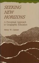
Castner developed this innovative perspective on geographic education through observation of the Orff-Schulwerk technique of music education. This pedagogical method provides an organizational framework within which the primitive elements and concepts of music can be introduced, experienced, and explored, and auditory discrimination developed. The process of improvisation is the focal point of the Schulwerk. Castner suggests that the numerous educational benefits of improvisation can be obtained in geographic education by the process of "mapping." He defines mapping as graphic description, analysis, and presentation in a problem-solving context. After more than two decades of research in cartographic communication, Castner concludes that success in examining and analysing landscapes, and images representative of them, is dependant upon developed skills in visual discrimination. Seeking New Horizons describes a rationale for linking basic visual discriminations to their logical extensions in the concepts that are fundamental to geographic thinking, thus providing challenging approaches to developing spatial awareness, graphic literacy, and geographic understanding. In addition, Castner identifies eight basic concepts which would allow students and teachers to work interactively with spatial information and, over time, with increasingly complex and sophisticated tools and at increasingly abstract levels of generalization.
Geography --- Visual perception. --- Cartography --- Cartography, Primitive --- Chartography --- Map-making --- Mapmaking --- Mapping (Cartography) --- Mathematical geography --- Surveying --- Map projection --- Maps --- Area studies --- Optics, Psychological --- Vision --- Perception --- Visual discrimination --- Study and teaching. --- Psychological aspects --- Geographical perception. --- Environmental perception --- Maps, Mental --- Mental maps --- Perceptual cartography --- Perceptual maps --- Orientation (Psychology) --- Space perception
| Listing 1 - 10 of 18 | << page >> |
Sort by
|