| Listing 1 - 10 of 10 |
Sort by
|
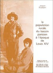
ISBN: 2713206928 9782713206924 285939110X Year: 1979 Publisher: Paris: École des hautes études en sciences sociales,
Abstract | Keywords | Export | Availability | Bookmark
 Loading...
Choose an application
- Reference Manager
- EndNote
- RefWorks (Direct export to RefWorks)
Paris Basin (France) --- Population --- History --- History. --- -Bassìn de Paris (France) --- -History --- -Population --- Bassìn de Paris (France) --- Paris Basin (France) - Population - History. --- Population rurale --- Démographie historique.
ISBN: 2222015685 Year: 1964 Publisher: Paris : C.N.R.S.-Editions (Centre National de la Recherche Scientifique),
Abstract | Keywords | Export | Availability | Bookmark
 Loading...
Choose an application
- Reference Manager
- EndNote
- RefWorks (Direct export to RefWorks)
Paris, Bassin de (France) --- -New Stone age --- -Bassìn de Paris (France) --- Neolithic period --- France --- Paris Basin (France) --- Antiquities. --- Antiquities --- New Stone age --- Stone age --- Bassìn de Paris (France) --- Antiquités --- Neolithique --- Parisien, bassin (france) --- Antiquites
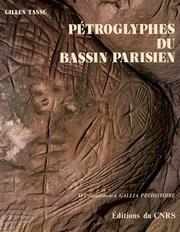
ISBN: 2222028620 9782222028628 Year: 1982 Volume: 16 Publisher: Paris: CNRS,
Abstract | Keywords | Export | Availability | Bookmark
 Loading...
Choose an application
- Reference Manager
- EndNote
- RefWorks (Direct export to RefWorks)
Petroglyphs --- France --- Paris Basin (France) --- Paris, Bassin de (France) --- Antiquities --- Antiquités --- % 9611AR --- -Carvings, Rock --- Engravings, Rock --- Rock carvings --- Rock engravings --- Rock inscriptions --- Stone inscriptions --- Inscriptions --- Picture-writing --- Rock paintings --- -France --- Bassìn de Paris (France) --- Antiquities. --- -Paris Basin (France) --- Antiquités --- Carvings, Rock --- Petroglyphs - France - Paris Basin --- Paris Basin (France) - Antiquities --- France - Antiquities
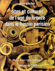
ISBN: 2222027438 9782222027430 Year: 1981 Volume: 15 Publisher: Paris: CNRS,
Abstract | Keywords | Export | Availability | Bookmark
 Loading...
Choose an application
- Reference Manager
- EndNote
- RefWorks (Direct export to RefWorks)
Bronze age --- Age du bronze --- France --- Paris Basin (France) --- Paris, Bassin de (France) --- Antiquities --- Antiquités --- % 9611AR --- -Civilization --- -France --- Bassìn de Paris (France) --- Antiquities. --- -Paris Basin (France) --- Antiquités --- Civilization --- Bronze age - France - Paris Basin --- Paris Basin (France) - Antiquities --- France - Antiquities
Book
ISSN: 0769010X ISBN: 2735105016 2735125920 Year: 1994 Volume: 43 Publisher: Paris : Editions de la Maison des Sciences de l'Homme,
Abstract | Keywords | Export | Availability | Bookmark
 Loading...
Choose an application
- Reference Manager
- EndNote
- RefWorks (Direct export to RefWorks)
L’application de différentes méthodes d’analyse (sédimentologiques, malacologiques, palynologiques. Anthracologiques, micromorphologiques, archéozoologiques, radiocarbones et thermoluminescence) à un programme de recherche sur les modes d’implantation et d’organisation des installations magdaléniennes dans le centre du Bassin parisien a permis de rassembler un important faisceau d’informations. La réalisation de cette synthèse, qui coordonne en une interaction dynamique toutes ces données, permet au lecteur de découvrir et d’apprécier la multiplicité des rapports entre les communautés préhistoriques observées et leur environnement d’une part, et entre les préhistoriens et leur objet d’étude d’autre part. The application of different analytical methods (sedimentology, malacology, palynology, anthracology. micromorphology, archaeozoology, radiocarbon and thermoluminescence dating) to a research programme has brought together informations concerning the way Magdalenian groups were implanted and organised in the centre of the Paris basin. In this synthesis, the interaction of all these results are coordinated, which enables the reader to discover and appreciate the multiplicity of contacts established between the prehistoric communities observed and their environment on one hand, and between prehistorians and their subject on the other.
Excavations (Archaeology) --- Dwellings --- Magdalenian culture --- Fouilles (Archéologie) --- Habitations --- Paris Basin (France) --- Paris, Bassin de (France) --- Antiquities --- Antiquités --- Antiquities. --- Fouilles (Archéologie) --- Antiquités --- Reindeer period --- Paleolithic period --- Archaeological digs --- Archaeological excavations --- Digs (Archaeology) --- Excavation sites (Archaeology) --- Ruins --- Sites, Excavation (Archaeology) --- Archaeology --- Bassìn de Paris (France) --- environnement --- habitat --- économie --- territoire --- Bassin parisien --- Paléolithique supérieur --- Magdalénien --- mode d’exploitation
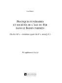
ISBN: 2271057965 9782271057969 Year: 2003 Volume: 56 Publisher: Paris: CNRS,
Abstract | Keywords | Export | Availability | Bookmark
 Loading...
Choose an application
- Reference Manager
- EndNote
- RefWorks (Direct export to RefWorks)
Excavations (Archaeology) --- Grave goods --- Tombs --- Iron age --- Fouilles (Archéologie) --- Mobilier funéraire --- Tombes --- Age du fer --- Paris Basin (France) --- Paris, Bassin de (France) --- Antiquities. --- Antiquités --- Antiquities --- Iron age - France - Paris Basin --- Grave goods - France - Paris Basin --- Tombs - France - Paris Basin --- Paris Basin (France) - Antiquities --- Bassìn de Paris (France)
Book
ISBN: 2735101584 2735120511 Year: 2021 Volume: 4 Publisher: Paris : Éditions de la Maison des sciences de l’homme,
Abstract | Keywords | Export | Availability | Bookmark
 Loading...
Choose an application
- Reference Manager
- EndNote
- RefWorks (Direct export to RefWorks)
Patrice Brun procède dans cet ouvrage à une étude critique du concept de "civilisation des Champs d’Urnes” et du modèle des vagues de migrations qu’il induit. A partir d’une reprise méthodique de la documentation du Bassin parisien il se livre à une étude comparative avec les ensembles clos extérieurs à a région. Il en vient à réfuter l’interprétation classique. Deux ruptures nettes sont dégagées dans révolution de la culture matérielle entre le XIIIe et le VIIe s. av. J.-C. Ces ruptures dans l’évolution du mobilier archéologique correspondent à des ruptures socio-économiques qui, loin de concerner le seul Bassin parisien, affectent une grande partie de l’Europe. Elles se synchronisent notamment avec les transformations qui conditionnent l’émergence des civilisations urbaines en Grèce et en Italie. In this book Patrice Brun critically examines the "Urnfield Culture” concept and the migration model that it implies. After reexamining the Paris Basin evidence, he presents a comparative study of closed finds from outside the region As a result, the traditional interpretation is rejected. Two clear breaks are evident in the development of material culture between the 13th and 7th centuries B.C. These breaks coincide with major socio-economic changes which. Far from being restricted to the Paris Basin, affect a large part of Europe. They also coincide with the transformations that led to the emergence of urban civilisations in Greece and Italy.
Bronze age --- Hallstatt period --- Age du bronze --- Civilisation de Hallstatt --- France --- Paris Basin (France) --- Paris, Bassin de (France) --- Antiquities --- Antiquités --- Urnfield culture --- Antiquities. --- Urn burial --- Bassìn de Paris (France) --- cimetière --- Seine --- tumulus --- âge du Fer --- âge du Bronze --- Yonne --- sépulture --- Bassin parisien --- Champs d’Urnes --- période des Champs d’Urnes --- Urnenfelderkultur --- Urnenfelderzeit --- confluent Yonne-Seine --- marais de Saint-Gond
Book
ISSN: 12552127 ISBN: 2735108007 9782735108008 2735126277 Year: 1999 Volume: 78 Publisher: Paris: Maison des sciences de l'homme,
Abstract | Keywords | Export | Availability | Bookmark
 Loading...
Choose an application
- Reference Manager
- EndNote
- RefWorks (Direct export to RefWorks)
Three Upper Palaeolithic sites have been discovered during the construction of the A5 motorway between Melun and Troyes.Marolles-sur-Seine, in the Seine-et-Marne area, is related to the other Magdaleman sites discovered in the Paris basin. The excellent preservation of the finds (silex, animal bones, heated stones) has made possible a palaeo ethnological study of this horse hunting site, a type of research rarely possible in a rescue excavation Technological analysis of the lithic from Lailly (Aurignacian), in the Yonne area, and Fontvannes (Perigordian ?), in the Aube area, has revealed the production techniques for three kinds of artefacts blades, flakes and bladelets. These two sites increase the importance of the Vanne valley in the understanding of occupation of the south east of the Paris basin.
Paleolithic period --- Excavations (Archaeology) --- Magdalenian culture --- Paléolithique --- Fouilles (Archéologie) --- Industries, Prehistoric --- Tools, Prehistoric --- Paléolithique --- Fouilles (Archéologie) --- Prehistoric archaeology --- Eolithic period --- Old Stone age --- Palaeolithic period --- Stone age --- Implements, Prehistoric --- Implements, utensils, etc., Prehistoric --- Prehistoric implements --- Prehistoric tools --- Prehistoric industries --- Paris Basin (France) --- Bassìn de Paris (France) --- Antiquities. --- Industries, Primitive --- Paleolithic period - France - Paris Basin --- Industries, Prehistoric - France - Paris Basin --- Tools, Prehistoric - France - Paris Basin --- Industries, Prehistoric. --- Paleolithic period. --- Tools, Prehistoric. --- France --- blades --- flakes --- bladelets
Book
ISSN: 0769010X ISBN: 2735109844 9782735109845 9782735126446 2735126447 Year: 2020 Volume: 97 Publisher: Paris : Éditions de la Maison des sciences de l’homme,
Abstract | Keywords | Export | Availability | Bookmark
 Loading...
Choose an application
- Reference Manager
- EndNote
- RefWorks (Direct export to RefWorks)
Le secteur Seine-Yonne occupe, pour la connaissance des sociétés néolithiques, une situation particulière : zone de contact entre les courants méridional et nord-oriental, il est aussi le domaine exclusif du silex de la craie. S’appuyant sur le concept de « système technique », l’auteur a cherché à reconnaître les niveaux de compétence des tailleurs, l’éventuelle existence de spécialistes, la division spatiale de la chaîne opératoire, les modes d’acquisition et de diffusion des matériaux, pour aborder le problème de l’organisation socio-économique de la production d’outillage. Sa réflexion s’appuie sur l’examen de douze séries de référence : plus de 100 000 artefacts en silex ont fait l’objet d’une analyse multivariée recourant notamment à la cladistique, jamais encore appliquée à ce domaine. Ce travail, par des références constantes à des problématiques anthropologiques et historiques, constitue une contribution importante à l’étude de la néolithisation en Europe. The Seine-Yonne sector occupies a special place in our knowledge of Neolithic societies. Although an interface between the southern and north-eastern branches, it is also the exclusive preserve of chalk flint. Applying the "technological system" concept, the author seeks to identify the skills levels of the flint knappers, asks whether expert knappers existed, and explores the spatial breakdown of the operational chain and the methods of acquiring and distributing raw materials in order to address the question of the socio-economic organization of flint tool production. Her exploration is based on the study of twelve reference series comprising over 100.000 flint artifacts in a multivariate analysis making use, among other approaches, of cladistics, the first time this technique has ever been applied to this field. By systematically referring to anthropological and historical questions, this book constitutes an important contribution to the study of the development of Neolithic communities across…
Stone implements --- Flint industry --- Excavations (Archaeology) --- Outils de pierre --- Silex --- Fouilles (Archéologie) --- Industrie --- Paris Basin (France) --- Paris, Bassin de (France) --- Antiquities. --- Antiquités --- Neolithisierung - Neolithikum - Frankreich --- Frankreich - Ile-de-France - Bassin parisien --- Silex - Neolithikum --- Werkzeug - Neolithikum --- Archaeology --- Flint --- 5th-4th centuries --- 5th-4th centuries. --- Fouilles (Archéologie) --- Antiquités --- Flint implements --- Lithic implements --- Implements, utensils, etc. --- Debitage --- Archaeological digs --- Archaeological excavations --- Digs (Archaeology) --- Excavation sites (Archaeology) --- Ruins --- Sites, Excavation (Archaeology) --- Bassìn de Paris (France)
Book
ISBN: 9782877723794 2877723798 Year: 2009 Publisher: Paris: Errance,
Abstract | Keywords | Export | Availability | Bookmark
 Loading...
Choose an application
- Reference Manager
- EndNote
- RefWorks (Direct export to RefWorks)
Cet ouvrage est conçu comme un guide de lecture des cartes élaborées à partir du xviiie siècle par les principaux organismes nationaux (ponts et chaussées, dépôt de la guerre, service historique de l'armée de terre, ign, service du cadastre, brgm). il ne s'agit pas d'un catalogue exhaustif des cartes anciennes mais d'un outil de travail concernant les fonds cartographiques les plus accessibles en archives ou sur le net et couvrant l'ensemble du territoire français. il a été constitué sur la hase d'une véritable expérience de la manipulation de ces fonds, qui ont été comparés entre eux et avec des données archéologiques. ces travaux ont donné lieu à des enseignements en cursus d'archéologie, de géographie et d'architecture. ses auteurs ont souhaité rendre plus largement accessible ce travail original d'inventaire raisonné, réalisé au sein du service départemental du val-d'oise. il est conçu avec une organisation chronologique par fonds : pour chacun sont donnés un historique, une évaluation, des tableaux d'assemblage et des légendes inédites. des introductions écrites par des chercheurs permettent d'élargir le propos et de mettre les cartes en perspective avec d'autres, non détaillées ici. cet ouvrage s'adresse avant tout aux archéologues (chercheurs, étudiants, professionnels) mais peut aussi trouver un public chez les historiens, les géographes, les architectes, les urbanistes et toute personne intéressée par l'évolution du territoire ou effectuant des recherches sur les fonds cartographiques, comme les généalogistes.
France --- --Cartographie --- --XVIIIe-XXe s., --- Cartography --- History --- Val D'Oise (France) --- Paris Basin (France) --- Historical geography --- Maps --- Archaeology --- Île de France --- Map reading --- Lecture de cartes --- geographie --- Cartography, Primitive --- Chartography --- Map-making --- Mapmaking --- Mapping (Cartography) --- Mathematical geography --- Surveying --- Map projection --- aardrijkskunde --- Val-d'Oise --- Seine-et-Oise (France) --- Bassìn de Paris (France) --- Pʻŭrangsŭ --- Frankrig --- Francja --- Frant︠s︡ii︠a︡ --- Prantsusmaa --- Francia (Republic) --- Tsarfat --- Tsorfat --- Franḳraykh --- Frankreich --- Fa-kuo --- Faguo --- Франция --- French Republic --- République française --- Peurancih --- Frankryk --- Franse Republiek --- Francland --- Frencisc Cynewīse --- فرنسا --- Faransā --- Franza --- Republica Franzesa --- Gallia (Republic) --- Hyãsia --- Phransiya --- Fransa --- Fransa Respublikası --- Franse --- Францыя --- Frantsyi︠a︡ --- Французская Рэспубліка --- Frantsuzskai︠a︡ Rėspublika --- Parancis --- Pransya --- Franis --- Francuska --- Republika Francuska --- Bro-C'hall --- Френска република --- Frenska republika --- França --- República Francesa --- Pransiya --- Republikang Pranses --- Γαλλία --- Gallia --- Γαλλική Δημοκρατία --- Gallikē Dēmokratia --- فرانسه --- Farānsah --- צרפת --- רפובליקה הצרפתית --- Republiḳah ha-Tsarfatit --- פראנקרייך --- 法国 --- 法蘭西共和國 --- Falanxi Gongheguo --- フランス --- Furansu --- フランス共和国 --- Furansu Kyōwakoku --- Francija --- Ranska --- Frankrike --- France (Provisional government, 1944-1946) --- Early maps --- Cartes anciennes --- Cartographie --- Histoire --- Cartes --- Early maps. --- XVIIIe-XXe s., 1701-2000 --- Cartography - France - History - 18th century --- France - Historical geography - Maps --- Val D'Oise (France) - Maps --- Paris Basin (France) - Maps --- Val-d'Oise (France) --- Parisien, Bassin (France) --- 18e siècle --- 1800-.... --- Guides, manuels, etc.
| Listing 1 - 10 of 10 |
Sort by
|

 Search
 Feedback
 About UniCat
  Help
Help News
News